Nombre:
Presa de Fort Randall
Otro:
Localización:
View Larger Map
Récord: 6700 hm³
Récord de Altura: 50.30 m
Tipo: Presas
Categoría:
Foto:

Voto:
Continente: América
País: Estados Unidos
Localización: Dakota del Sur
Año: 1956
Estado: Terminado
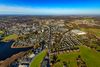
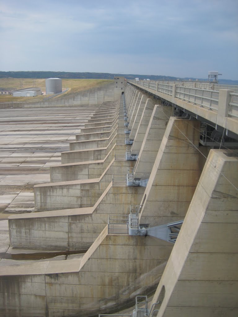
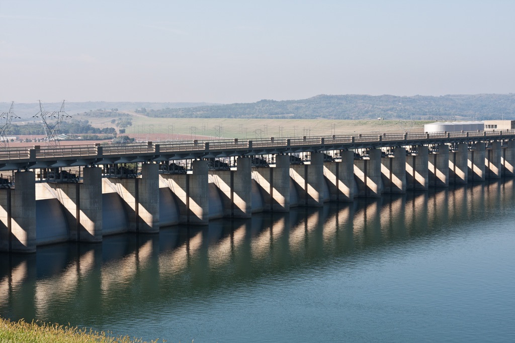
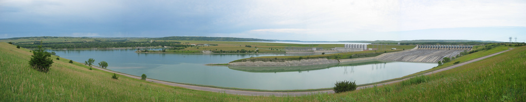
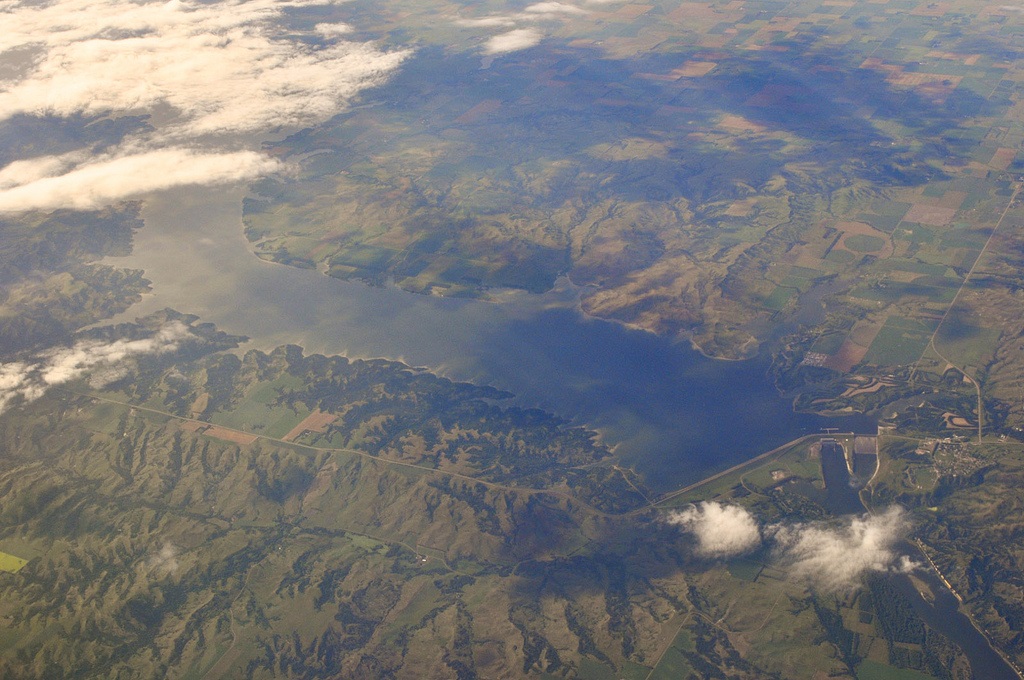
Descripción:The Fort Randall Dam is an earth embankment dam impounding the Missouri River in South Dakota, United States and forming Lake Francis Case. It is one of six Missouri River dams, four being located in South Dakota.
The dam was authorized by the Flood Control Act of 1944 and plays a key role in the Pick-Sloan Plan for development of water resources in the Missouri River basin. The Corps of Engineers began construction of Fort Randall Dam in 1946, and it was the first Pick-Sloan dam completed by the Omaha District. President Dwight D. Eisenhower threw the switch that started the first power generating unit in 1954. When completed in 1956, Fort Randall Dam and the Lake Francis Case Project cost approximately $200 million.
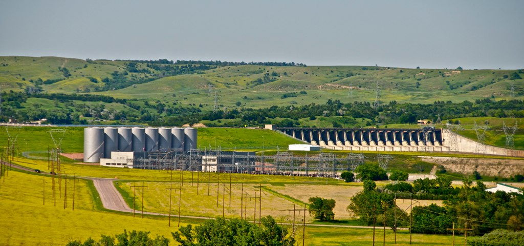
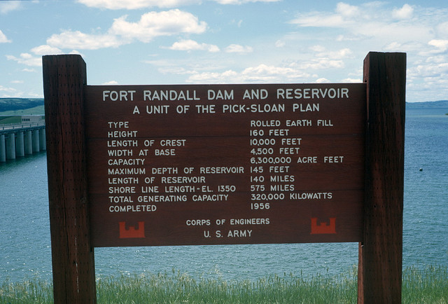
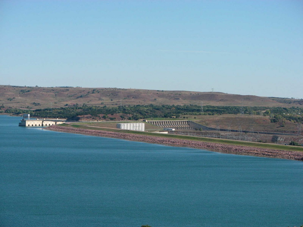
The eight generating units of the Fort Randall Dam are capable of generating 40 megawatts of electricity each, with an annual production of 1.727 billion kilowatt hours.[1] The combined maximum capacity of 320 megawatts is enough to supply 245,000 households, according to the Corps of Engineers. The river behind the dam drains an area of 263,480 mi² (682,410 km²). Its reservoir, Lake Francis Case, has a surface area of 102,000 acres (41,000 ha) at maximum operating pool, coinciding with a volume of 5,700,000 acre feet (7.0×10⁹ m3).
http://en.wikipedia.org/wiki/Fort_Randall_Dam
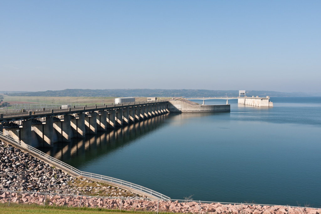
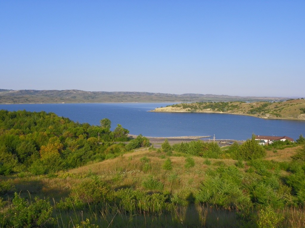
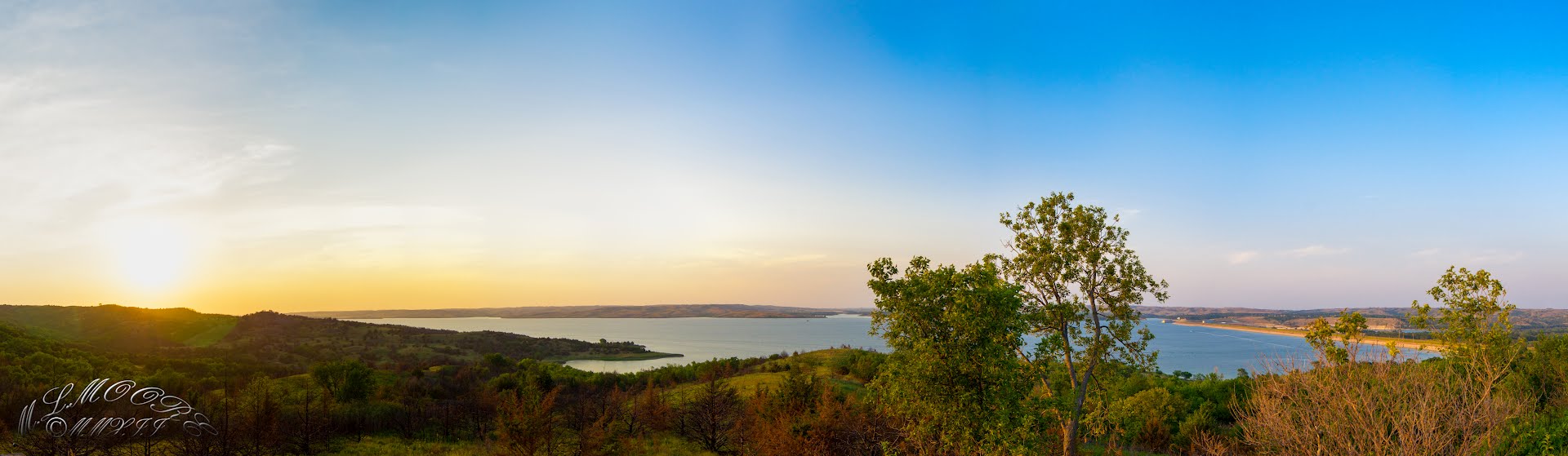
Lake Francis Case is a large reservoir behind Fort Randall Dam on the Missouri River in south-central South Dakota, USA. The lake has an area of 102,000 acres (410 km2) and a maximum depth of 140 ft (43 m).[1] Lake Francis Case has a length of approximately 107 mi (172 km) and has a shoreline of 540 mi (870 km).[1] The reservoir is named for former South Dakota Senator Francis H. Case.[2]
http://en.wikipedia.org/wiki/Lake_Francis_Case
http://www.nwd-mr.usace.army.mil/rcc/projdata/summaryengdat.pdf
http://www.flickr.com/photos/88553567@N02/tags/fortrandalldam/
http://www.panoramio.com/photo/76590295
Vídeo:
Contador: 6084
Inserción: 2013-08-30 13:37:55
Lugares a visitar en un radio de 100 km (en línea recta)
Mapa de los lugares a 100 km (en línea recta)
Mostrando Registros desde el 1 hasta el 0 de un total de 0
Visitas RSS |
Más visitados Basílica de San Marcos  155909 Catedral de Notre Dame (París)  145452 Torre de Pisa  132425 Monte Saint-Michel  101541 Burj Khalifa  85999 |
Incorporaciones |
Comentarios Agenaktof  Mumbai (Bombay) In addition, folks these living in the residence, and stability of who're opioid addicted spend... Wein Plaza  Mumbai (Bombay) Thanks a lot. Loads of knowledge! Wein Plaza - JerryMiff  Mumbai (Bombay) Всем доброго времени суток! Хочу посоветовать... Oscarhealf  Mumbai (Bombay) Прикиньте, вчера я осознал, что мир маркетплейс... Sergio alumb  Puerto de Klaipeda Not long ago I started exploring coin collecting. I found a helpful resource at |