
Nombre:
Puente de las Siete Millas
Otro: Seven Mile Bridge
Localización:
View Larger Map
Récord: 10887 m
Tipo: Puentes
Categoría:
Foto:
Voto:
Continente: América
País: Estados Unidos
Localización: Florida Keys, Monroe County
Año: 1982
Estado: Terminado
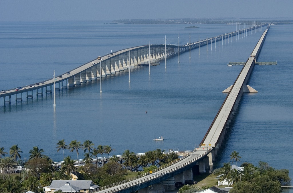
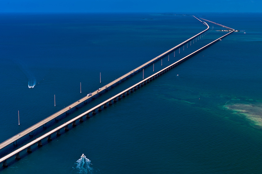
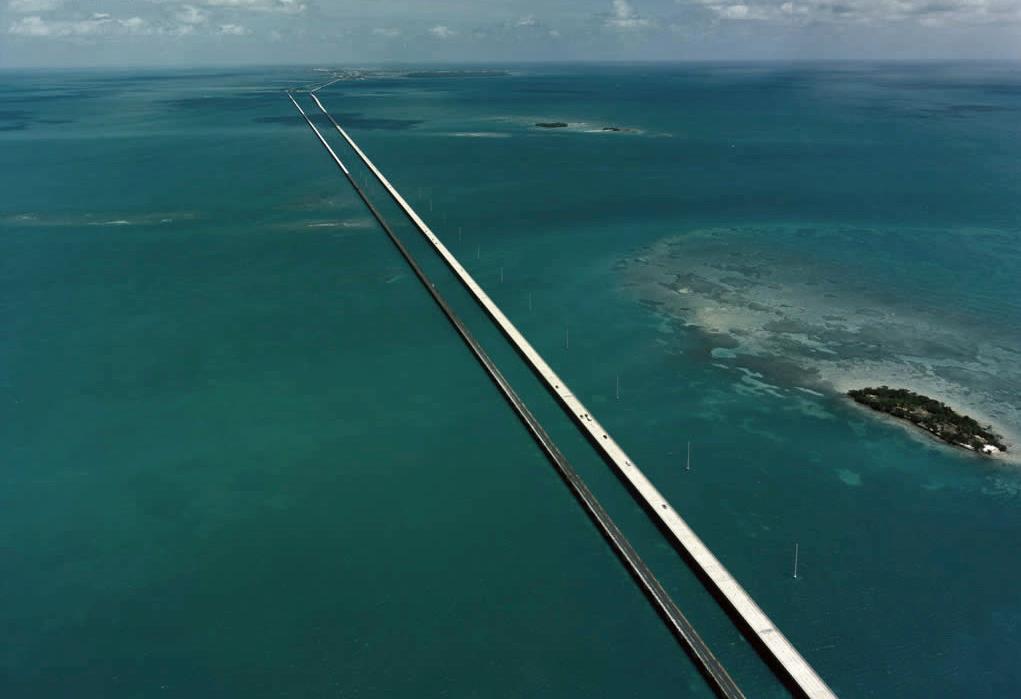
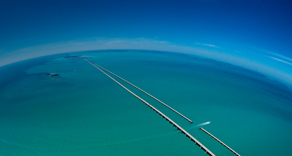
Descripción:Y la decima y última posición en este top 10 de los diez puentes mas largos del mundo es para el “Seven Mile Bridge”, o puente de las Siete Millas, que conecta el Golfo de México y la península de Florida, con 10.887 metros de longitud y construido en 1982. La carretera que lo cruza es conocida como “Overseas Highway”, carretera sobre el mar.
http://losmejorestop10.wordpress.com/2010/01/04/top-10-puentes-mas-largos-del-mundo/
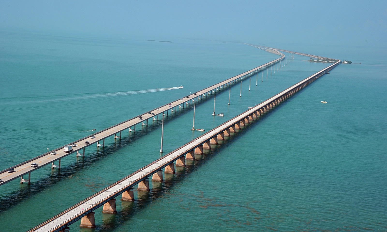
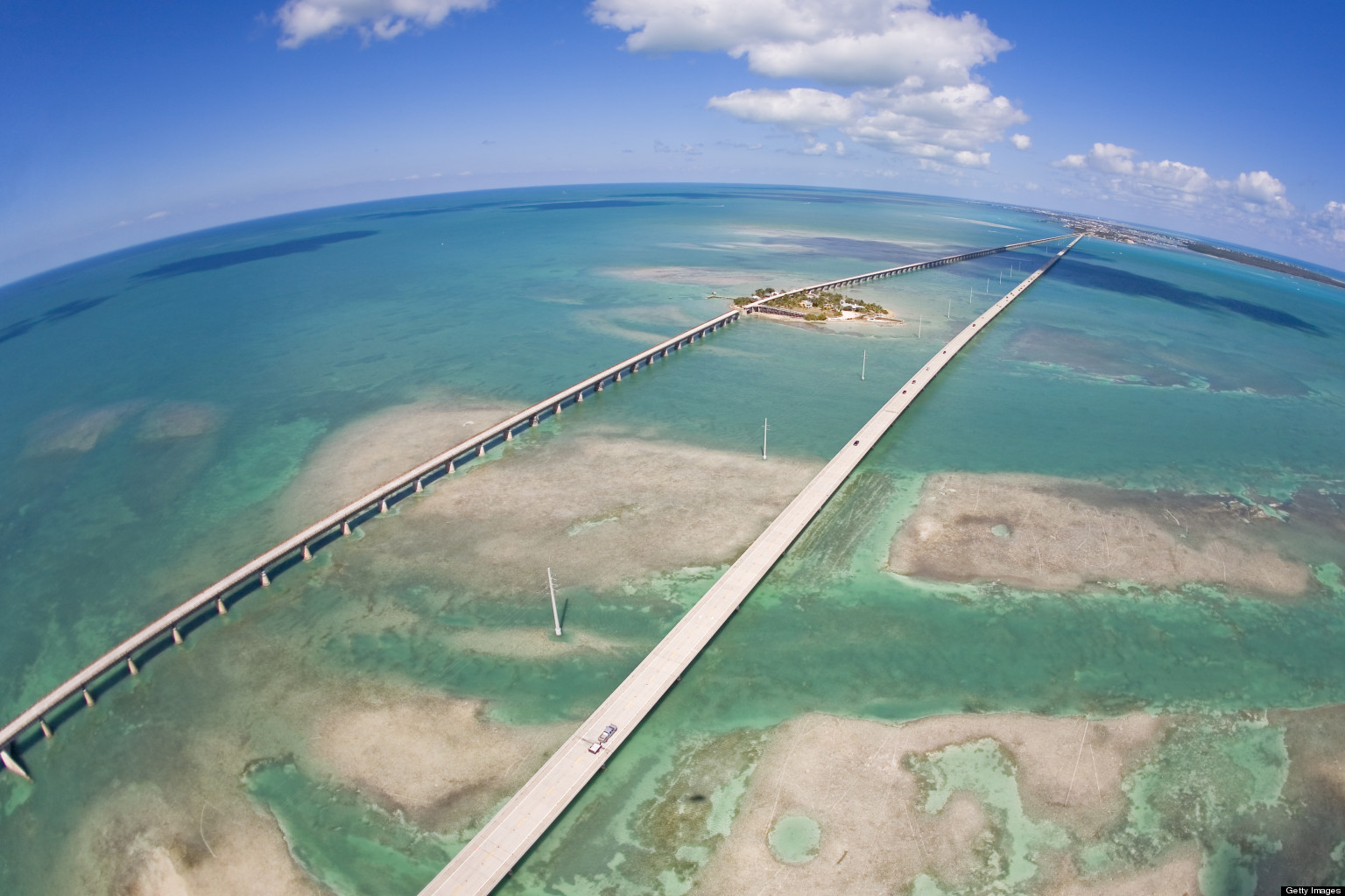
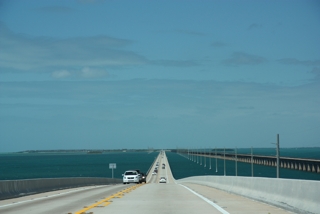
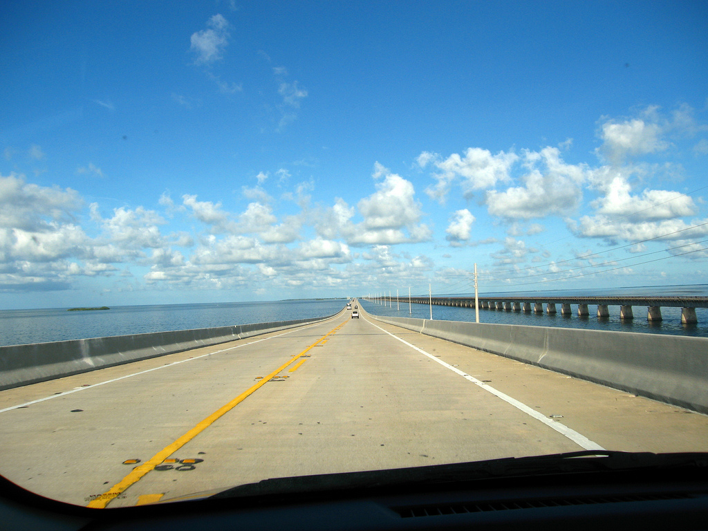
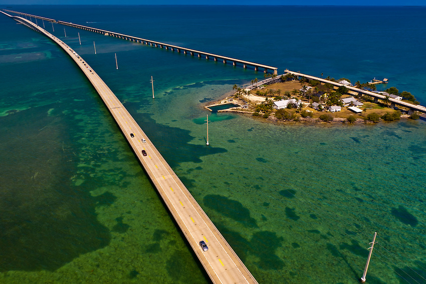
El puente de las Siete Millas,conecta el Golfo de Mexico y la peninsula de Florida, con 10.887 metros de longitud y construido en 1982. La carretera que lo cruza es conocida como "Overseas Highway", algo asi como carretera sobre el mar.
www.taringa.net/posts/imagenes/5489993/Los-Puentes-mas-largos-del-mundo-sorprendente.html
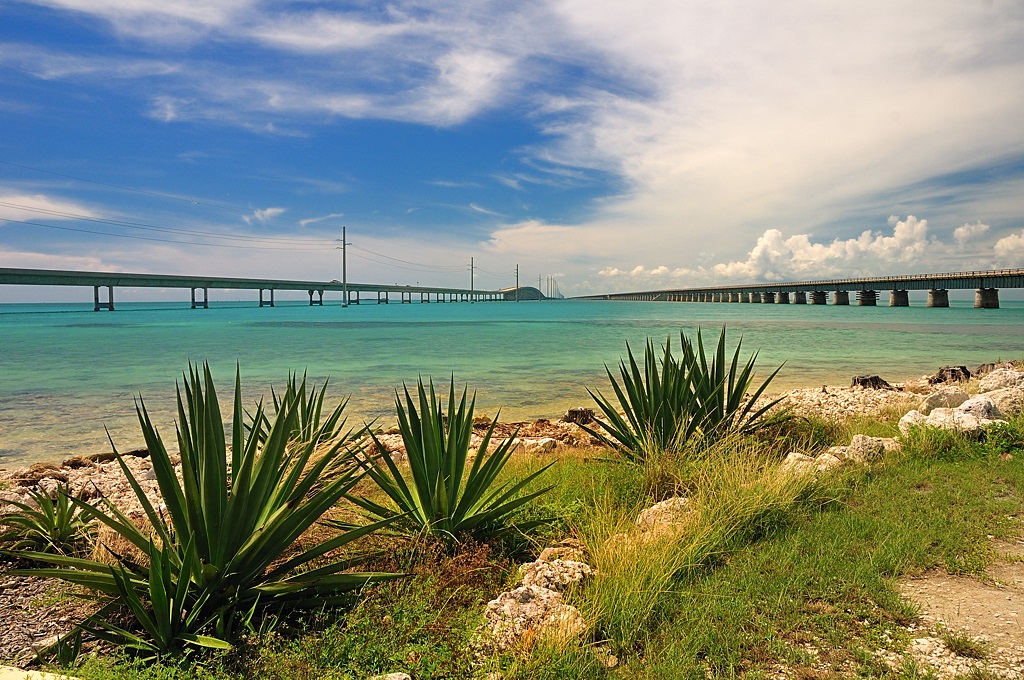
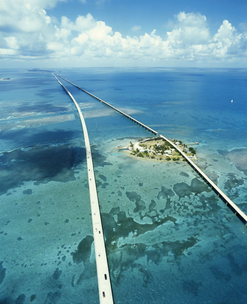
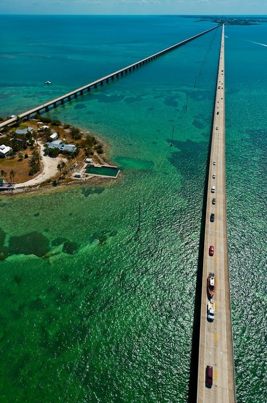
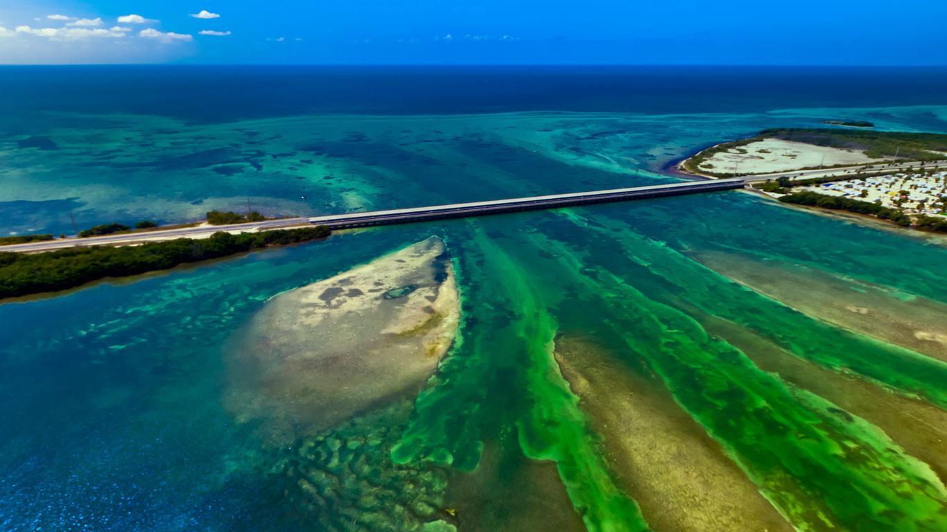
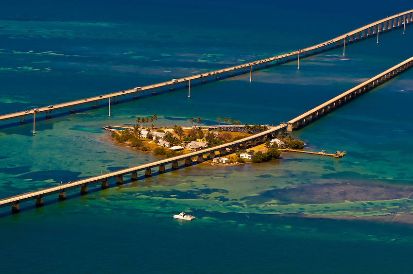
The Seven Mile Bridge is a famous bridge in the Florida Keys, in Monroe County, Florida, United States. It connects Knight's Key (part of the city of Marathon, Florida) in the Middle Keys to Little Duck Key in the Lower Keys. Among the longest bridges in existence when it was built, it is one of the many bridges on US 1 in the Keys, where the road is called the Overseas Highway.
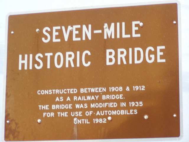
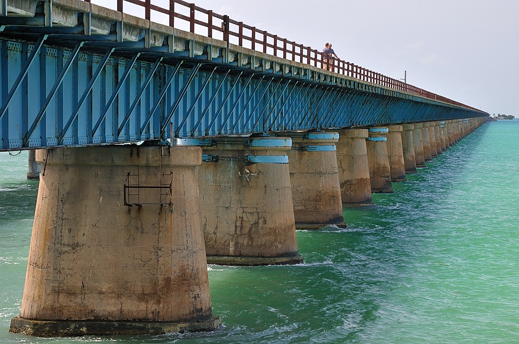
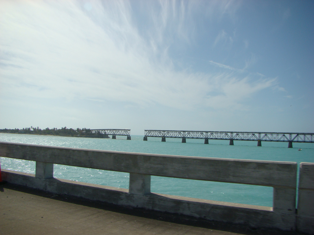
There are two bridges in this location. The older bridge, originally known as the Knights Key-Pigeon Key-Moser Channel-Pacet Channel Bridge, was constructed from 1909-1912 under the direction of Henry Flagler as part of the Florida East Coast Railway's Key West Extension, also known as the Overseas Railroad.
Contents
History
After the railroad sustained considerable damage due to effects of the Labor Day Hurricane of 1935, the line was sold to the United States Federal Government, who subsequently refurbished Seven Mile Bridge for automobile use. Dismantled trackage was recycled, painted white, and used as guardrails. It had a swing span that opened to allow passage of boat traffic, near where the bridge crosses Pigeon Key, a small island where a work camp for Flagler's railroad was located. Hurricane Donna in 1960 caused further damage.
The current road bridge was constructed from 1978 to 1982. The vast majority of the original bridge still exists, used as fishing piers and access to Pigeon Key, but the swing span over the Moser Channel of the Intracoastal Waterway has been removed.
http://en.wikipedia.org/wiki/Seven_Mile_Bridge
http://www.skyscrapercity.com/showthread.php?t=823046
http://www.flickr.com/photos/jakeperks/tags/sevenmilebridge/
http://www.flickr.com/search/?w=58373741@N00&q=Seven Mile Bridge
http://www.friendsofoldseven.org/
Vídeo:
Contador: 15003
Inserción: 2013-08-07 14:30:42
Lugares a visitar en un radio de 100 km (en línea recta)
Mapa de los lugares a 100 km (en línea recta)
Mostrando Registros desde el 1 hasta el 0 de un total de 0
Visitas RSS |
Más visitados Basílica de San Marcos  150625 Catedral de Notre Dame (París)  139516 Torre de Pisa  129066 Monte Saint-Michel  98322 Presa de las Tres Gargantas  75472 |
Incorporaciones Punta Arenas  102 Curicó  90 Aeropuerto de Maracaibo  99 Puerto Oeste de Berlín  95 Catedral de Panamá  127 |
Comentarios granylator  Central hidroeléctrica de Sarátov Производим оборудование для гранулирования корма. Arq. Jaime Fuentes Flores  Torres Obispado EXTRAORDINARIO . FELICIDADES . Un Cordial saludo Directivos y Personal de ... hazola  Cúpula de la Roca gracias me... gera  Buenos Aires las mejores fotos de la mejor ciudad del... Daniel M. - BRASIL  San Francisco ... |


