
Nombre:
Askja
Otro:
Localización:
View Larger Map
Tipo: Naturales
Categoría: Volcanes
Foto:
Voto:
Continente: Europa
País: Islandia
Localización: Dyngjufjöll
Año:
Estado: Terminado
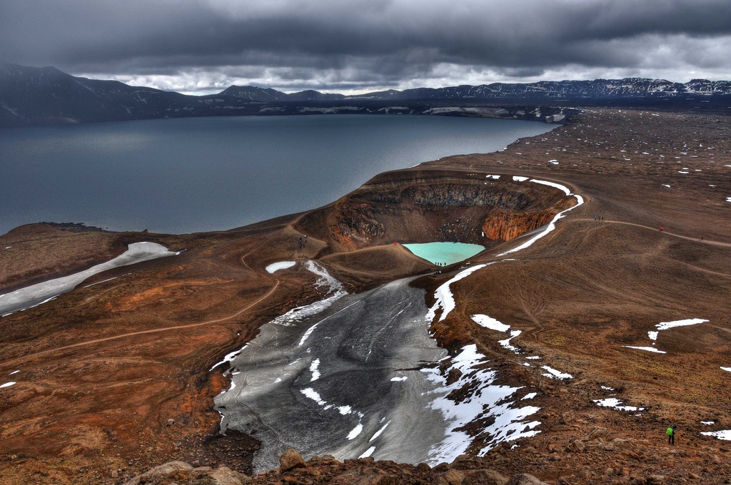
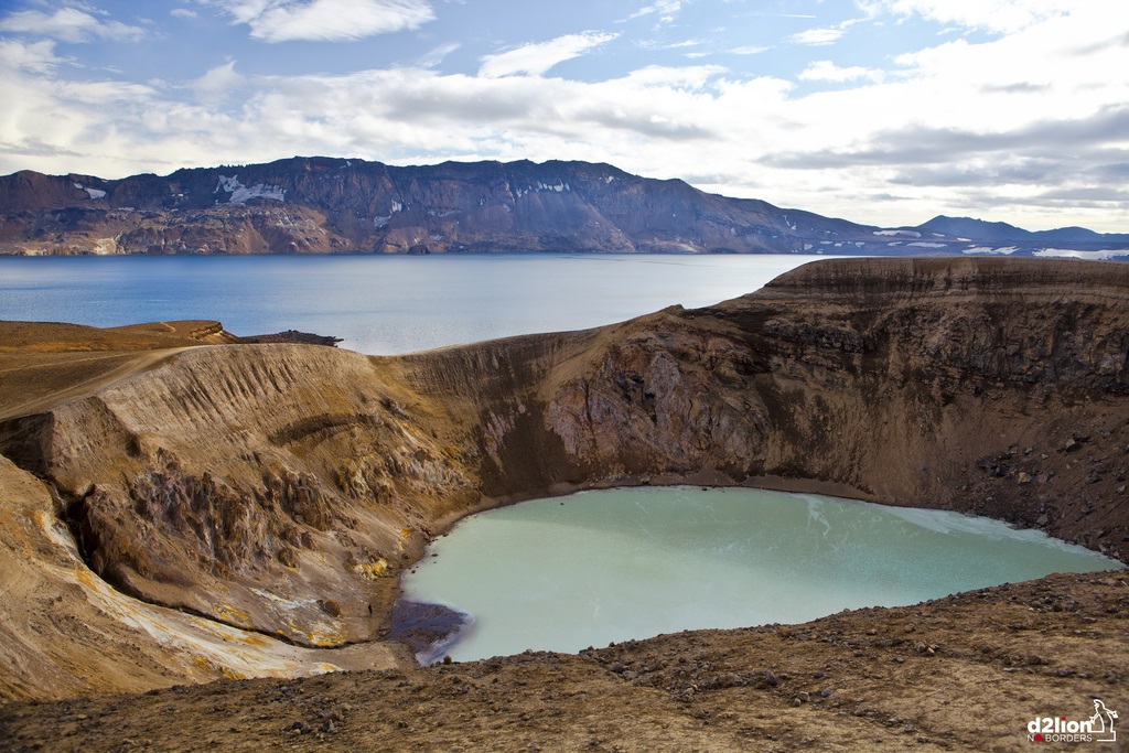
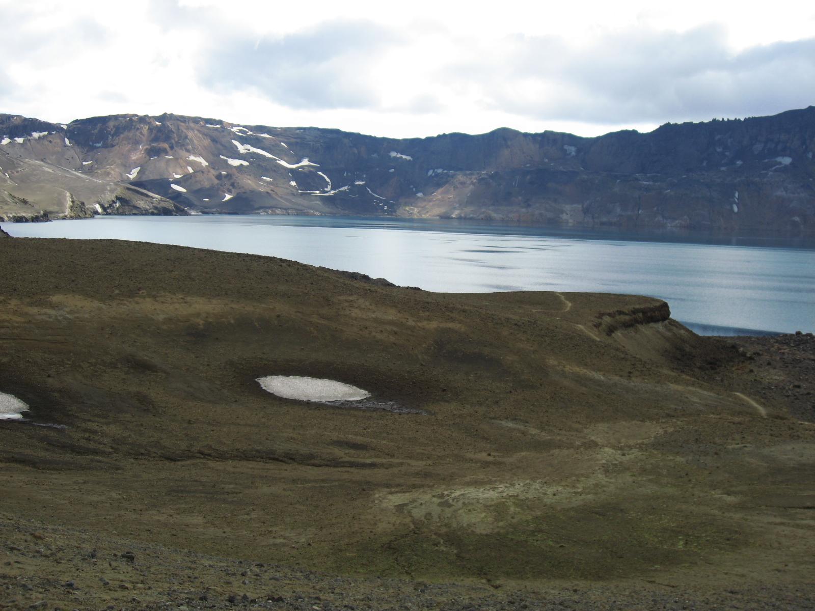
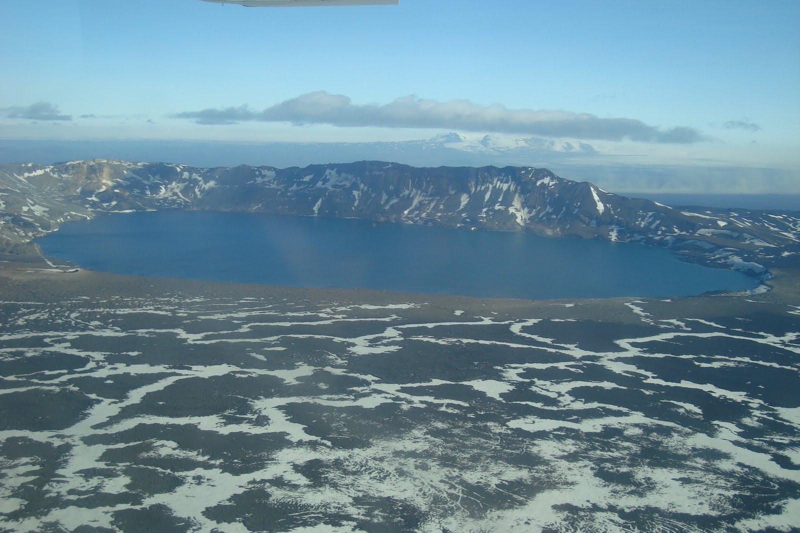
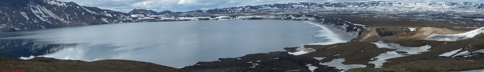
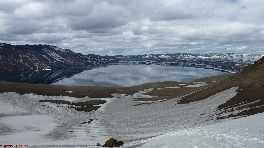
Descripción:Askja es el cráter más grande de la caldera volcánica de Dyngjufjöl ubicado en Islandia. Se encuentra a 32 km al norte de Vatnajökull, el mayor campo de hielo islandés.
Sus escabrosas cumbres, por encima de los 1,510 m, rodean un lago de 11 km2 que reside en la concavidad. El volcán hizo erupción en 1875 y de nuevo en 1961.
http://en.wikipedia.org/wiki/Askja
Un paisaje “lunar” entre cráteres y lagos verdes (Askja, Islandia)
Escrito por: Matías Callone
Islandia, tenía que ser. El país donde se pueden encontrar fisuras geológicas que dividen continentes cubiertas de aguas prístinas, o una colección de paisajes que parecen de otro planeta. De hecho, el paisaje a continuación, también tiene mucho de paisaje que podríamos imaginar “extraterrestre”. Hablamos de una región que sólo es accesible unos pocos meses al año por las condiciones del clima. Un sitio inhóspito, que fue utilizado para entrenar a algunos astronautas para las misiones a la Luna dentro del programa Apolo, y que incluye cráteres que parecen dormir, cubiertos de agua en colores intensos por su riqueza mineral:
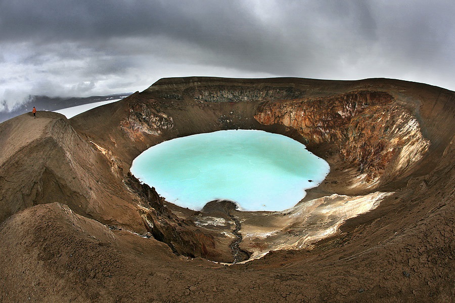
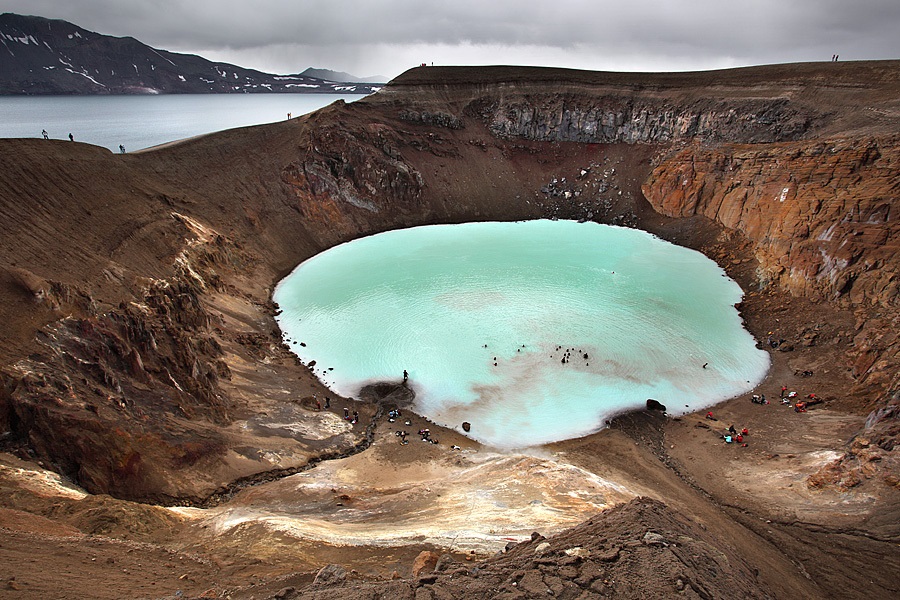
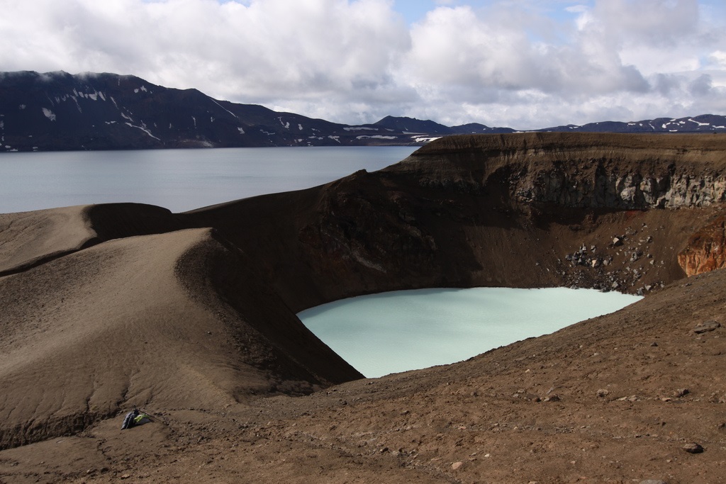
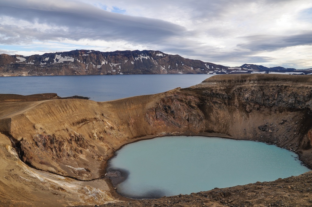
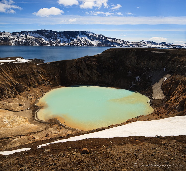
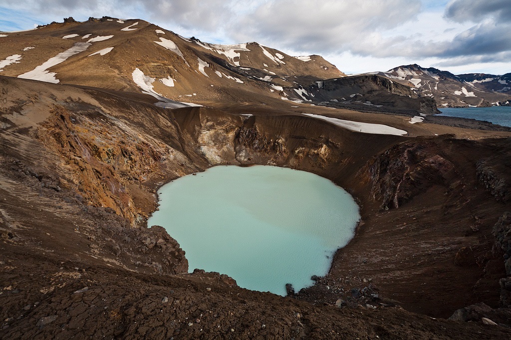
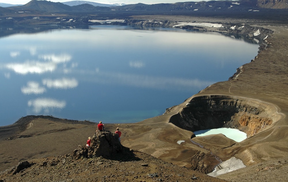
Askja es el cráter más importante de la caldera volcánica de Dyngjufjöl en Islandia. Las cumbres en la zona alcanzan alturas que superan apenas los 1.500 msnm, altura en la que se encuentra el lago del cráter Askja, junto a otro cráter más pequeño llamado Viti. Viti también aparece en las fotos a continuación, y lo podemos identificar por su color verde-azulado intenso. Tiene un diámetro de 150 metros y tiene una temperatura en teoría agradable para nadar. Aunque nadar no es un buena idea (por el dióxido de carbono que se acumula en la superficie del agua que podría intoxicar a cualquier nadador), en una de las fotos se puede ver a un nadador, algo muy llamativo (o no tanto, se llama imprudencia) y nada recomendable.
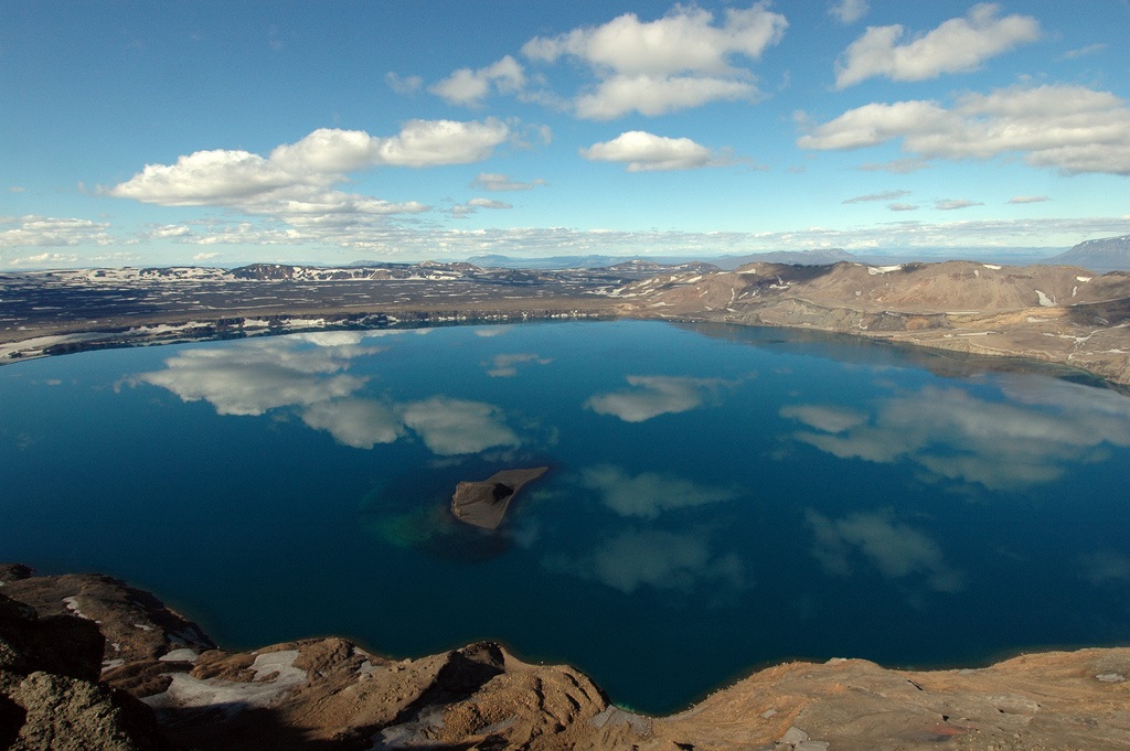
En cambio, el lago del cráter Askja es más grande, y según los controles geológicos que se realizan, hay un aumento de la actividad sísmica a partir de 2010, lo que podría anunciar una erupción en cualquier momento.
Por la belleza despojada del lugar, Askja es una atracción turística con un mínimo de servicios que incluye dos refugios de montaña y camping. Se llega a través de la carretera que rodea Islandia (Circulo Dorado), y la aventura incluye una caminata breve, sólo posible entre finales de junio y hasta principios de octubre.
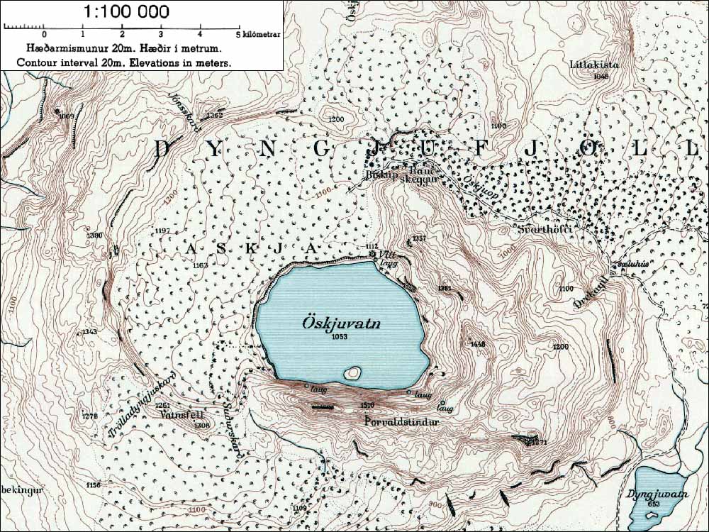
Askja (Icelandic pronunciation: [ˈascja]) is a stratovolcano situated in a remote part of the central highlands of Iceland. The name Askja refers to a complex of nested calderas within the surrounding Dyngjufjöll mountains, which rise to 1,510 m (4,954 ft), askja meaning box or caldera in Icelandic[2]
Location
The region is only accessible for a few months of the year. Being situated in the rain shadow to the northeast of the Vatnajökull glacier, the area receives only about 450 mm of rainfall annually. The area was used during training for the Apollo program to prepare astronauts for the lunar missions. Their main objective in Askja was to study geology.
Eruptions
Askja was virtually unknown until the tremendous eruption which started on March 29, 1875. Especially in the eastern fjords of Iceland, the ashfall was heavy enough to poison the land and kill livestock. Ash, or tephra from this eruption was wind-blown to Norway and Sweden. The eruption triggered a substantial wave of emigration from Iceland. Another less well-known eruption occurred in the early Holocene, ca 11,000 years ago. Tephra from this eruption has been found in south-east Sweden, Northern Ireland and north Norway. The last eruption of the Askja was in 1961.
The outer caldera of Askja, representing a prehistoric eruption, is about 50 km², and there is evidence of other later caldera-forming events within it. The main crater floor lies at about 1,100 m.
In June 2010, Volcano expert Hazel Rymer said seismic activity was increasing at Askja and that an eruption could be around the corner[3] The increased earthquake activity is located to the northeast of the central volcano, in the direction of Herðubreið. It was ruled out that any activity from Eyjafjallajökull was responsible for the increase in activity at Askja. The news came as scientists continue to watch Katla.
In early April 2012 it was noted that the lake in the caldera was totally clear of ice, which usually does not happen until in June or July in a normal year. It is believed that increased geothermal activity in the volcano is heating the lake. Travel in the area was restricted until further research could be carried out. [4]
Öskjuvatn lake
Öskjuvatn is a large lake that fills much of the smaller caldera resulting from the 1875 eruption. Its surface lies about 50 m below the level of the main crater floor and covers about 12 km². When the lake originally formed it was warm, but today it is frozen over for most of the year. Öskjuvatn is the second deepest lake in Iceland at 220 m deep.[5]
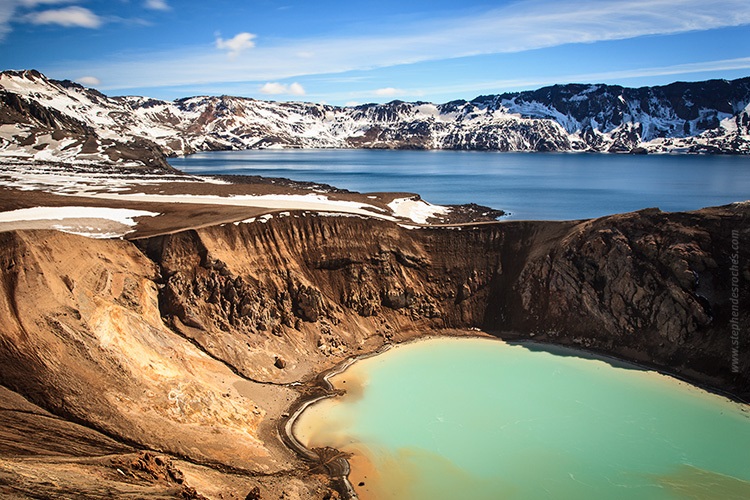
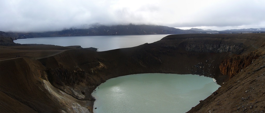
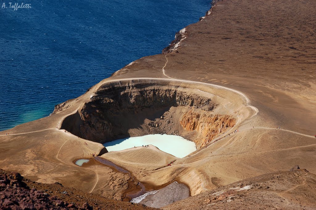
Askja's Víti crater
Víti is a smaller explosion crater on the north east shore of Öskjuvatn, approximately 150 metres diameter. It contains a geothermal lake of mineral-rich, sulphurous, opaque blue water, which is maintained at a comfortable temperature for swimming. Swimming in these craters is not a good idea because carbon dioxide can accumulate on top of the water, making the swimmer pass out and drown. However, it has to be mentioned that there rarely is a calm day in Askja. Víti was formed in the eruption of 1875.
http://en.wikipedia.org/wiki/Askja
http://volcanocafe.wordpress.com/2012/05/15/herdubreid-renewed-activity-at-askja/comment-page-1/
http://flickrhivemind.net/Tags/askja/Recent
http://www.flickr.com/photos/eetu-immonen/tags/askja/
http://www.flickr.com/photos/berserkjahraun/tags/ökjuvegur/
http://wwwislandiatierraindomita.blogspot.com.es/2010/08/sabado-24-7-2010.html
Vídeo:
Contador: 3911
Inserción: 2013-06-28 16:43:53
Lugares a visitar en un radio de 100 km (en línea recta)
Mapa de los lugares a 100 km (en línea recta)
Mostrando Registros desde el 1 hasta el 0 de un total de 0
Visitas RSS |
Más visitados Basílica de San Marcos  152340 Catedral de Notre Dame (París)  141476 Torre de Pisa  129751 Monte Saint-Michel  99002 Presa de las Tres Gargantas  78322 |
Incorporaciones |
Comentarios accidentally took another fina  Puerto de la bahia de Saldanha propecia... hazola  Cúpula de la Roca gracias me... gera  Buenos Aires las mejores fotos de la mejor ciudad del... Daniel M. - BRASIL  San Francisco ... PEQUE  Presa Chicoasén SERA QUE ALGUIEN ME PUEDE DAR MAS INFORMACIÓN DE ESTE PROYECTO ESTUDIO EN LA UNACH Y ES PARA UN... |


|
Foro |

|