Nombre:
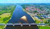
Canal de Bydgoszcz
Otro: Canal de Bromberger
Localización:
View Larger Map
Récord: 24.70 km
Tipo: Canales
Categoría:
Foto:

Voto:
Continente: Europa
País: Polonia
Localización: Bydgoszcz-Nakło, Vístula-Óder
Año: 1772-1775
Estado: Terminado
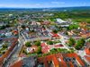
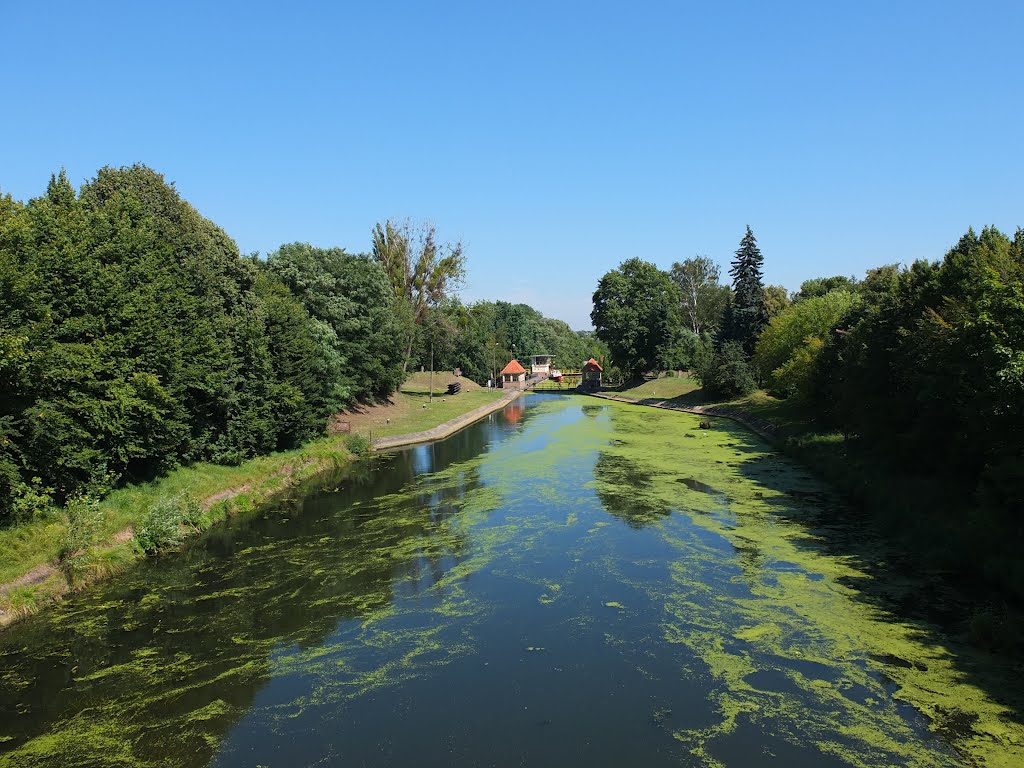
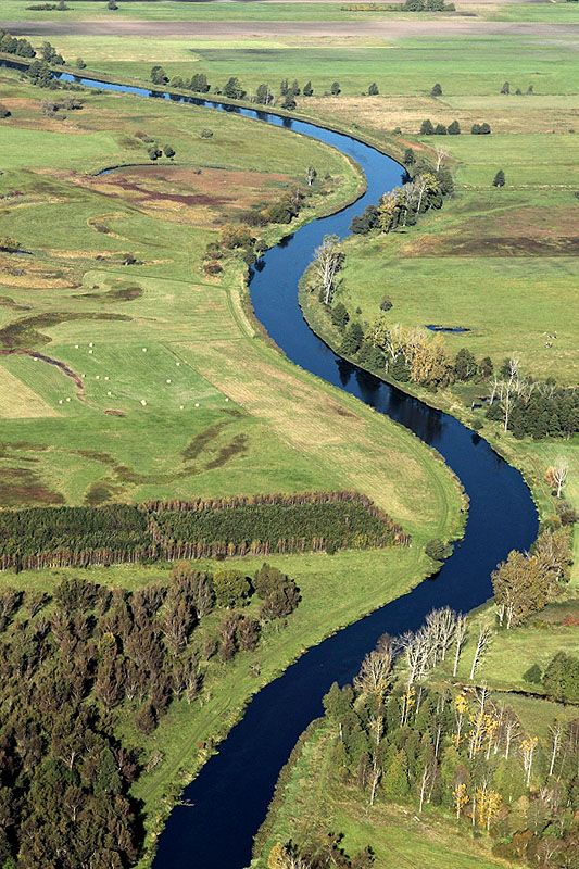
Descripción:Bydgoszcz Canal was built in the years 1773-1774 as a part of the international waterway E 70. It connects the Vistula River and the Odra River through their tributaries: the Brda River, the Notec River and the Warta River. The establishment of Bydgoszcz Canal has contributed to the dynamic development of the city.
The modern hydrotechnical devices have been used. The combination of the industrial, residential and recreational buildings, has created the unique style of the city, its riverside identity and a status of one of the main centers of inland waterway transport.

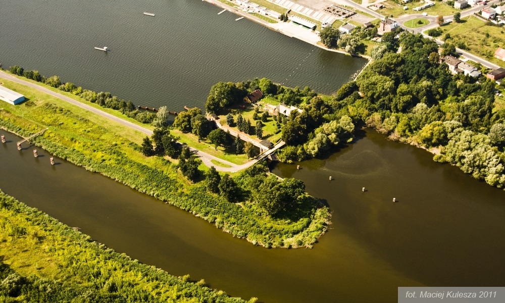


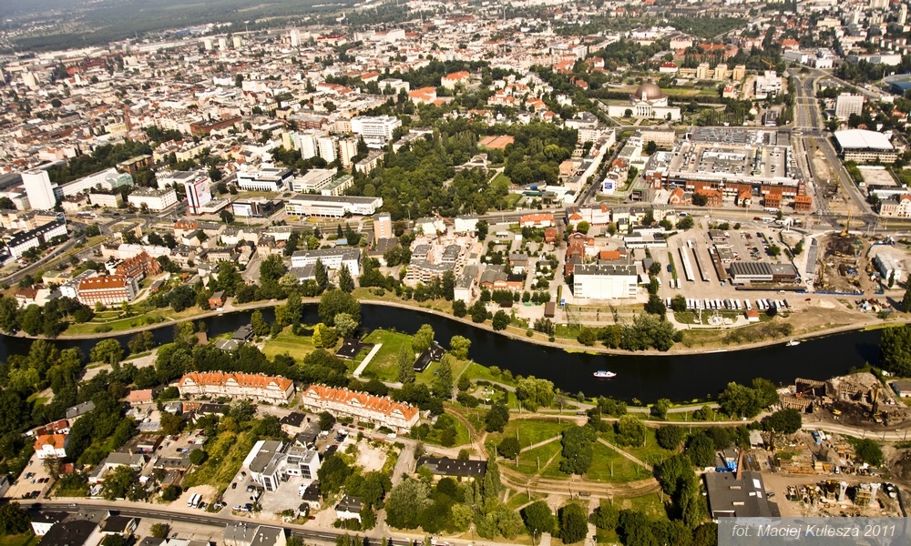


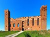
In the years 1908-1915 New Canal was built, along with its unique locks located in Czyżkówko and Okole districts. It's equipped with expansion tanks that allow to save most of the water. At the beginning of the twentieth century the Canal was rebuilt. The new passage connected the Canal with Brda River from the city center. The former course was losing its important transport. But surroundings of the Old Canal became a place for walks and social events for enriching and growing community from the city centre. It was a habit for many well-mannered inhabitants to drink coffee in cafes or restaurants located at Canal. After Second World War, social life at the Old Canal disappeared. In the seventies, its main section was buried in the city center. Antique locks began to disintegrate and the river transport deteriorated.
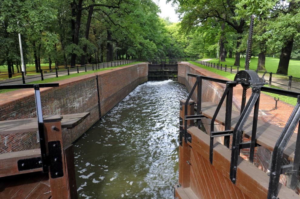
Bydgoszcz Canal has revived recently. Nowadays, the old section of Bydgoszcz Canal with its five locks and a beautiful park is used mainly for recreation. The surroundings of the Old Canal are well maintained. The historic locks have been renovated. The restaurant "Przy IV Śluzie" located in the "Park Hotel" refers to a romantic pre-war tradition.
We recommend a stroll over the Canal. It is a place where you can move in time and hear the voices of people who spend their lives there. With a little bit of imagination, you will be able to see the boats and rafts. The Bydgoszcz Canal Museum is situated nearby. There, you can find mementos of those interesting times.
http://www.visitbydgoszcz.pl/index.php/en/explore/what-to-see/2364-bydgoszcz-canal


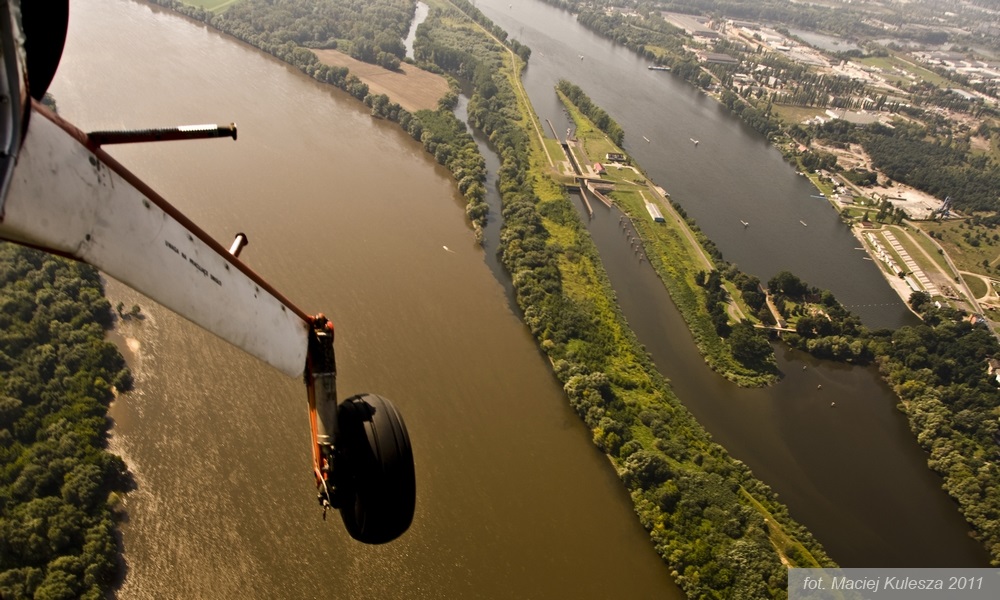
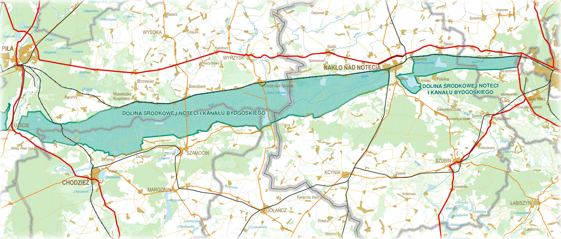
River Notec and Notec skanalizowana (canalised)
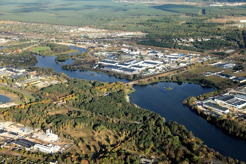
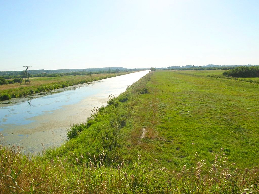
Notec flows into the Warte at the village of Santok, just before Grozow Wielkopolski. From this point there are another 68.2 km to the mouth of the Oder. Over the first 49 km the river is free, afterwards more or less canalised. Before arriving at kanal Bydgoski (Bromberger Kanal) one has to deal with 12 locks and 138.1 km. Colonies are rare and one is well advised to start the journey well equipped, in any aspect.
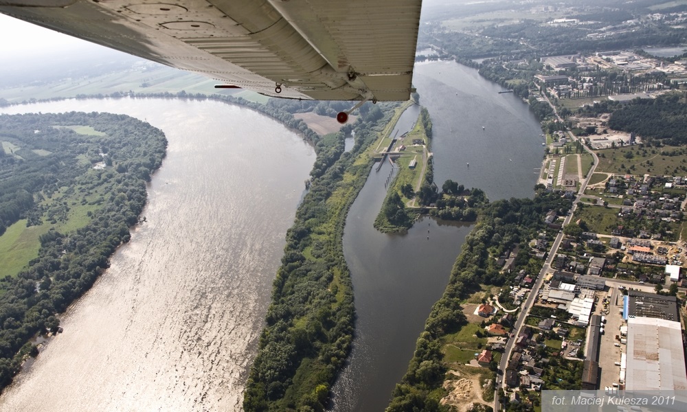
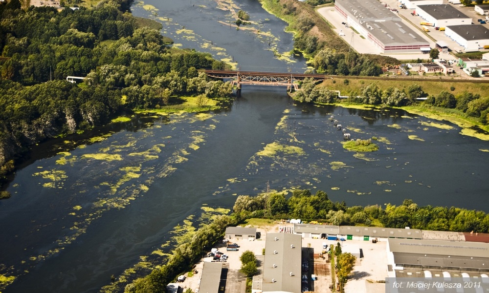
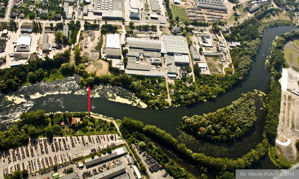
Kanal Bydgoski (Bromberger Kanal)
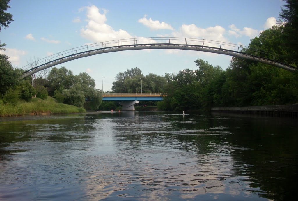
takes us across the eastern outskirts into the middle of the city of Bydgoszcz (Bromberg), ending as a dead end. But short before, there is the turning off into the Nowym canal, this brings us over 1.5 km into the, from there, canalised Brda (Brahe).
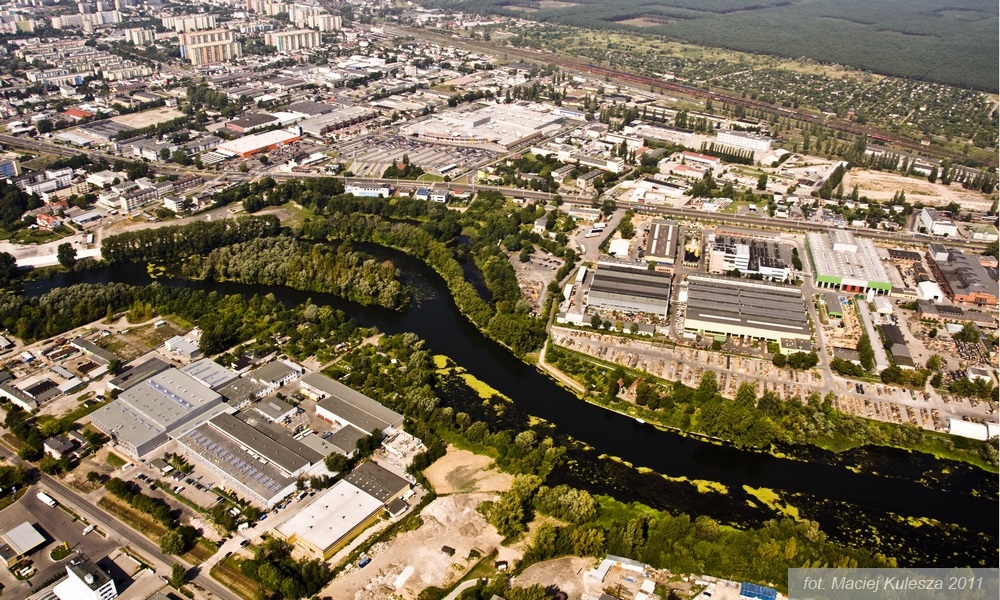
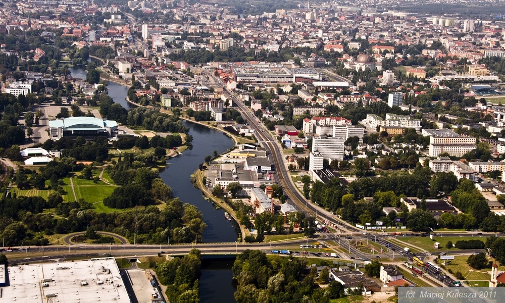
River Brda (Brahe)
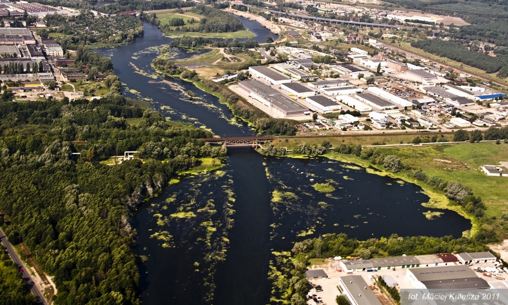
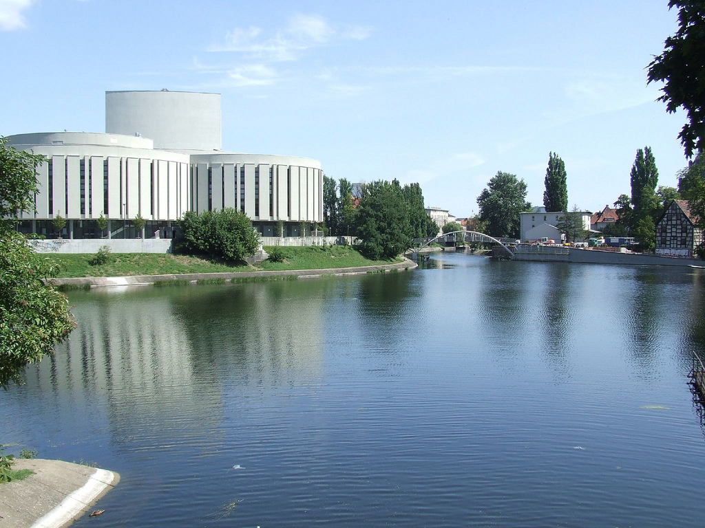
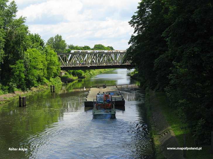
is navigable after the confluence with Nowym canal. It flows through the old harbour town of Bydgoszcz and meets the Wisla (Weichsel) 14 km later.
River Gwada
turns off to the north at the small town of Ujscia and used to be navigable over 3 locks to the industrial town of Pila / Gwada. However, these locks are not intact since the Second World War.
http://www.european-waterways.eu/e/info/poland/Netze_bromberger_kanal_brahe.php


Bydgoszcz Canal
2012-12-07
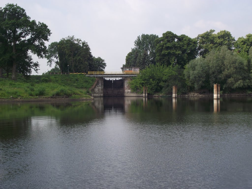
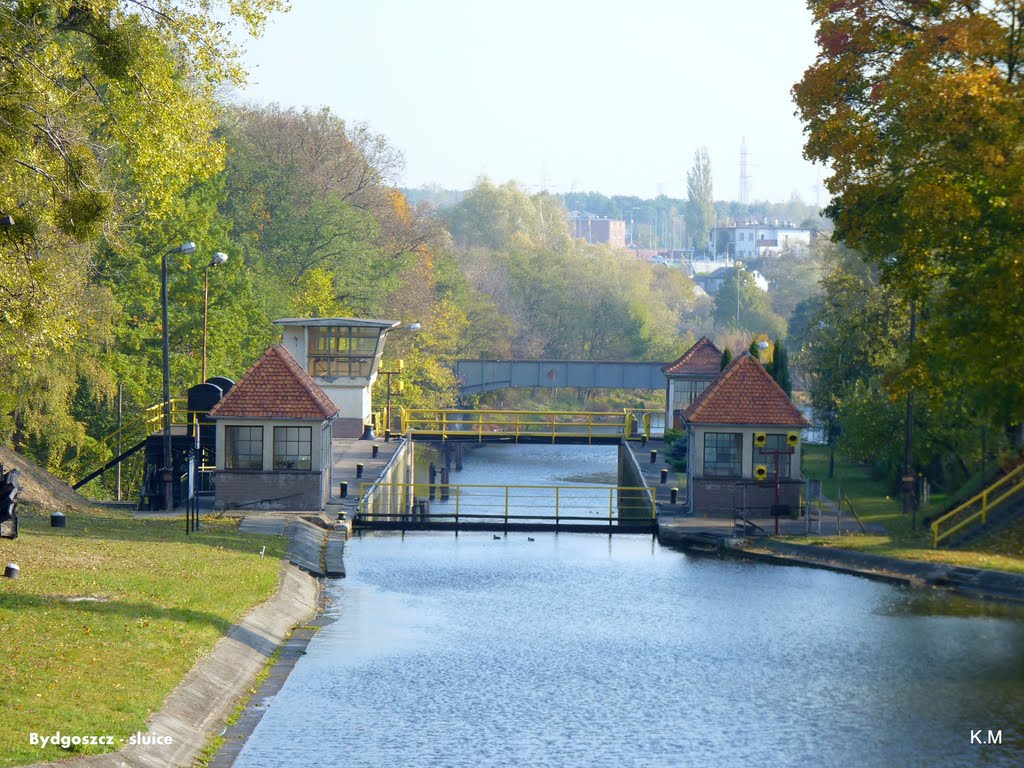
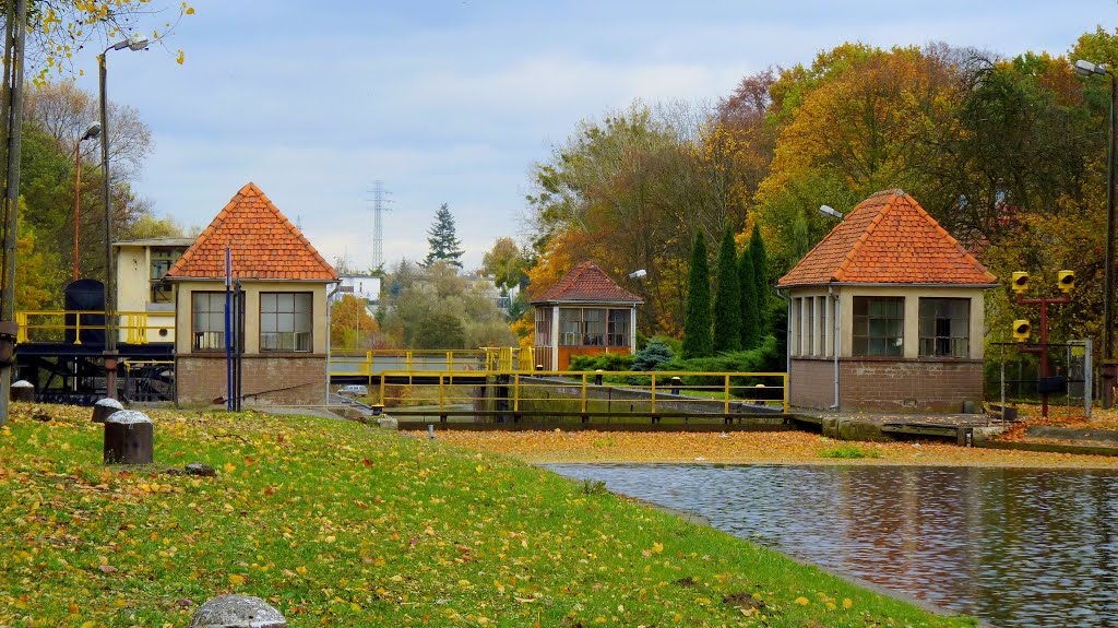
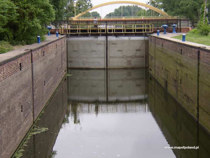
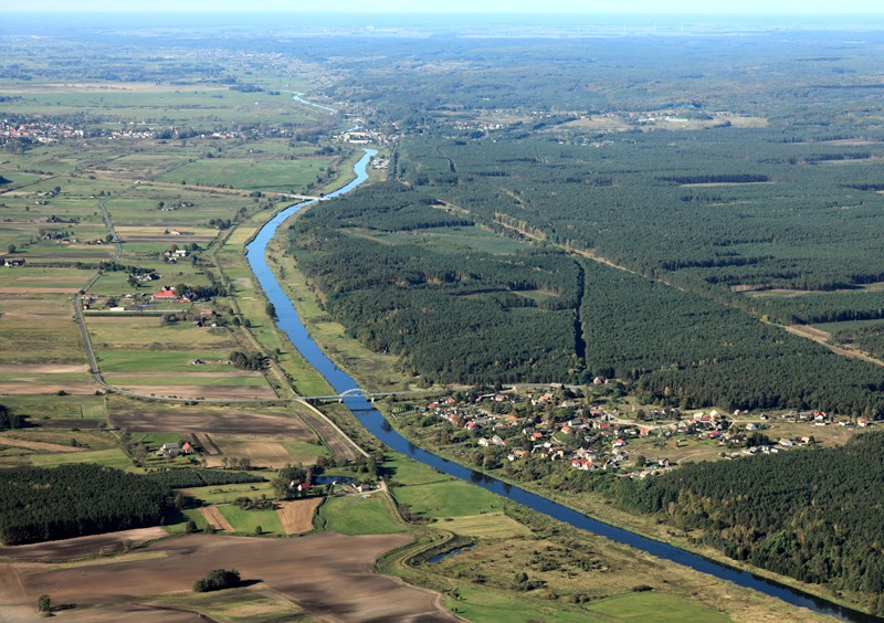
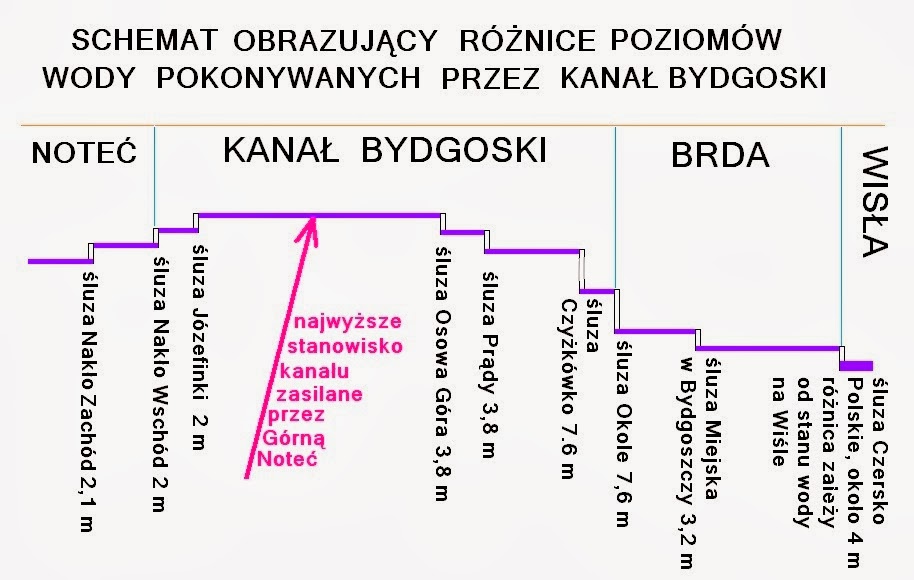
The Bydgoszcz Canal is the oldest operating and navigable canal in Poland. It is 24.5 km long and connects two water systems: the Brda River system (the Vistula basin) and the Noteć system (the Oder basin). The present route and the design of the locks date back to the period of 1912-1914.
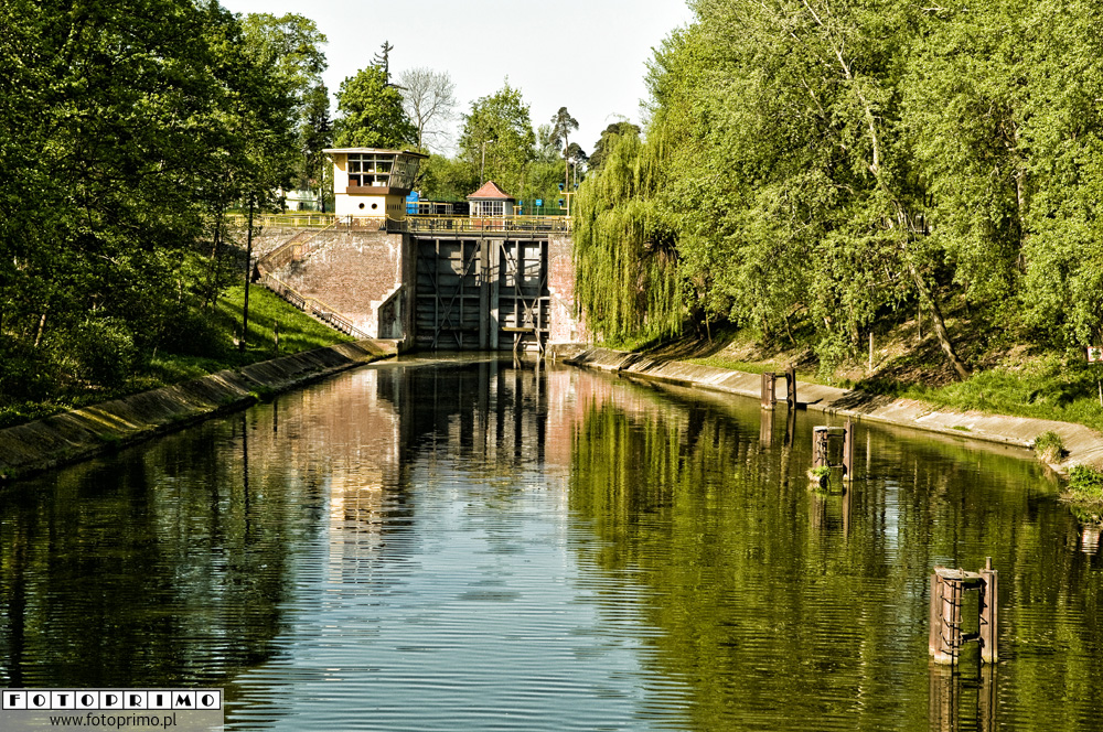
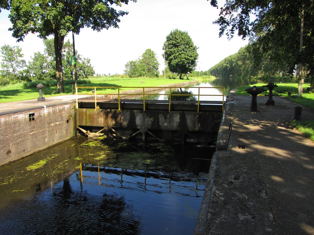
The canal has six canal locks in Okole, Czyżkówko, Prądy, Osowa Góra, Józefinki and Nakło Wschód. The difference of water levels between the locks is about 21 m in total. All the lock canals together are 57.4 m long and 9.6 m wide. The damming height ranges from 3.7 to 7.6 m. The lock canals Okole and Czyżkówko are electrically powered, while the others are hand-operated.
The navigable route of the Bydgoszcz Canal is 28-30 m wide and 1.6-2 m deep (class II waterway).
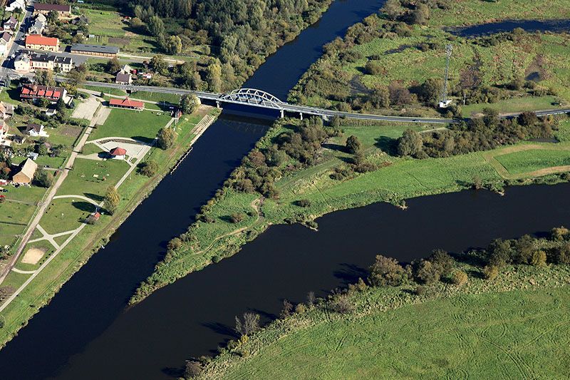
High-voltage lines are at a height of at least 8 m from the water surface. The lowest bridge is located at the Osowa Góra lock and the clearance is about 3.7 m at high navigable water level.
In the period from mid-July to the end of October duckweed (Lemna minor) forms green, over 5 cm thick layers covering the stream from bank to bank. It can be a real nuisance for owners of vessels with low-power engines or external water cooling.
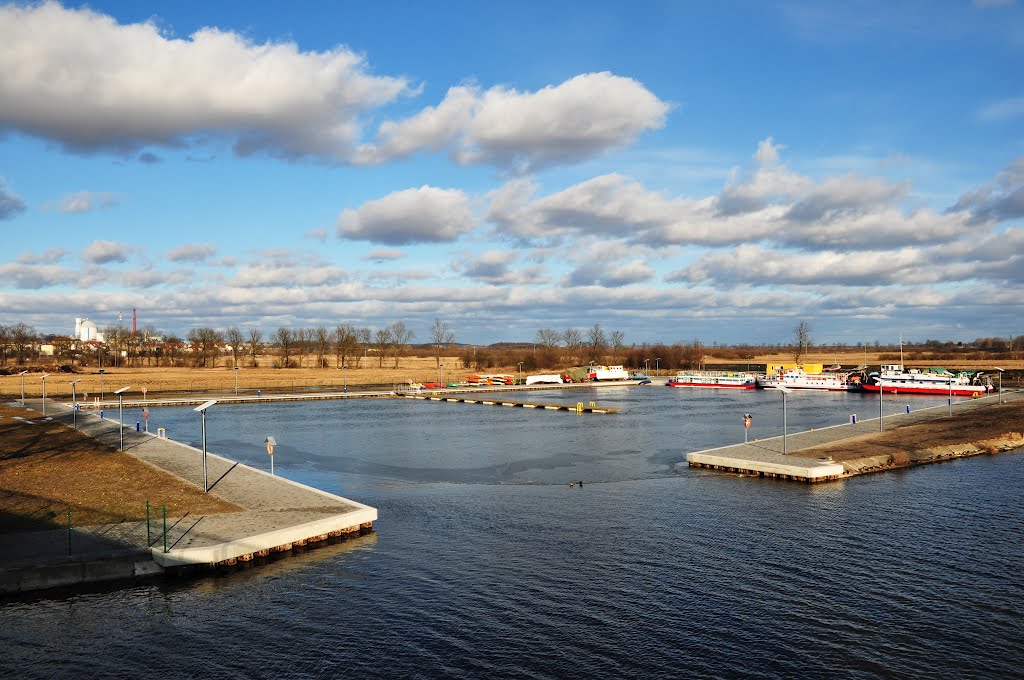
The canals banks are not suitable for mooring. Professional port services are provided only at the "Gwiazda" harbour, neighbouring with two historic locks: Czyżkówko and Lock no. VI.
http://www.mdwe70.pl/article/47/89/kanal-bydgoski
http://mdwe70.pl/web/aplikacja/index.php?id=przewodnik&str=14&lang=ger
http://en.wikipedia.org/wiki/Bydgoszcz_Canal
http://pl.wikipedia.org/wiki/Kanał_Bydgoski
Pinche para ver las Fuentes seleccionadas

Vídeo:
Contador: 6723
Inserción: 2014-10-17 16:49:22
Lugares a visitar en un radio de 100 km (en línea recta)


Mapa de los lugares a 100 km (en línea recta)
Mostrando Registros desde el 1 hasta el 0 de un total de 0
Visitas RSS |
Más visitados Basílica de San Marcos  156030 Catedral de Notre Dame (París)  145646 Torre de Pisa  132517 Monte Saint-Michel  101651 Burj Khalifa  86292 |
Incorporaciones |
Comentarios JamesNox  Mumbai (Bombay) Free bot for Telegram to generate freebies, subscriptions. Super boost TG channels! We is... Agenaktof  Mumbai (Bombay) In addition, folks these living in the residence, and stability of who're opioid addicted spend... Wein Plaza  Mumbai (Bombay) Thanks a lot. Loads of knowledge! Wein Plaza - JerryMiff  Mumbai (Bombay) Всем доброго времени суток! Хочу посоветовать... Oscarhealf  Mumbai (Bombay) Прикиньте, вчера я осознал, что мир маркетплейс... |