Nombre:
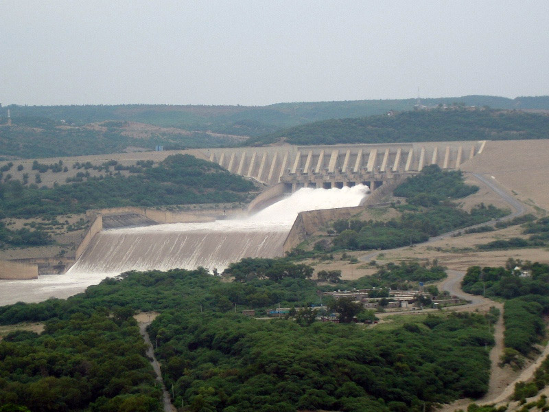
Presa de Mangla
Otro:
Localización:
View Larger Map
Récord: 7250 hm³
Récord de Altura: 150 m
Tipo: Presas
Categoría:
Foto:
Voto:
Continente: Asia
País: Pakistán
Localización: Mangla, Azad Kashmir
Año: 1961-1967
Estado: Terminado
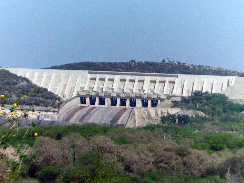
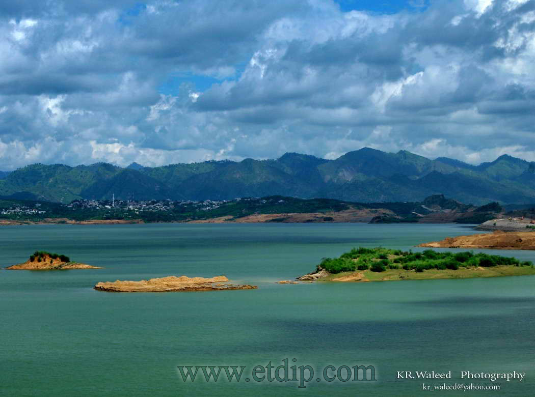
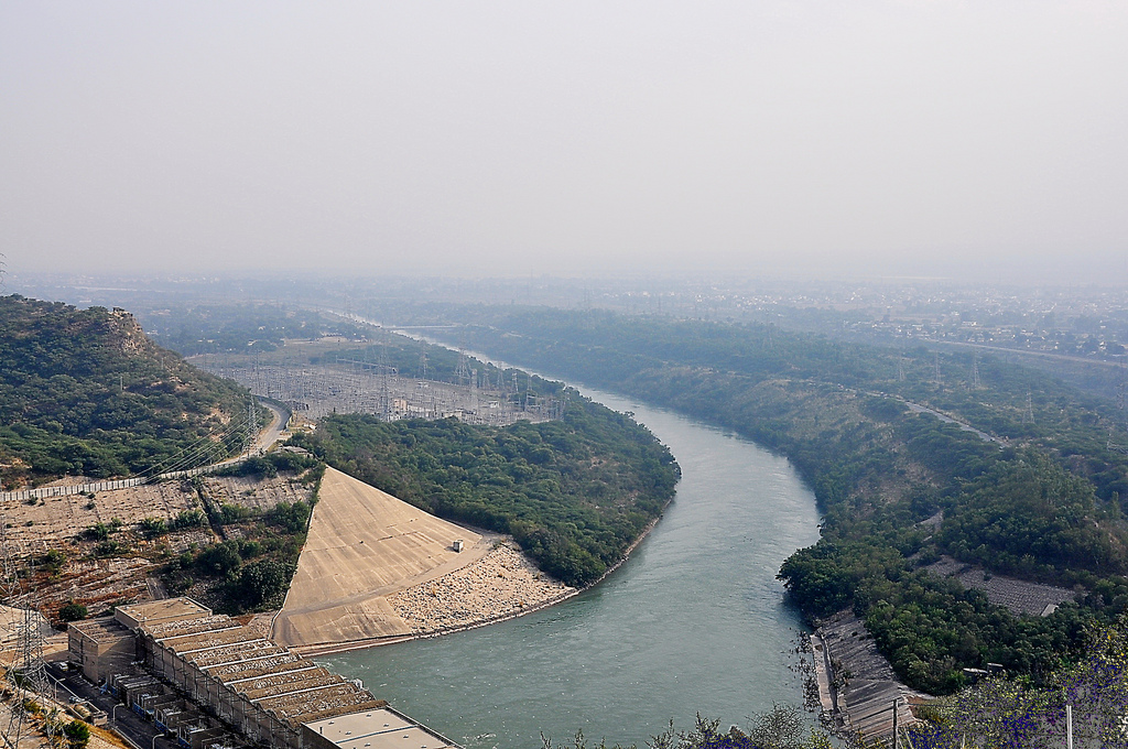
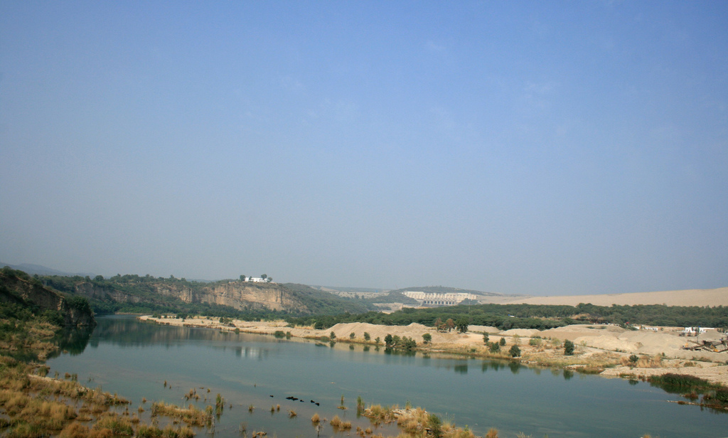
Descripción:La presa de Mangla (Urdu: منگلا بند) ubicada en el distrito de Mirpur, es la sexta presa en tamaño del mundo.1 Fue construida entre 1961 y 1967 con fondos procedentes del Banco Mundial. El proyecto fue diseñado y supervisado por Binnie & Partners de Londres, y fue construido por Mangla Dam Contractors, un consorcio de ocho firmas de construcción estadounidense, esponsorizada por Guy F. Atkinson Company de San Francisco Sur. Los contratistas de la presa de Mangla emplearon a pakistaníes, estadounidenses, británicos, canadienses, alemanes e irlandeses.2
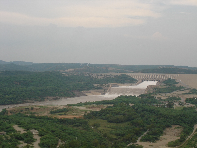
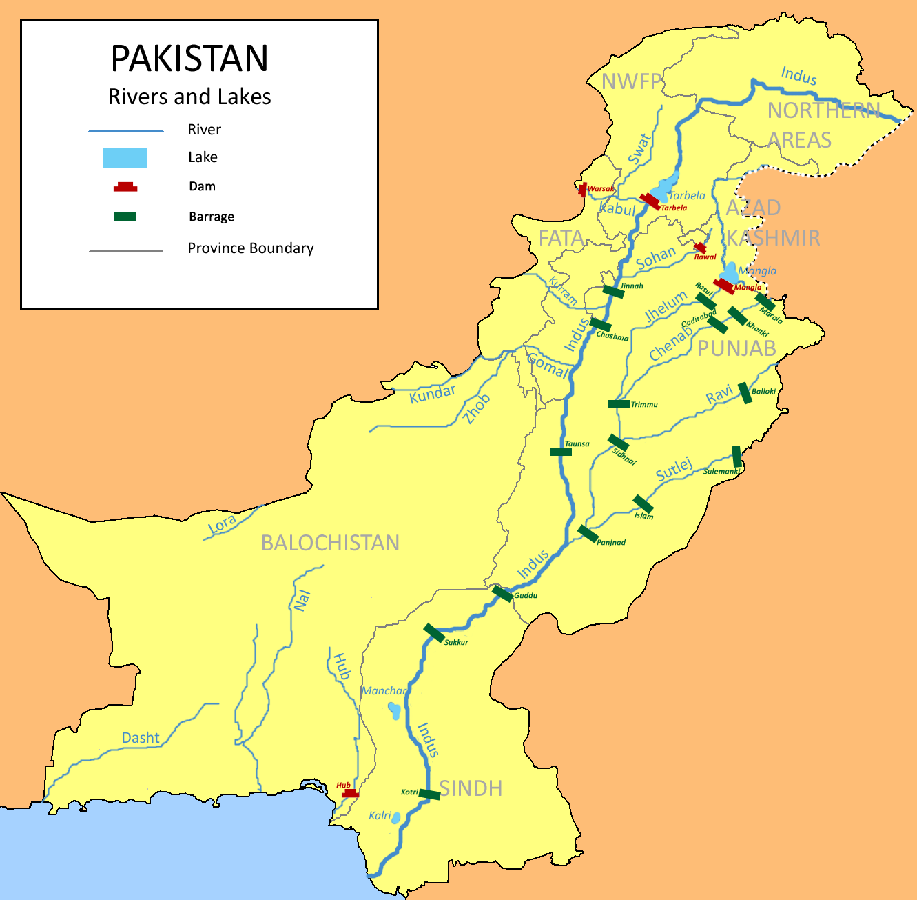
Como parte del Tratado de las Aguas del Indo firmado en el año 1960, la India obtuvo derecho a las aguas de los ríos Ravi, Sutlej y Beas, mientras que Pakistán, además de las aguas de esos tres ríos dentro de Pakistán y algunas compensaciones monetarias, recibió los derechos a desarrollar las cuencas de los ríos Jhelum, Chenab e Indo a través de la construcción del Proyecto de la Cuenca del Indo. Hasta 1967, todo el sistema de irrigación de Pakistán dependía totalmente de los caudales sin regular del Indo y sus principales afluentes. El rendimiento agrícola era muy bajo por una serie de razones, siendo la más importante la falta de agua durante períodos de crecimiento críticos. Este problema derivaba de las variaciones estacionales en el caudal del río debido a los monzones y la ausencias de embalses de almacenamiento para conservar las vastas cantidades de agua sobrante durante aquellos períodos de grandes descargas del río. 3 4
http://es.wikipedia.org/wiki/Presa_de_Mangla
http://en.wikipedia.org/wiki/Mangla_Dam
http://ur.wikipedia.org/wiki/منگلا_بند
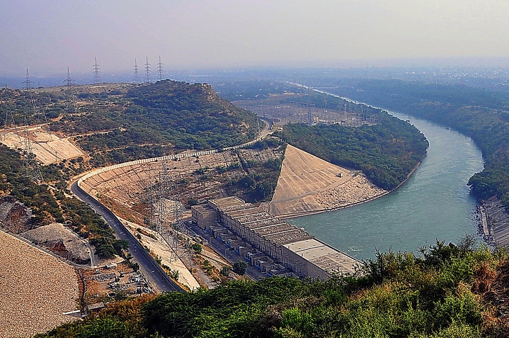
The Mangla Dam water storage and power generation project was the beginning of the construction of mega projects in Pakistan. The construction started on 8 May 1962 and was finally inaugurated on 23 November 1967. The dam was built by a international consortium, which besides the World Bank also included Austria, Canada, West Germany, New eland, the UK and USA.
The project was designed primarily to increase the amount of water that could be used for irrigation from the flow of the Jhelum and its tributaries. Its secondary function was to generate electrical power from the irrigation releases at the artificial head of the reservoir. The project was not designed as a flood control structure, although some benefit in this respect also arises from its use for irrigation and water supply.
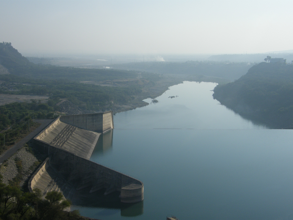
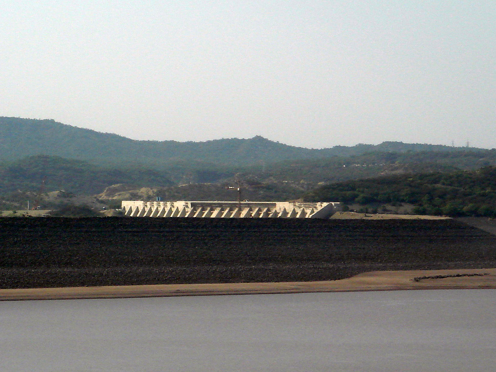
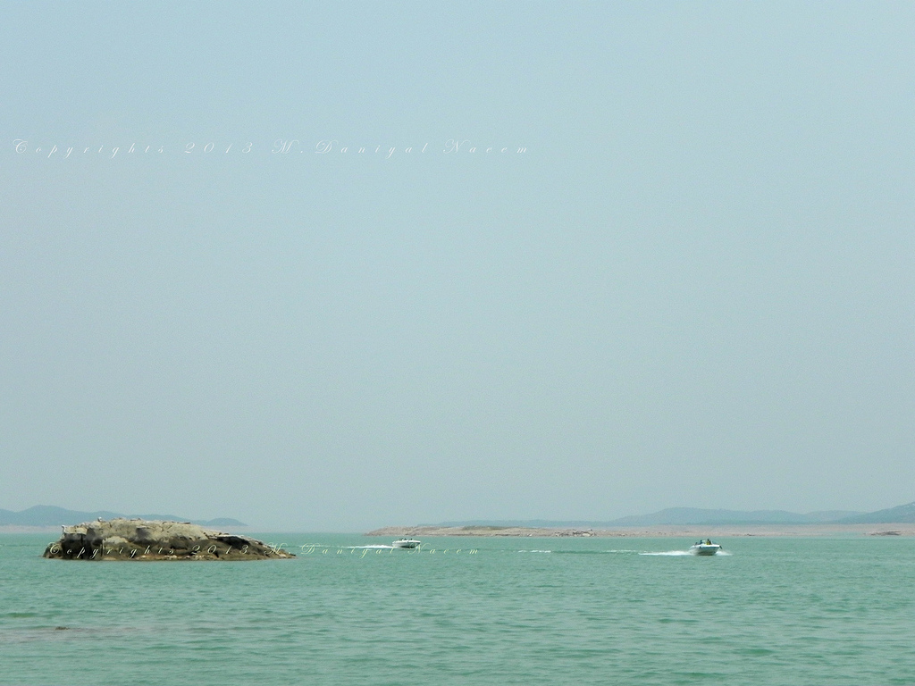
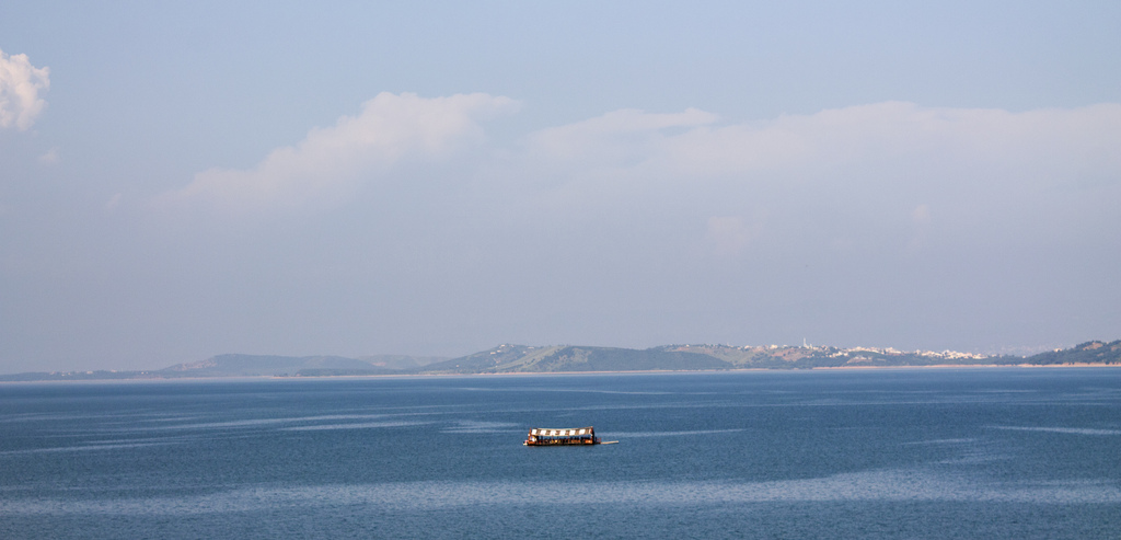
The main structures of the dam include 4 embankment dams, 2 spillways, 5 power-cum-irrigation tunnels and a power station. The main dam is 10,300 feet long and 454 feet high (above core trench) with a reservoir of 97.7 square miles. The dam is 3,353 meters long and 116 meters high above the river bed. Its lake is spread over 100 kilometres. The main dam is supported by two auxiliary dams, the Jari and Sukhian dams. It is designed to store 5.88 MAF water and also used for power generation. Mangla had an initial storage capacity of 5.88 MAF in 1967, which has now been reduced to 1.97 MAF (34% of the initial). In view of its declining storage, recently a massive raising project is presently underway to raise the level by 30 feet from the existing 1210 feet level at an approximate cost of Rs. 59 billion. Mangla Dam is one of the biggest earth filled dams in the world and is approximately two and a half times bigger than the Egyptian Aswan Dam. The dam was damaged partially during an Indian Air Force bombing in the Indo-Pakistani War of 1971 when the dam was hit by the bombs, against the international convention that large water reservoirs should not be targeted in war.
http://www.skyscrapercity.com/showthread.php?t=1085937
http://www.skyscrapercity.com/showthread.php?t=747686
Vídeo:
Contador: 7861
Inserción: 2013-06-07 14:12:40
Lugares a visitar en un radio de 100 km (en línea recta)

Mapa de los lugares a 100 km (en línea recta)
Mostrando Registros desde el 1 hasta el 0 de un total de 0
Visitas RSS |
Más visitados Basílica de San Marcos  155905 Catedral de Notre Dame (París)  145446 Torre de Pisa  132417 Monte Saint-Michel  101536 Burj Khalifa  85975 |
Incorporaciones |
Comentarios Agenaktof  Mumbai (Bombay) In addition, folks these living in the residence, and stability of who're opioid addicted spend... Wein Plaza  Mumbai (Bombay) Thanks a lot. Loads of knowledge! Wein Plaza - JerryMiff  Mumbai (Bombay) Всем доброго времени суток! Хочу посоветовать... Oscarhealf  Mumbai (Bombay) Прикиньте, вчера я осознал, что мир маркетплейс... Sergio alumb  Puerto de Klaipeda Not long ago I started exploring coin collecting. I found a helpful resource at |