
Nombre:
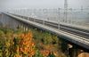
Presa de Sanmenxia
Otro:
Localización:
Ver mapa más grande
Récord: 65000 hm³
Récord de Altura: 106 m
Tipo: Presas
Categoría: Concreto Gravedad
Foto:
Voto:
Continente: Asia
País: China
Localización: Sanmenxia
Año: 1960
Estado: Terminado
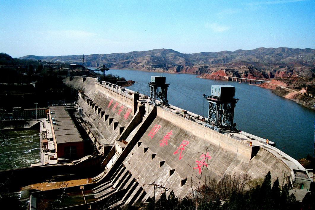
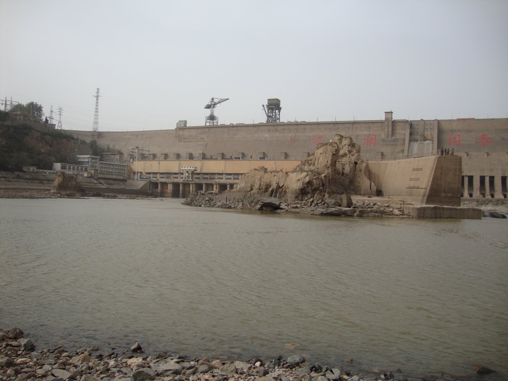
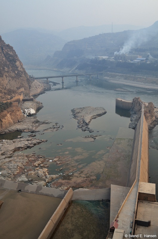
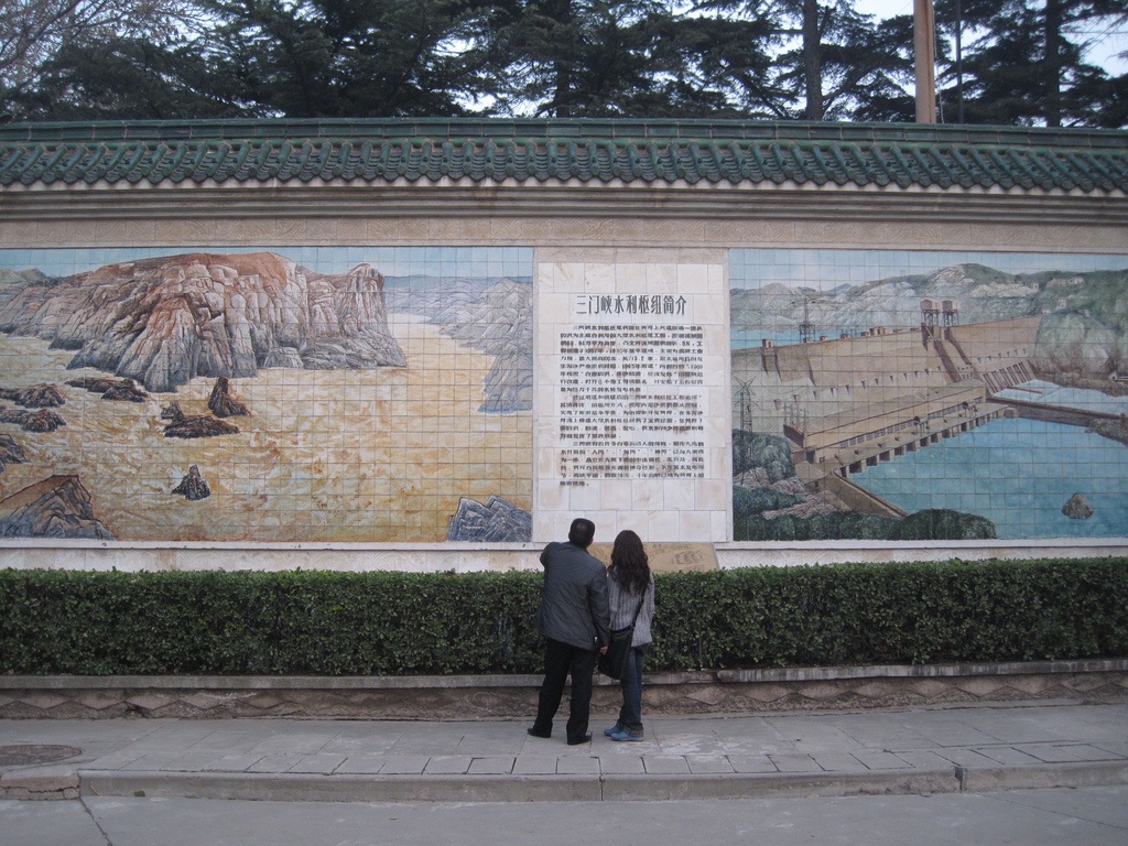
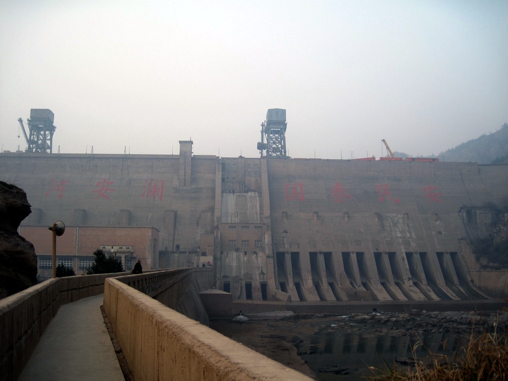
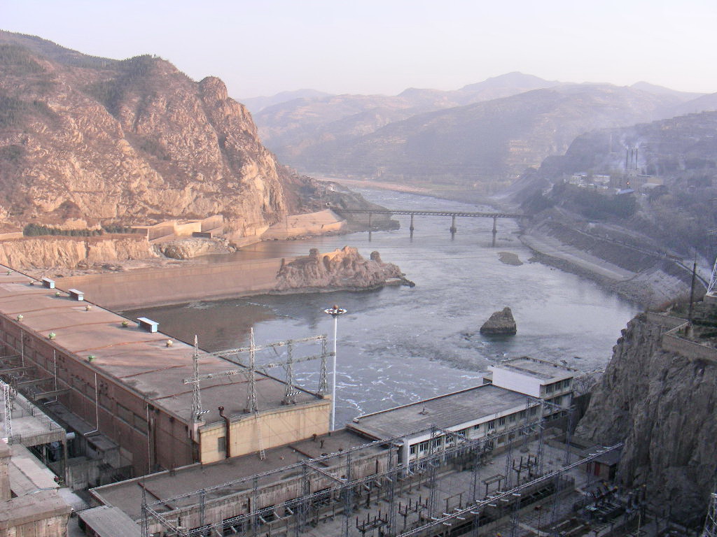
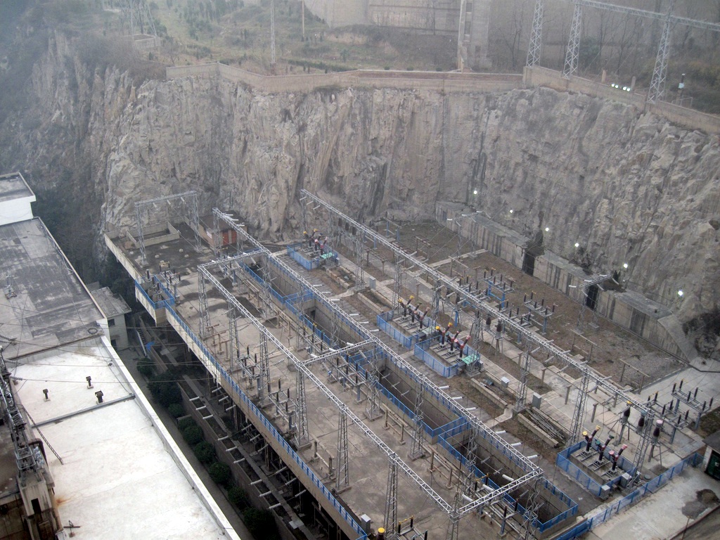
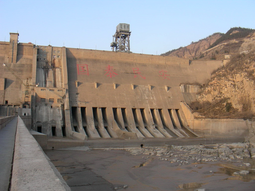
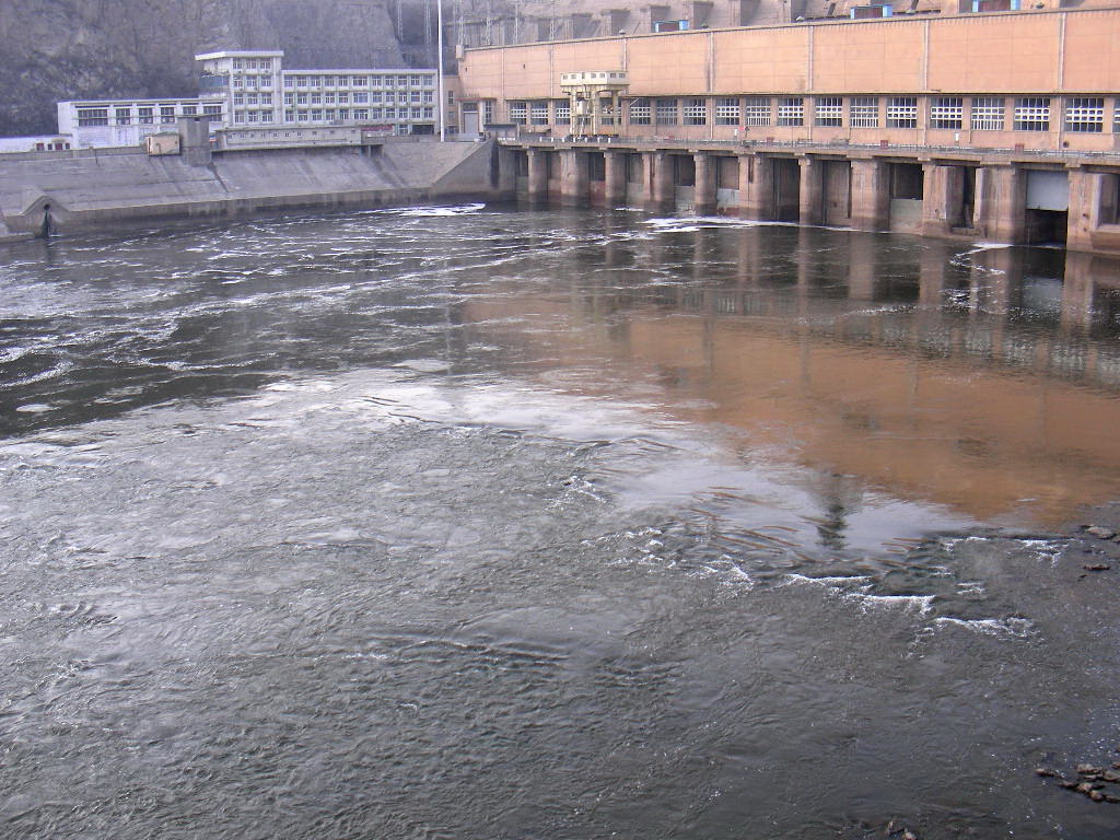
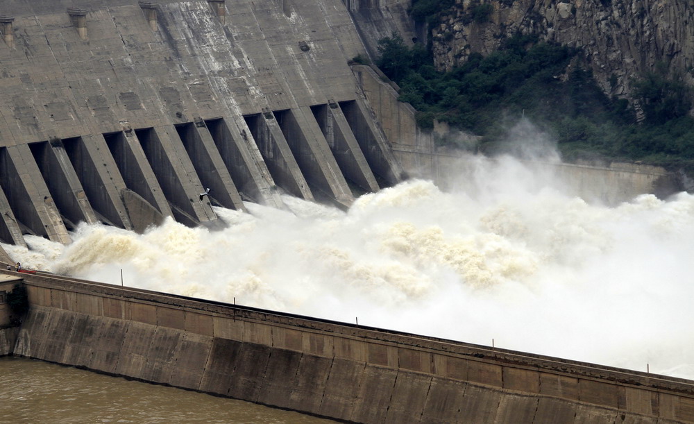
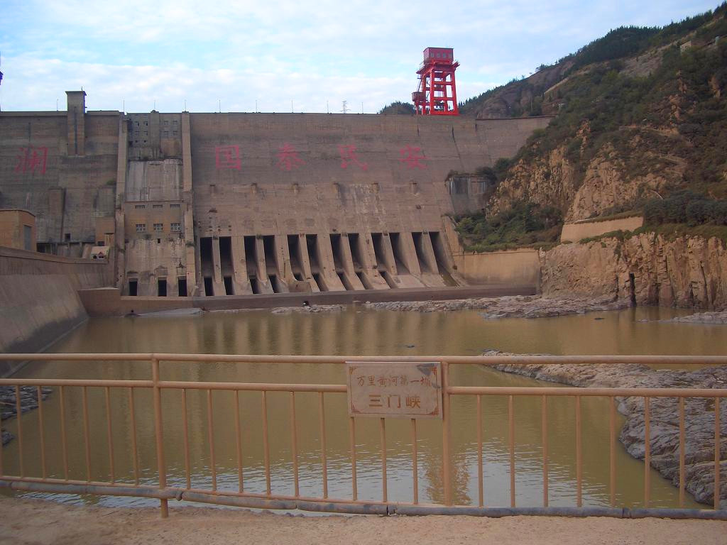
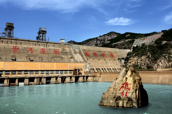
Descripción:The Sanmenxia Dam is a concrete gravity dam on the middle-reaches of the Yellow River near Sanmenxia on the border Shanxi and Henan Province, China. The dam is multi-purpose and was constructed for flood and ice control along with irrigation, hydroelectric power production and navigation. Construction began in 1957 and was completed in 1960. It is the first major water control project on the Yellow River and was viewed as a major achievement of the new People's Republic of China. Subsequently, its image was printed on the country's bank notes. However, due to sediment accumulation in the reservoir, the dam was later renovated. The effects from sediment, which include flooding upstream, have placed the dam at the center of controversy and criticism-related arrests by the Chinese government.
History
In response to centuries of flooding on the Yellow River, engineers initially proposed the Sanmenxia Dam in early 1935.[1] In 1954, the Yellow River Planning Board was established and oversaw a survey of the river with help from Soviet engineers. The Soviet engineers recommended a dam at the Sanmenxia site. Original plans for the dam called for a maximum reservoir level 360 m (1,181 ft) above sea level (ASL). This would have required the relocation of 870,000 people and the flooding of 3,500 km2 (1,351 sq mi). The design was revised to a maximum level of 340 m (1,115 ft) ASL which required the relocation of 400,000 people and flooded much less area.[2] In 1955 the Comprehensive River Basin Planning Report officially proposed the project. The report was submitted to the National People's Congress and swiftly approved that same year while preliminary construction began soon after. Under Soviet Union supervision, construction ceremoniously began on 13 April 1957. Construction on the left-bank cofferdam began in June 1957 and excavation was completed a year later along with the pouring of the left-bank foundation. In October 1958, construction on the right-bank cofferdam was initiated and the river was closed by November 1958. In June 1960, the reservoir was at full pool and the dam crest reached its design elevation of 353 m (1,158 ft) ASL in April 1961.[3][1][4] The dam's generators were commissioned between 1973 and 1975.[5] The dam was the first major water project on the Yellow River and constructed with manual labor. Upon completion, it was hailed as an engineering success for the new republic and its image was printed on Chinese banknotes.[6][7][8]
http://en.wikipedia.org/wiki/Sanmenxia_Dam
El sueño de Mao
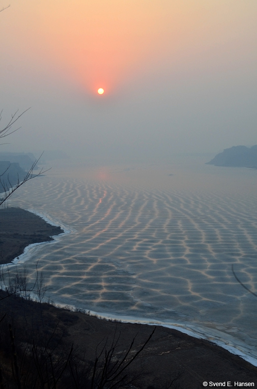
La política hidráulica del socialismo real se ha guiado por los mismos axiomas del capitalismo desarrollista, y el resultado es similar, cuando no supera los desastres ambientales. El embalse de Sanmenxia, en el río Amarillo, inaugurado en 1960, desplazó de sus tierras a 300.000 personas, con el fin, al menos en el proyecto inicial, de producir electricidad, evitar inundaciones catastróficas y crear nuevos regadíos.
La realidad en Sanmenxia fue muy distinta a la planificada. En apenas cinco años los sedimentos colmataron el embalse, y sólo tras costosas obras pudo ser de nuevo puesto en marcha, aunque con una capacidad que no llega a un tercio de la inicial.
http://www.holistika.net/vida_sostenible/sostenibilidad/grandes_presas_grandes_problemas.asp
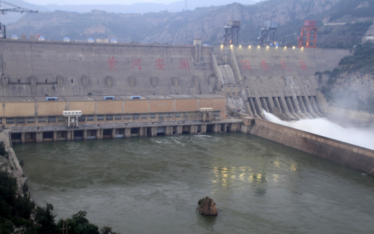
Río Amarillo ya no es más “amarillo” en Sanmenxia
2012-11-01 17:20 BJT
Sanmenxia, 01/11/2012(El Pueblo en Línea)-Un grupo de cisnes nada en las aguas del embalse de Sanmenxia, el 30 de octubre del 2012. La represa de Sanmenxia se encuentra en la curso medio del Río Amarillo, cerca de la ciudad homónima, en la frontera entre las provincias de Shanxi y Henan. En los últimos años las autoridades locales de agua aprovecharon la arena en esa sección del río, lo cual ha mejorado considerablemente la calidad del agua.
http://espanol.cntv.cn/20121101/107179.shtml
http://www.flickr.com/photos/svende1970/tags/dam/
http://www.flickr.com/search/?w=75478114@N00&q=dam
http://en.hnta.cn/Htmls/Scenic/Scenic_277.shtml
http://www.zxlszy.com/kywh/Article/gdmsgj/hen/shanmx/200810/1152.html
http://bbs.voc.com.cn/topic-2420366-1-1.html
http://www.ha.xinhuanet.com/zfwq/2011-06/15/content_23018560.htm
http://www.smxly.com/KeHu/jd/jingdian_gk.aspx?jdid=11
http://lujianli.blogchina.com/1277590.html
http://blog.voc.com.cn/blog_showone_type_blog_id_558988_p_1.html
http://baike.soso.com/v405350.htm
http://tieba.baidu.com/f?kz=949730241
Vídeo:
Web recomendada: http://blog.sina.com.cn/s/blog_66945d350100qy90.html
Contador: 7349
Inserción: 2012-11-07 13:58:50
Lugares a visitar en un radio de 100 km (en línea recta)
Mapa de los lugares a 100 km (en línea recta)
Mostrando Registros desde el 1 hasta el 0 de un total de 0
Visitas RSS |
Más visitados Basílica de San Marcos  152955 Catedral de Notre Dame (París)  142296 Torre de Pisa  130117 Monte Saint-Michel  99361 Presa de las Tres Gargantas  79189 |
Incorporaciones |
Comentarios hazola  Cúpula de la Roca gracias me... gera  Buenos Aires las mejores fotos de la mejor ciudad del... Daniel M. - BRASIL  San Francisco ... PEQUE  Presa Chicoasén SERA QUE ALGUIEN ME PUEDE DAR MAS INFORMACIÓN DE ESTE PROYECTO ESTUDIO EN LA UNACH Y ES PARA UN... Mery  Huaca Pucllana Muy interesante, muy buena la información y... |


|
Foro |

|