Nombre:
Puerto Hedland
Otro:
Localización:
Ver mapa más grande
Tipo: Puertos
Categoría:
Foto:

Voto:
Continente: Oceanía
País: Australia
Localización: South Hedland
Año: 1880
Estado: Terminado
Descripción:Port Hedland, Australia
Port Hedland ha sido el centro de una próspera industria del hierro con un puerto natural que maneja el mayor tonelaje que cualquier otro puerto de Australia. Aunque famosa por su industria de recursos masivos, trenes largos, barcos grandes y montones de sal, la ciudad portuaria es tan rica en playas inmaculadas y manglares, que son el hogar de una gran cantidad de peces y otro tipo de vida silvestre. Gran parte de la población reside en la ciudad satélite de South Hedland. Tómate el tiempo para explorar esta ciudad portuaria moderna y visita la Torre de Observación de la ciudad de 26 metros de alto donde tendrás una vista excepcional.


http://www.royalcaribbean.es/findacruise/ports/group/home.do?portCode=HED
Port Hedland is the highest tonnage port in Australia[2] and largest town[3] in the Pilbara region of Western Australia, with a population of approximately 14,000, including the satellite town of South Hedland, 18 km away.
Port Hedland is a natural deep anchorage port which, as well as being the main fuel and container receival point for the region, was seen as perfect for shipment of the iron ore being mined in the ranges located inland from the town. The ore is moved by railway lines from four major iron ore deposits to the east and south of Port Hedland area. In August 2010 the port exported 13.6 million tonnes of iron ore.[4] Other major resource activities supported include the offshore natural gas fields, salt, manganese, and livestock. Grazing of cattle and sheep was formerly a major revenue earner for the region but this has slowly declined. Port Hedland was formerly the terminus for the WAGR Marble Bar Railway which serviced the gold mining area of Marble Bar.


History
Port Hedland is known by the Indigenous Kariyarra and Nyamal people as Marapikurrinya, which either means "place of good water" (as told by a Nyamal language speaker) and makes reference to the three reliable fresh water soaks that can still be seen in and around the town, or as the town council's website says "refers to the hand like formation of the tidal creeks coming off the harbour (marra - hand, pikurri - pointing straight and nya - a place name marker)".[5] According to Dreamtime legend there was a huge blind water snake living in the landlocked area of water known as Jalkawarrinya. This landlocked area is now the turning basin for the ships that enter the port and as the story goes, "the coming of the big ships meant it was unable to stay".
Though the coastline in the area had been explored in the 18th century, Captain Peter Hedland was one of the first Europeans to explore the harbour for the purpose of developing an export port. Peter Hedland arrived in the area in April 1863 onboard his boat, Mystery that he had built himself at Point Walter on the banks of the Swan River. He named the harbour Mangrove Harbour and reported that it would make a good landing site with a well protected harbour and that there was also fresh water available. What Hedland failed to point out was that the harbour was difficult to enter because of a huge sandbar that sealed the entrance meaning it was only accessible at high tide and that it was difficult to enter in bad weather because of the narrow entrance.[6]
In 1866, the resident Magistrate of Roebourne, Treverton Sholl, commissioned Charles Wedge to investigate alternative town sites to Roebourne. Wedge's reports were pessimistic about the suitability of Port Hedland. In 1891, exploration of the area by Tom Traine, John Wedge and Syd Hedley identified two landings and described the harbour as "pretty as well as safe". In September 1895, Cossack residents requested the District Surveyor to survey the headland at Port Hedland and requested the Government to build a jetty.
Mining
Goldsworthy Mining developed an iron ore mine approximately 100 kilometres east of Port Hedland in the early 1960s and built the towns of Goldsworthy and later Shay Gap as mine sites. A rail line was then built to Port Hedland where dredging was undertaken to deepen and widen the port's channel and a wharf was built opposite the township of Port Hedland on Finucane Island. Shipment of ore began on 27 May 1966 when the Harvey S Mudd sailed from Port Hedland to Japan with 24,900 tonnes of ore.
In 1967 iron ore was discovered at Mount Whaleback and a mining venture was undertaken that included the establishment of a new town, Newman, 426 km of rail from the mine to the port and the development of processing equipment at both Newman and Port Hedland. In 1986, at a cost of $87 million, the existing channel was dredged to allow the port to increase the tonnage of those ships able to enter the port. Prior to dredging the port was only able to load vessels less than 2,000 tonnes but today it is able to accommodate ships over 250,000 tonnes.
1968 plane crash
Main article: MacRobertson Miller Airlines Flight 1750
On 31 December 1968, a Vickers Viscount operated by MacRobertson Miller Airlines crashed at nearby Indee Station. The plane had flown from Perth to Port Hedland without incident until about 10 minutes before landing it suffered a catastrophic right hand spar failure with the wing separating from the fuselage. All 26 on board, including the pilot, a first officer and two flight attendants were killed.[7][8]


Immigration detention facility
In 1991, an immigration detention facility was opened at Port Hedland to deal with the arrival of boat people seeking asylum. Port Hedland was seen as a good location as it is in an area where many illegal boat people were entering Australia, and had an international airport that would allow for easy deportations when required. The Detention Centre was privatised by the John Howard Government in the late 1990s. The centre was closed in 2004 due to the falling numbers of asylum seekers arriving by boat to Australia's northwest. The town mayor called for the federal government to allow the town to use the detention centre to accommodate the many new mine workers needed in the town's current mining boom. A lack of accommodation makes it difficult for companies to operate efficiently as they are unable to house staff or consultants within the town's small number of hotels. The Detention Centre, which is situated on the beach front and was formerly single-men's quarters for Mount Newman Mining (now BHP Billiton).[9] The centre is now operating as the Beachfront.
Geography and climate
The climate of Port Hedland is warm to hot, with mean maximum temperatures of 36.4 °C (97.5 °F) in January and 27.1 °C (80.8 °F) in July. Maximum temperatures in summer are usually moderated by a warm but humid sea breeze. Annual rainfall (falling almost exclusively between December and June) averages 311.5 mm (12.26 in) but because of erratic cyclones is subject to some of the largest variations in the world. As an illustration, in 1942 1,040 mm (41 in) fell, but in 1944 only 32 mm (1.3 in) fell and the town went for over 300 days with no rain.[10] The high summer temperatures experienced in Port Hedland mean that most tourists to the area choose to visit in the cooler months between May and September.
http://en.wikipedia.org/wiki/Port_Hedland,_Western_Australia
http://bluecloudspatial.com/port-hedland-aerials/
http://www.flickr.com/photos/the_grateful_dad/tags/porthedland/
http://www.flickr.com/photos/thestrez/tags/porthedland/
http://www.flickriver.com/photos/tags/ironorecarrier/interesting/


Vídeo:
Web recomendada: http://www.porthedland.wa.gov.au/
Contador: 7529
Inserción: 2012-12-27 13:17:03
Lugares a visitar en un radio de 100 km (en línea recta)
Mapa de los lugares a 100 km (en línea recta)
Mostrando Registros desde el 1 hasta el 0 de un total de 0
Visitas RSS |
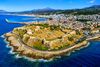
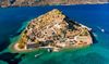
Más visitados Basílica de San Marcos  155940 Catedral de Notre Dame (París)  145496 Torre de Pisa  132450 Monte Saint-Michel  101571 Burj Khalifa 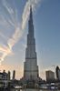 86150 |
Incorporaciones |
Comentarios Agenaktof  Mumbai (Bombay) In addition, folks these living in the residence, and stability of who're opioid addicted spend... Wein Plaza  Mumbai (Bombay) Thanks a lot. Loads of knowledge! Wein Plaza - JerryMiff  Mumbai (Bombay) Всем доброго времени суток! Хочу посоветовать... Oscarhealf  Mumbai (Bombay) Прикиньте, вчера я осознал, что мир маркетплейс... Sergio alumb  Puerto de Klaipeda Not long ago I started exploring coin collecting. I found a helpful resource at |