Nombre:
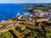
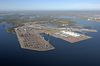
Puerto de Primorsk
Otro:
Localización:
Ver mapa más grande
Tipo: Puertos
Categoría:
Foto:

Voto:
Continente: Europa
País: Rusia
Localización: Primorsk, Leningrad Oblast
Año: 2001
Estado: Terminado
Descripción:Primórsk (en ruso: Примо́рск; finés: Koivisto; sueco: Björkö) es una localidad costera del raión de Víborg, óblast de Leningrado, en Rusia. Es el puerto ruso más grande en el Báltico. Está ubicada en el Istmo de Carelia, 137 km al oeste de San Petersburgo, en la costa norte del Golfo de Finlandia, cerca a las Islas de los Abedules. Población: 5.172 habitantes (Censo de 2010).


Historia
Primórsk fue mencionada en las crónicas rusas de 1268 con el nombre de Beriozovskoie (villa de abedules), cuando los mercantes germanos de Gotland pidieron a la República de Nóvgorod asegurar su pasaje al río Nevá. Los suecos anexaron la región durante La tercera cruzada sueca. Los rusos retomaron las islas en la Gran Guerra del Norte, en 1721. Entonces, el lugar pasó a compartir el mismo destino del Istmo de Carelia.
Primórsk se desarrolló en el siglo XX como puerto de salida para la ciudad de Viborg. Adquirió el estatus de gorod (ciudad, zona urbana) en 1940. Fue capturada por los soviéticos el 18 de Junio de 1944 y transferida como parte del Tratado de paz de Paris. En 1948 fue renombrada como Primórsk.
Economía
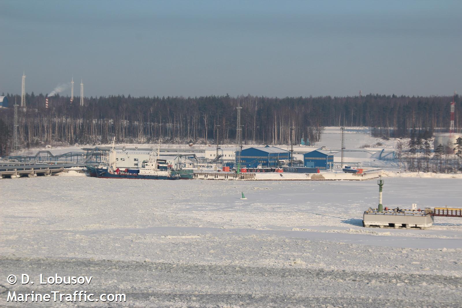
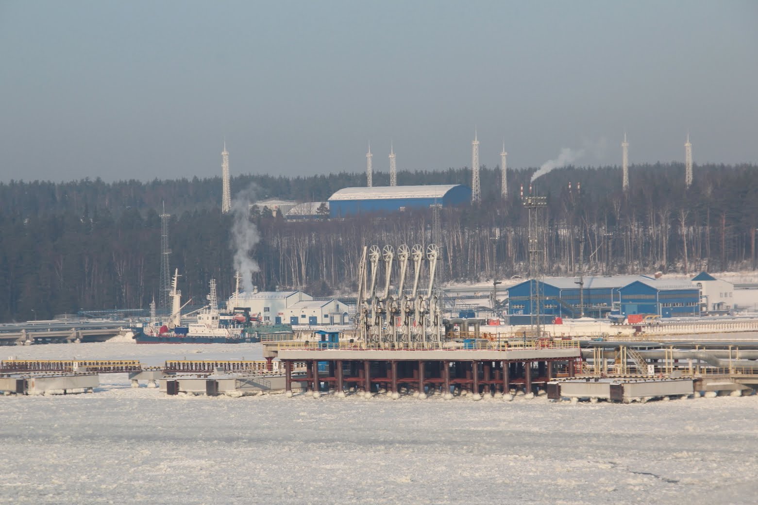
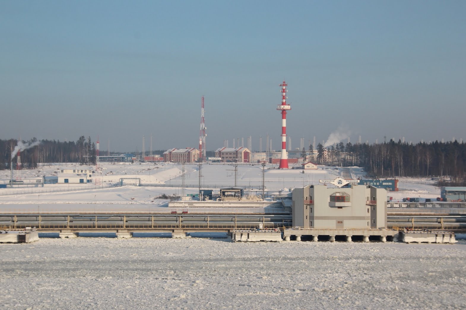
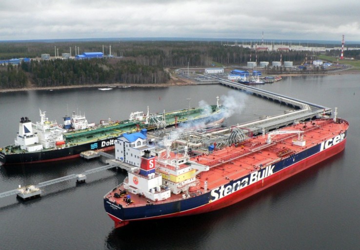
Es el lugar de la terminal de petróleo más grande del Mar Báltico. Comenzó a operar en Diciembre de 2001, superando en un año a Ventspils y a otras compañías extranjeras rivales.
Transporte
La localidad se encuentra en la línea férrea que enlaza a San Petersburgo y a Viborg, además cuenta con rutas de buses a otras localidades cercanas.
http://es.wikipedia.org/wiki/Primorsk_(Leningrado)
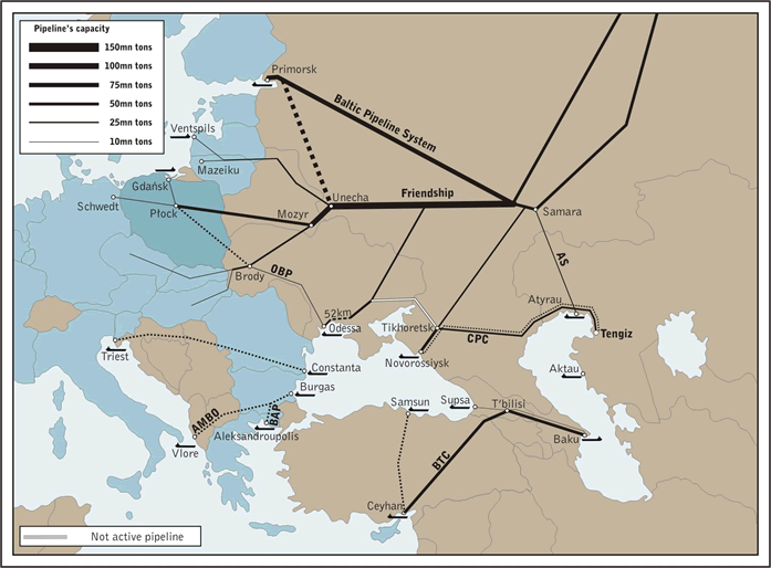
Pipeline Geopolitics
A central issue on the GUAM-NATO drawing board at the July GUAM Summit in Batumi, was the Odessa-Brody-Plotsk (Plock on the Vistula) pipeline route (OBP) (see Maps 3 and 4), which brings Central Asian oil via Odessa, to Northern Europe, bypassing Russian territory. An extension of OBP to Poland’s port of Gdansk on the Baltic sea is also envisaged.
It should be noted that the OBP also links up with Russia’s Friendship Pipeline (Druzhba pipeline) in an agreement with Russia.
Washington’s objective is ultimately to weaken and destabilize Russia’s pipeline network –including the Friendship Pipeline and the Baltic Pipeline System (BPS)– and its various corridor links into the Western Europe energy market.
It should be noted that Russia has established as part of the Druzhba pipeline network, a pipeline corridor which transits through Belarus, thereby bypassing the Ukraine. (See Maps 2 and 3 below)
The Baltic Pipeline System (BPS) also operated by Russia’s Transneft links Samara to Russia’s oil tanker terminal at Primorsk in the Gulf of Finland. (See map below) It carries crude oil from Russia’s Western Siberian region to both North and Western European markets.
Another strategic pipeline system, largely controlled by Russia, is the Caspian Pipeline Consortium (CPC). The CPC is a joint venture arrangement between Russia and Kazakhstan, with shareholder participation from a number of Middle East oil companies.
The Baltic Pipeline System (BPS) is tied into the Atyrau-Samara (AS) pipeline, which is a joint venture between Russia’s Transneft and Kazakhstan’s national pipeline operator, KazTransOil. The AS pipeline in turn links up with the Russia-Kazakhstan Caspian Petroleum Consortium (CPC), which pumps Tengiz crude oil from Atyrau (Western Kazakhstan) to the CPC’s Russian tanker terminal near Novorossiysk on the Black Sea.
On July 10, 2008, barely a week following the GUAM Summit, Transneft and KazTransOil announced that they were in talks to expand the capacity of the Atyrau-Samara pipeline from 16 to 26 million tons of oil per year. (RBC Daily, July 10, 2008).
http://www.panoramio.com/user/2969704/tags/порт Приморск
http://www.marinetraffic.com/ais/es/showallphotos.aspx?mmsi=2247&photoid=700346

Vídeo:
Web recomendada: http://www.sfprimorsk.ru/indexen.html
Contador: 6700
Inserción: 2013-04-05 14:16:37
Lugares a visitar en un radio de 100 km (en línea recta)


Mapa de los lugares a 100 km (en línea recta)
Mostrando Registros desde el 1 hasta el 0 de un total de 0
Visitas RSS |
Más visitados Basílica de San Marcos  149131 Catedral de Notre Dame (París)  137782 Torre de Pisa  128243 Monte Saint-Michel  97382 Presa de las Tres Gargantas  73710 |
Incorporaciones |
Comentarios Arq. Jaime Fuentes Flores  Torres Obispado EXTRAORDINARIO . FELICIDADES . Un Cordial saludo Directivos y Personal de ... hazola  Cúpula de la Roca gracias me... gera  Buenos Aires las mejores fotos de la mejor ciudad del... Daniel M. - BRASIL  San Francisco ... PEQUE  Presa Chicoasén SERA QUE ALGUIEN ME PUEDE DAR MAS INFORMACIÓN DE ESTE PROYECTO ESTUDIO EN LA UNACH Y ES PARA UN... |