Nombre:
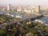
Puente 6 de Octubre
Otro:
Localización:
Ver mapa más grande
Récord: 20005 m
Tipo: Puentes
Categoría: Viaductos
Foto:
Voto:
Continente: África
País: Egipto
Localización: El Cairo
Año: 1969-1996
Estado: Terminado
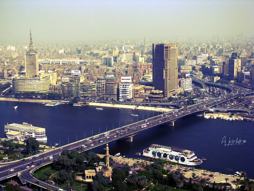
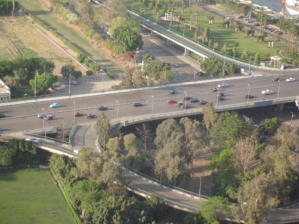
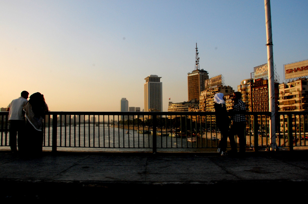
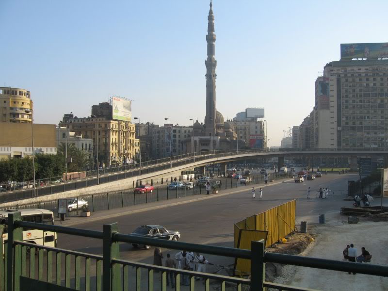
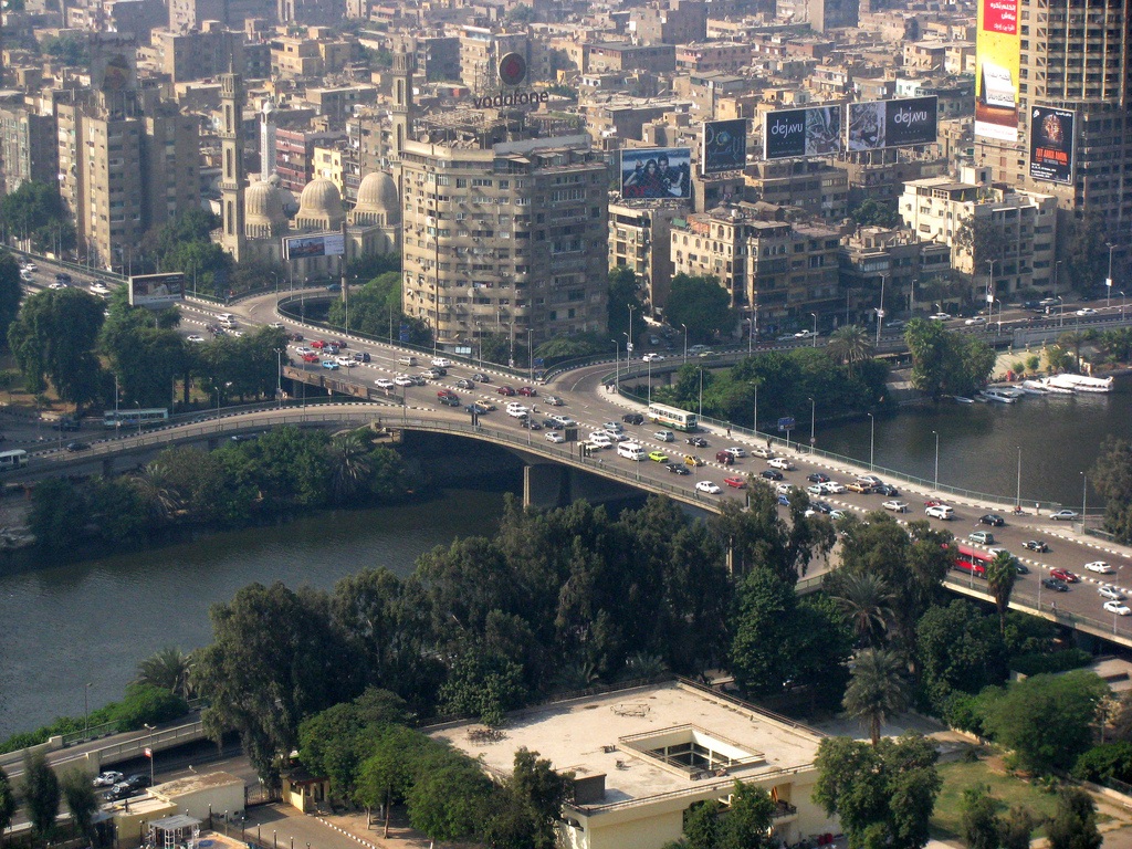
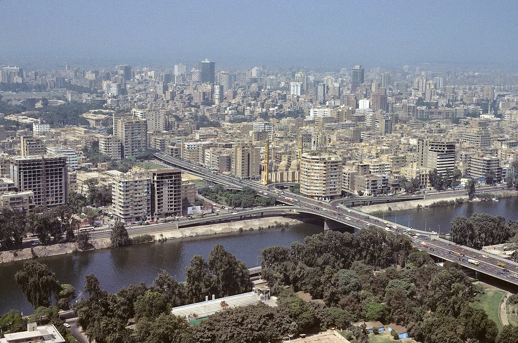
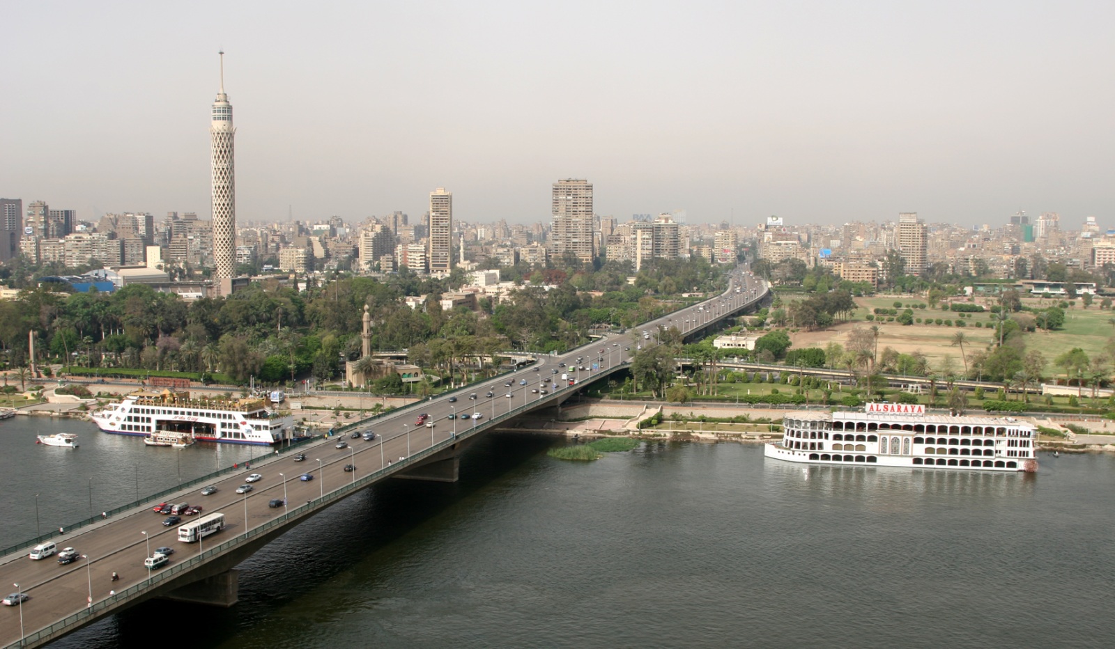
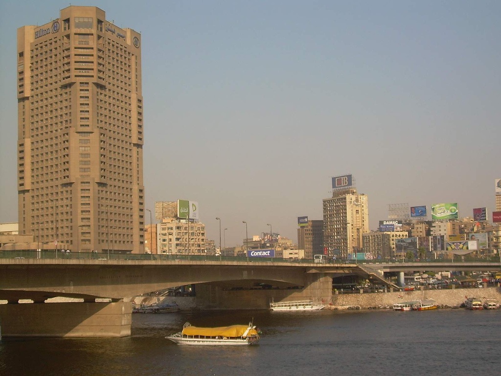
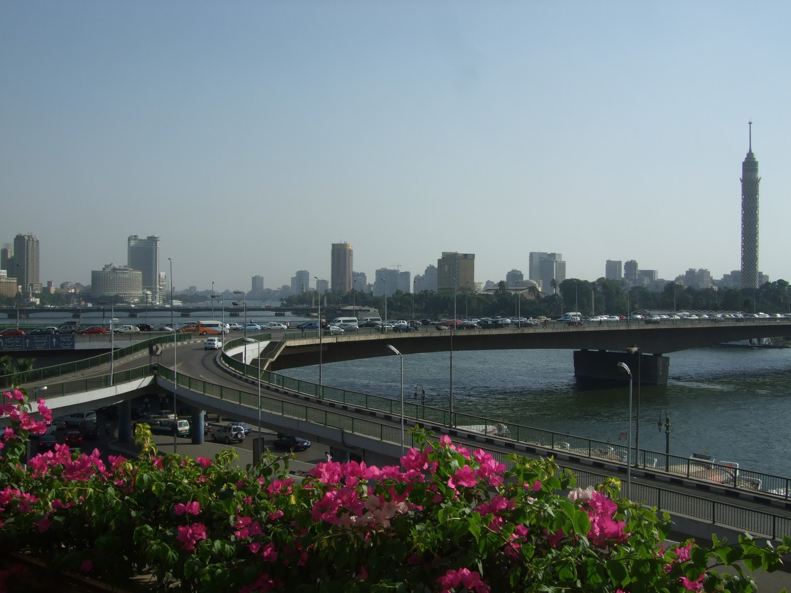
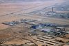
Descripción:The 6th October Bridge (Arabic: جسر 6 أكتوبر, Kubri 6 uktubar) is an elevated highway in central Cairo, Egypt. The 20.5 kilometres (12.7 mi) bridge and causeway crosses the Nile River twice from the west bank suburbs, east through Gezira Island to Downtown Cairo, and on to connect the city to the Cairo International Airport to the east.
Its name commemorates the date of 'The Crossing' which commenced the outbreak day of the October War in 1973.
History
The bridge and causeway were completed in 1996, with construction taking nearly 30 years. It began in 1969 with the modest, 130 metres (430 ft)-long Phase 1, which only spanned the smaller west branch of the Nile from Gezira to Agouza (built from May 1969 to August 1972). Phase 9 completed the 20.5 kilometres (12.7 mi)-long final length in 1996. The '6th October Bridge and Flyover' runs from the Agricultural Museum in Dokki east to the Autostrade in Nasr City.
The building of the 6th October Bridge and causeway has been declared a national infrastructure project.
Public use
The 6 October Bridge has been called the 'spinal cord' of Cairo, with approximately half a million Cairene people using it on a daily basis.[1] Due to its role as Cairo's central east—west automobile and truck route, the bridge and causeway is nearly always crowded with traffic, with the trip from one end to another taking up to 45 minutes.
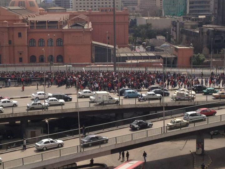
2011 Egyptian protests
Al Jazeera video of the democracy demonstration clashes at 6th October Bridge and ramps (on 28 January 2011).
During the 2011 Egyptian protests, the bridge has been a major route to the Tahrir Square democracy demonstrations, and also itself been the scene of violent confrontations between pro-Mubarak protesters and anti-Mubarak protesters.[2]
http://en.wikipedia.org/wiki/6th_October_Bridge
http://www.egyptcranes.com/MajorProjects/RoadsTunnelsBridges/tabid/126/language/en-US/Default.aspx
http://weekly.ahram.org.eg/1999/444/eg13.htm
http://cairomylove.blogspot.com.es/2007/04/cairo-traffic.html
http://www.egypt-cairo.com/cairo_ring_road.html
Vídeo:
Web recomendada: http://weekly.ahram.org.eg/1999/428/special.htm
Contador: 8029
Inserción: 2012-11-28 13:26:47
Lugares a visitar en un radio de 100 km (en línea recta)


Mapa de los lugares a 100 km (en línea recta)
Mostrando Registros desde el 1 hasta el 0 de un total de 0
Visitas RSS |
Más visitados Basílica de San Marcos  155933 Catedral de Notre Dame (París)  145486 Torre de Pisa  132445 Monte Saint-Michel  101566 Burj Khalifa  86113 |
Incorporaciones |
Comentarios Agenaktof  Mumbai (Bombay) In addition, folks these living in the residence, and stability of who're opioid addicted spend... Wein Plaza  Mumbai (Bombay) Thanks a lot. Loads of knowledge! Wein Plaza - JerryMiff  Mumbai (Bombay) Всем доброго времени суток! Хочу посоветовать... Oscarhealf  Mumbai (Bombay) Прикиньте, вчера я осознал, что мир маркетплейс... Sergio alumb  Puerto de Klaipeda Not long ago I started exploring coin collecting. I found a helpful resource at |