Nombre:
Calzada Yolo
Otro: Yolo Causeway
Localización:
Ver mapa más grande
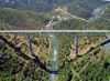
Récord: 5200 m
Tipo: Puentes
Categoría: Viaducto
Foto:
Voto:
Continente: América
País: Estados Unidos
Localización: Sacramento-Davis
Año: 1962
Estado: Terminado
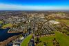
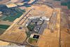
Descripción:Yolo County, California Bridges: I-80 Bridges over Yolo Bypass
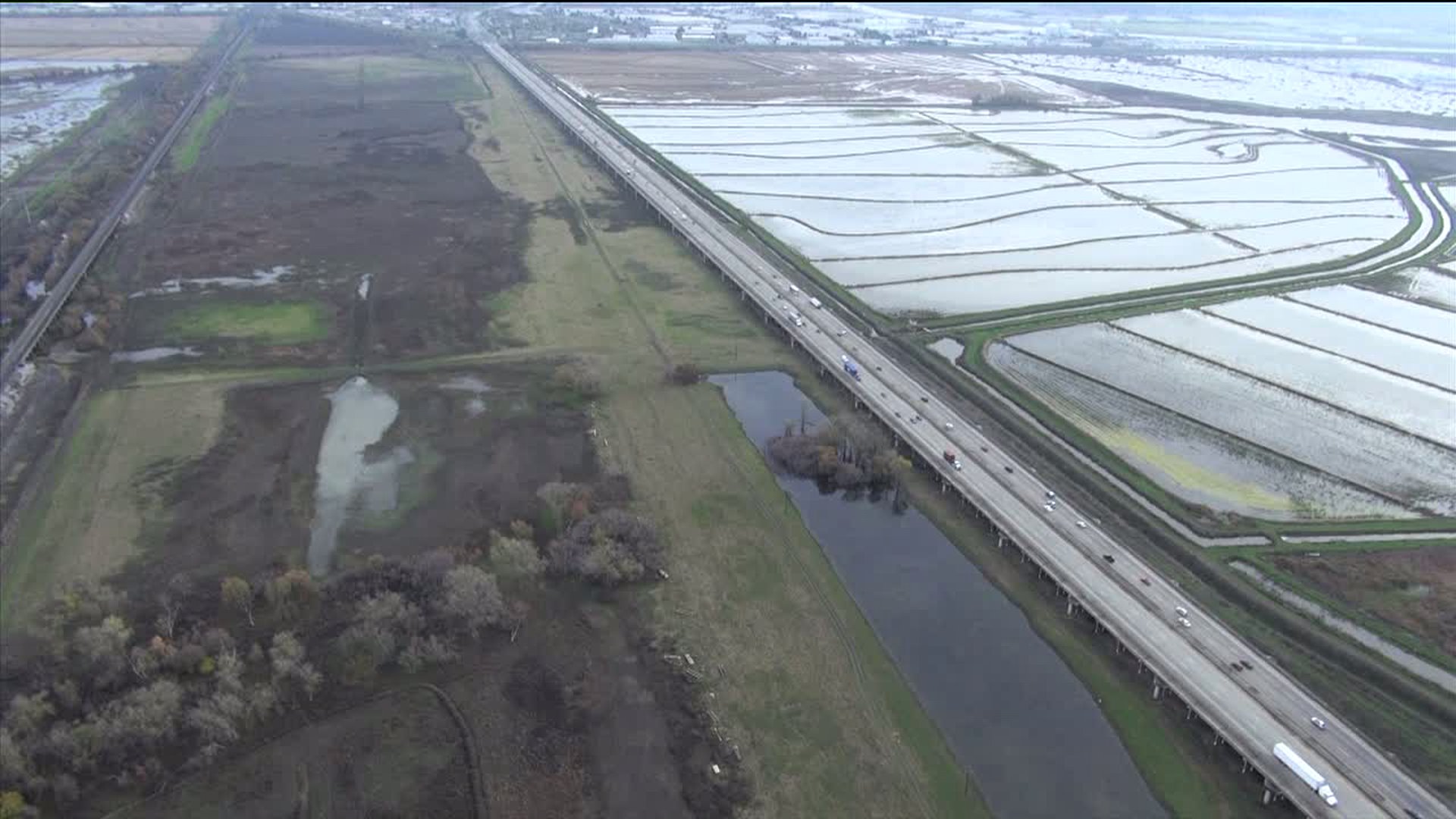
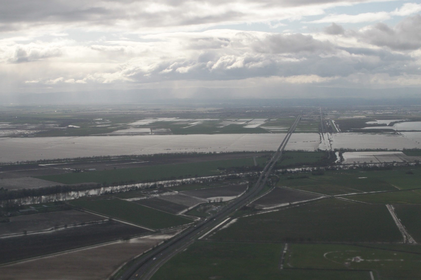
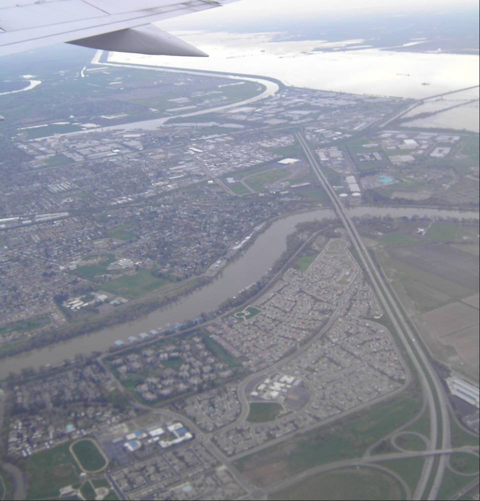
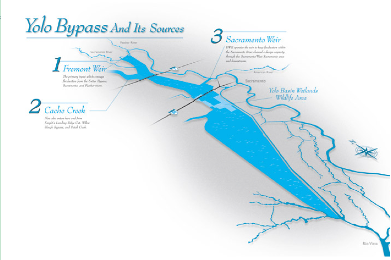
Continuing west on what is now Interstate 80 we enter the Yolo Bypass (that was previously discussed when we visited the I-5 Bypass Bridge). This large basin fills with water during the winter and prevents flooding of East and West Sacramento. We can see where I-5 and I-80 cross the Bypass in the figure below.
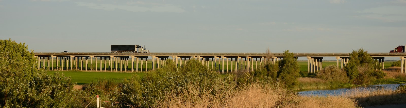
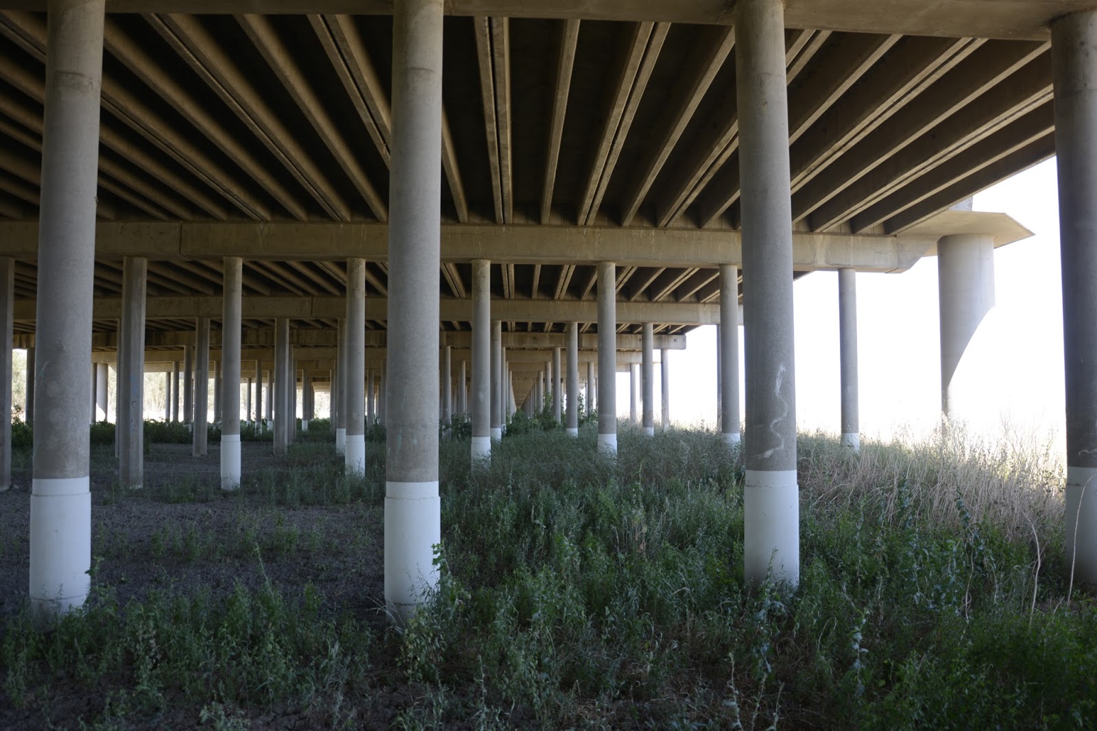
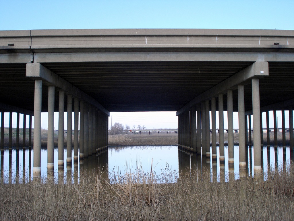
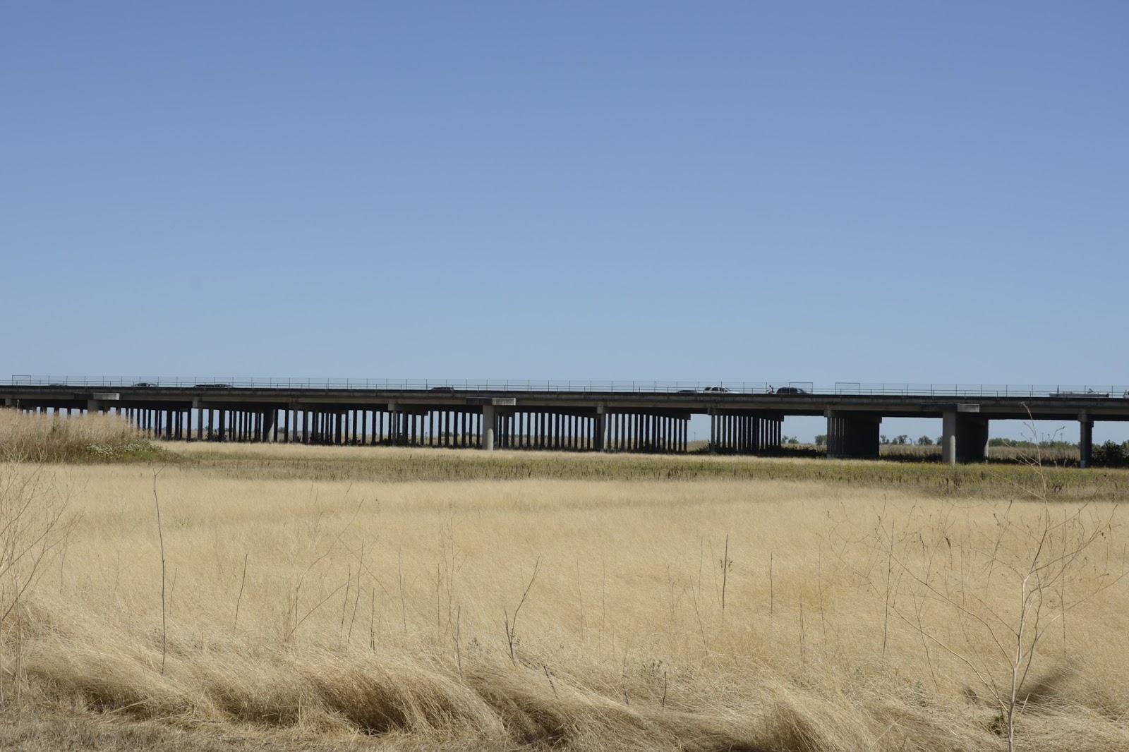
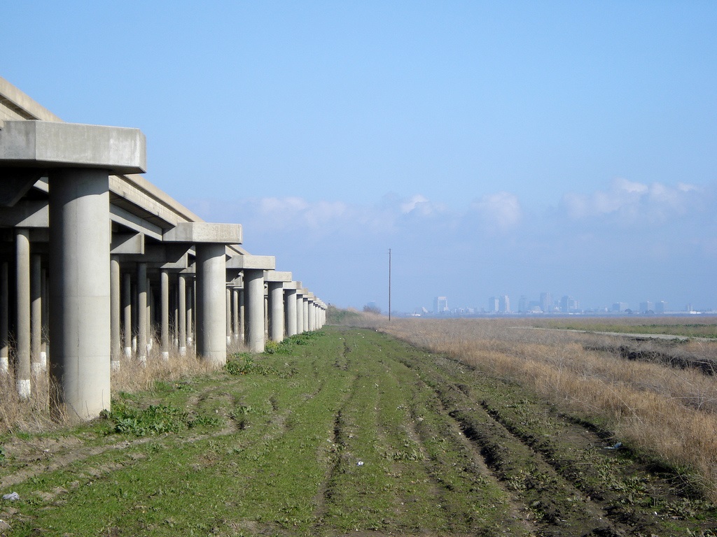
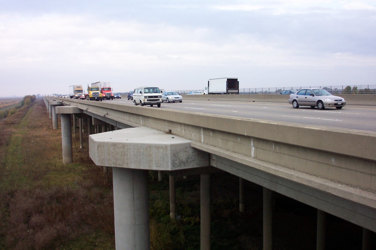
The Yolo Causeway is actually two long viaducts (Yolo Causeway East (22 0045) and Yolo Causeway West (22 0044)) with a short embankment between them. The East Causeway is a 220 span prestressed concrete T girder bridge and the West Causeway is a 72 span prestressed concrete T girder bridge. These bridges were built in 1962.
The Causeway was retrofitted in 1997 with fiber reinforced polymer collars at the connection between the shafts and the shaft extensions. This should allow them to form strong pins during an earthquake that will prevent the connections from breaking. Also, every fifth bent cap had an extension built on the end to connect it to a large diameter shaft. During an earthquake these shafts will prevent the causeway from undergoing large displacements.
Similar to I-5 Bypass Bridge to the north, the I-80 Causeway also has a parallel railroad viaduct. However, these tracks carry Amtrak and Union Pacific freight trains and are in constant use.
http://www.bphod.com/2013/07/yolo-county-california-bridges-i-80_23.html
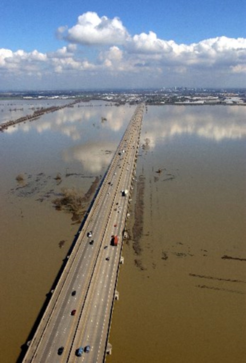
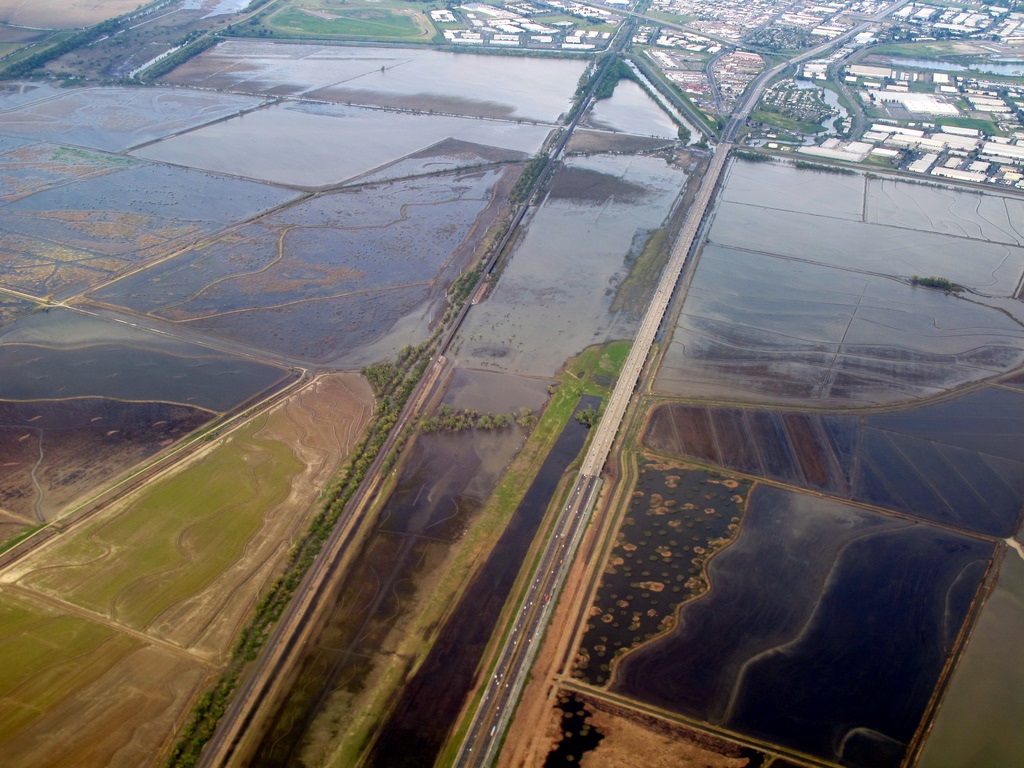
The Yolo Causeway is a 3.2-mile (5.2-kilometer) long elevated highway viaduct on Interstate 80 that crosses the Yolo Bypass floodplain and connects the cities of Sacramento, California and Davis, California (through West Sacramento, California).
http://en.wikipedia.org/wiki/Yolo_Causeway
http://marcvaldez.blogspot.com.es/archives/2006_04_09_marcvaldez_archive.html
http://fox40.com/2012/11/29/sky-fox40-rivers-and-reservoirs-can-handle-rain/sky-fox40-yolo-bypass/
https://www.flickr.com/photos/28016468@N06/tags/yolobypass/
Vídeo:
Web recomendada: http://www.bphod.com/2013/07/yolo-county-california-bridges-i-80_23.html
Contador: 6205
Inserción: 2014-06-25 13:09:09
Lugares a visitar en un radio de 100 km (en línea recta)
Mapa de los lugares a 100 km (en línea recta)
Mostrando Registros desde el 1 hasta el 0 de un total de 0
Visitas RSS |
Más visitados Basílica de San Marcos  155907 Catedral de Notre Dame (París)  145446 Torre de Pisa  132418 Monte Saint-Michel  101540 Burj Khalifa  85983 |
Incorporaciones |
Comentarios Agenaktof  Mumbai (Bombay) In addition, folks these living in the residence, and stability of who're opioid addicted spend... Wein Plaza  Mumbai (Bombay) Thanks a lot. Loads of knowledge! Wein Plaza - JerryMiff  Mumbai (Bombay) Всем доброго времени суток! Хочу посоветовать... Oscarhealf  Mumbai (Bombay) Прикиньте, вчера я осознал, что мир маркетплейс... Sergio alumb  Puerto de Klaipeda Not long ago I started exploring coin collecting. I found a helpful resource at |