")
Nombre:
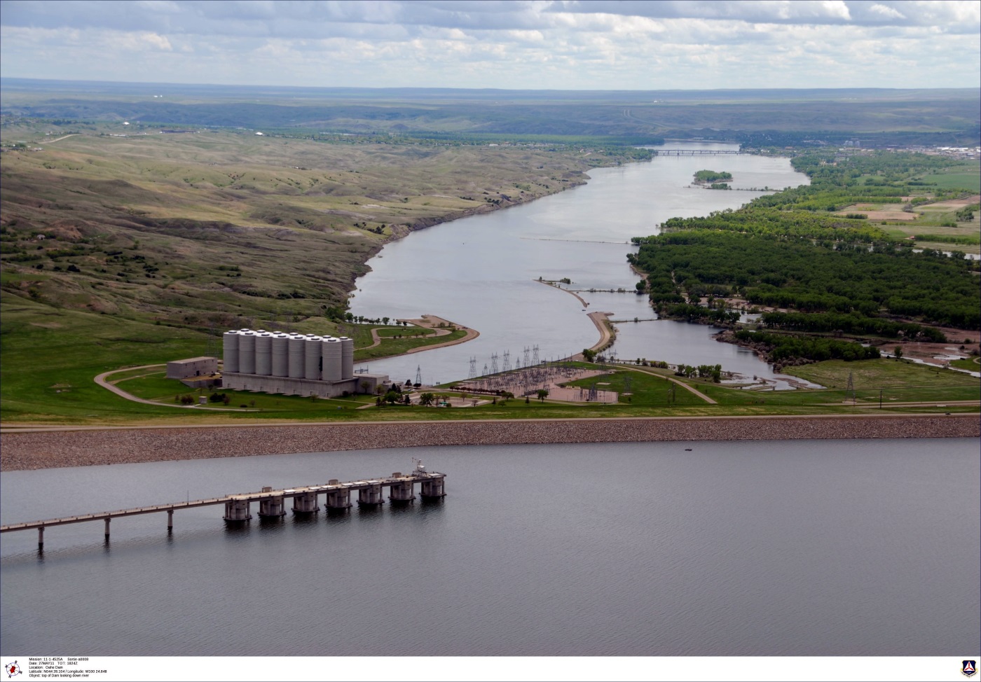
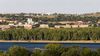
Presa de Oahe
Otro:
Localización:
Ver mapa más grande
Récord: 29110 hm³
Récord de Altura: 75 m
Tipo: Presas
Categoría:
Foto:
Voto:
Continente: América
País: Estados Unidos
Localización:
Año: 1962
Estado: Terminado
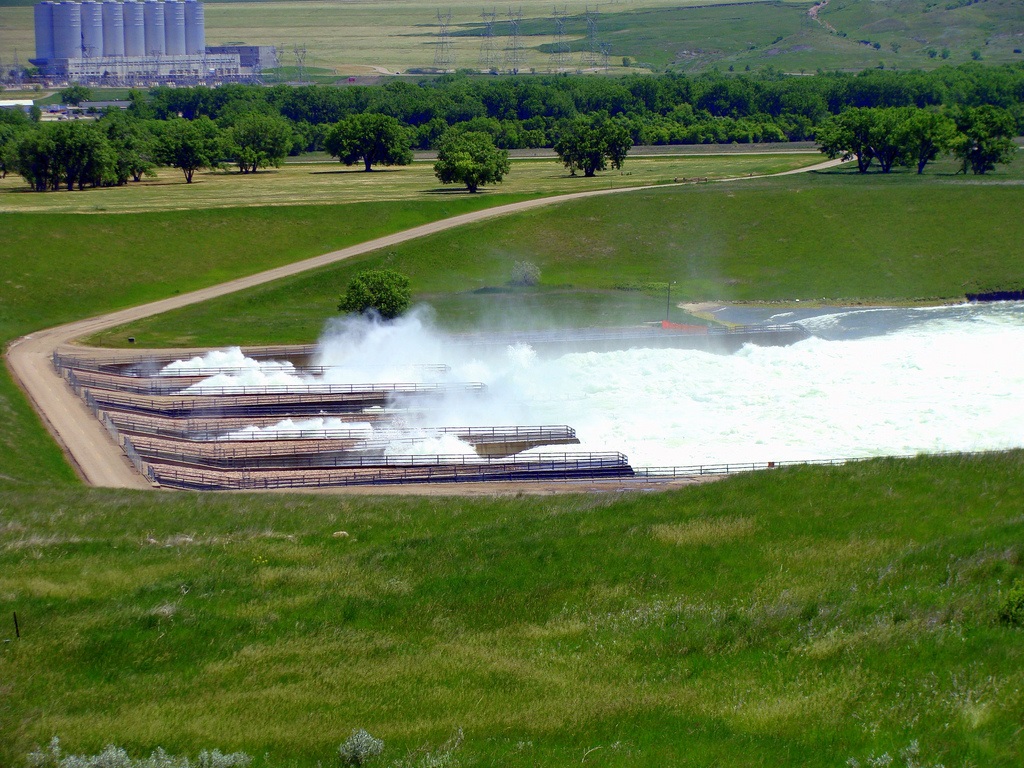
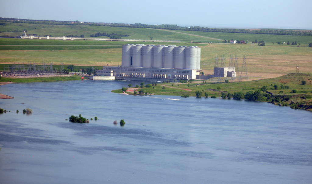
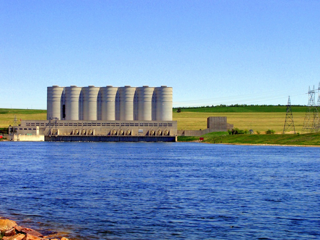
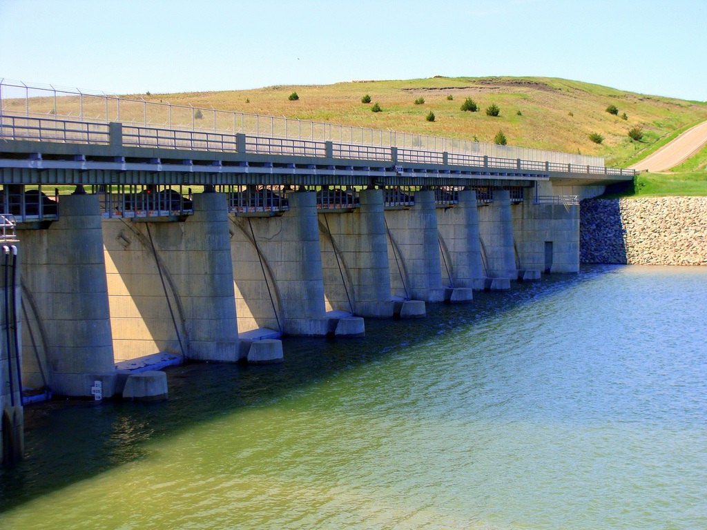
Descripción:Oahe Dam
Statistics:
Rolled earth fill
9,360 feet long (2,850 meters)
245 feet high (75 meters)
7 generators; 786,000 kw output
Impounds Oahe Lake
Completed: 1962
Seven miles north of Pierre, South Dakota
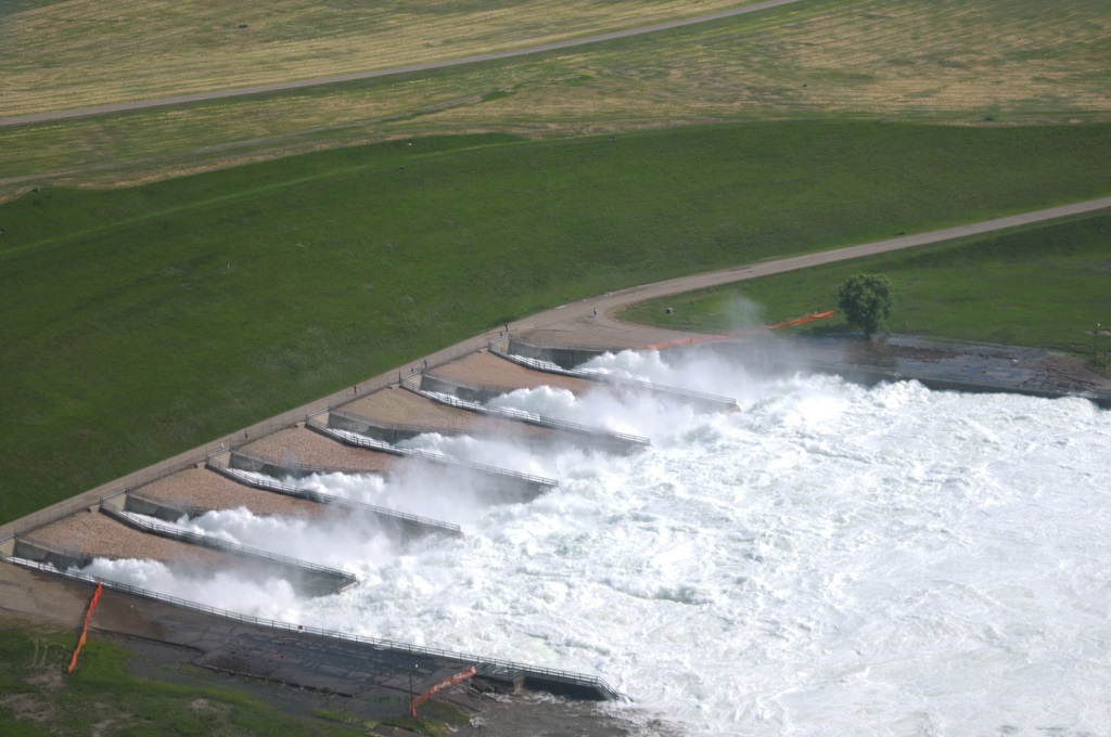
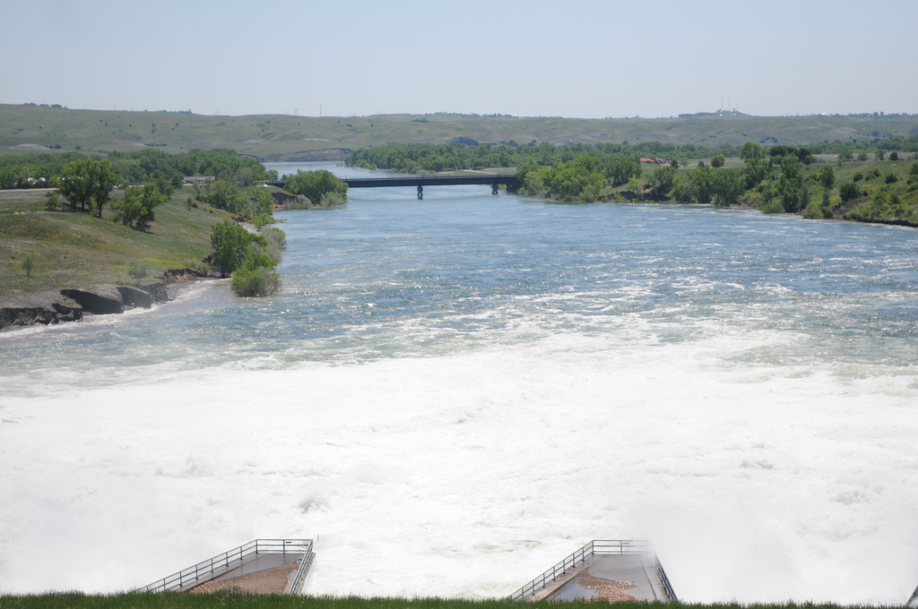
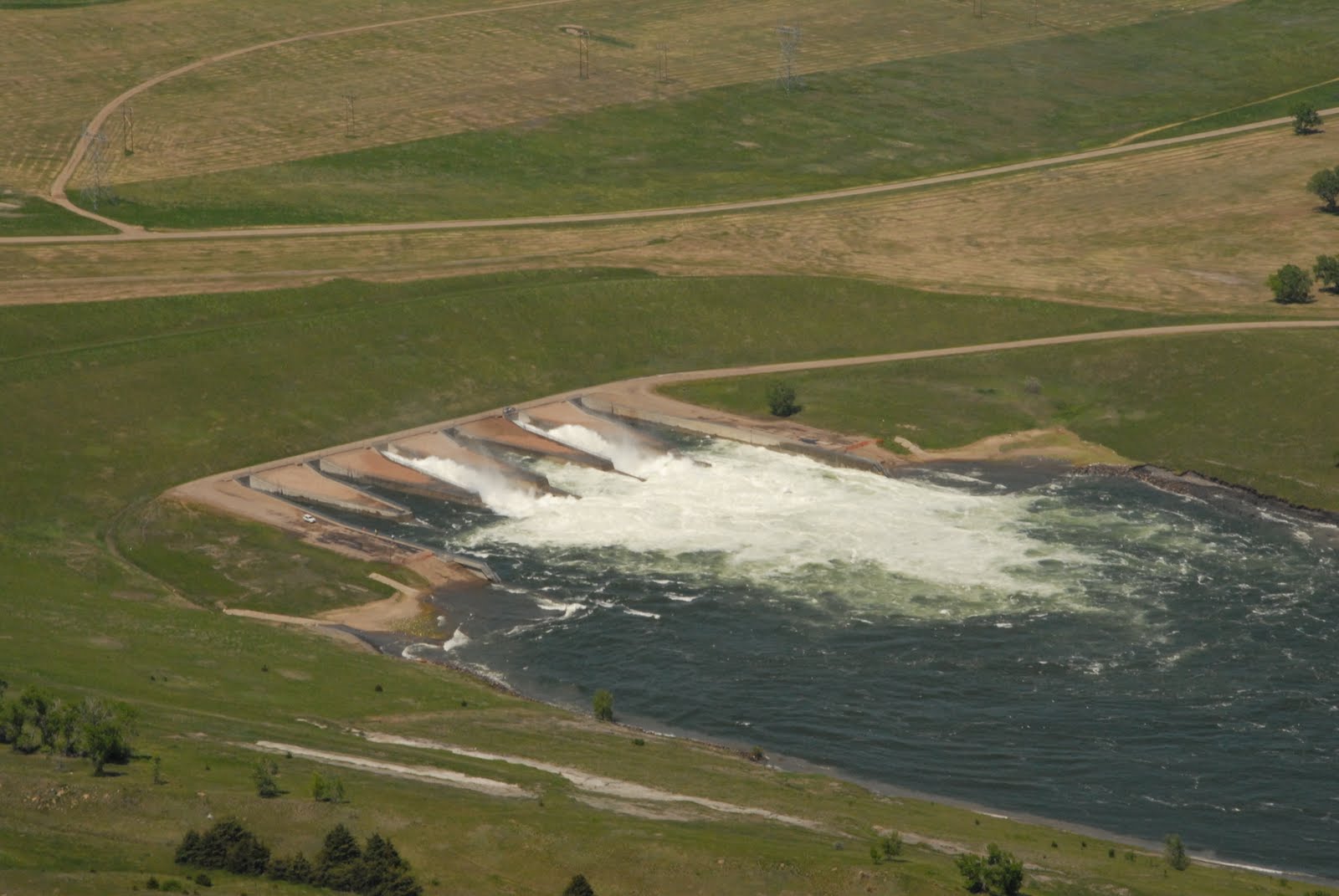
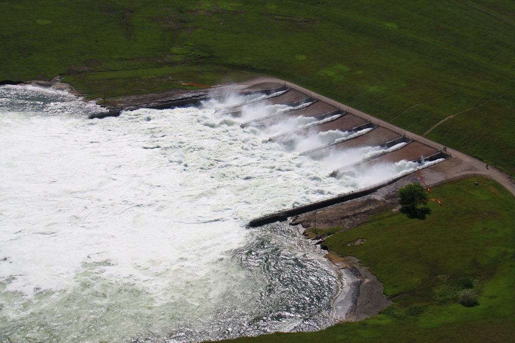
Water Flow: This is the emergency flow the Corps of Engineers released from Lake Oahe. This is what is caused the flooding in the cities of Pierre and Fort Pierre in late May 2011. This is what water traveling near 60 miles per hour, 88,000 cubic feet/second, looks like up close!
http://www.oil-electric.com/2011/06/missouri-river-second-coming.html
Oahe Dam
by Katlyn Richter on March 28, 2012
There is a Great Place in South Dakota that is located north of the Pierre and Fort Pierre communities. It creates the fourth largest artificial reservoir in the United States and one of the largest earth-rolled dams in the world. It’s the Oahe Dam.
Lake Oahe extends 231 miles from Pierre to Bismarck, N.D. Along Lake Oahe are 51 recreation areas which offer camping, picnicking, fishing, hunting, skiing, boating, birding, hiking, biking and other activities. Walleye, smallmouth bass, white bass, northern pike and perch are all common catches for anglers fishing on Lake Oahe.
Not only does the Oahe Dam provide great recreation along Lake Oahe, but it also supplies irrigation, conservation, and electric power to many Midwestern states.
The Missouri River today is much different than the muddy, winding waterway that Meriwether Lewis and William Clark once traveled some 200 years ago. Today, four massive dams, completed in the early 1960s, mitigated the river and created more than 900 miles of open water and 3,000 miles of shoreline. In addition, the dams have created a world-class freshwater fishery.
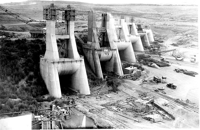
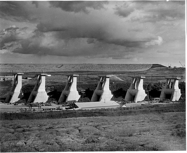
The Oahe Dam was authorized in 1944 by the Flood Control Act. Work began on the dam in 1948 by the U.S. Army Corps of Engineers. By 1962, the Oahe Dam was functioning and producing hydoelectic power. The dam was dedicated on August 17, 1962, by President John F. Kennedy.
Visitors can view the Oahe Dam and Lake Oahe by following Highway 1804 seven miles north of Pierre. The Oahe Dam Visitor Center provides a complete history of Lake Oahe and the surrounding area. Exhibits feature the history of the construction of the dam and power plant and the natural history of Lake Oahe and the Missouri River.
The Oahe Dam Visitor Center, located above the dam, is open year-round with summer hours 9 a.m. to 5 p.m., and winter hours 10 a.m. to 3 p.m. The Visitor Center features interactive displays and information about the Oahe Dam and the Missouri River. Tours of the power plant are available. Visitors can also tour the Oahe Chapel which was built in 1877, and relocated to its current location in 1964, after the dam was built. For more information call 888-386-4617 or go to http://www.sdgreatlakes.org/thelakes/lakeoahe/.
http://blog.travelsd.com/index.php/2012/03/28/oahe-dam/
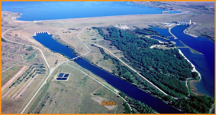
La presa de Oahe (en inglés, Oahe Dam) se encuentra en el río Missouri y forma el lago Oahe, el cuarto embalse artificial en tamaño del país, que se extiende a lo largo de 231 km corriente arriba del Missouri hasta Bismarck (Dakota del Norte). Se encuentra en los condados de Hughes y Stanley, en Dakota del Sur, Estados Unidos de América. Queda justo al norte de Pierre (Dakota del Sur). La central hidroeléctrica de la presa proporciona electricidad para gran parte de los Estados Unidos centro-septentrionales. Recibe su nombre de la misión india de Oahe creada entre los siux lakota en 1874. El proyecto proporciona control frente a las inundaciones, energía eléctrica, irrigación y beneficios para la navegación, calculados por el Cuerpo de Ingenieros en 150 millones de dólares al año.
En septiembre y octubre de 1804, la expedición de Lewis y Clark pasó a través de lo que hoy en día es el lago Oahe mientras exploraban el río Missouri.
La presa de Oahe fue autorizada por la Ley de control de inundaciones de 1944, y la construcción por el Cuerpo de Ingenieros del Ejército de los Estados Unidos comenzó en 1948. La principal presa de tierra y pizarra alcanzó su altura total en octubre de 1959. Fue oficialmente inaugurado por el presidente John F. Kennedy el 17 de agosto de 1962, año en el que comenzó a generar electricidad. El proyecto original costó 340 millones de dólares.
Lago Oahe
El lago Oahe es un gran embalse detrás de la presa de Oahe en el río Missouri comenzando en el centro de Dakota del Sur y sigue hacia el norte hasta Dakota del Norte en los Estados Unidos. El lago tiene una superficie de 1.500 kilómetros cuadrados y una profundidad máxima de 62 metros.1 Por volumen es el cuarto embalse en los Estados Unidos.1 El lago Oahe tiene una longitud de aproximadamente 372 km y una costa de 3.620 km.1 51 zonas recreativas se encuentran a lo largo del lago Oahe,2 y millón y medio de personas visitan el embalse cada año.1 El lago toma su nombre de la misión india de Oahe del año 1874.2
https://es.wikipedia.org/wiki/Presa_de_Oahe
http://en.wikipedia.org/wiki/Oahe_Dam
http://www.flickr.com/photos/capitaljournal/tags/oahedam/
http://www.flickr.com/photos/47772639@N00/tags/oahe/
http://www.flickr.com/photos/trypnotic/tags/oahe/
http://www.engineeringsights.org/sightDetail.asp?Sightid=481&image=0&id=bridges&view=k&name=&page=1
http://disasterrecovery.sd.gov/flood_pics.aspx
http://www.nwo.usace.army.mil/Missions/DamandLakeProjects/MissouriRiverDams/Oahe.aspx
Vídeo:
Web recomendada: http://www.johnweeks.com/river_missouri/pages/sd_mo_09.html
Contador: 9744
Inserción: 2013-05-10 13:11:46
Lugares a visitar en un radio de 100 km (en línea recta)
Mapa de los lugares a 100 km (en línea recta)
Mostrando Registros desde el 1 hasta el 0 de un total de 0
Visitas RSS |
Más visitados Basílica de San Marcos  155695 Catedral de Notre Dame (París)  145152 Torre de Pisa  132262 Monte Saint-Michel  101367 Presa de las Tres Gargantas  82366 |
Incorporaciones |
Comentarios Oscarhealf  Mumbai (Bombay) Прикиньте, вчера я осознал, что мир маркетплейс... Sergio alumb  Puerto de Klaipeda Not long ago I started exploring coin collecting. I found a helpful resource at hazola  Cúpula de la Roca gracias me... gera  Buenos Aires las mejores fotos de la mejor ciudad del... Daniel M. - BRASIL  San Francisco ... |


