
Nombre:
Puente Bayside
Otro:
Localización:
View Larger Map
Récord: 4270 m
Tipo: Puentes
Categoría:
Foto:
Voto:
Continente: América
País: Estados Unidos
Localización: Old Tampa Bay, Clearwater, FL to Largo, FL
Año: 1993
Estado: Terminado
Descripción:Located immediately west of the north end of the Bayside Bridge, this City of Clearwater Park was designated for passive daytime recreational use. Amenities include limited parking, a small sand beach about 100 yards from the parking area, a drinking fountain, benches, trash cans and a one-half mile scenic walking trail with two shade shelters and many large oak trees.
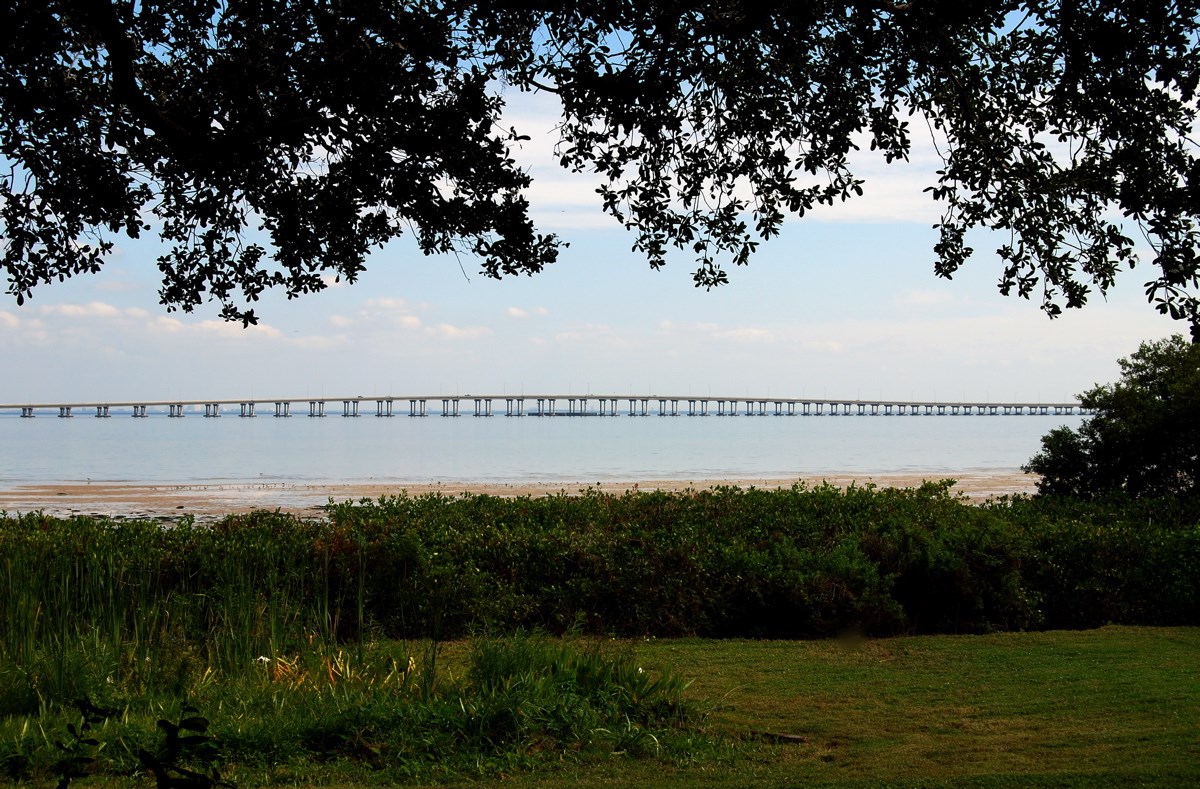
The area is tidally influenced and may be more difficult to access during low tide. From here, paddle east and north along the coastline, passing under the Bayside Bridge and the Courtney Campbell Causeway to enter Upper Tampa Bay for access to Safety Harbor and Oldsmar. Parking is available in Bayview Park during daylight hours only.
http://www.pinellascounty.org/Plan/blueways/map8.htm
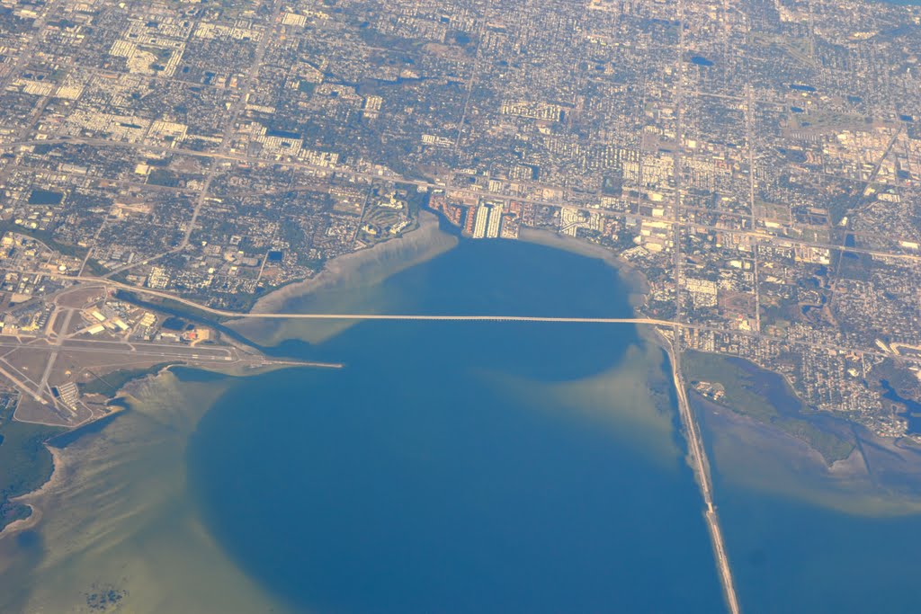
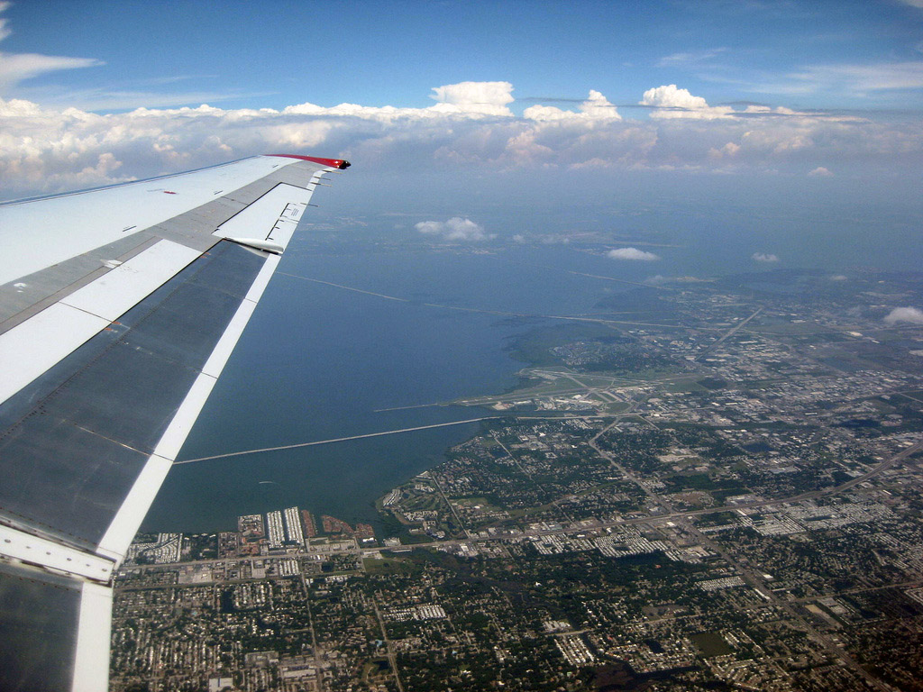
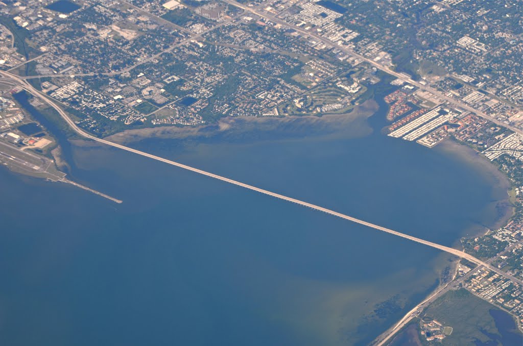
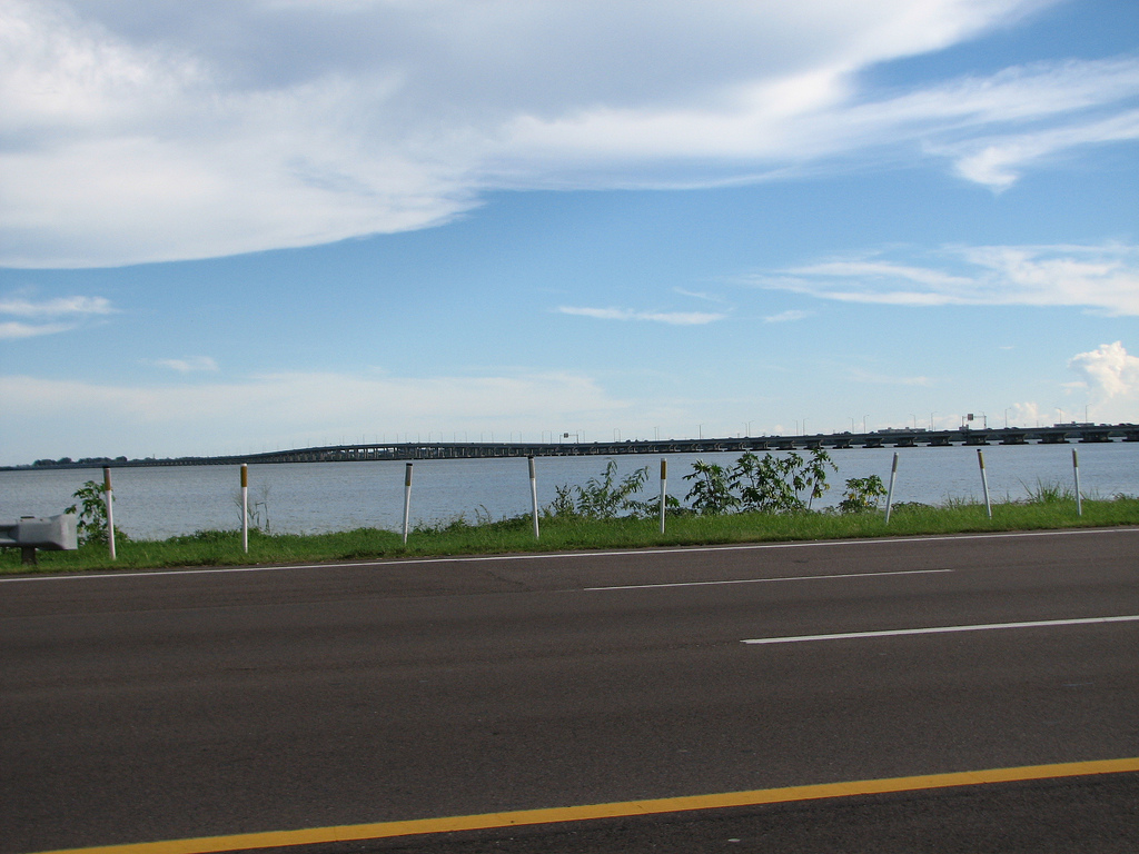
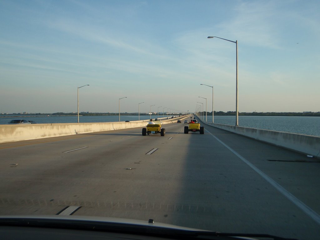
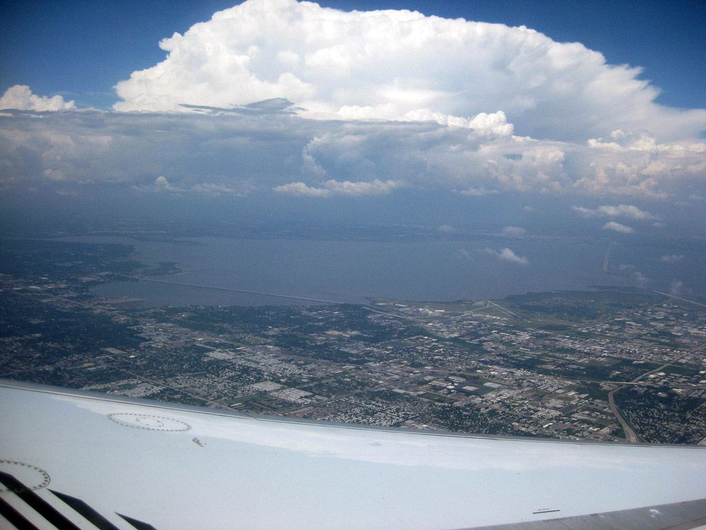
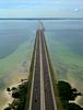
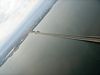
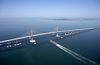
The Bayside Bridge crosses over the northwesternmost end of Tampa Bay, connecting Clearwater, Florida and Largo, Florida. Construction began in the early 1990s and was completed in Summer of 1993, officially opening for traffic on June 2 of that year. Originally conceived in the 1970s as the 49th Street Bridge, a toll-levied part of the 12-mile (19 km) Pinellas Parkway, the current six-lane twin-span bridge provides direct, unmitigated access from eastern Clearwater to St. Petersburg/Clearwater International Airport by connecting McMullen Booth Road to 49th Street North and also serves as a bypass for heavily congested US 19. The speed limit is 55 mph (or about 88 km/h) until you reach McMullen Booth. It features a SPUI interchange at State Road 60 and a diamond interchange on the south end of the bridge. Along with the bridge, a $12 million interchange was built at the intersection of 49th Street and Roosevelt Boulevard. The bridge was completed before McMullen Booth Road was widened, dumping up to 36,000 cars a day onto the 2-lane road. On streets such as Marlo Road, drivers could wait as long as 15 minutes before being able to make a left turn.[2]
http://en.wikipedia.org/wiki/Bayside_Bridge_(Pinellas_County,_Florida)
https://www.flickr.com/photos/spacemanspiff27/4729291532
http://www.panoramio.com/photo/72676958
Vídeo:
Web recomendada: http://www.southeastroads.com/cr-611sa_fl.html
Contador: 7351
Inserción: 2014-12-03 13:33:57
Lugares a visitar en un radio de 100 km (en línea recta)


Mapa de los lugares a 100 km (en línea recta)
Mostrando Registros desde el 1 hasta el 0 de un total de 0
Visitas RSS |
Más visitados Basílica de San Marcos  155506 Catedral de Notre Dame (París)  144917 Torre de Pisa  132115 Monte Saint-Michel  101222 Presa de las Tres Gargantas  82178 |
Incorporaciones |
Comentarios hazola  Cúpula de la Roca gracias me... gera  Buenos Aires las mejores fotos de la mejor ciudad del... Daniel M. - BRASIL  San Francisco ... PEQUE  Presa Chicoasén SERA QUE ALGUIEN ME PUEDE DAR MAS INFORMACIÓN DE ESTE PROYECTO ESTUDIO EN LA UNACH Y ES PARA UN... Mery  Huaca Pucllana Muy interesante, muy buena la información y... |


