Nombre:
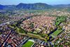
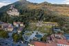
Puerto de La Spezia
Otro:
Localización:
Ver mapa más grande
Tipo: Puertos
Categoría:
Foto:
Voto:
Continente: Europa
País: Italia
Localización: La Spezia, Liguria
Año: XIX
Estado: Terminado
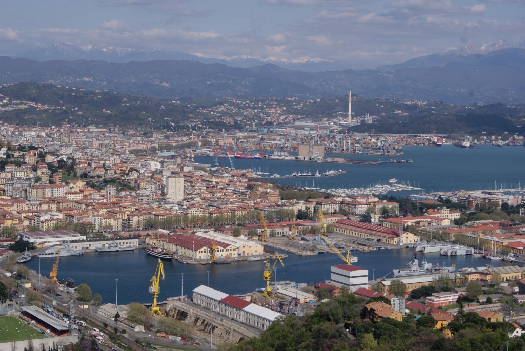
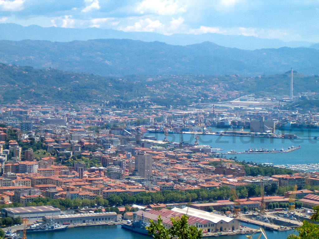
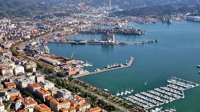
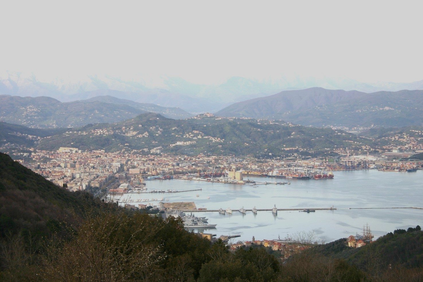
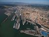
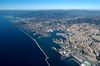
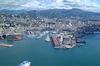
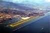
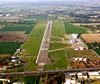
Descripción:The port of La Spezia is situated at the centre of the coast between Genoa and Leghorn and serves the markets of the Padana Plain, Switzerland, Austria and Bavaria.
Inside a 150 hectares harbour and protected by an outer breakwater, the port of La Spezia has over 5 km quays and 575.00 sqm surface at its disposal, with rail tracks for 17.000 metres and roads for 3.500 metres.

The draught is up to 14 metres, which allows the newest container ships to enter the port; current dredging works will increase draught up to 15 metres.
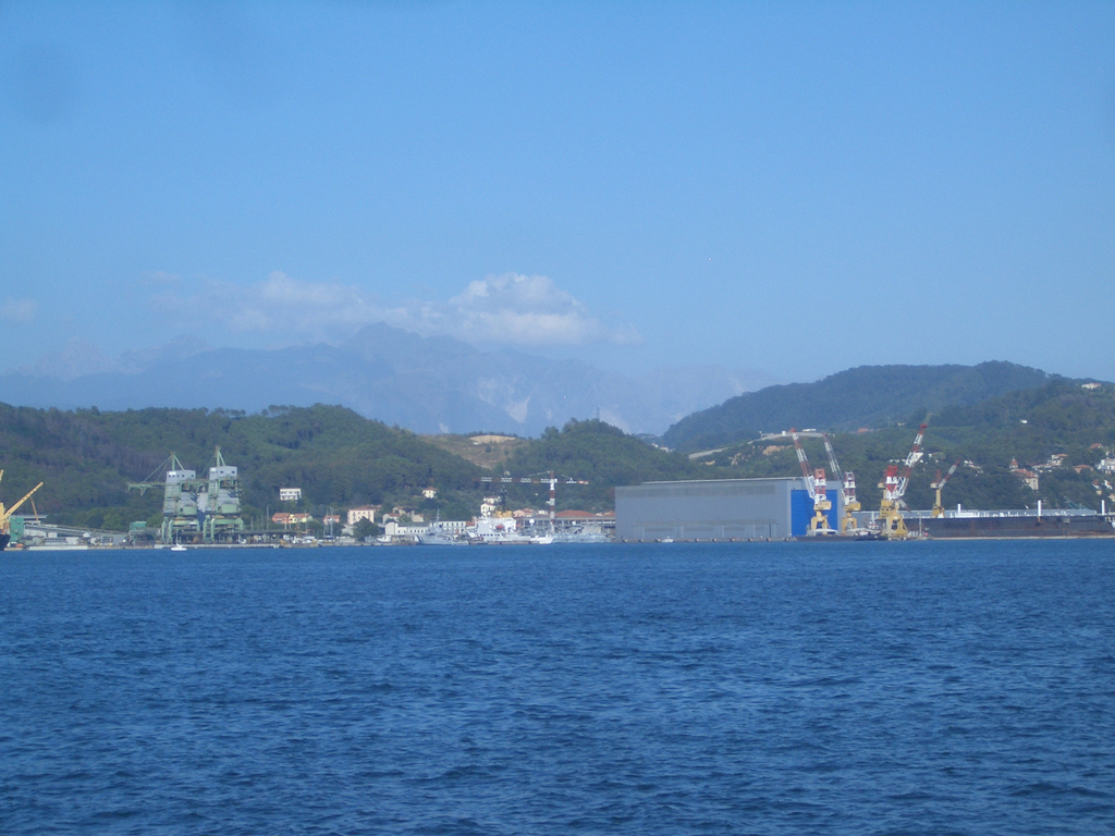
The terminals have cranes up to 100 tons capacity and covered warehouses for a total of 13.000 sqm at their disposal.
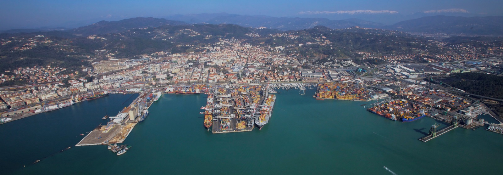
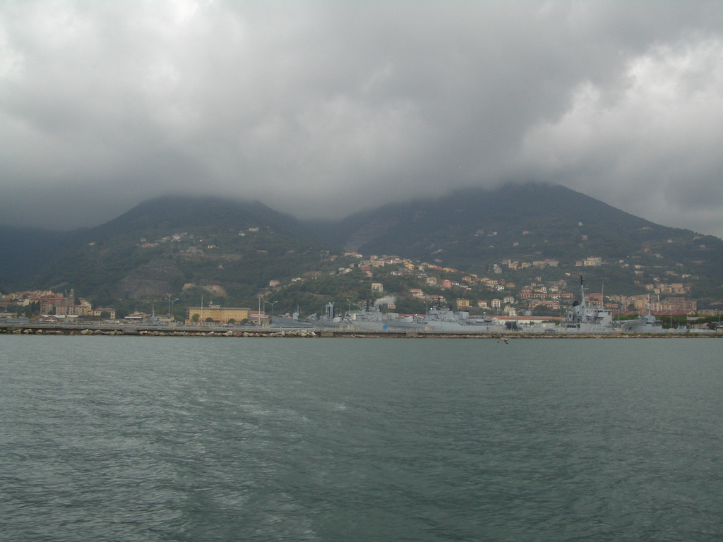
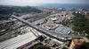
In the port, two container terminals, one multipurpose terminal, one coal terminal, two oil terminals, one LNG terminal and two cement terminal are operative.
In the European scenario, the port of la Spezia is one of the main port as concerns intermodal transport, the first for rail transport; besides, regular services connect it weekly with the most important intermodal centres of North Italy.
More than 50 ship lines link the port with over 200 ports all over the world.
The port of La Spezia is directly connected to the rail and highway net and is located at the cross between the Tyrrenian-Brenner and the coast lines. The nearest international airport is the Pisa Airport, at about 80km from the town.
Geographical position
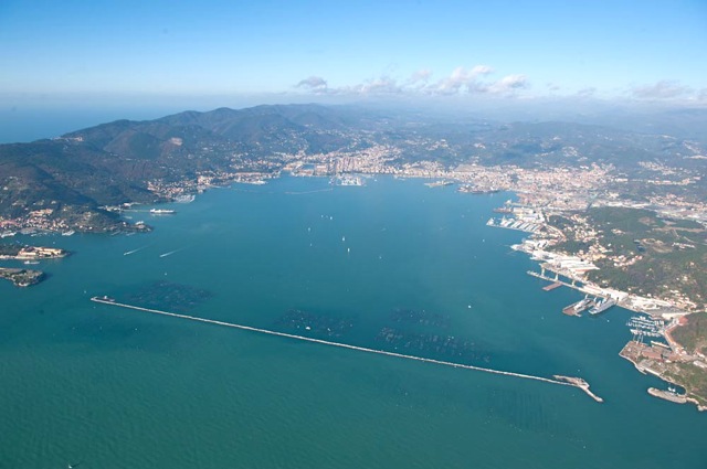
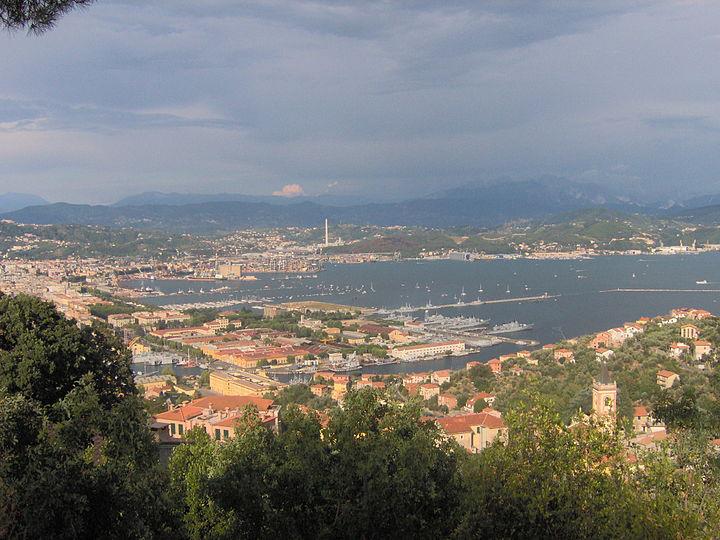
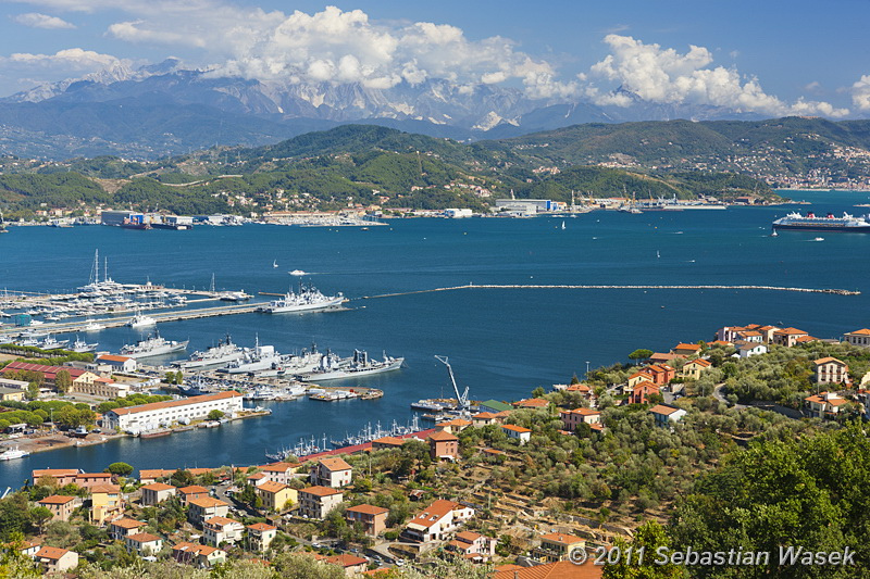
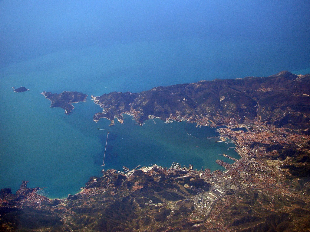
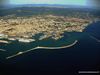
The port’s particular position , at the end of a deep gulf North-West / South-East oriented, makes it a natural port like few others.
A mountain chain protects the port backwards, while the cape of Portovenere and the islands Palmaria and Tino save the port from the strong south-west winds.
A outer breakwater assures very good sea conditions to the gulf all over the year, allowing port operation by every weather condition.
The outer breakwater is 2.210 metres long and cuts the gulf between cape S. Maria westwards and cape S. Teresa eastwards, leaving two passages of 200 and 400 metres for the ships entering into the port.
The bay is about 4,6 km deep and 3,2 km wide.
http://www.porto.laspezia.it/il-porto
Il porto della Spezia è uno dei maggiori scali mercantili del Mar Ligure e si trova nella parte più settentrionale del Golfo della Spezia in Liguria.
Il suo sviluppo risale alla fine del XIX secolo, e da allora è cresciuto sino a diventare uno degli scali principali anche del Mar Mediterraneo, particolarmente specializzato nella movimentazione dei container.
All'interno di una rada di circa 1500 ettari, protetta da una diga foranea di circa 2.200 metri che assicura l'operatività tutti i giorni dell'anno, il porto della Spezia ha 5.100 metri di banchine e 575.000 m² di aree disponibili con 17.000 metri di binari ferroviari e 3.500 metri di strade. I pescaggi arrivano fino a 14 metri consentendo l'accosto alle navi portacontainer dell'ultima generazione.
I terminal hanno gru con capacità di sollevamento fino a 100 tonnellate e magazzini coperti per un totale di 13.000 m². Rimorchiatori, piloti e ormeggiatori garantiscono i movimenti delle navi 24 ore su 24 per 365 giorni all'anno. Sono operativi, con relative attrezzature specializzate, due terminal container, tre terminal multipurpose, due terminal petroliferi, un terminal carbonifero, un terminal per GPL, due terminal per cereali, un terminal per oli alimentari, un terminal per rinfuse, due terminal per cemento.
Dentro lo specchio acqueo del golfo le isobate rivelano fondali che, per lo spazio interessato alle attività portuali, non scendono, in generale, sotto i sette metri, mentre nelle zone escavate per l'accesso e la manovra delle petroliere, due canali ed un'area di evoluzione, raggiungono una profondità di -11,50. Ciò corrisponde a possibilità di attracco di navi fino a 50-60.000 tsl, senza allibo. È previsto, in connessione con lo sviluppo futuro del porto, un ulteriore approfondimento dei fondali, nei bacini di nuova costruzione (fino a 13 metri in testa ai moli).
http://it.wikipedia.org/wiki/Porto_della_Spezia
Vídeo:
Web recomendada: http://www.portolaspezia.it/
Contador: 8675
Inserción: 2013-03-21 13:34:25
Lugares a visitar en un radio de 100 km (en línea recta)
Mapa de los lugares a 100 km (en línea recta)
Mostrando Registros desde el 1 hasta el 0 de un total de 0
Visitas RSS |
Más visitados Basílica de San Marcos  155905 Catedral de Notre Dame (París)  145446 Torre de Pisa  132418 Monte Saint-Michel  101539 Burj Khalifa  85983 |
Incorporaciones |
Comentarios Agenaktof  Mumbai (Bombay) In addition, folks these living in the residence, and stability of who're opioid addicted spend... Wein Plaza  Mumbai (Bombay) Thanks a lot. Loads of knowledge! Wein Plaza - JerryMiff  Mumbai (Bombay) Всем доброго времени суток! Хочу посоветовать... Oscarhealf  Mumbai (Bombay) Прикиньте, вчера я осознал, что мир маркетплейс... Sergio alumb  Puerto de Klaipeda Not long ago I started exploring coin collecting. I found a helpful resource at |