
Nombre:
Canal de Caledonia
Otro:
Localización:
Récord: 96.60 km
Tipo: Canales
Categoría:
Foto:
Voto:
Continente: Europa
País: Reino Unido
Localización: Conecta la costa oriental en Inverness, con la costa occidental en Corpach cerca de Fort William. Escocia
Año: 1803-1822
Estado: Terminado
Descripción:El Canal de Caledonia, cruceros en Escocia
Jose Manuel Vargas
De un tiempo a esta parte el turismo fluvial es algo que cada vez está adquiriendo mayor interés por parte de los turistas. De esta manera tenemos la oportunidad de visitar en pocos días diferentes ciudades europeas y disfrutar de ellas desde el mar. Una perspectiva realmente única, interesante y diferente.
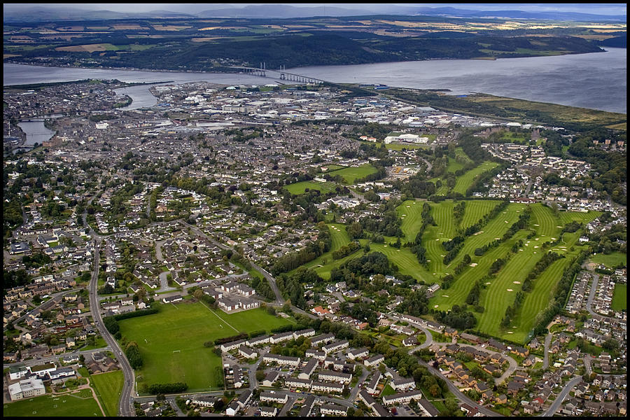
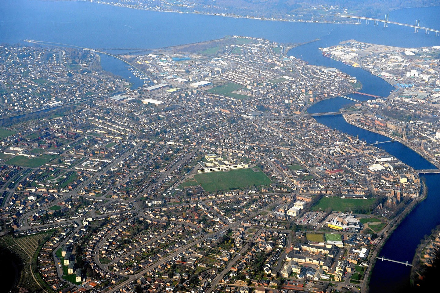
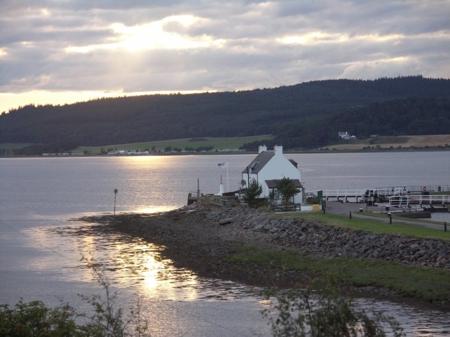
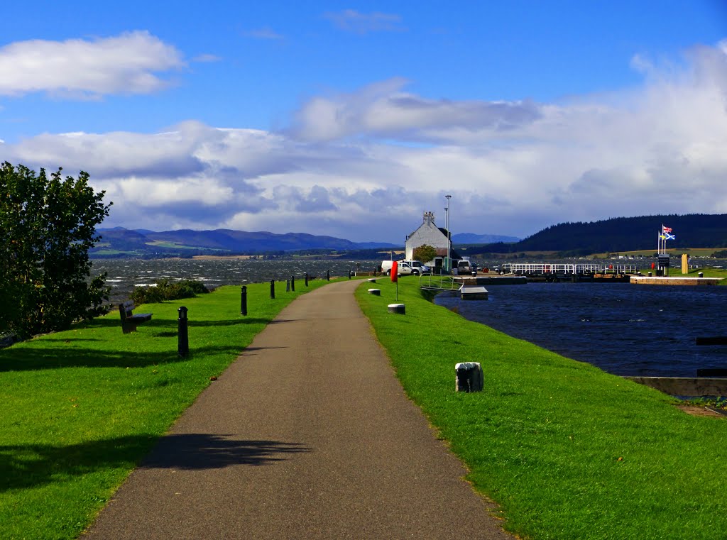
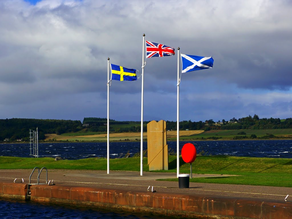
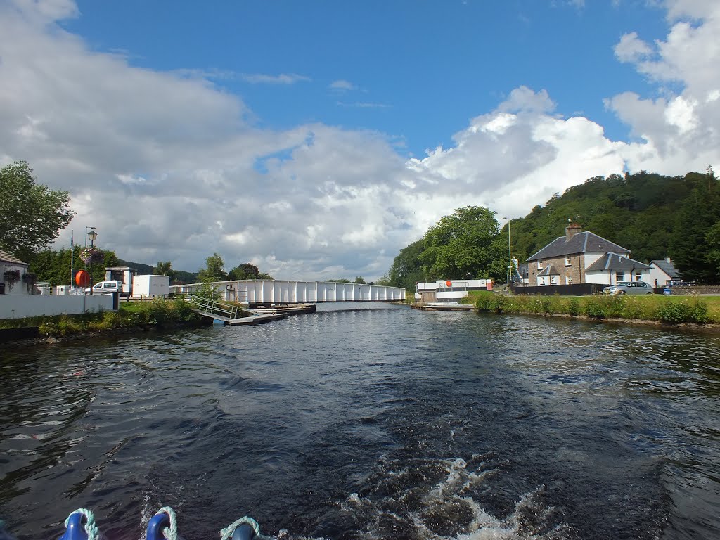
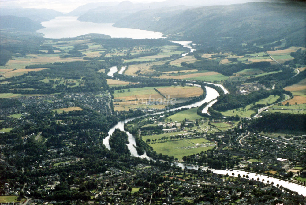
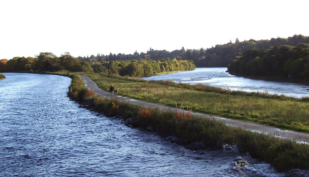
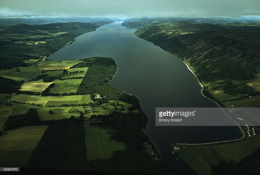
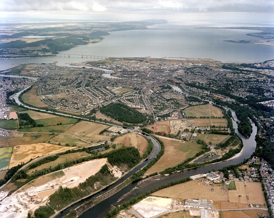
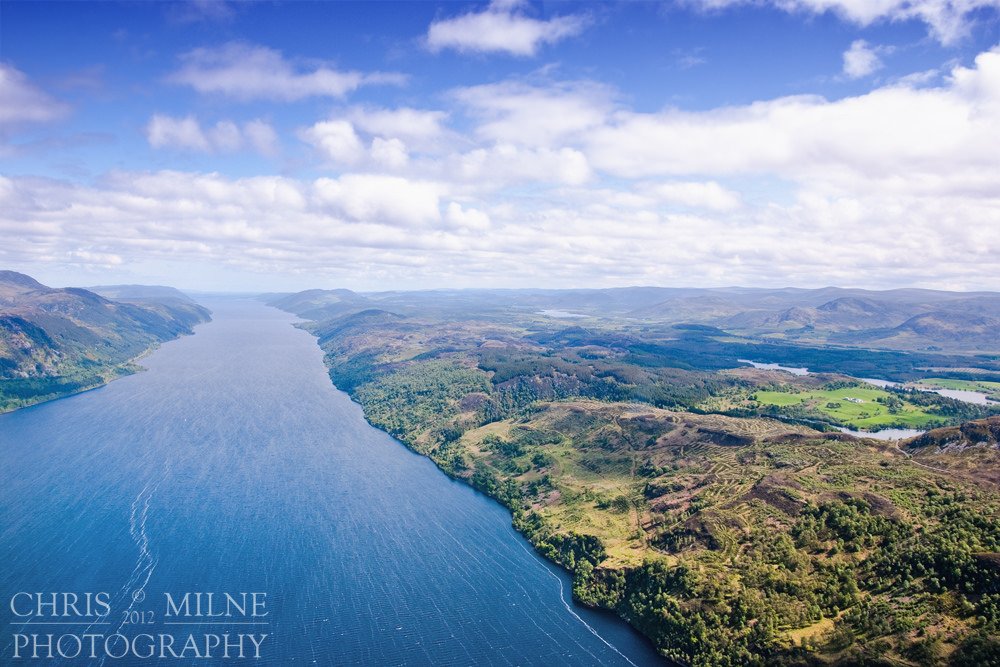
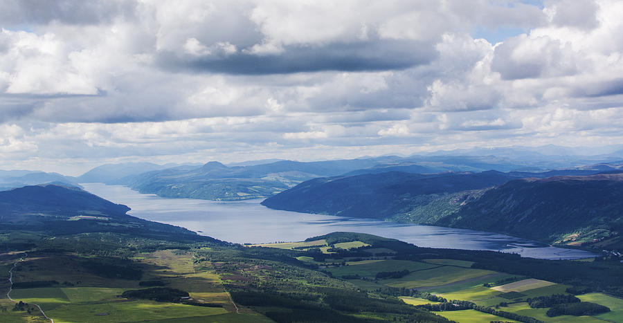
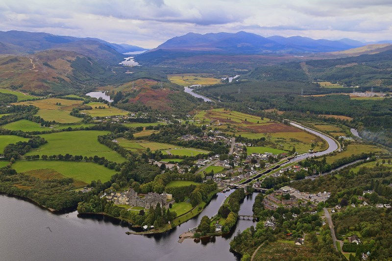
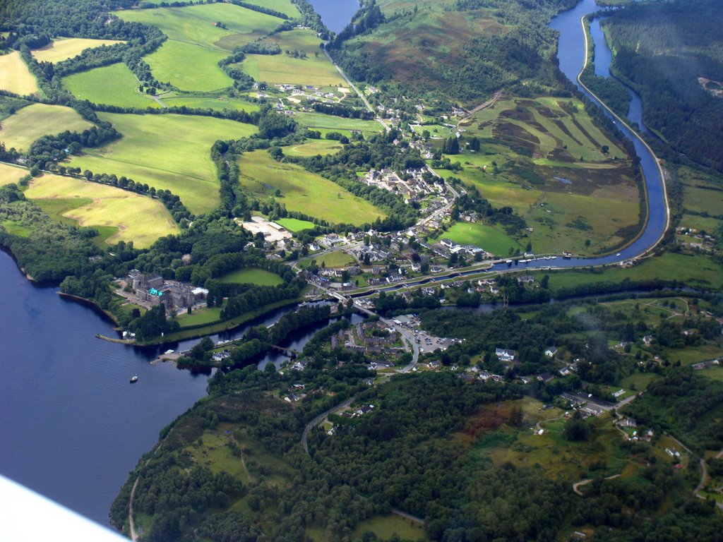
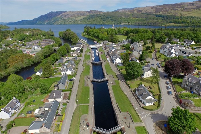
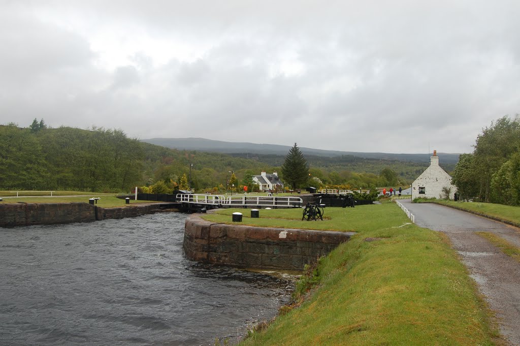
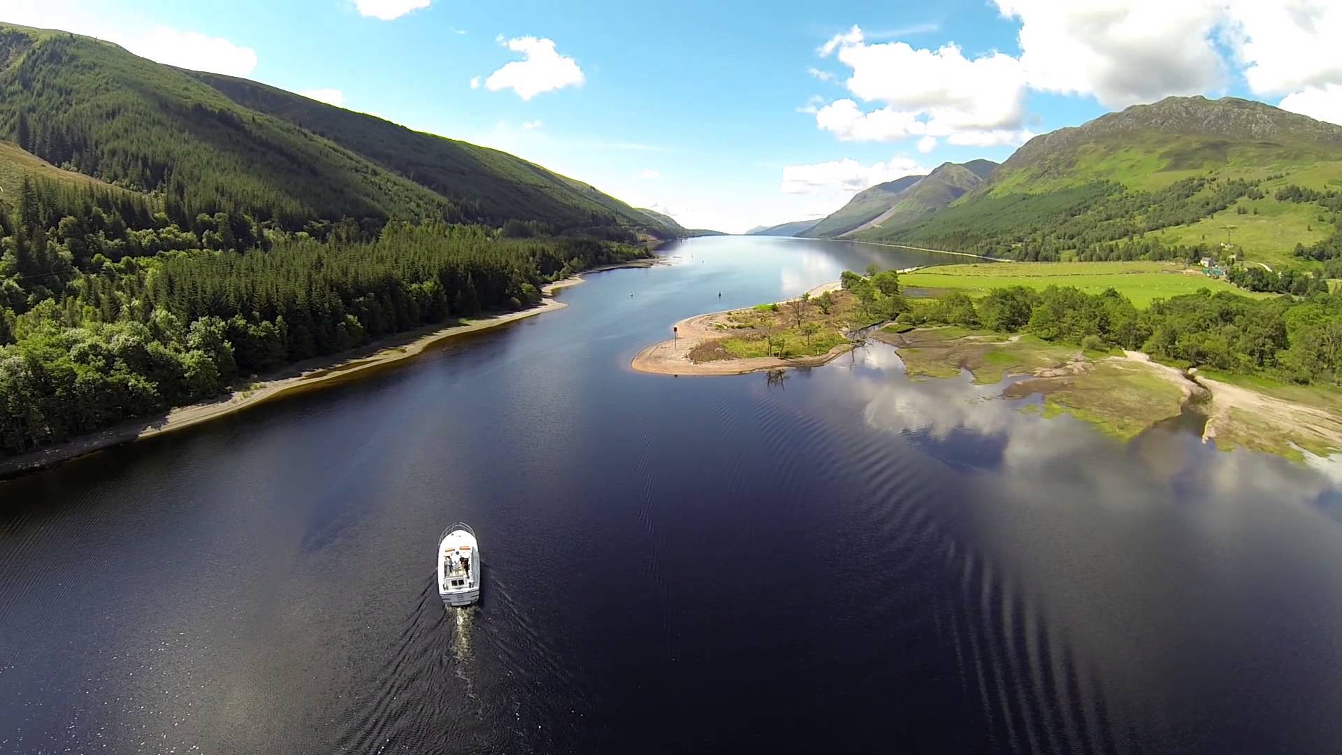
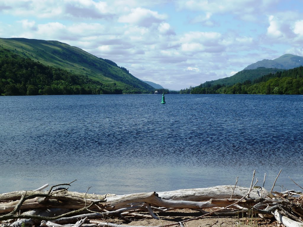
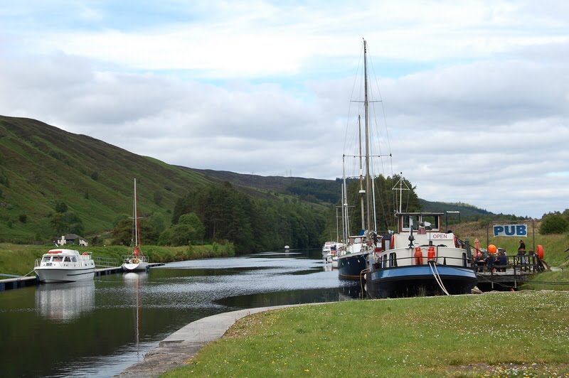
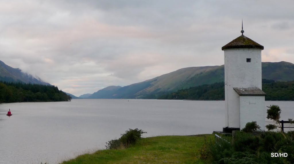
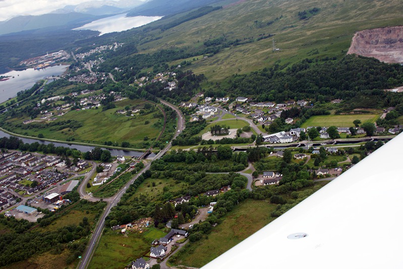
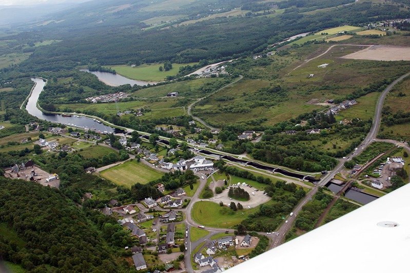
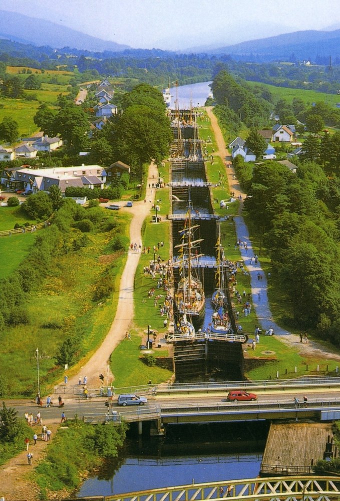
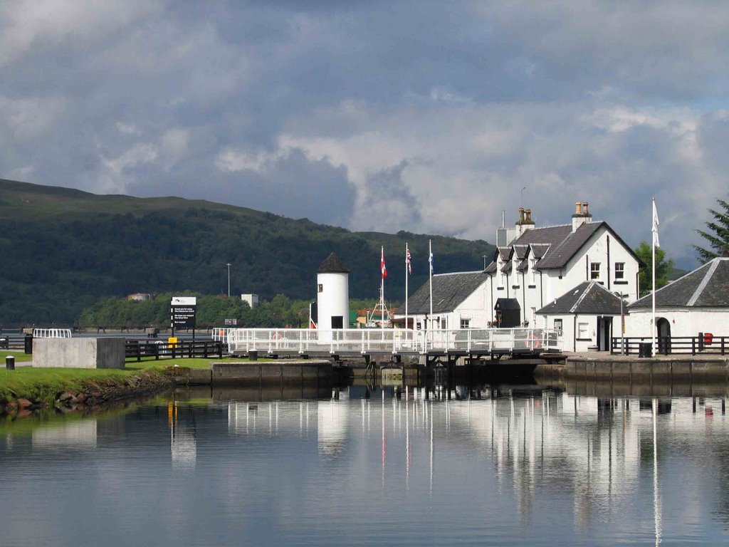
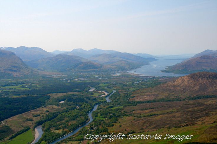
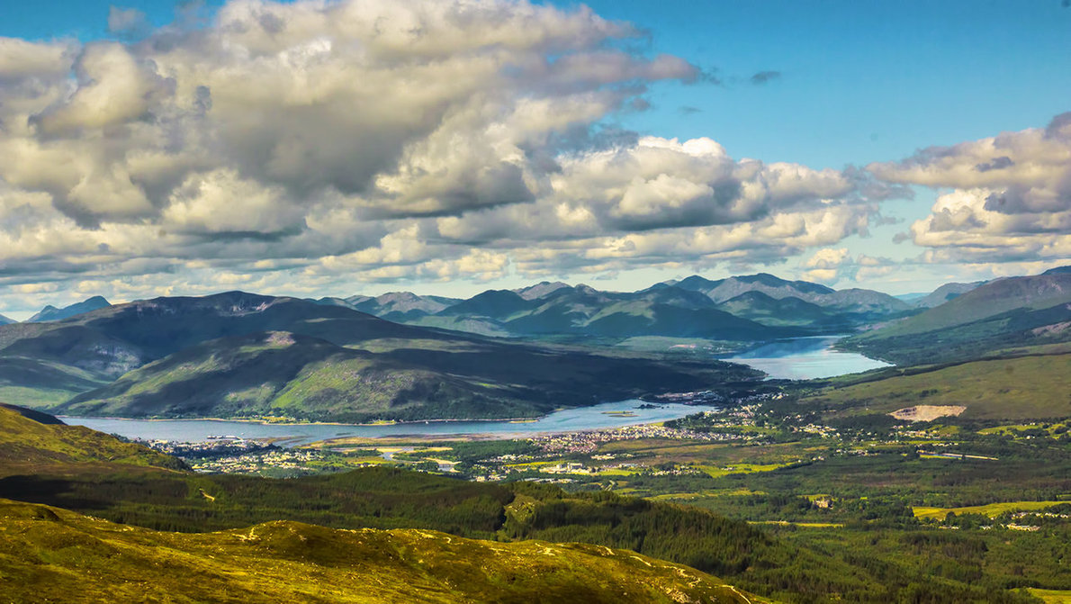
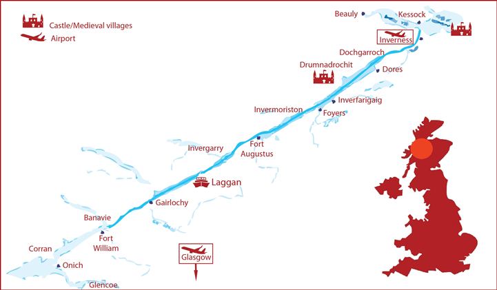
Los escoceses han paseado desde siempre a través del Canal de Caledonia, una vía navegable que conecta la costa oriental en Inverness, al norte, con la costa occidental en Corpach, cerca de Fort William, al sur. En total algo más de cien kilómetros en donde descubrir las verdaderas Higlands, el Loch Oich o atravesar el Lago Ness en busca del famoso Nessie y visitar Drumnadrochit, el centro de observación del monstruo.
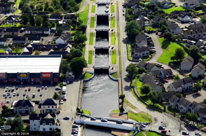
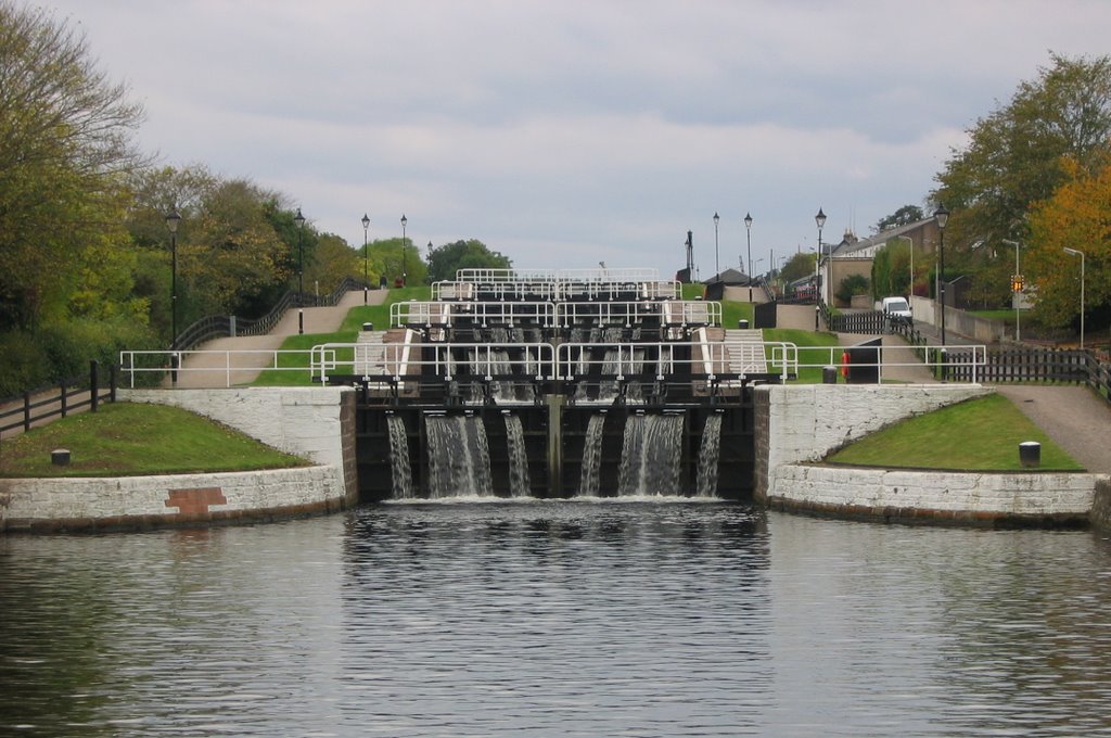
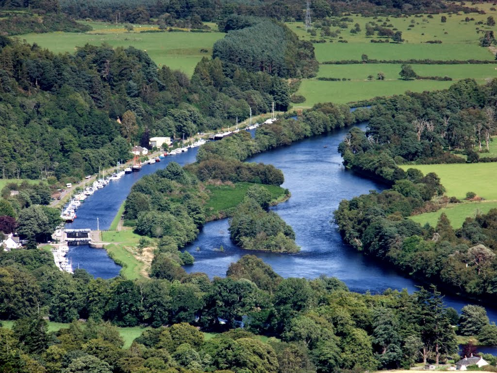
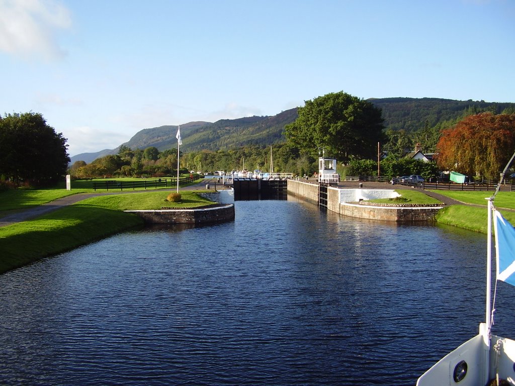
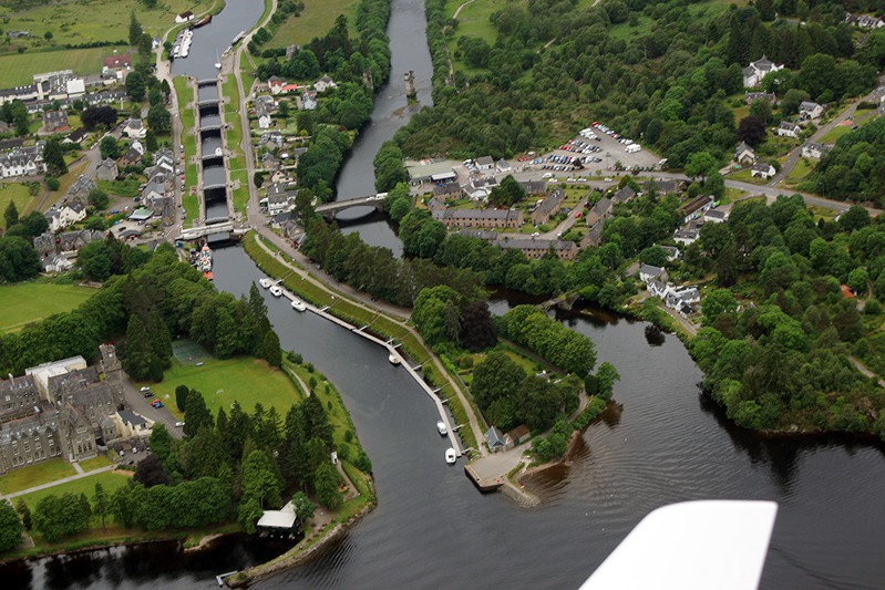
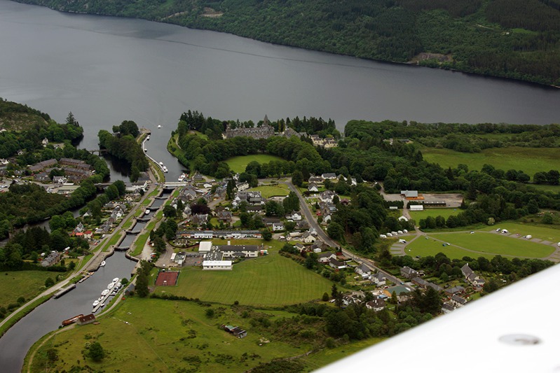
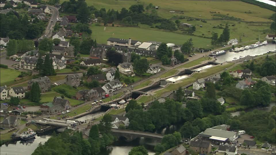
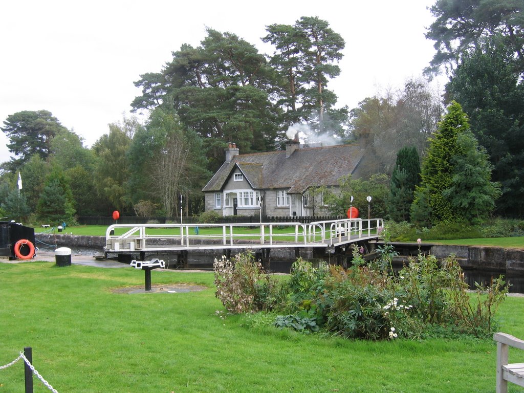
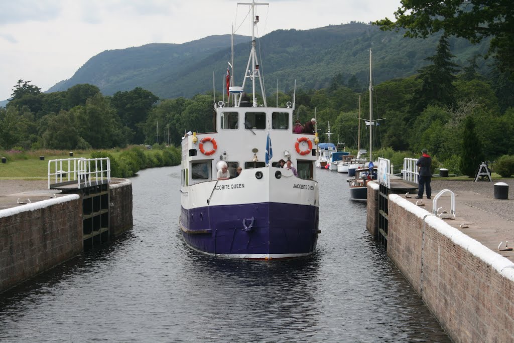
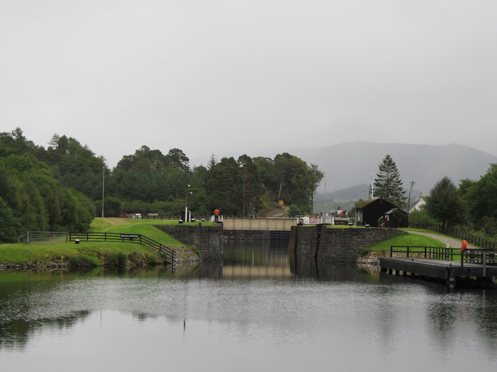
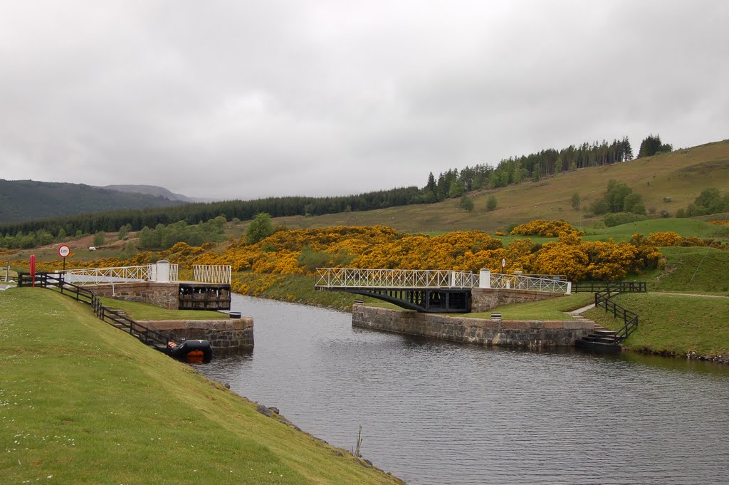
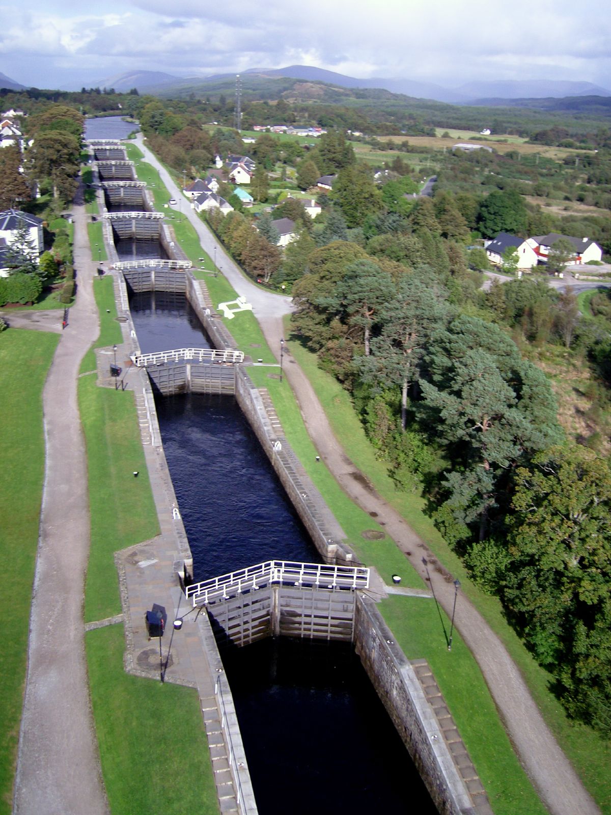
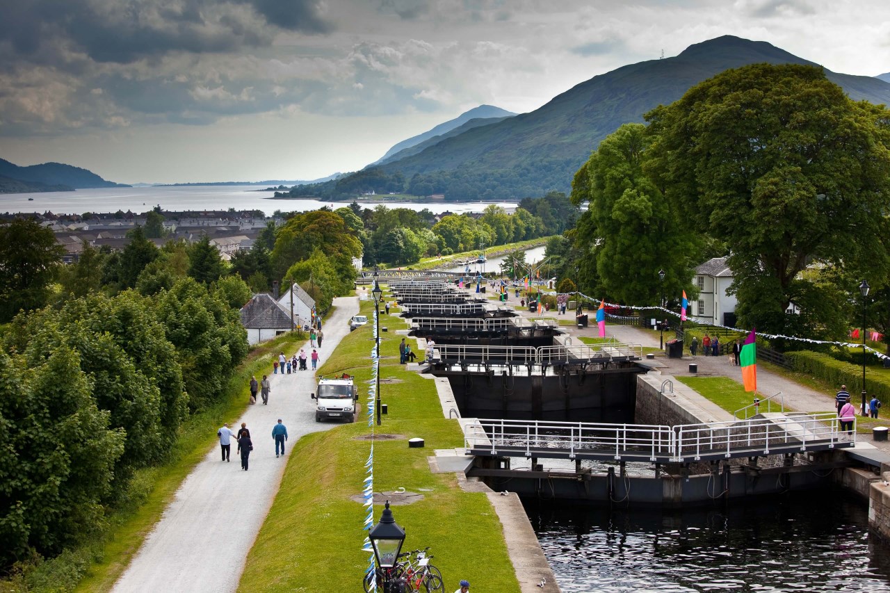
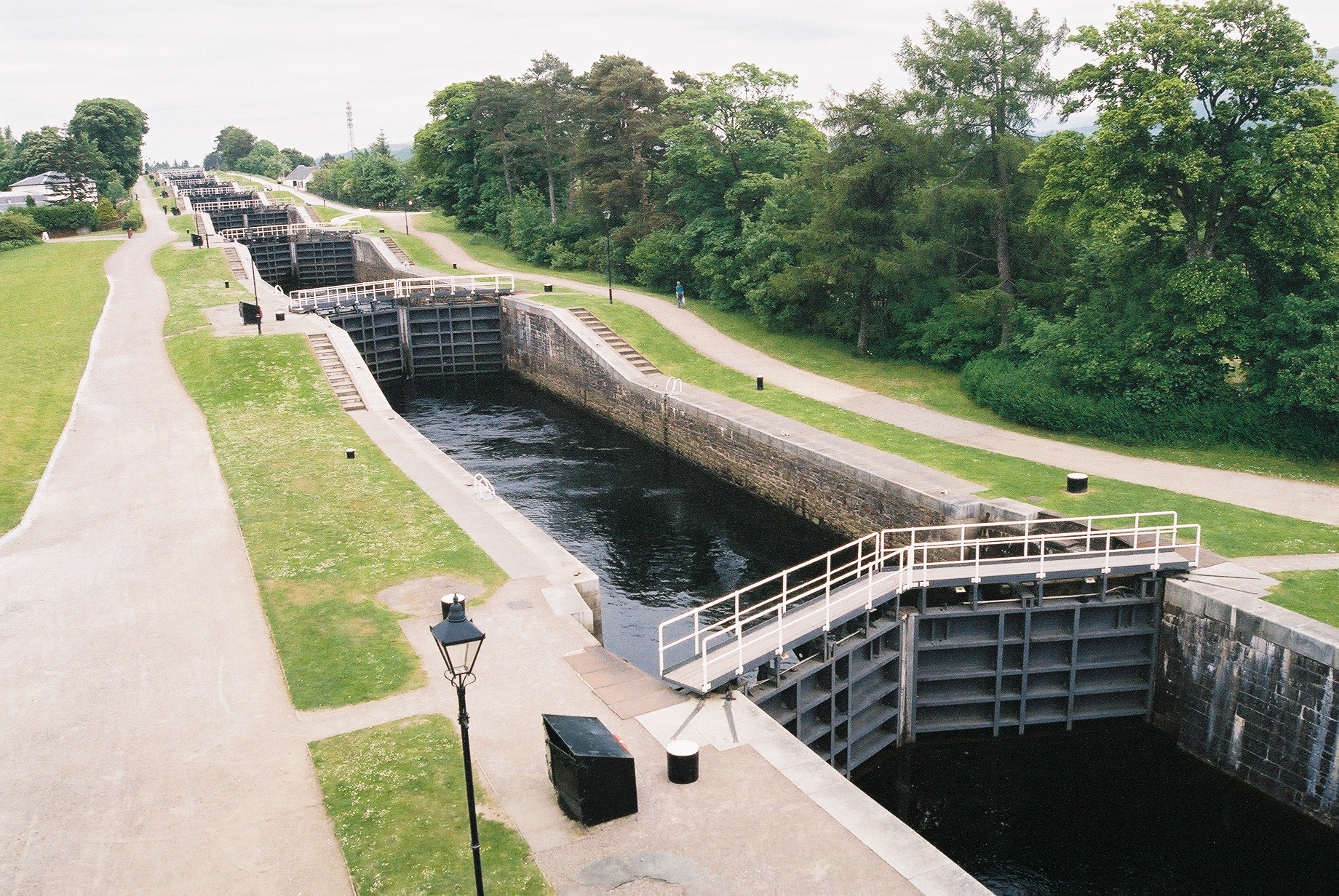
El Canal de Caledonia fue diseñado por el ingeniero Thomas Telford entre 1803 y 1822. En la actualidad cuenta con 29 esclusas, cuatro acueductos y diez puentes. Hay diferentes compañías que, especialmente en verano, organizan pequeños cruceros por el canal. Además de la vegetación abundante y los pequeños pueblos, atravesamos el Loch Dochfour y el Loch Lochy, entrando así en el Great Glen, la notable depresión que cruza Escocia.
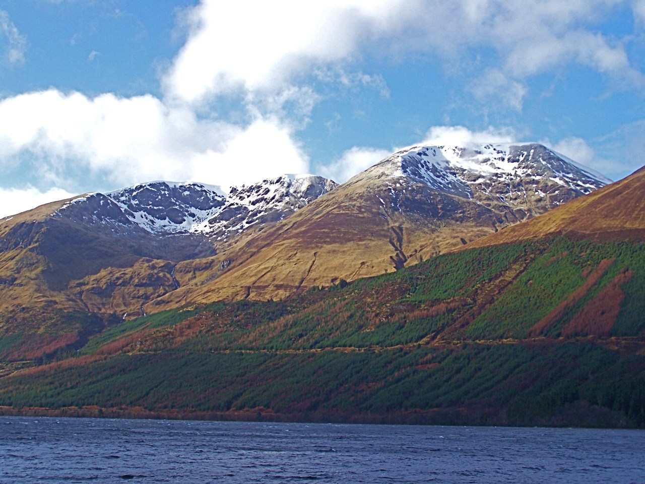
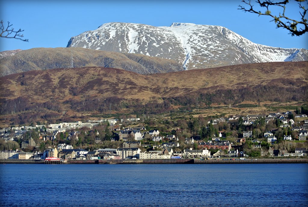
Las vistas desde el pequeño crucero son únicas, ya que sin ir más lejos pasaremos a los pies del Ben Nevis, la montaña más alta de Gran Bretaña. Asimismo cruzaremos diferentes estaciones náuticas en donde organizan numerosas actividades como paseos en canoa, windsurf o esqúí acuático.
Pero no todo en el Canal de Caledonia son actividades acuáticas. Alrededor del canal aparece la Great Glen Way, una de las rutas de senderismo más conocidas y turísticas de Escocia. Tiene casi 120 kilómetros y va desde el Ben Nevis hasta el final del Lago Ness. Son miles y miles los turistas los que la recorren cada año, disfrutando desde tierra firme de las preciosas vistas del canal.
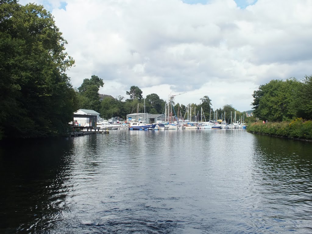
Los cruceros varían desde un día hasta una semana. Visitaremos los pueblos que se sitúan a orillas del canal, tendremos la oportunidad de saborear su gastronomía y perdernos en los relatos de sus leyendas, así como maravillarnos ante el fascinante paisaje evocador que nos rodea.
Si vais hasta Escocia en busca de buenas fotografías y una naturaleza imponente, nada mejor que hacer un crucero por el Canal de Caledonia. Un recorrido que os dejará maravillados.
http://sobreescocia.com/2013/05/27/el-canal-de-caledonia-cruceros-en-escocia/
The Caledonian Canal
Connecting Iverness to Fort William
Researched and written by Jeannette Briggs
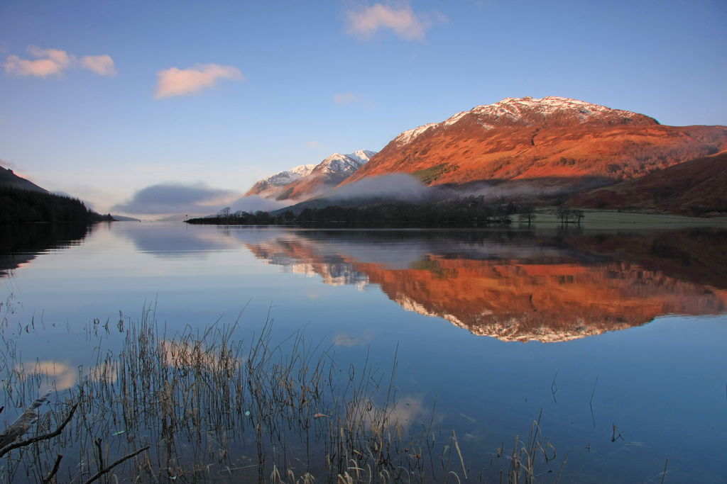
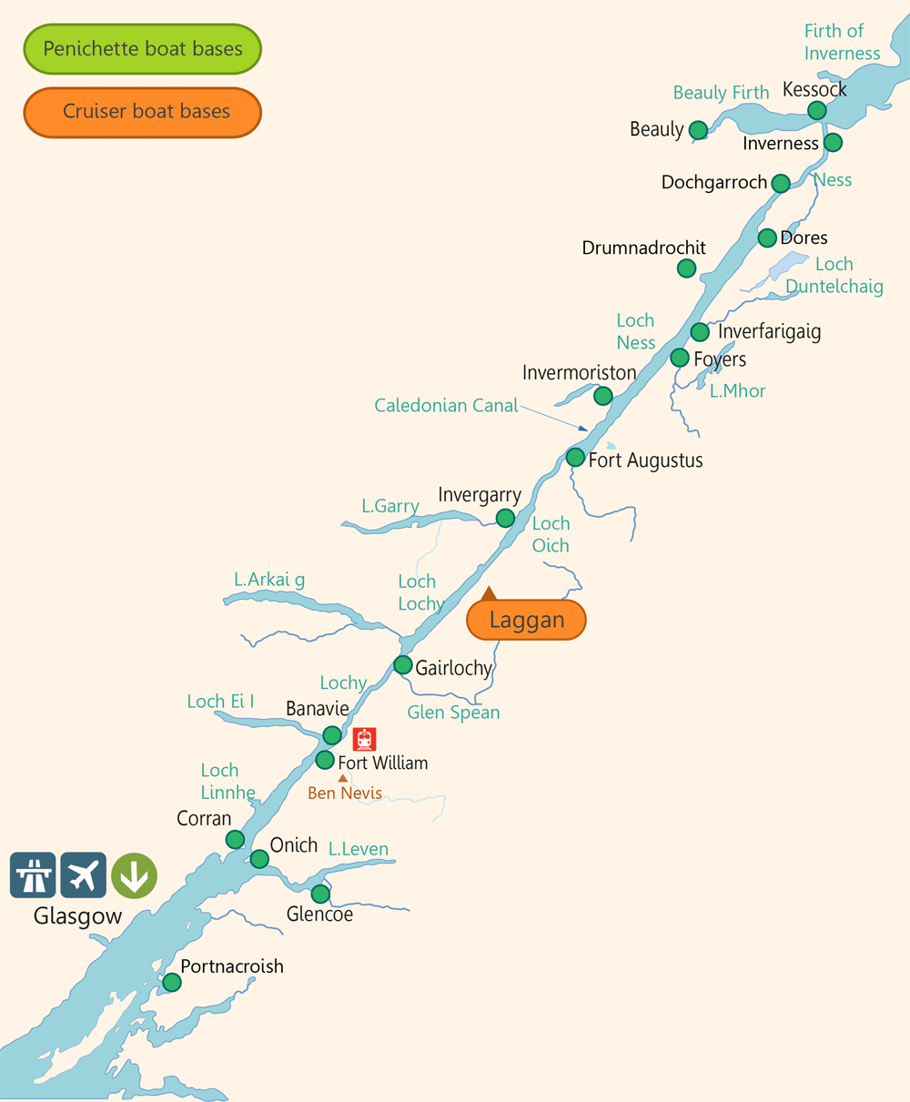
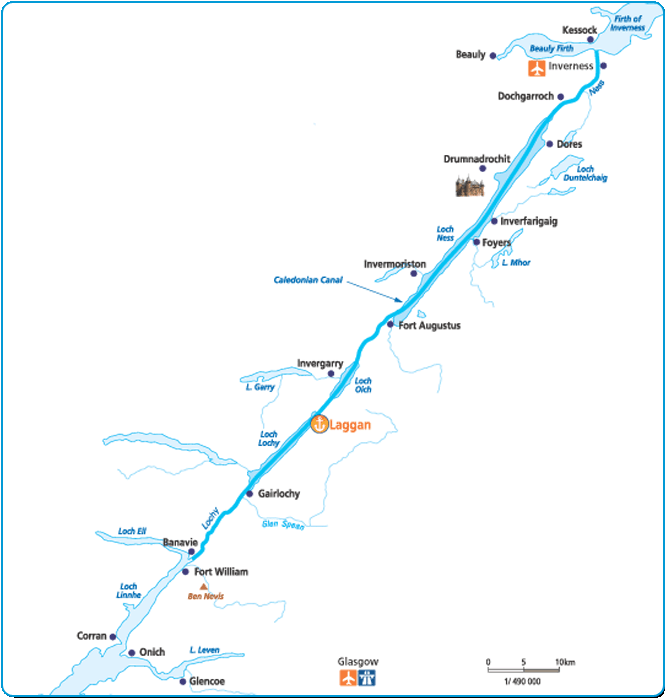
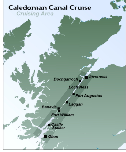
The Caledonian Canal links the west of Scotland to the East, and makes it possible to navigate a canal boat journey coast to coast right through Scotland's Great Glen, between Fort William and Inverness. It is scenically spectacular along its whole length, surrounded as it is by Scotland's highest mountains and most beautiful scenery. It takes about 3 days to cruise from east to west (or vice versa) through the lochs and the stretches of man-made canal that inter-connect with them.
The original canal was started in 1802 to plans produced by Thomas Telford the great engineer. It was primarily designed as a building scheme to provide employment for thousands of impoverised Scots, who had been disposessed by the notorious Highland Clearances (when the rich Scottish Lords swept away their poor tenant farmers and crofters to provide more land for their sheep to graze...) When it was finished it provided a route for sea going vessels from west to east, so that they did not have to negotiate the long and dangerous coastal route round the far north of Scotland.
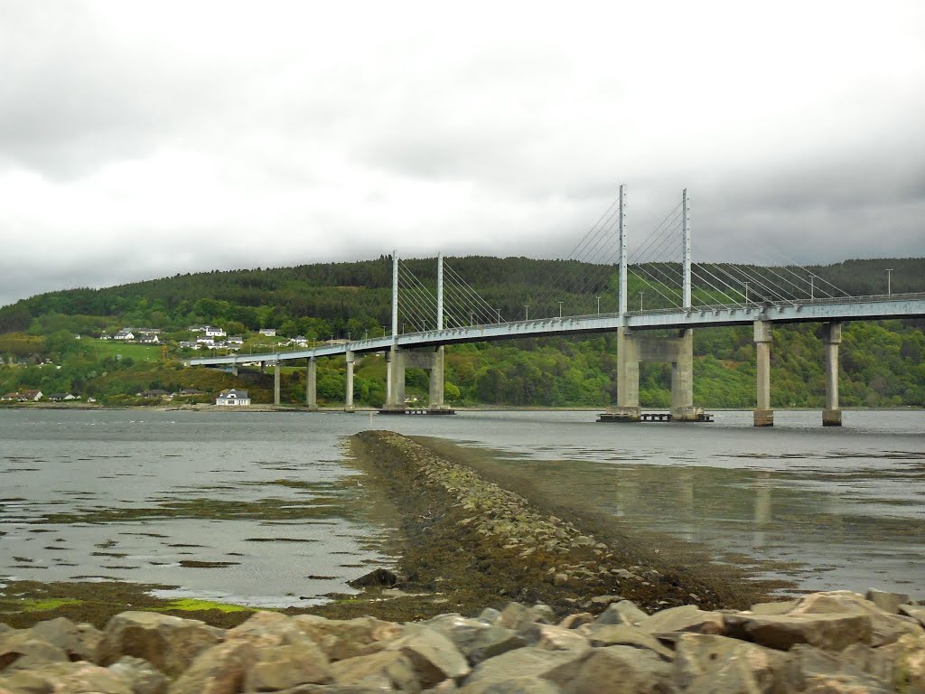
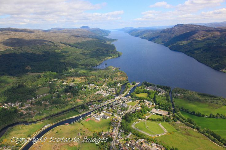
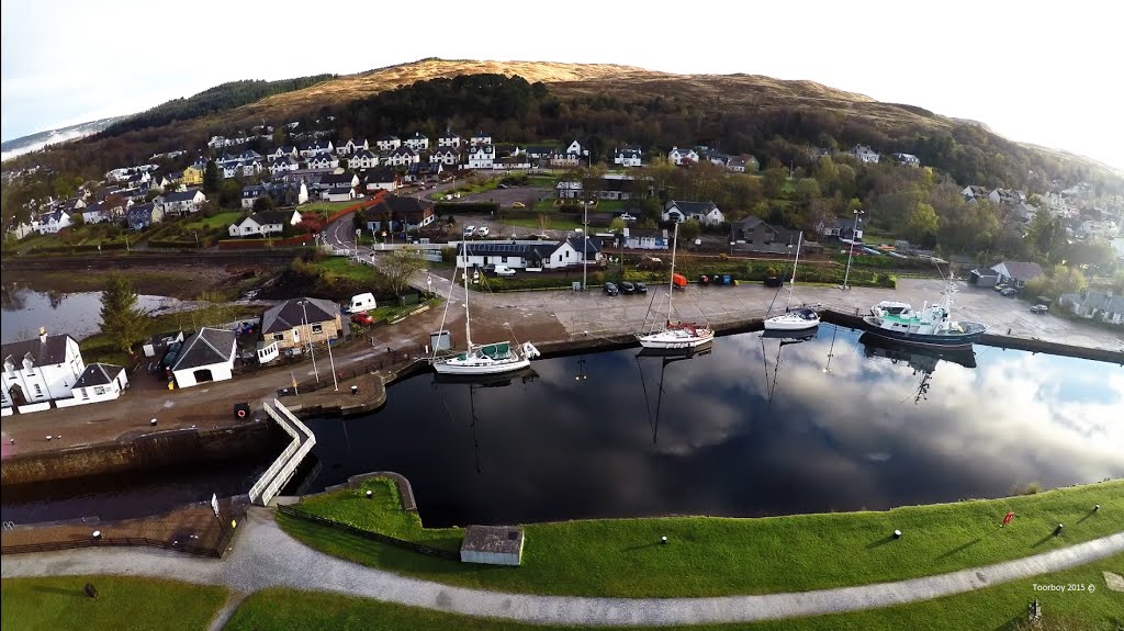
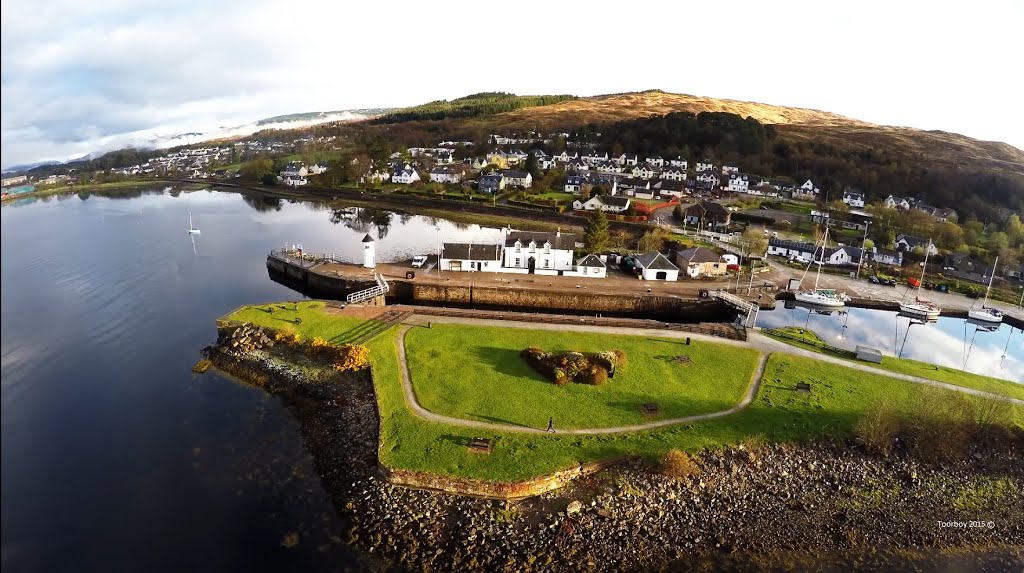
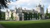
The canal is sixty miles long, from Corpach near Fort William in the west to Inverness on the north east coast of Scotland, and it traverses through the Great Glen and Loch Ness - the home of the famous 'Loch Ness Monster'. Even on the long stretches of open water you are never far away from sheltered canal boat moorings, and the short stretches of man made canal have only 10 locks for you to navigate, all operated by lock-keepers. In short, the Caledonian Canal offers you magnificent rugged scenery to enjoy when taking a canal boat holiday. There are welcoming little towns and villages, plenty of hotels and pubs with jetties and canal boat moorings. The villages have well-stocked shops and the larger towns offer full services. Ben Nevis- Britain's highest mountain - overlooks the Caledonian canal at Corpach and is always in view on the first section. You can see Inverness Castle, and Drumnadrochit with the Loch Ness Monster Exhibition at the other end of the canal.
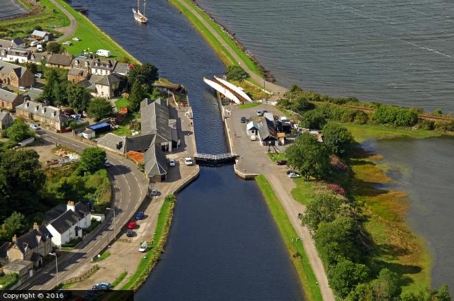
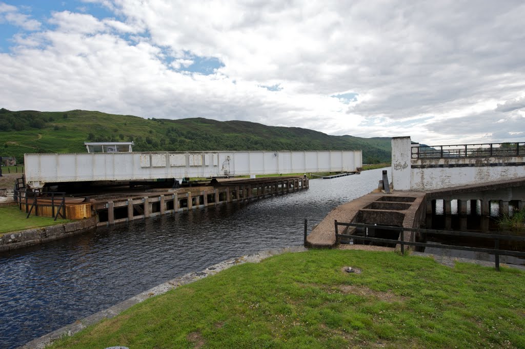
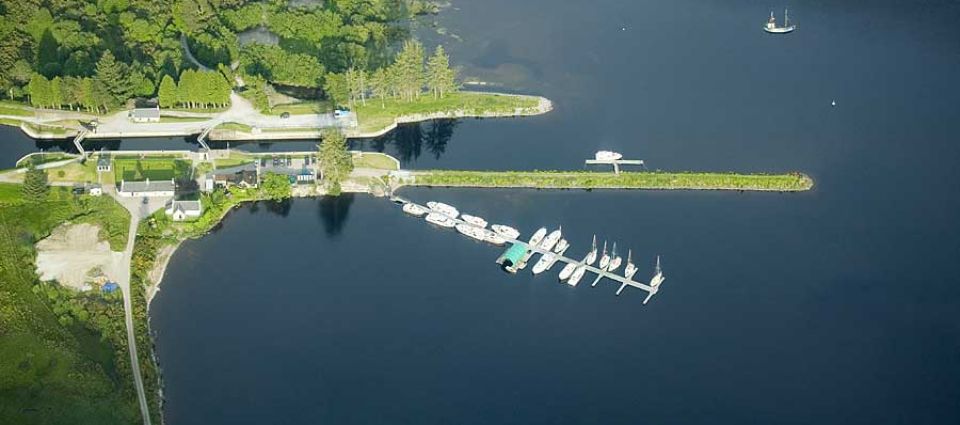
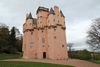
Neptune's Staircase is located just north of Fort William on the Corpach road and it marks the beginning of the Caledonian Canal. You may not be able to extend your canal boat holiday to visiting the open sea beyond the canal basin at Corpach because this requires a separate licence, so head north east from Banavie. Here the canal passes through magnificent scenery, totally dominated by the dark brooding north west escarpment of Ben Nevis, south of the canal, you see mountains and magnificent forest scenery on all sides of the canal, as you sail towards the little village of Gairlochy, which is where the canal opens up to join the first of the three lochs, Loch Lochy. You will find jetties and canal boat moorings along the length of this loch , until you reach Laggan which you leave the loch and re-enter a stretch of man-made canal. having passed through Laggan locks. This takes you to the tree covered shores of Loch Oich, past Invergarry Castle and a power station and on to the villages of Aberchalder and Bridge of Oich. You once again enter a man made stretch of canal through the locks at Cullochy and Kytra, all the while surrounded by magnificent mountain and forest scenery.
http://www.canalguide.co.uk/canals/britain_canal_caledonian.html
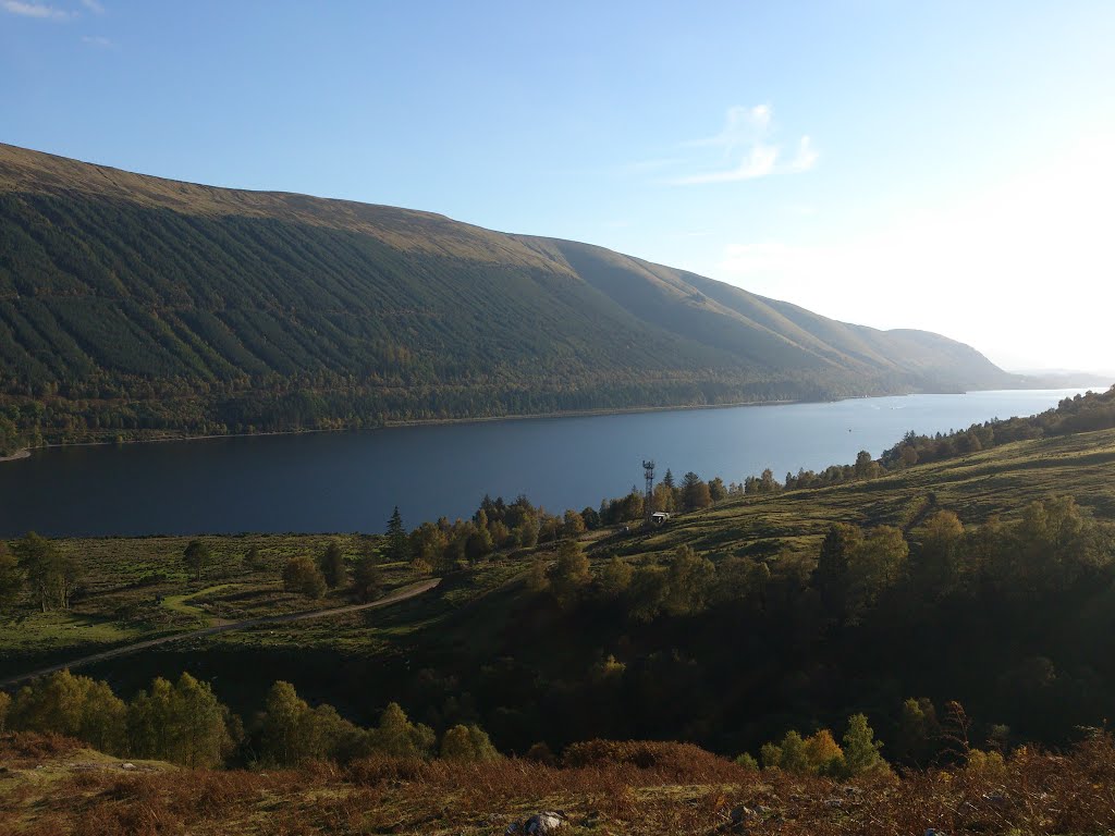
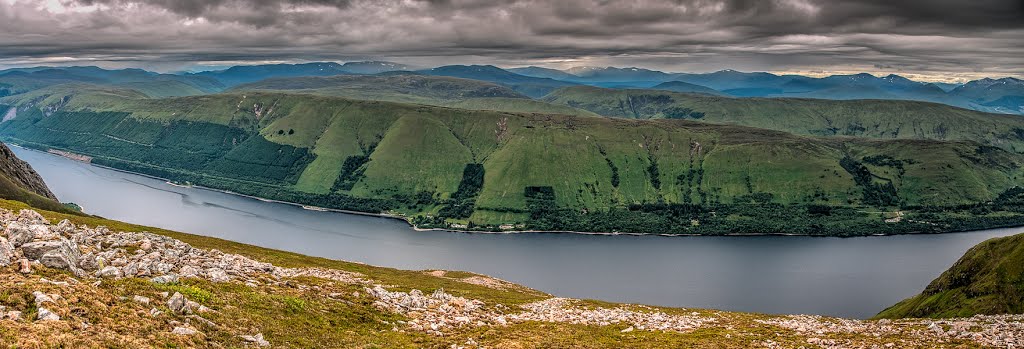
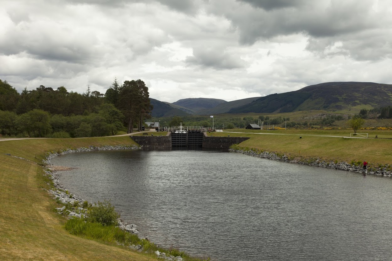
The Caledonian Canal runs from Corpach (just north of Fort William) on the west coast of Scotland, through the Great Glen, to Inverness on the east coast. It comprises a series of canals built to link lochs Ness, Oich, Lochy and Linhe. The Canal is 60 miles (96.6 km) long and has 29 locks.
The maximum size of boat that can navigate throughout the Caledonian Canal is
length: 150' (45.7 metres)
beam: 35' (10.6 metres)
height: 89' 8" (27.3 metres)
draught: 13' 6" (4.1 metres)
https://www.waterways.org.uk/waterways/canals_rivers/caledonian_canal/caledonian_canal
El canal de Caledonia (en inglés: Caledonian Canal) es una vía navegable del Reino Unido que discurre por Escocia, conectando la costa oriental en Inverness, con la costa occidental en Corpach cerca de Fort William.
Tiene un recorrido de alrededor de 100 kilómetros desde el noreste al suroeste. Sólo un tercio de su longitud es artificial mientras que el resto está formado por el Loch Dochfour, el Loch Ness, el Loch Oich y el Loch Lochy. Estos lochs forman parte del Great Glen, una falla geológica en la corteza terrestre. Hay 29 esclusas (incluyendo 8 en la Escalera de Neptuno, Banavie), cuatro acueductos y 10 puentes en el curso del canal.
https://es.wikipedia.org/wiki/Canal_de_Caledonia
https://en.wikipedia.org/wiki/Caledonian_Canal
http://travelphotobox.blogspot.com.es/2015/11/ruta-por-inverness-islas-del-ness-canal.html
Vídeo:
Web recomendada: https://www.scottishcanals.co.uk/canals/caledonian-canal/
Contador: 7988
Inserción: 2016-06-22 17:34:17
Lugares a visitar en un radio de 100 km (en línea recta)


Mapa de los lugares a 100 km (en línea recta)
Mostrando Registros desde el 1 hasta el 0 de un total de 0
Visitas RSS |
Más visitados Basílica de San Marcos  155495 Catedral de Notre Dame (París)  144901 Torre de Pisa  132100 Monte Saint-Michel  101210 Presa de las Tres Gargantas  82167 |
Incorporaciones |
Comentarios hazola  Cúpula de la Roca gracias me... gera  Buenos Aires las mejores fotos de la mejor ciudad del... Daniel M. - BRASIL  San Francisco ... PEQUE  Presa Chicoasén SERA QUE ALGUIEN ME PUEDE DAR MAS INFORMACIÓN DE ESTE PROYECTO ESTUDIO EN LA UNACH Y ES PARA UN... Mery  Huaca Pucllana Muy interesante, muy buena la información y... |


