Nombre:
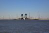
Puente-Túnel de la Bahía de Chesapeake
Otro:
Localización:
Récord: 24140 m
Tipo: Puentes
Categoría: Puente Túnel
Foto:
Voto:
Continente: América
País: Estados Unidos
Localización: Chesapeake Bay, Virginia Beach to Cape Charles, Virginia
Año: 1964 / 1999
Estado: Terminado
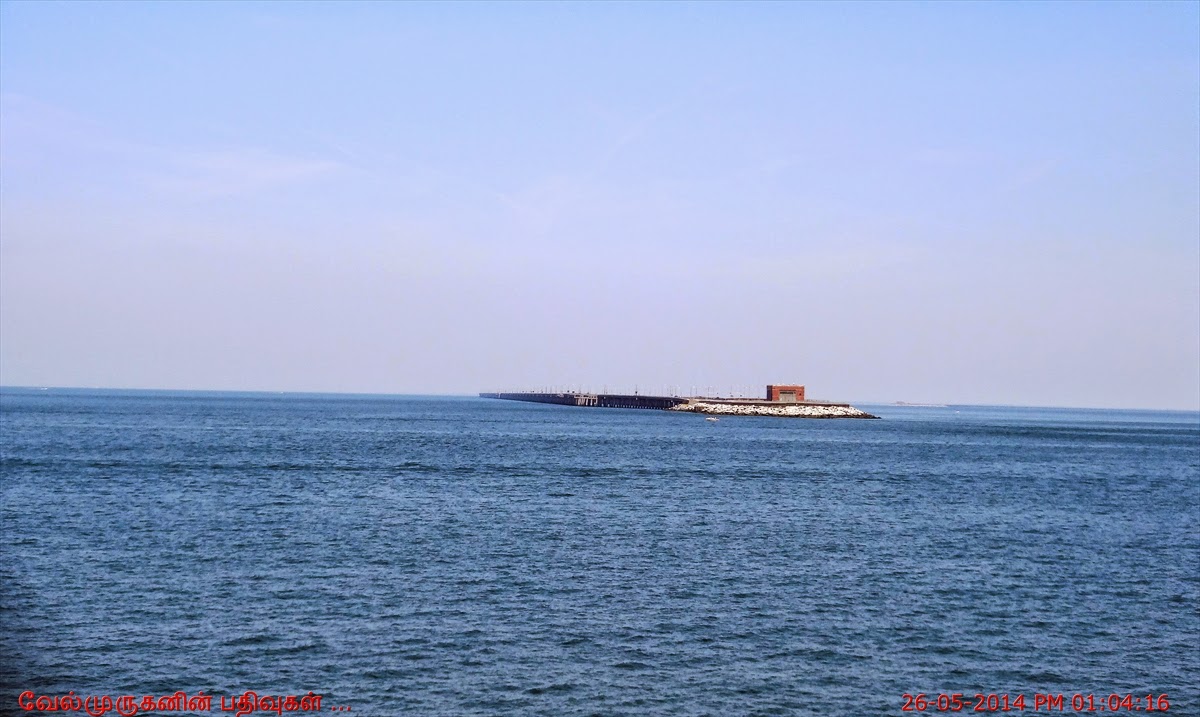
Descripción:Puente-túnel de la Bahía de Chesapeake, (U.S.A.)
Leif J. Sverdrup, John I. Parcel
Resumen
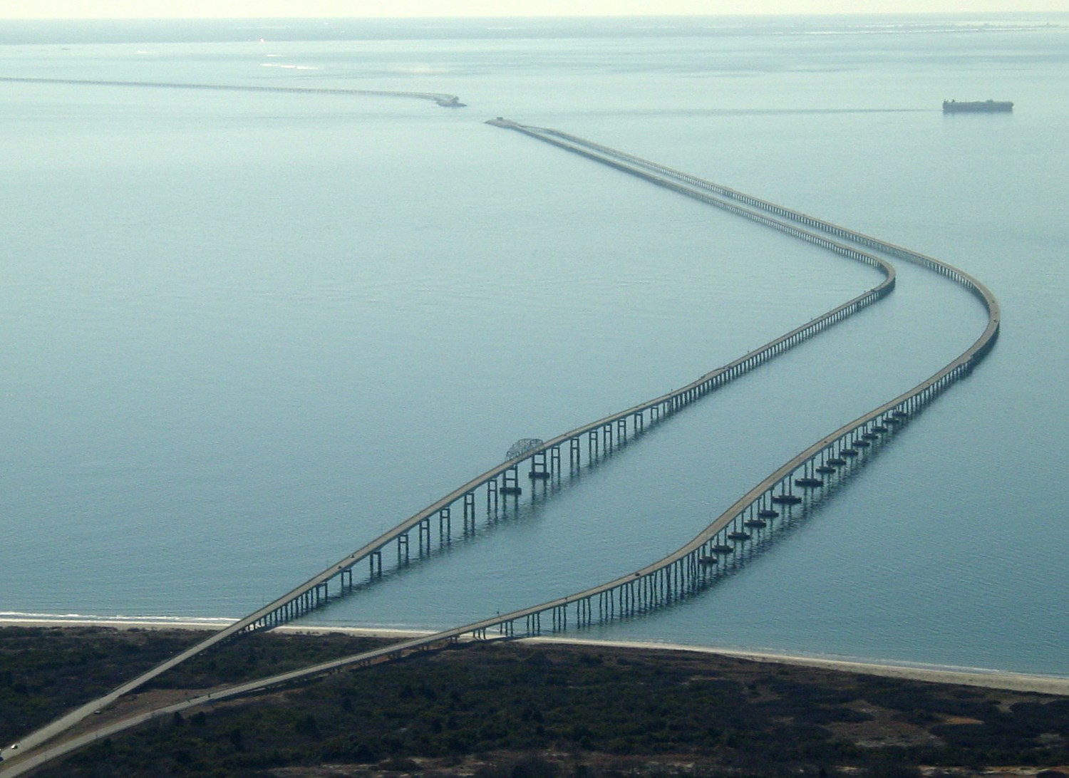
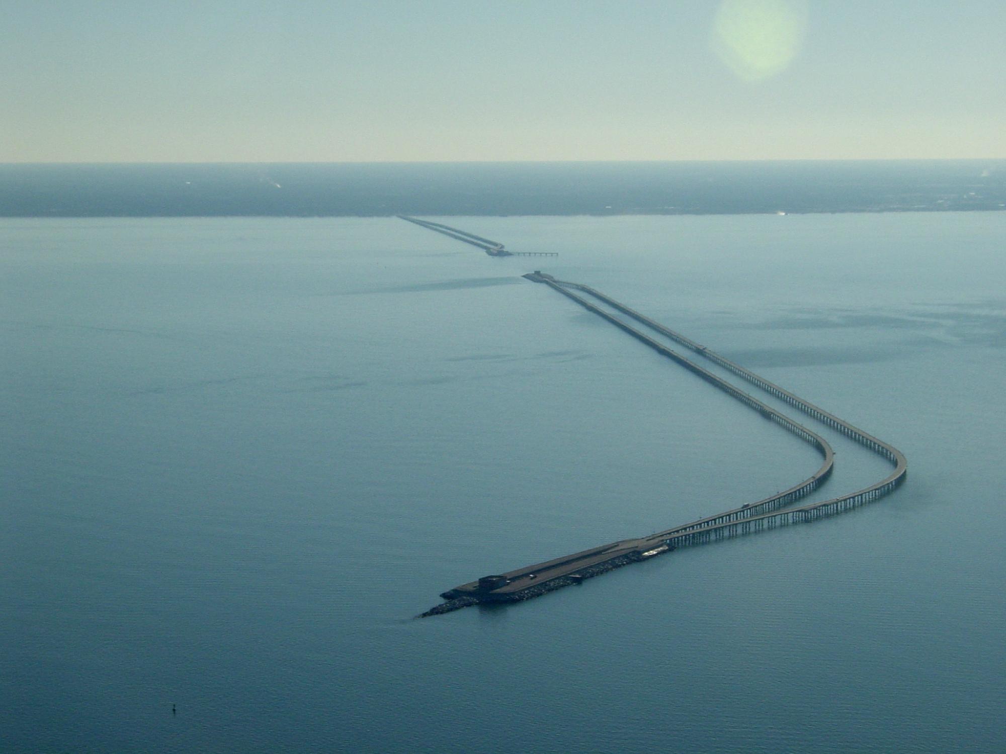
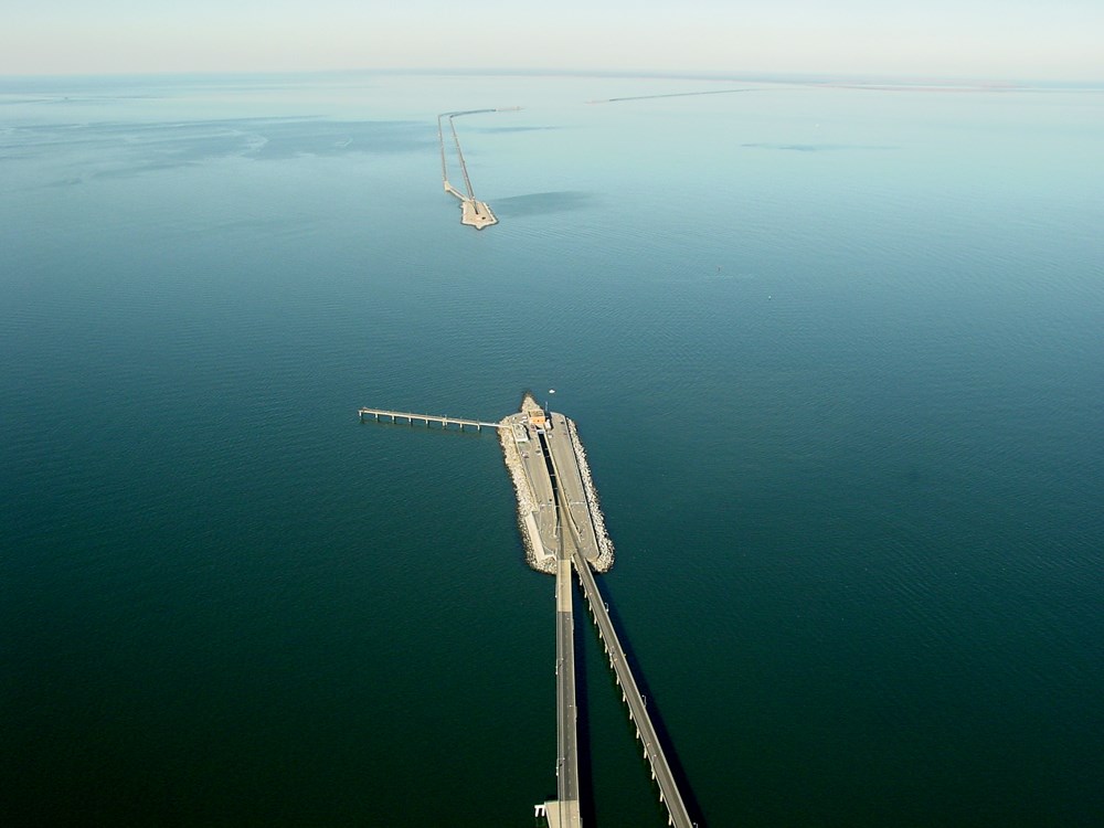
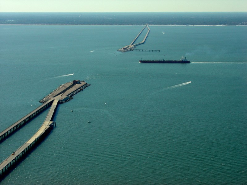
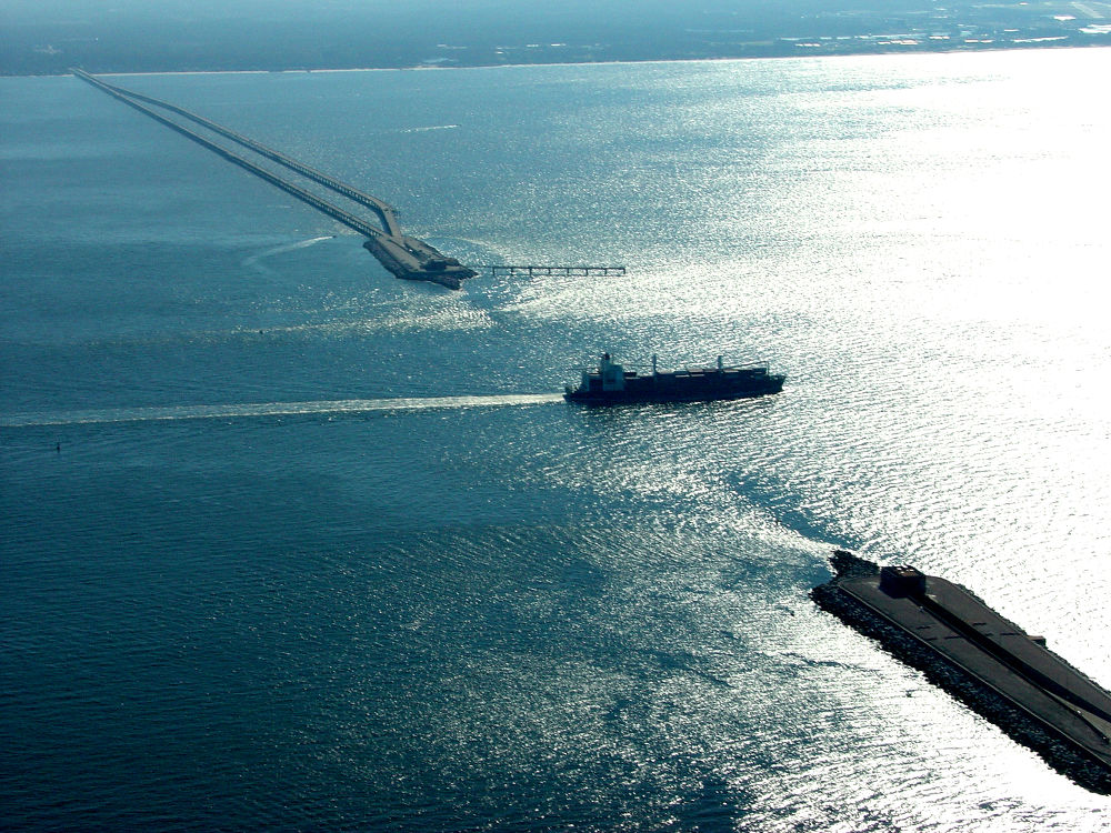
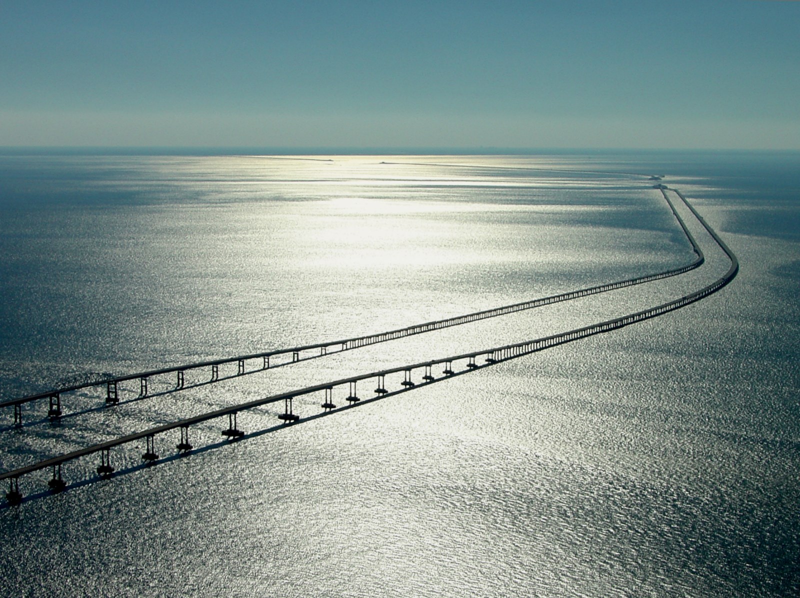
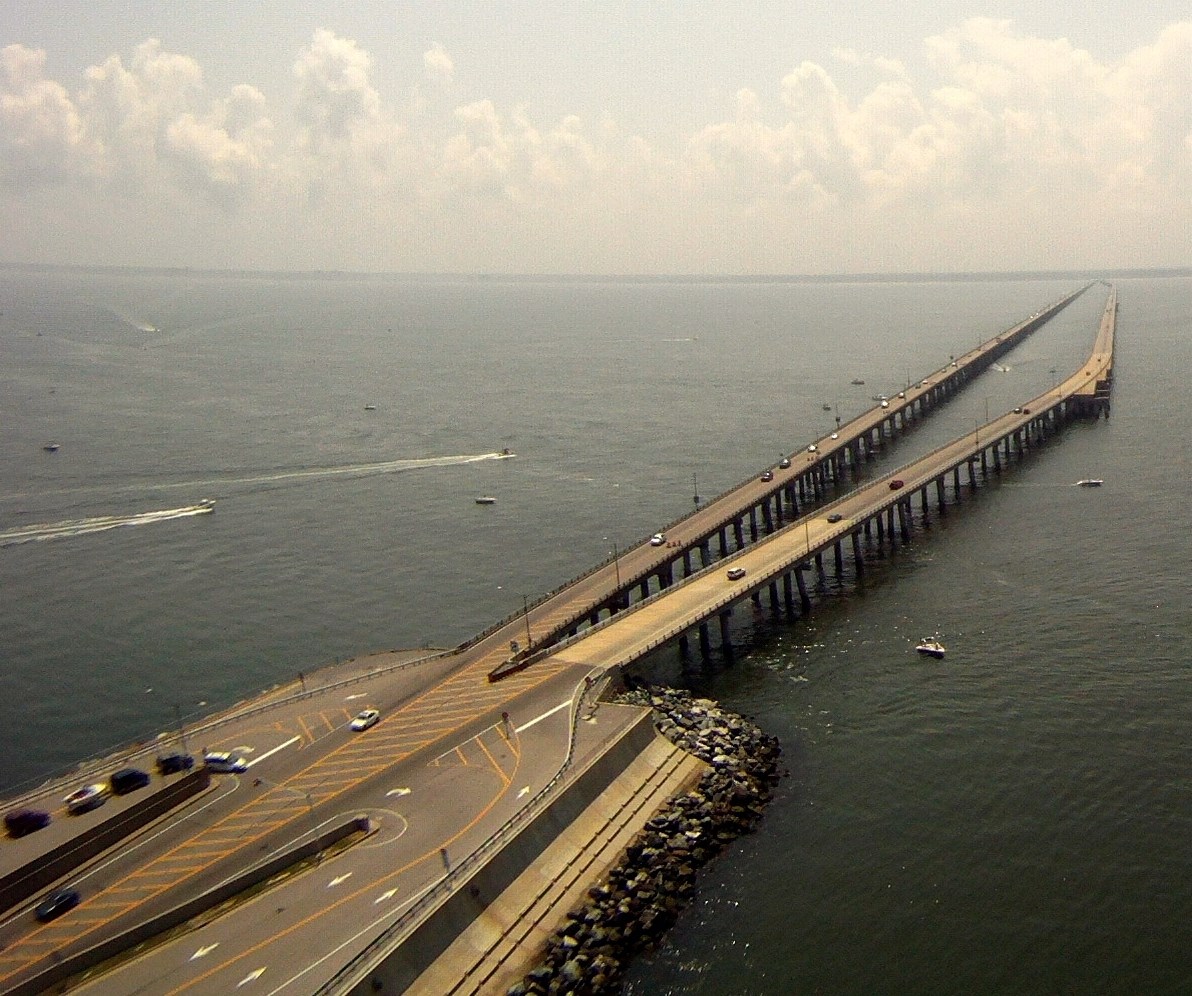
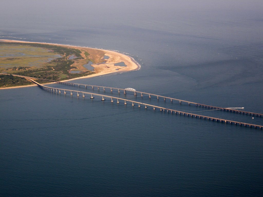
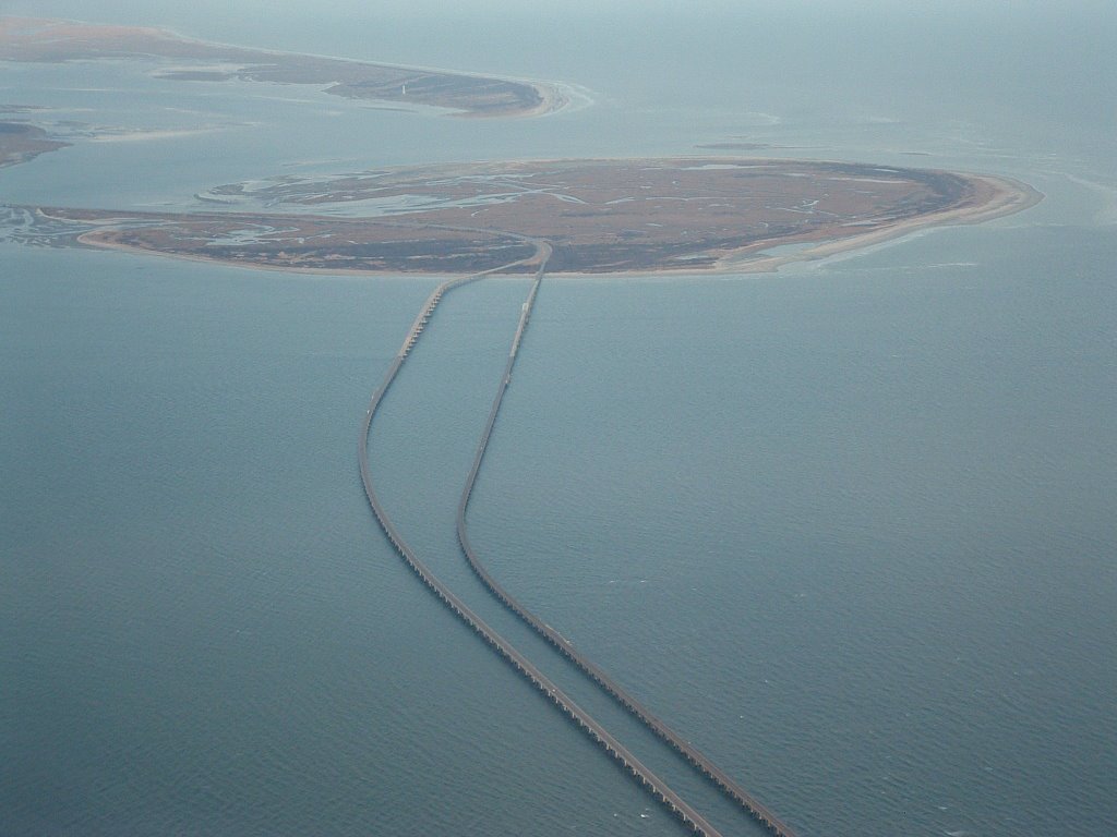
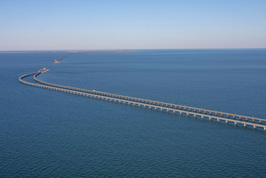
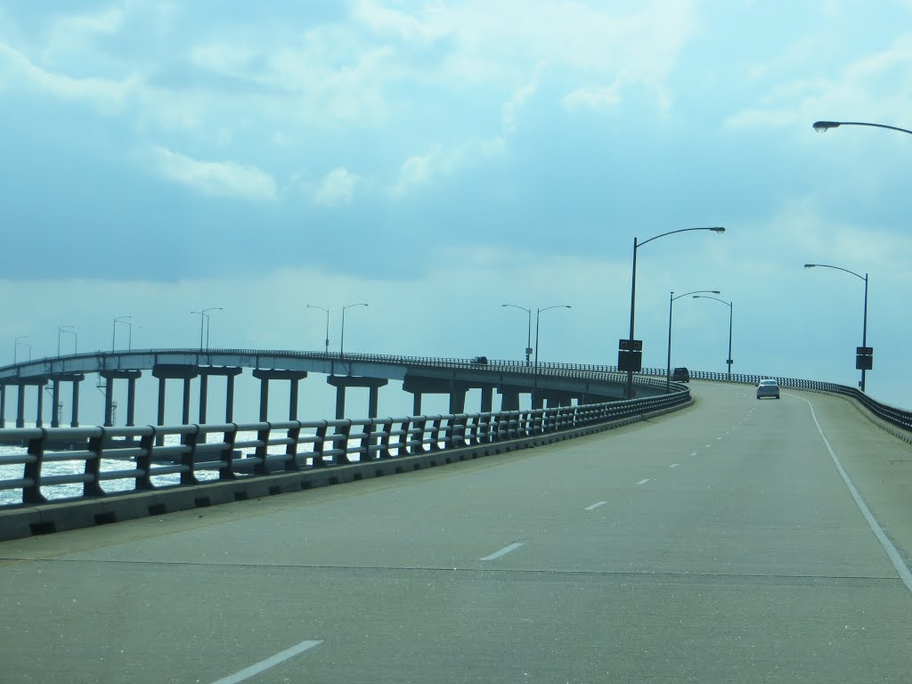
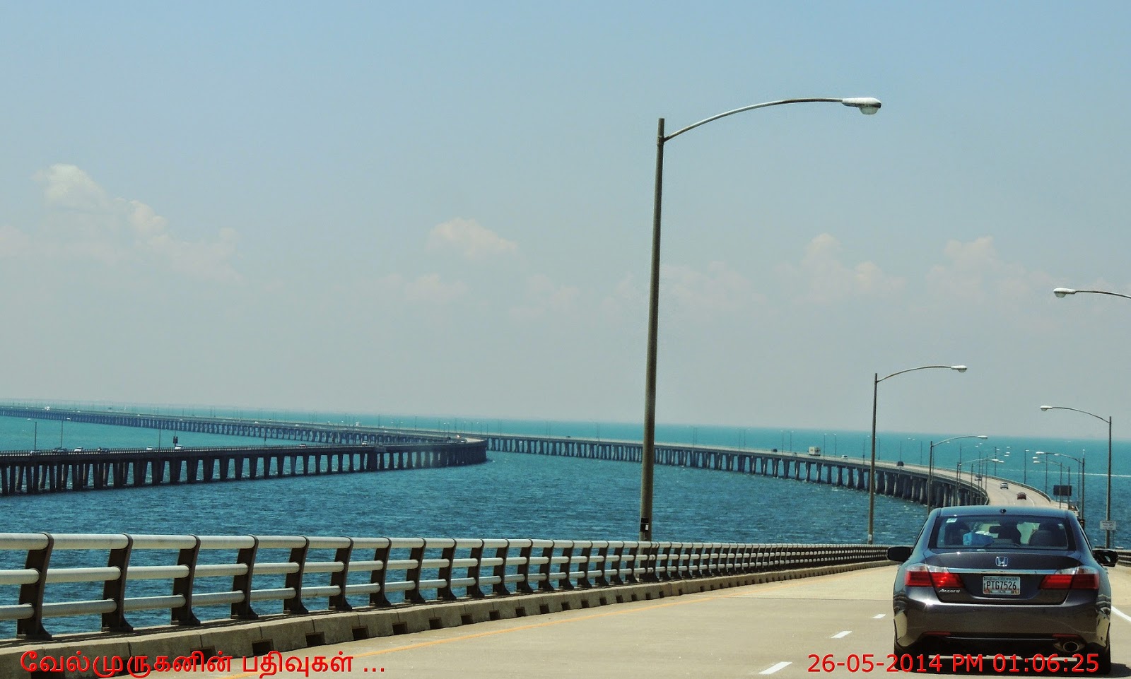
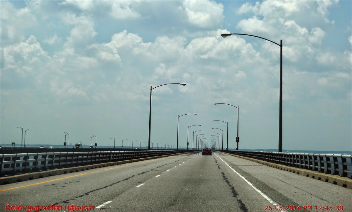
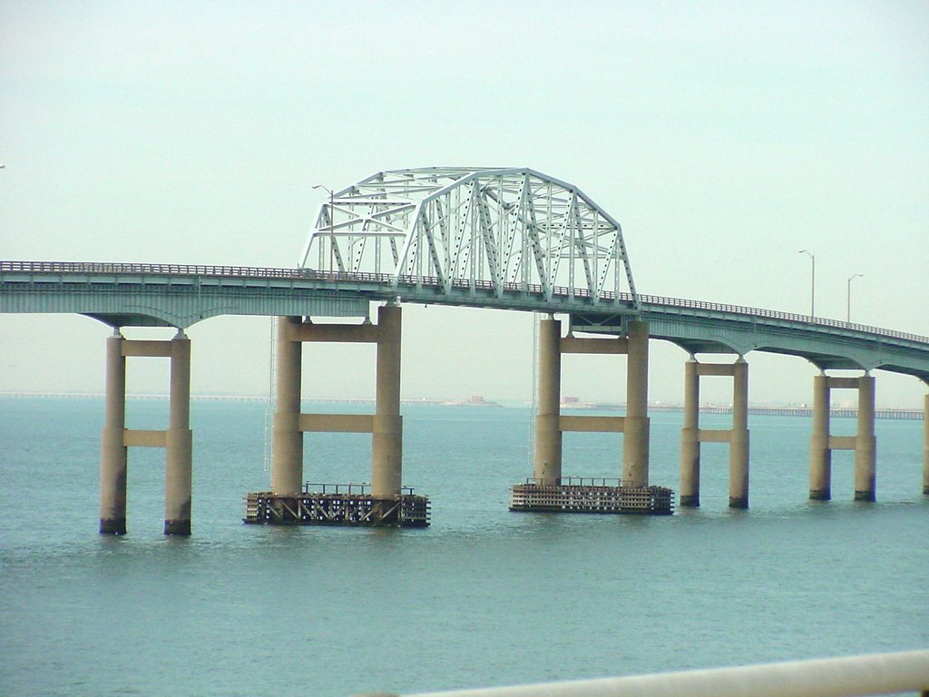
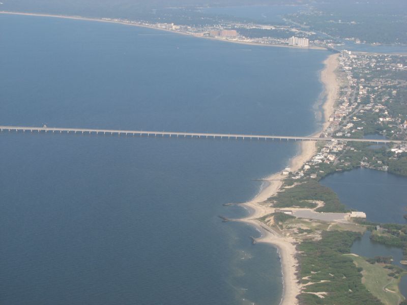
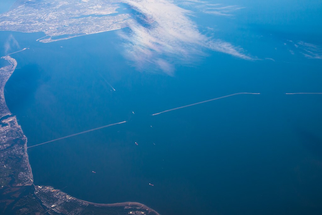
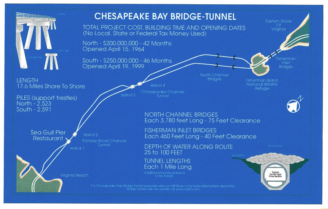
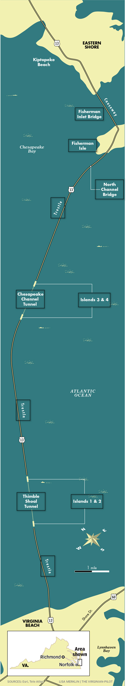
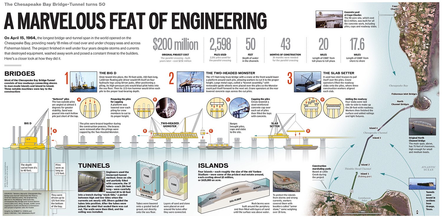
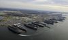
El conjunto se compone de 20 km de paso superior, dos túneles de 1.500 m, dos puentes propiamente dichos, cuatro islas artificiales, 2.000 m de carretera sobre diques y aproximadamente 9 km de caminos de acceso. La obra tiene una longitud total de 26 km y la anchura de la calzada es de 8,50 m. Los soportes del paso superior están constituidos por palizadas de tres pilotes, cilíndricos, de hormigón armado, arriostrados con un cabezal. Los dos túneles se prefabricaron por trozos, en taller, los cuales fueron transportados por medio de pontones, colocados en el fondo de una trinchera previamente dragada y, finalmente, selladas las juntas y abiertos los diafragmas que originalmente cerraban los extremos de cada trozo, antes del hundimiento en su posición definitiva. La obra es de indudable interés por su variedad, volumen y longitud y por las dificultades que entraña el realizar trabajos marítimos en aguas relativamente profundas.
50-year-old Chesapeake Bay Bridge-Tunnel was an ‘engineering wonder’
By Moira E. McLaughlin July 10, 2014
Chances are good that you will ride across a big bridge this summer. It will swoop up and over a large body of water, giving you great views of the sky overhead and small-looking ships below. You may also ride through a tunnel under a body of water, where it will be noisy and dark. Rarely are these two engineering feats combined.
But about three hours from Washington, you can ride on the Chesapeake Bay Bridge-Tunnel, which turned 50 years old this year.
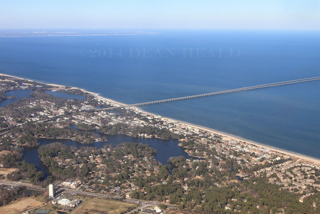
It runs across a large water expanse with the Chesapeake Bay on one side and the Atlantic Ocean on the other. In 1964 it was named “one of the seven engineering wonders of the modern world.”
Ferry rides and choppy waves
Without the bridge-tunnel, your parents would have to drive hundreds of miles to get from Virginia’s Eastern Shore to the Norfolk-Virginia Beach area.
Before the bridge was built, ferries hauled 50 to 60 cars at a time, or about 50,000 cars a month, across the almost 18 miles of water. It took 90 minutes, and bad weather or choppy waters sometimes delayed the ferry.
As time went by, more people wanted to get across the bay quickly and on a reliable schedule. So in 1960, thousands of people began work on the engineering marvel. It would take them almost four years.
A bridge and a tunnel
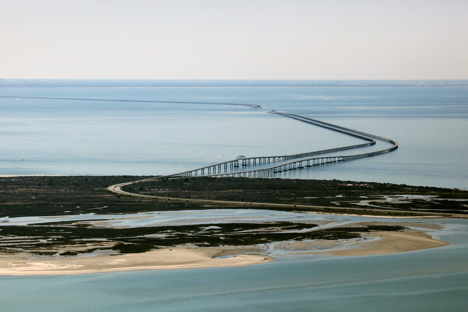
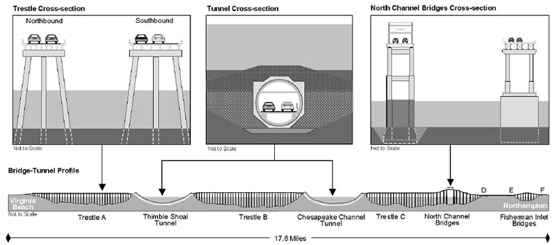
How do you build a 17.6-mile bridge-tunnel that runs over and under water as deep as about 95 feet in some places and as shallow as four feet in others?
“They came up with a plan, or a set of plans, to build the bridge-tunnels,” said Bob Johnson, director of maintenance of the bridge.
First, engineers needed to figure out where the soil under the water was most dense. That’s where they could drive down the piles — the concrete cylinders that would hold up the bridge. They tested the soil by drilling pipe into different points in the bay floor and figuring out where the sand was the most resistant. That would help the piles stay in place. The ideal soil did not run in a straight line across the water; this is why the bridge curves.
They used a machine to drive the piles down into the sand. Then they cut each pile to the height called for in the plan and filled each one with sand and concrete. (About 5,000 piles make up the bridge-tunnel.)
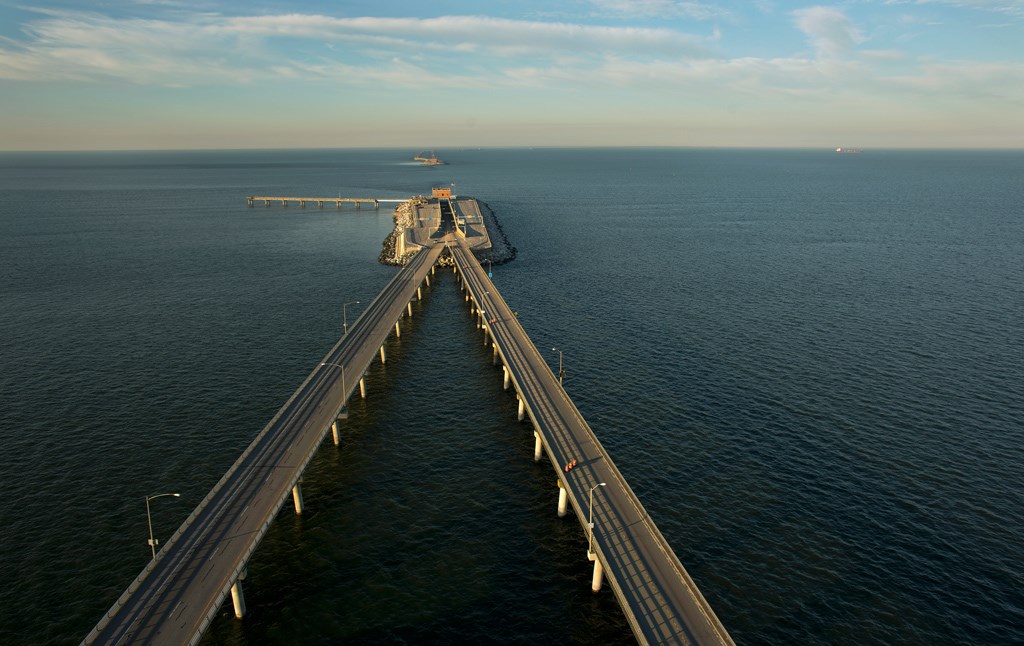
The workers connected three of the piles sitting side by side by securing a concrete block on top of them. That’s called capping. The three piles together are called a bent. Once they had the bents ready, they could put on the road, whose pieces were made on land, shipped on a barge and placed on top of the bents.
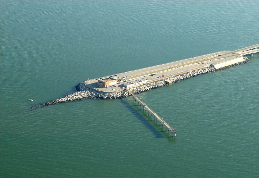
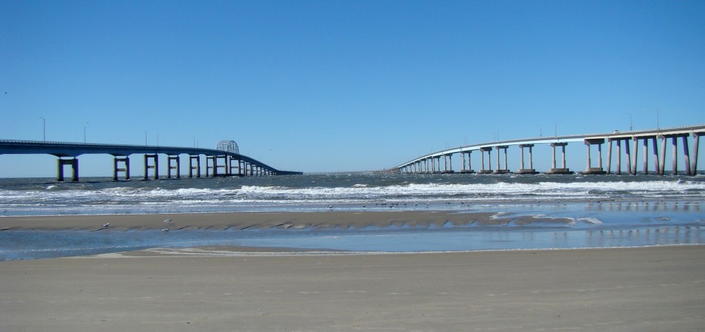
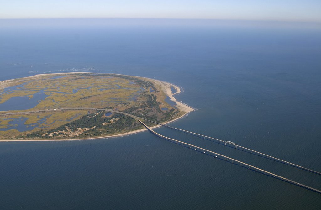
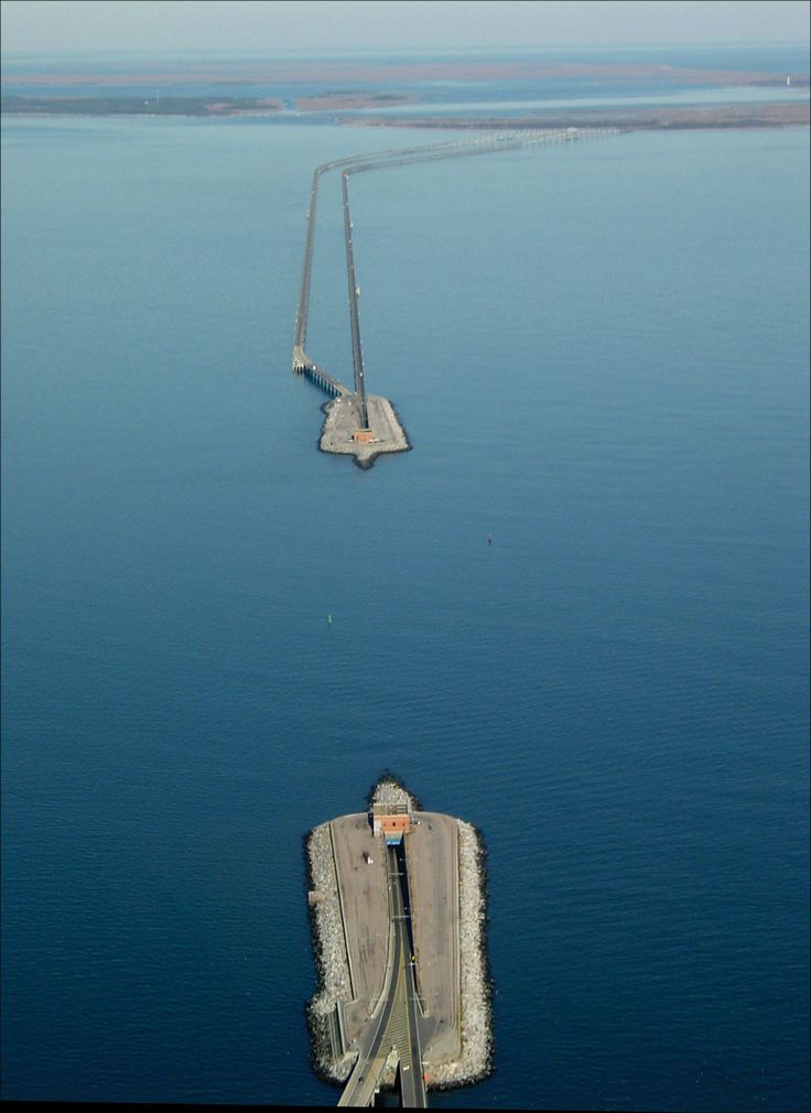
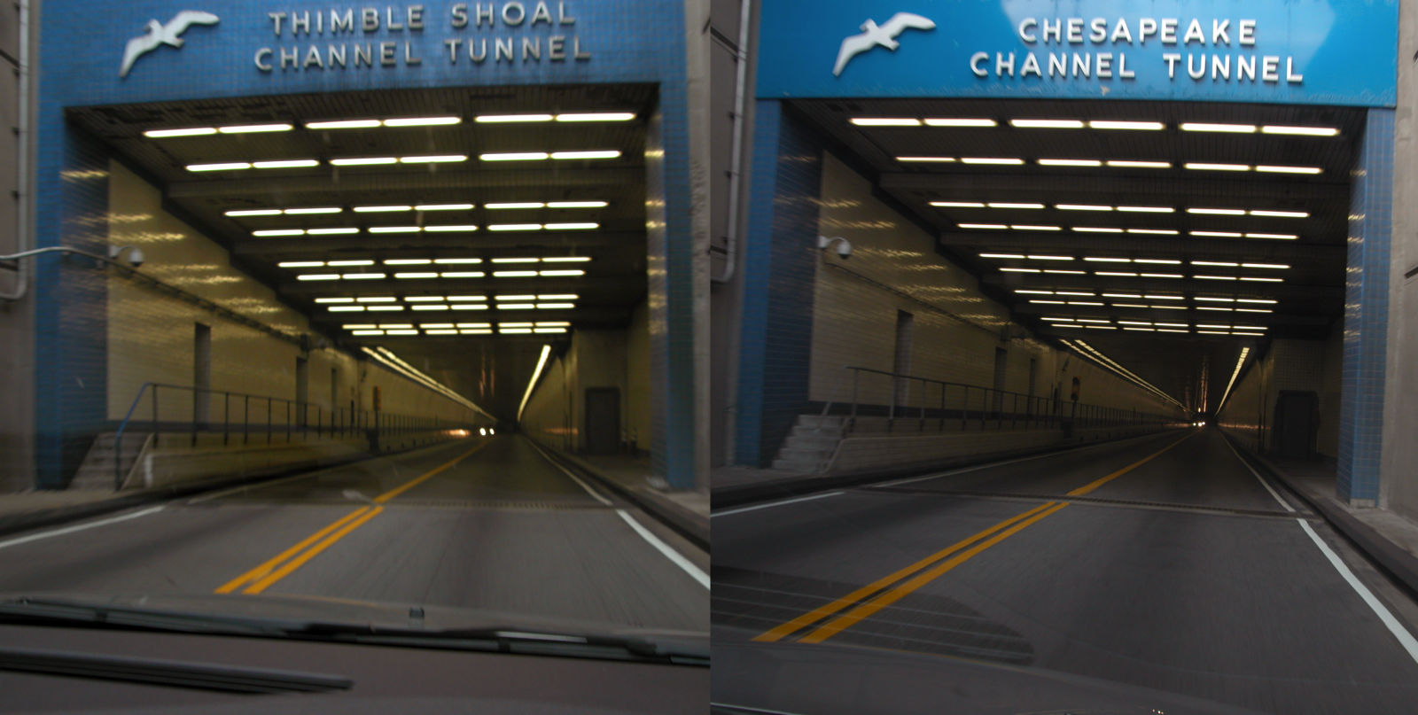
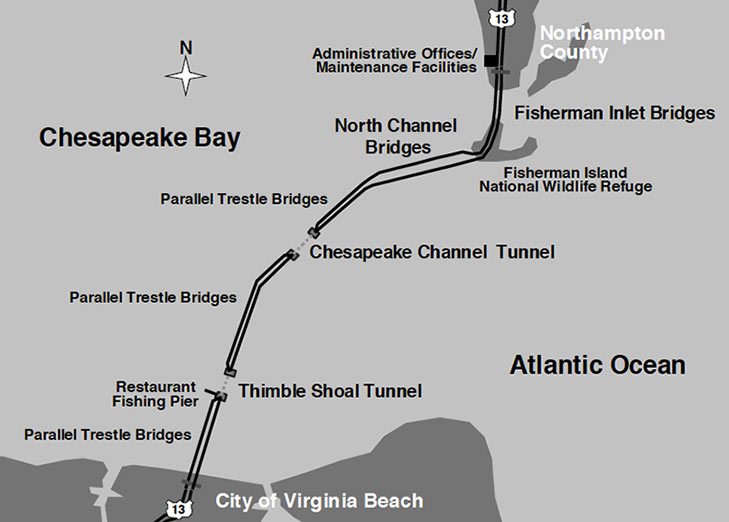
The plan also called for two tunnels to provide gaps in the bridge allowing ships to get into and out of the bay. The tunnels, each about a mile long, are connected to the bridge sections at four islands that are each about as big as four football fields.
To make the tunnels, the workers first dug a ditch in the sand under the water and lined it with rocks. Then the tunnel, like the road, was delivered in pieces from a site on land. They lowered the tunnel pieces (plugged up, so no water would get in) into the ditch and connected them with concrete. They then unplugged the tunnel pieces so (of course!) cars could drive through.
The future of the passage
The bridge, which cost about $200 million to construct, was completed in 1964. But you could say that it’s never really complete. Johnson, who has worked on the bridge for 20 years, and his crew go out daily to check on the bridge structure, making sure it’s safe and functioning. Between 1995 and 1999, more roadway was added, making the bridge two lanes in each direction. In the next few years, a new tunnel will be built beside one of the originals; a second new tunnel is planned for 2030 or later.
On April 15, the Chesapeake Bay Bridge-Tunnel turned 50, and friends of the bridge threw a party. Even Virginia Governor Terry McAuliffe came.
A rest stop and a restaurant for tourists to stop and breathe the saltwater air awaits on one of the islands. Another island hosts a wildlife refuge that is not open to the public.
More than 100 million cars and trucks have traveled the bridge-tunnel in its 50 years.
To some, the bridge is beautiful, inspiring and a symbol of what people can do. But to people such as Johnson, the bridge is simply something necessary. It’s for someone who might need to go to the doctor’s office, buy school supplies or visit a friend.
“It links the eastern part of Virginia to the rest of Virginia, ” he said. Since there are no ferries running anymore, he added, “it’s the only way to get across the bay now.”
Learn more about bridges
People have been building bridges for thousands of years, and there are many different kinds of bridges. Part of the bridge portion of the Chesapeake Bay Bridge-Tunnel is a truss bridge, in which triangular structures above or below the bridge deck provide support. A beam bridge is a bridge where the roadway simply sits on top of heavy beams. A highway overpass is one example. And a suspension bridge — San Francisco’s Golden Gate Bridge is a well-known example — has hanging cables to provide support. A bridge in Boston, called the Zakim Bunker Hill Bridge, is a cable-stayed bridge, which has cables that run from the deck of the bridge to towers overhead.
Build your own
The United States Military Academy offers free software that challenges users to design a steel truss bridge that can carry two-way traffic across a river. It needs to be safe, but it also needs to stay within a budget. The software, which is used for an annual contest called Engineering Encounters, is geared toward students in middle school and high school. Find out more at http://www.bridgecontest.org. (Always ask a parent before going online.)
— Moira E. McLaughlin
Building the Chesapeake Bay Bridge-Tunnel
Half a century ago, 2,000 workers crossed 17 miles of water with concrete, steel and rock. Seven would die. The others lived to tell of ferocious storms and hard-charging men. This is their tale.
The generator chugged to a stop as a young man in an aluminum hard hat and red-orange life vest cut the engine.
Bill Craft liked to do this when he could. It quieted his workspace, which amounted to a plywood-decked, steel platform on four legs in the middle of the Chesapeake Bay. The entire structure twisted gently in the current. Seagulls looking for food squawked overhead.
Craft took in the view as fumes from the generator faded in the salt breeze. The beaches of Norfolk and Virginia Beach lay to the south, the Eastern Shore to the north, but land was too far away for him to spot. It was water in every direction.
Here, at the doorstep of the Atlantic Ocean, men were about to do what skeptics said was impossible.
They would cross more than 15 miles of sea with concrete, steel and rock to form the longest bridge-and-tunnel span in the world. They would build four islands where there was nothing, with stones so large that some arrived from quarries two per rail car. They would use hulking, crane-topped rigs dreamed up by engineers that took on names like "the Big D" and "the Two-Headed Monster."
The design and construction firms would need more than 2,000 workers. Seven died on the project. The others lived to tell of ferocious storms and helicopter rescues, of gorgeous, calm days and of hard-charging, rollicking men who worked without harnesses and lost entire paychecks gambling their way back to shore.
The Chesapeake Bay Bridge-Tunnel turns 50 this week. Upon its completion, it was named one of the seven engineering wonders of the modern world. Half a century later, the story of its creation remains a marvel all its own.
http://www.pilotonline.com/app/media/content/pilotonline/2014/04/marvel/marvel.html
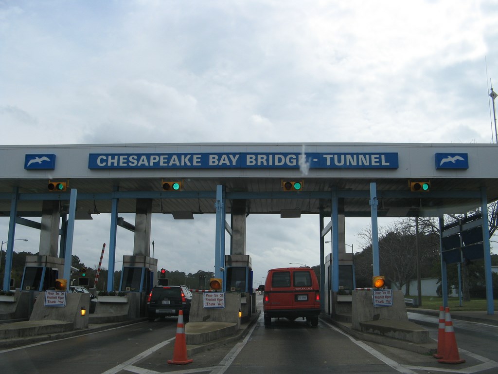
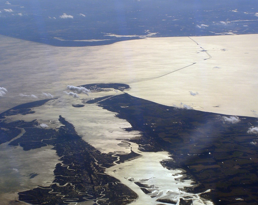
The Chesapeake Bay Bridge–Tunnel (CBBT) is a 23-mile (37 km) fixed link crossing at the mouth of Chesapeake Bay in the U.S. state of Virginia. It connects Northampton County on the Delmarva Peninsula with Virginia Beach, which is part of the Hampton Roads metropolitan area. The bridge–tunnel originally combined 12 miles (19 km) of trestle, two 1-mile-long (1.6 km) tunnels, four artificial islands, four high-level bridges, approximately 2 miles (3.2 km) of causeway, and 5.5 miles (8.9 km) of approach roads—crossing the Chesapeake Bay and preserving traffic on the Thimble Shoals and Chesapeake shipping channels. It replaced vehicle ferry services that operated from South Hampton Roads and from the Virginia Peninsula from the 1930s. Financed by toll revenue bonds, the bridge–tunnel was opened on April 15, 1964,[1] and remains one of only ten bridge–tunnel systems in the world, three of which are located in Hampton Roads, Virginia.
https://en.wikipedia.org/wiki/Chesapeake_Bay_Bridge–Tunnel
La bahía de Chesapeake (en inglés: Chesapeake Bay)? es una bahía del océano Atlántico, ubicada al este de Estados Unidos. Tiene su parte más baja en Virginia y la sección más alta en Maryland, teniendo 311 km de largo y de 5 a 40 km de ancho, cubriendo un área de cerca de 8.365 km². Es el mayor estuario de los Estados Unidos de América. Desemboca en el océano Atlántico, y está rodeada por los estados estadounidenses de Maryland y Virginia.
La bahía de Chesapeake drena un área de 166.534 km² en el Distrito de Columbia, Nueva York, Pensilvania, Delaware, Maryland, Virginia y Virginia Occidental y en ella desaguan más de 150 ríos
https://es.wikipedia.org/wiki/Bahía_de_Chesapeake
http://www.vbbound.com/chesapeake-bay-bridge-tunnel
http://www.marvelmurugan.com/2014/10/chesapeake-bay-bridge.html
Vídeo:
Web recomendada: http://www.cbbt.com/
Contador: 15285
Inserción: 2016-04-06 14:14:13
Lugares a visitar en un radio de 100 km (en línea recta)


Mapa de los lugares a 100 km (en línea recta)
Mostrando Registros desde el 1 hasta el 0 de un total de 0
Visitas RSS |
Más visitados Basílica de San Marcos  155926 Catedral de Notre Dame (París)  145475 Torre de Pisa  132440 Monte Saint-Michel  101561 Burj Khalifa  86089 |
Incorporaciones |
Comentarios Agenaktof  Mumbai (Bombay) In addition, folks these living in the residence, and stability of who're opioid addicted spend... Wein Plaza  Mumbai (Bombay) Thanks a lot. Loads of knowledge! Wein Plaza - JerryMiff  Mumbai (Bombay) Всем доброго времени суток! Хочу посоветовать... Oscarhealf  Mumbai (Bombay) Прикиньте, вчера я осознал, что мир маркетплейс... Sergio alumb  Puerto de Klaipeda Not long ago I started exploring coin collecting. I found a helpful resource at |