Nombre:
70 Pine Street
Otro: American International Building
Localización:
Récord: 290 m
Tipo: Rascacielos
Categoría:
Foto:
Voto:
Continente: América
País: Estados Unidos
Localización: Manhattan, Nueva York
Año: 1932
Estado: Terminado
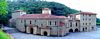
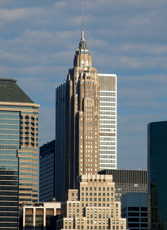
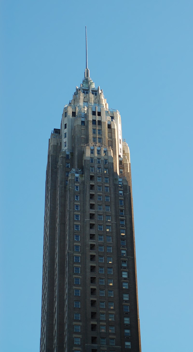
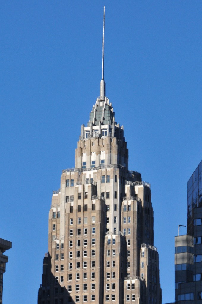
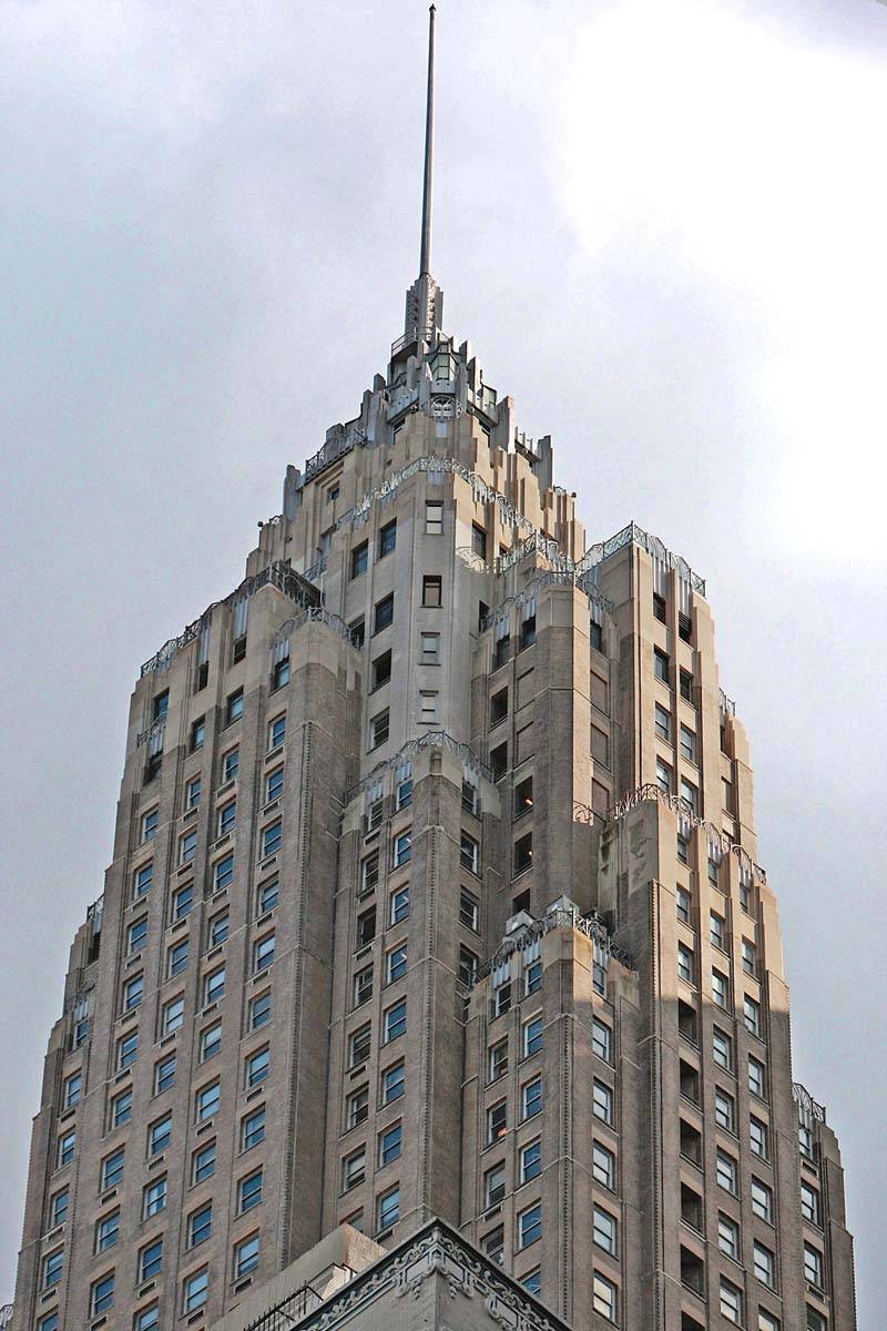
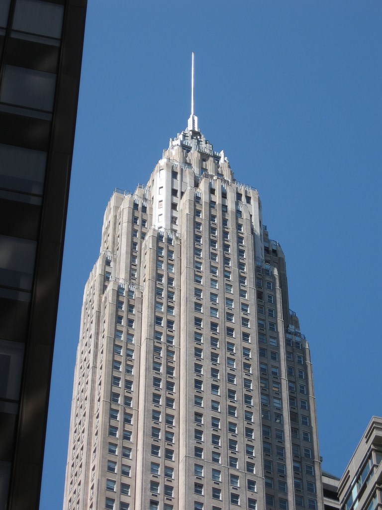
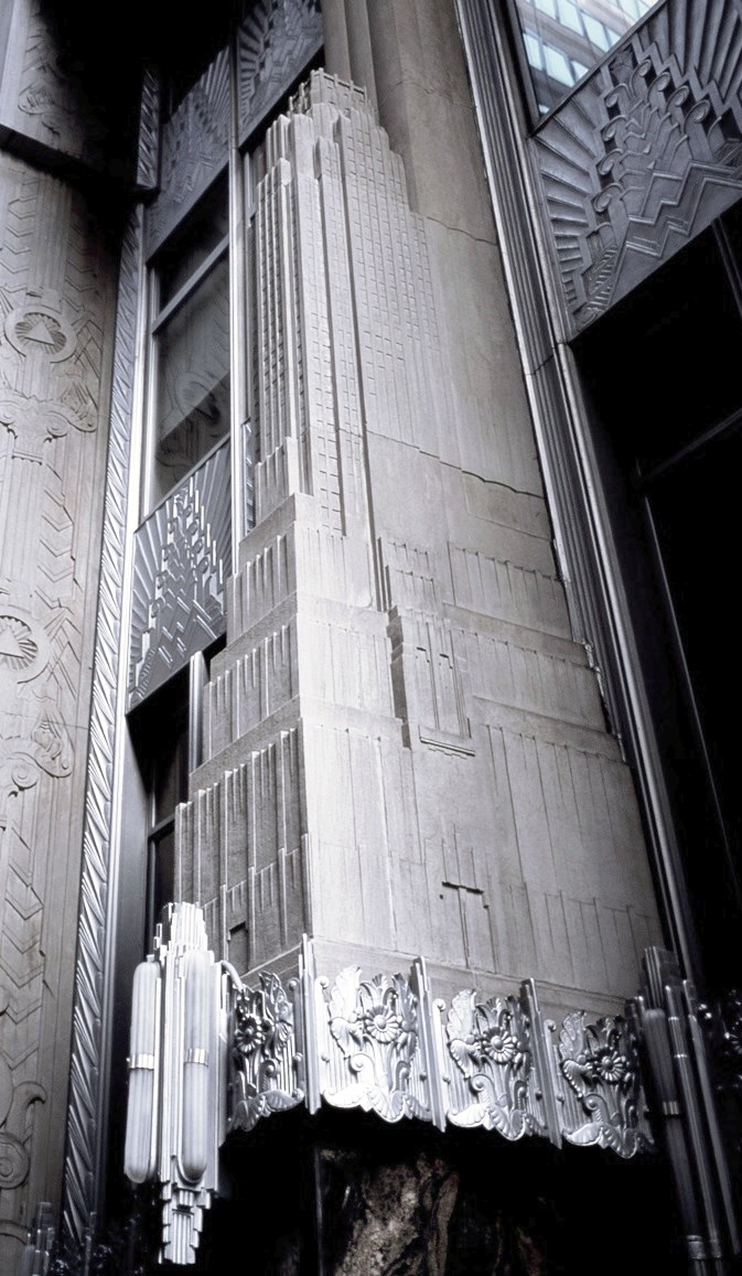
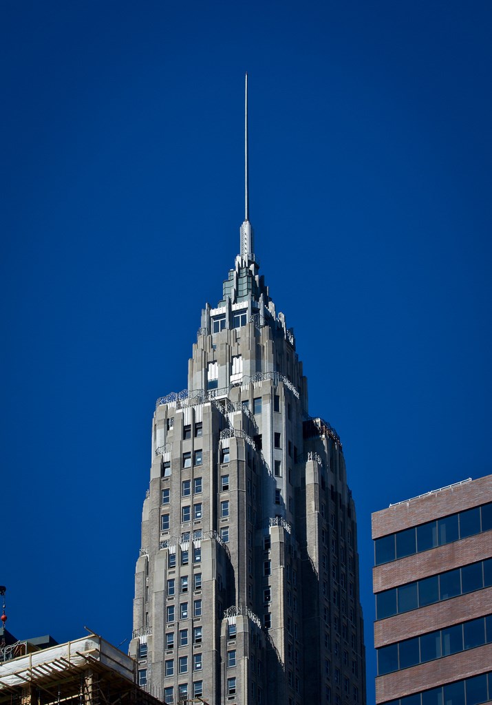
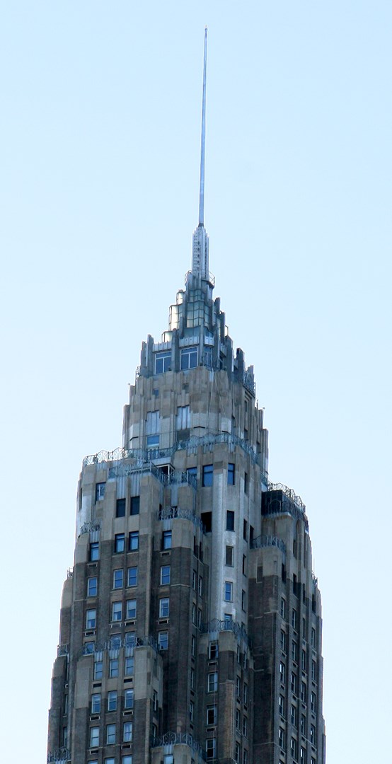
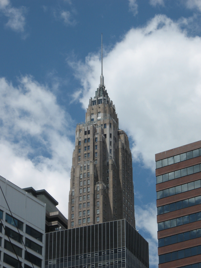
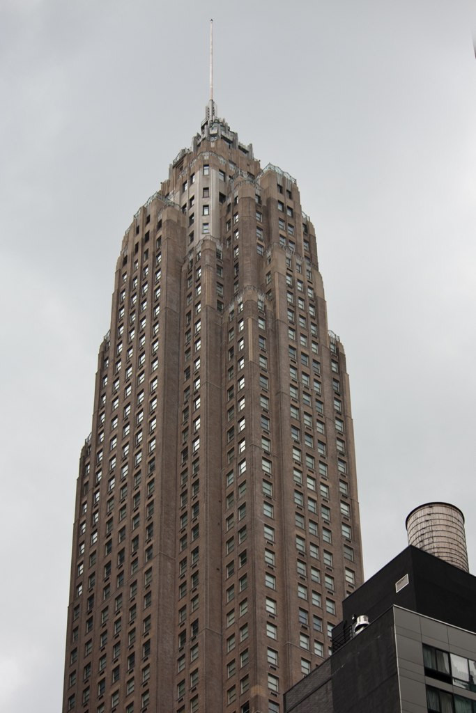
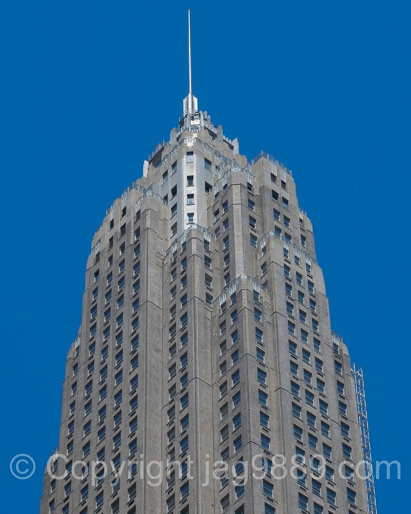
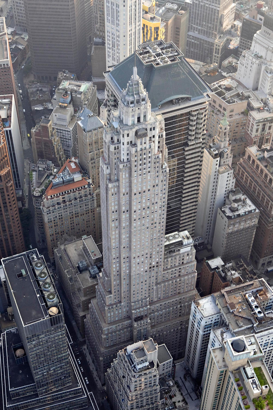
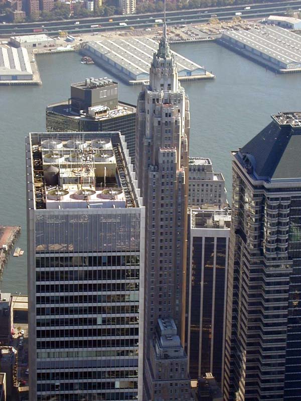
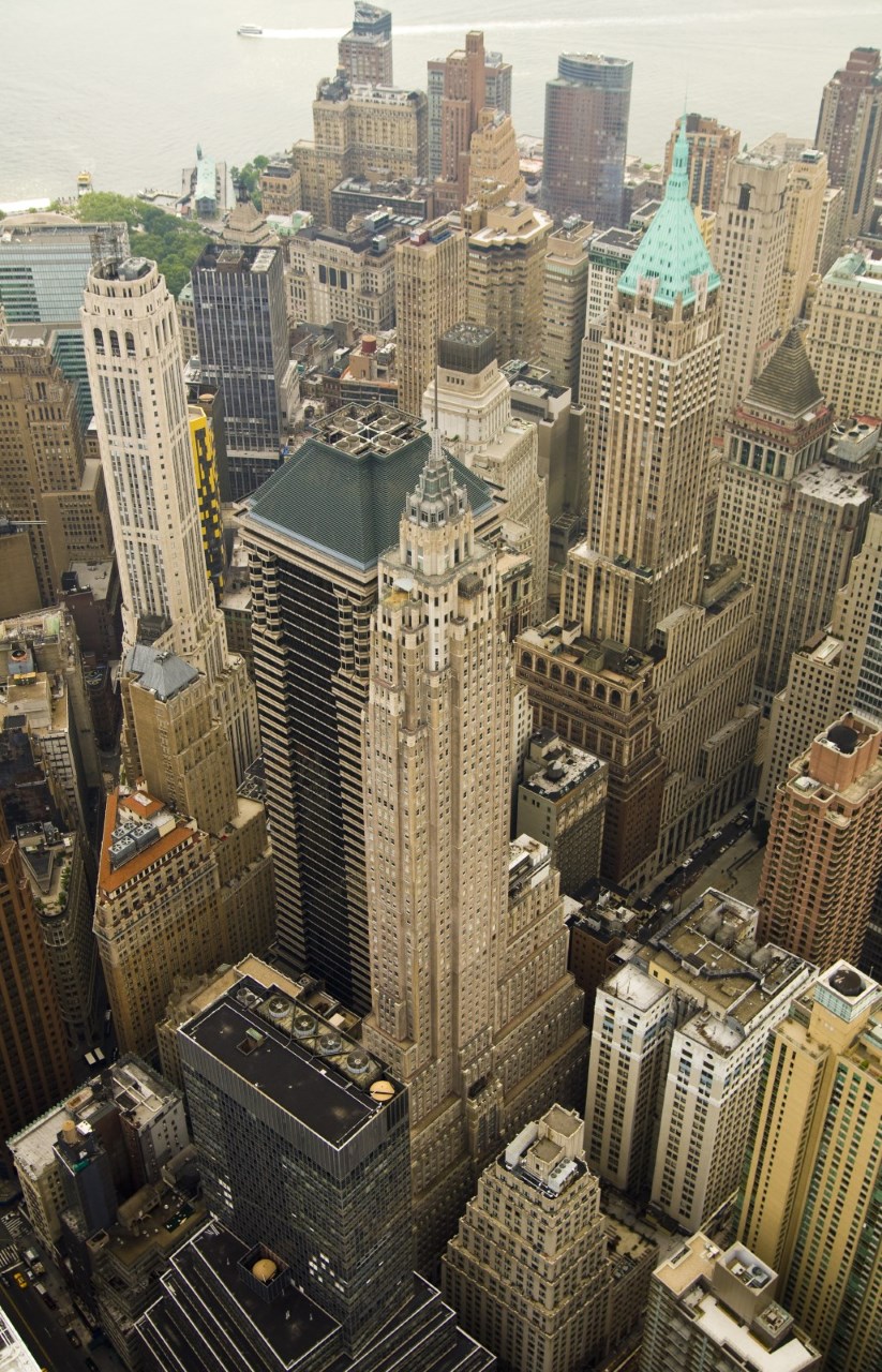
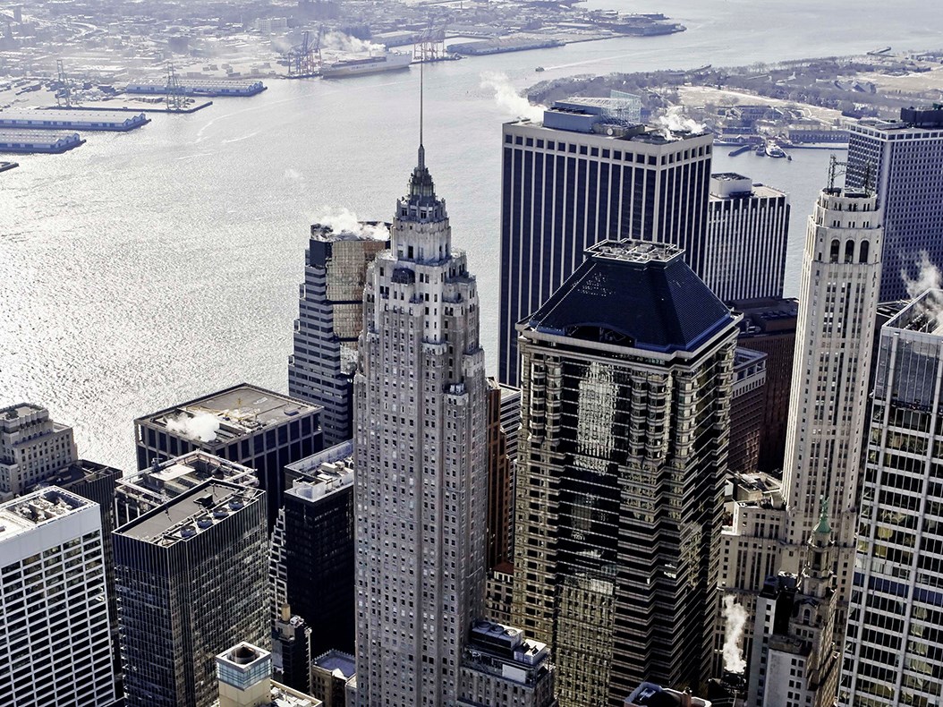
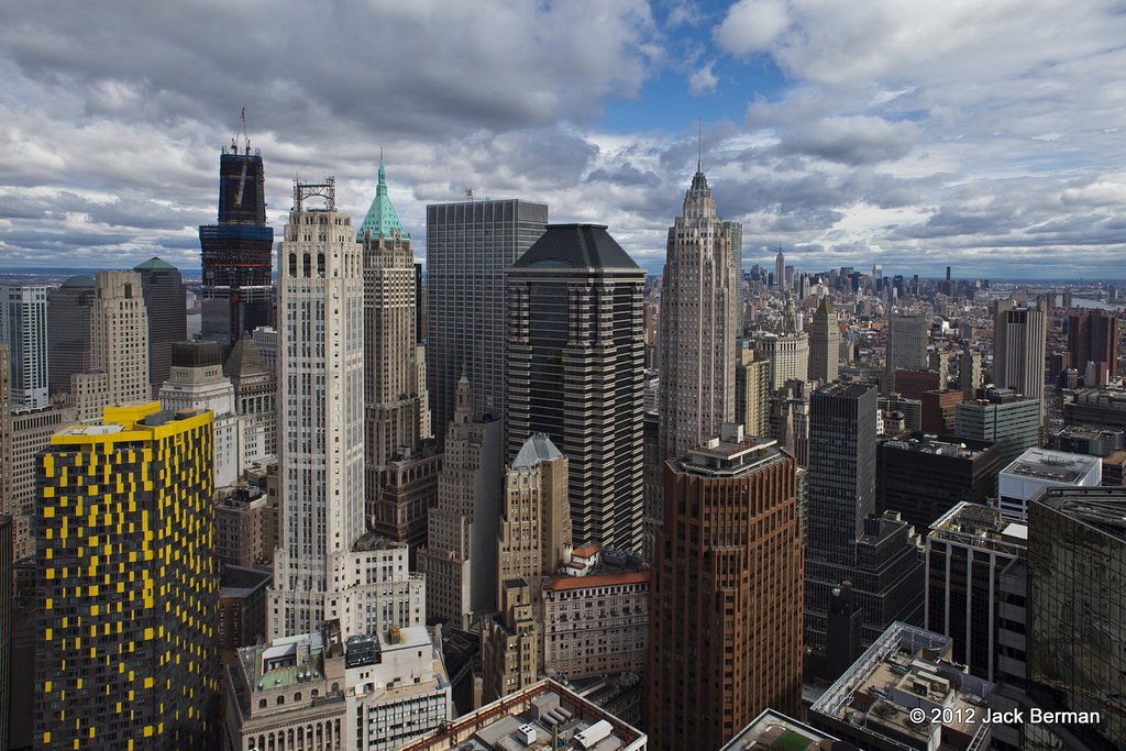
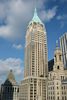
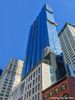
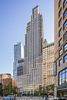
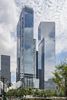
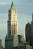
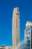
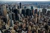
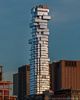
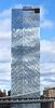
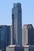
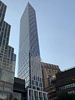
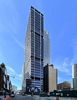
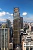
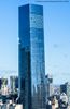
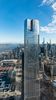
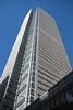
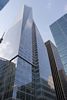
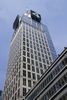
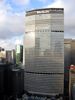
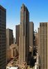
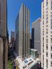
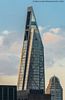
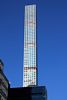
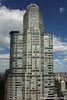
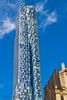
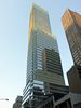
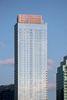
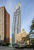
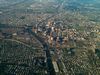
Descripción:El American International Building es un rascacielos de 66 plantas y 290 metros (952 pies), situado en Nueva York, Estados Unidos, cuya construcción finalizó en 1932.
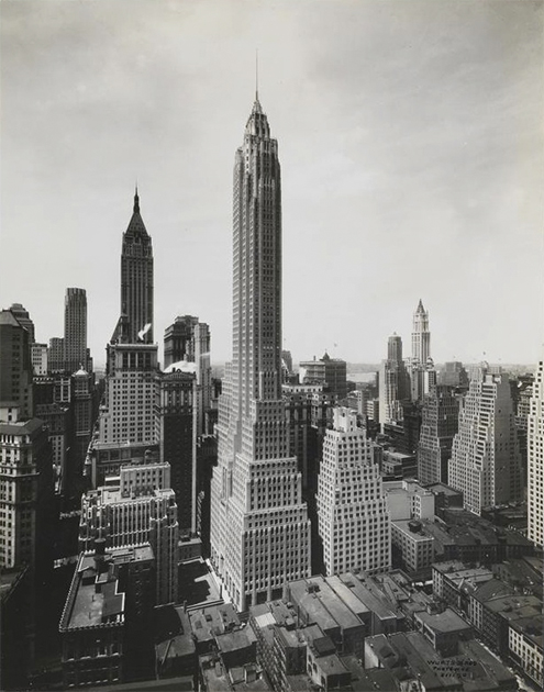
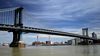
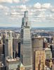
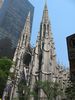
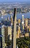
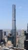
El edificio limita con la calle Cedar y Pearl street. Fue construido por la Cities Service Company, para el magnate del petróleo y el gas, Henry Latham Doherty. Esto ocurrió durante el boom de la construcción de rascacielos en Nueva York, lo que explica su torre de estilo de chapiteles góticos, un estilo de arquitectura popular en ese momento. Cuando se terminó, fue el tercer edificio más alto del mundo, sólo por detrás del Empire State y el edificio Chrysler.
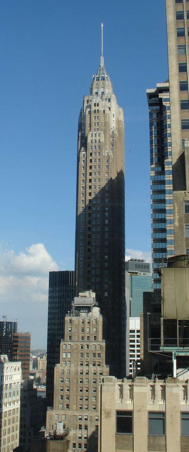
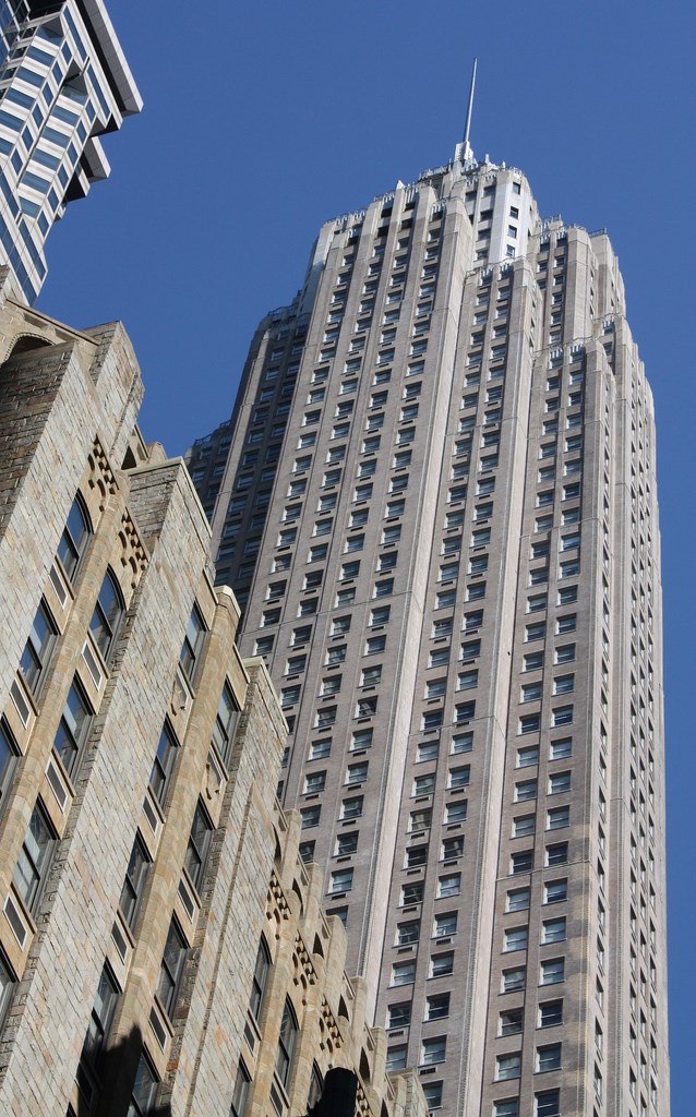
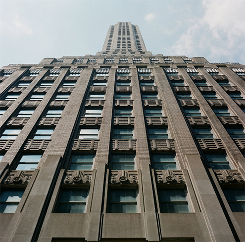
Además, fue el último que se construyó en el downtown Manhattan antes de la Segunda Guerra Mundial, y también el más alto de esa zona hasta la década de 1970 cuando se terminó el World Trade Center. Después de los ataques del 11 S, el edificio recuperó su puesto como el más alto del Downtown. Actualmente es el quinto más alto de Nueva York, tras el Empire State, el Bank of America Tower, el edificio Chrysler, y el New York Times building; y es el 16º más alto de Estados Unidos. A partir de 2006, fue el 39º más alto. El edificio se conoce generalmente como American International. Fue propiedad de la Citgo, que lo llamó Cities Service Building; después fue vendido al American International Group (AIG), cuando cambiaron la sede de la empresa a Tulsa, Oklahoma.
https://es.wikipedia.org/wiki/American_International_Building
Built in 1930-1932 for the Cities Service Company.
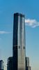
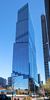
This 289.5-metre, Gothic-like, spire-topped skyscraper was the tallest building in the Downtown area until the completion of the World Trade Center. It also was to be the last skyscraper to be built in Financial District in the pre-WW II years. It took until 1961 that another tall skyscraper rose to the area, in the form of the Chase Manhattan Bank.
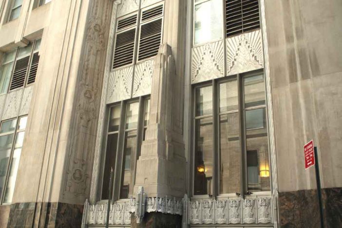
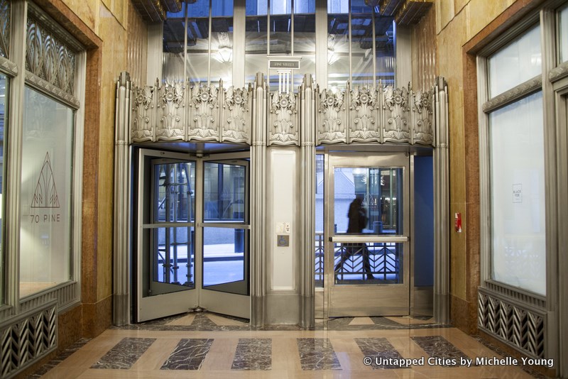
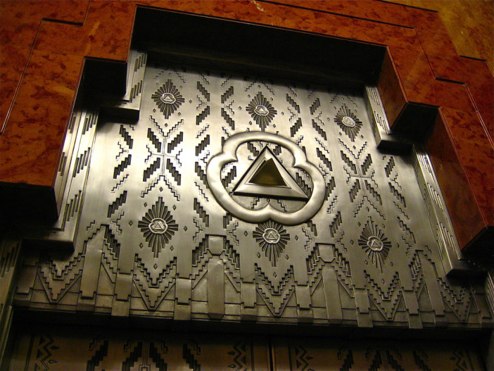
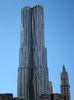
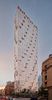
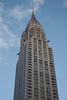
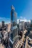
The Cities Service Company was a trust responsible for New York City's gas supply, as well as owning electric companies and street railways, and the building was designed to accordingly exude a sense of power. Limestone models of the 67-storey building are carved on the central columns of both main entrances and the doors are adorned with the agency's emblem, a triangle.
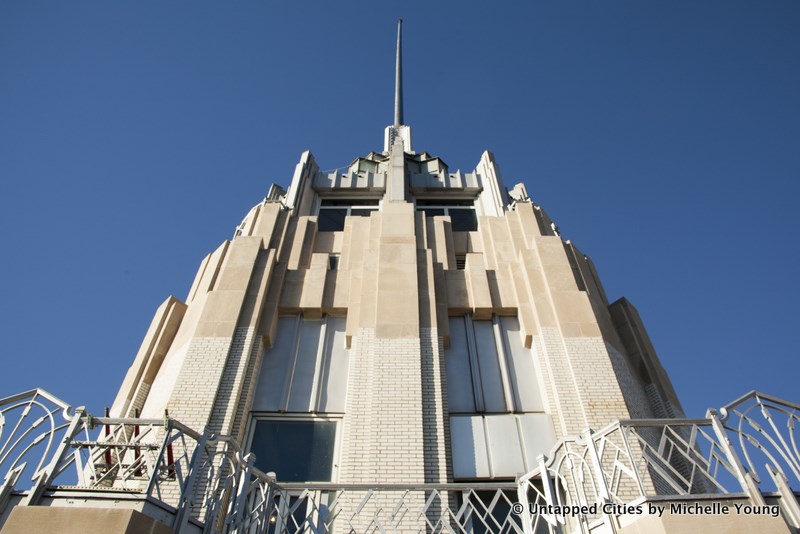
Above the granite-clad base, the brick tone of the tower lightens as it rises, until it sets back to a white-coloured top, like a snow cap on a mountain. The "mountain" had an open-air platform with an enclosed glass observatory above, offering undoubtedly the best views of Downtown before being closed from public.
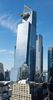
At one time called the 60 Wall Tower due to a fifteenth-floor connecting bridge to a building at 60 Wall St., the name was discarded along with the 60 Wall wing and the bridge when the Cities Service Co. vacated the building.
Originally equipped with double-decker elevators -- ie. ones that serve two floors at the time -- in order to provide sufficient vertical service for the narrow tower, these were nevertheless removed due to their unpopularity. The Citicorp Center, however, adopted the idea in the 1970s, to maximize the core usage as well as an energy-conscious choice.
Today the 80,400 m² building is owned by the American International Group, an insurance company. The observatory at the top is still used, albeit only as an executive oasis during lunch hours...
http://www.nyc-architecture.com/SCC/SCC010.htm
http://www.jmhdezhdez.com/2013/06/american-international-building-new_2.html
http://www.sofarsonear.com/portfolio/70-pine-street-new-york/
http://untappedcities.com/2015/12/21/top-10-secrets-about-nycs-art-deco-skyscraper-70-pine/
Vídeo:
Web recomendada: http://www.70pine.com/
Contador: 4161
Inserción: 2016-12-19 14:34:50
Lugares a visitar en un radio de 100 km (en línea recta)


Mapa de los lugares a 100 km (en línea recta)
Mostrando Registros desde el 1 hasta el 0 de un total de 0
Visitas RSS |
Más visitados Basílica de San Marcos  149070 Catedral de Notre Dame (París)  137695 Torre de Pisa  128209 Monte Saint-Michel  97334 Presa de las Tres Gargantas  73666 |
Incorporaciones |
Comentarios Arq. Jaime Fuentes Flores  Torres Obispado EXTRAORDINARIO . FELICIDADES . Un Cordial saludo Directivos y Personal de ... hazola  Cúpula de la Roca gracias me... gera  Buenos Aires las mejores fotos de la mejor ciudad del... Daniel M. - BRASIL  San Francisco ... PEQUE  Presa Chicoasén SERA QUE ALGUIEN ME PUEDE DAR MAS INFORMACIÓN DE ESTE PROYECTO ESTUDIO EN LA UNACH Y ES PARA UN... |