Nombre:
Puerto de Nueva York y Nueva Jersey
Otro:
Localización:
Ver mapa más grande
Tipo: Puertos
Categoría:
Foto:
Voto:
Continente: América
País: Estados Unidos
Localización: Nueva York y Nueva Jersey
Año: 1648
Estado: Terminado
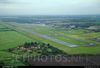
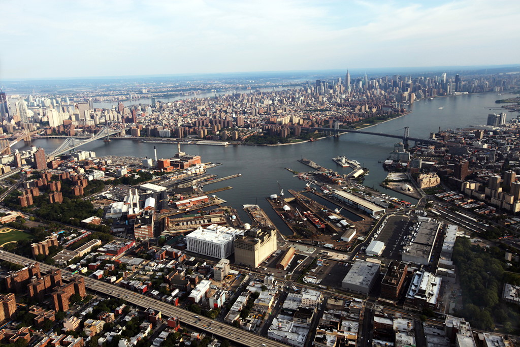
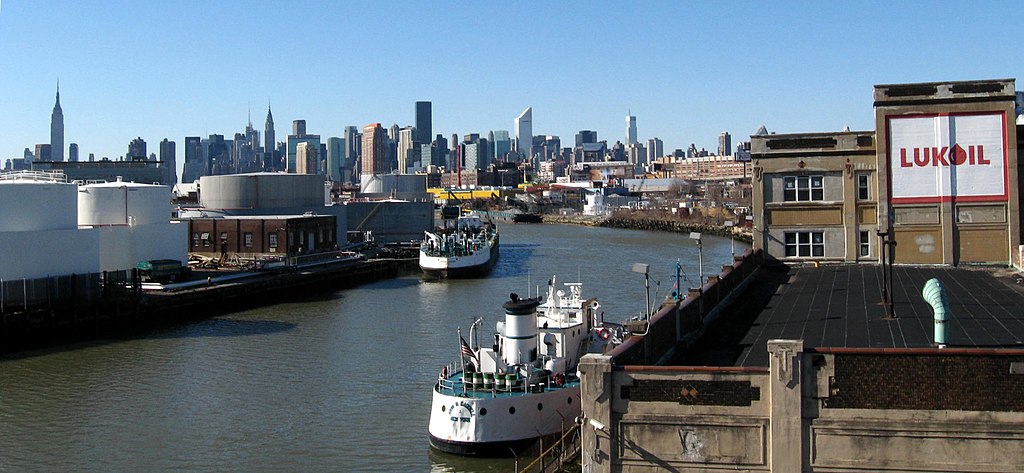
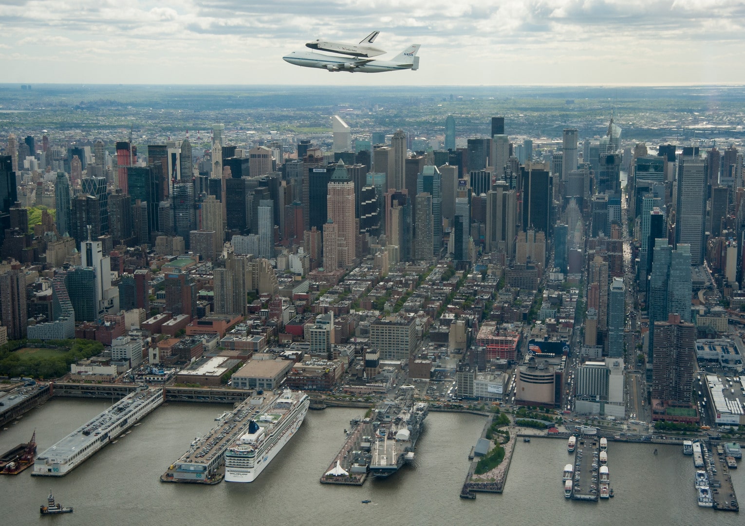
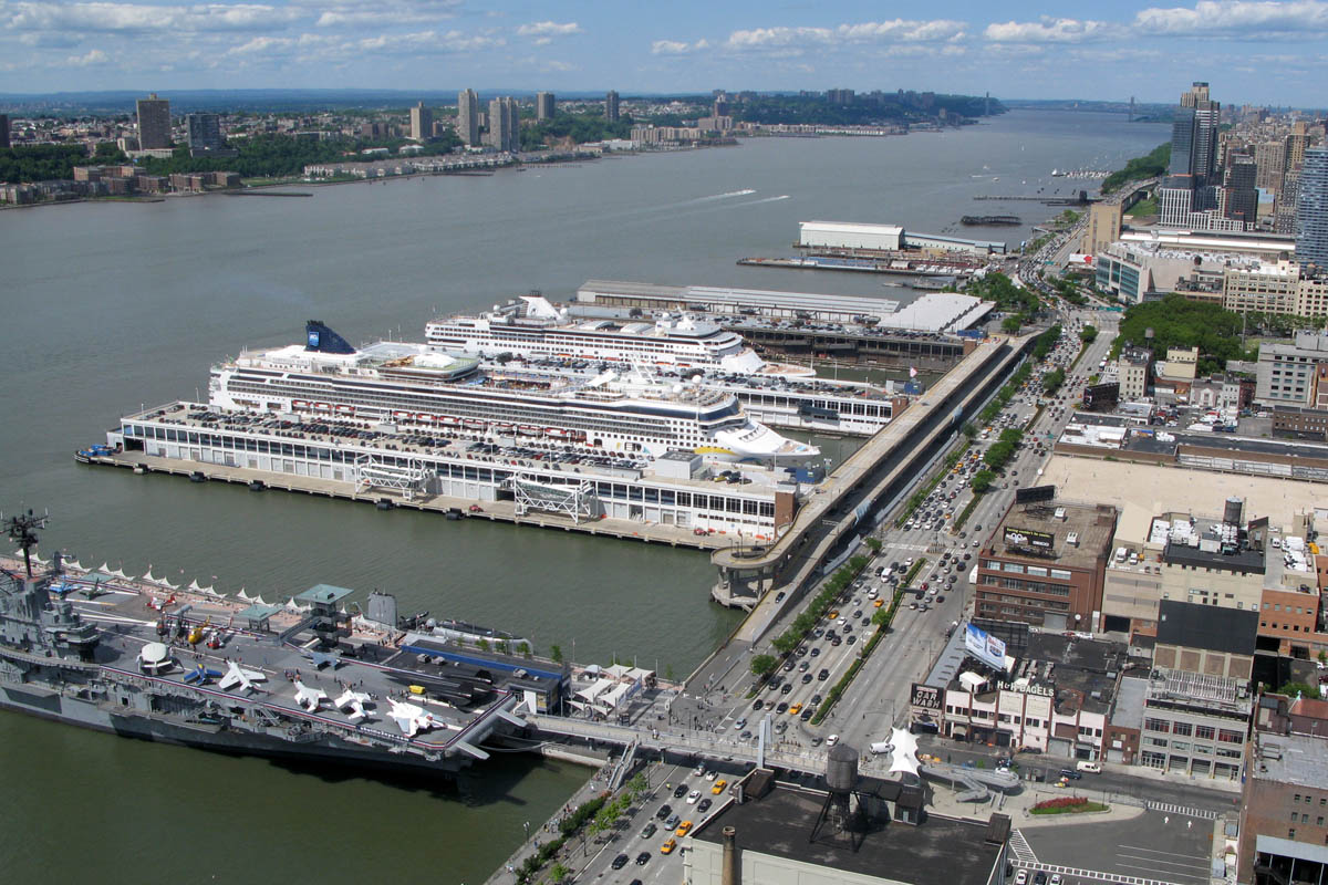
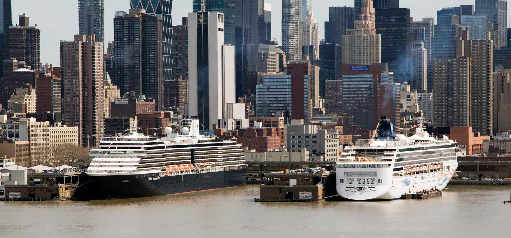
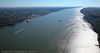
Descripción:Puerto de Nueva York: Uno de los más importantes
En esta ocasión vamos a visitar a uno de los puertos más destacables de nuestro planeta.
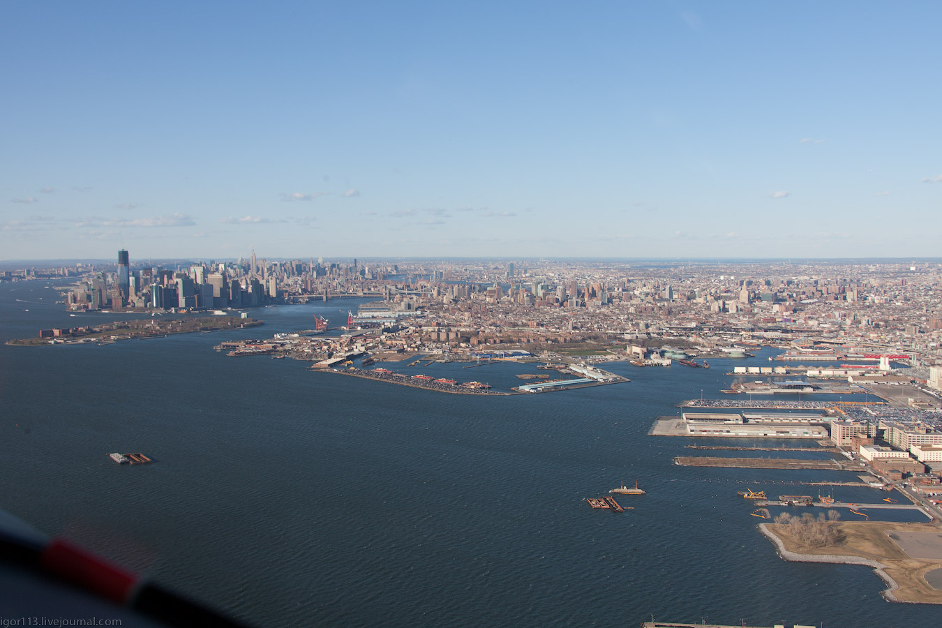
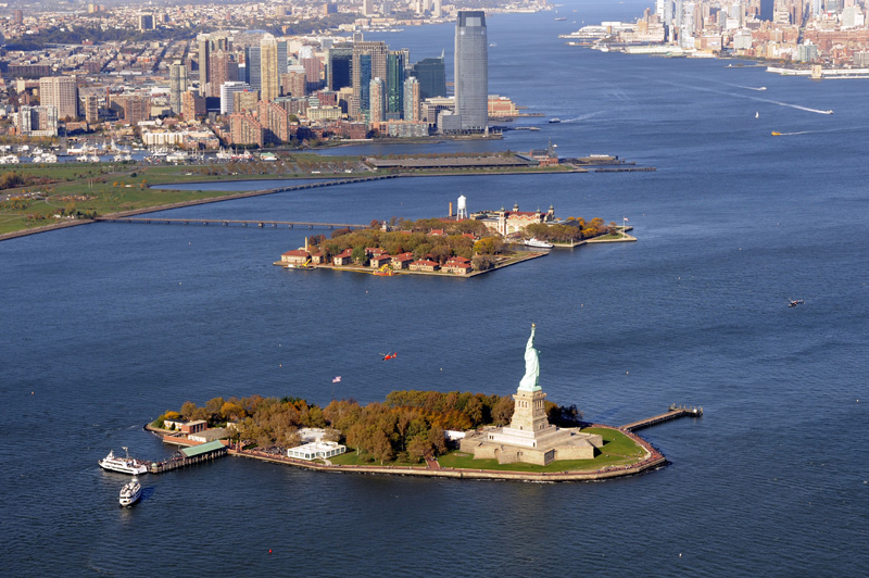
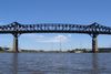
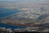
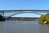
Nos referimos al Puerto de Nueva York está ubicado al Sureste por el Oceano Atlántico, al Noreste por el Río Este, por el Suroeste con una parte del río Raritan, al Noroeste con Newark Portuaria y al norte con el puente de George Washinqton.
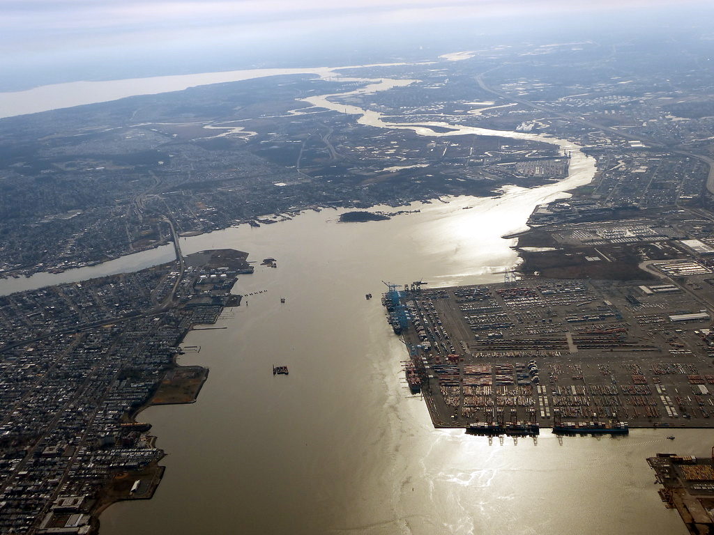
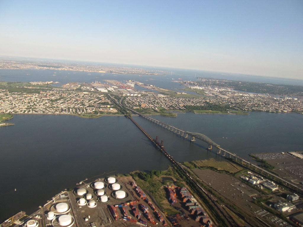
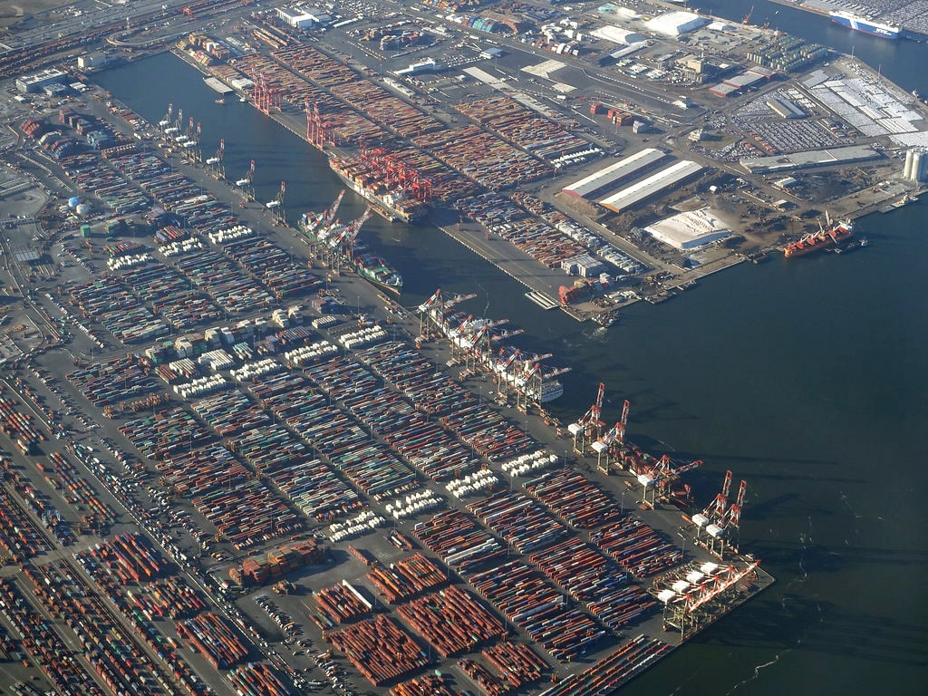
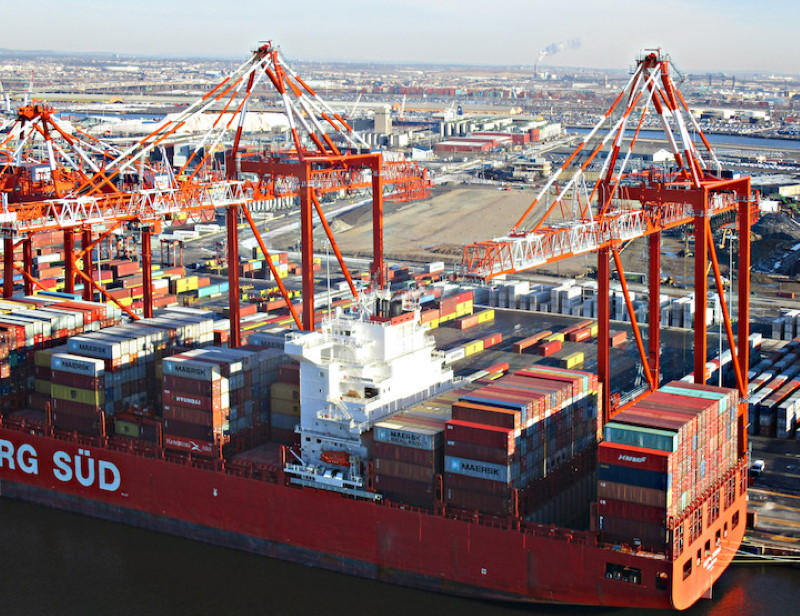
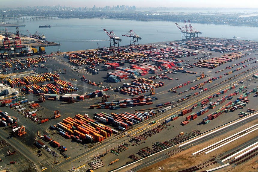
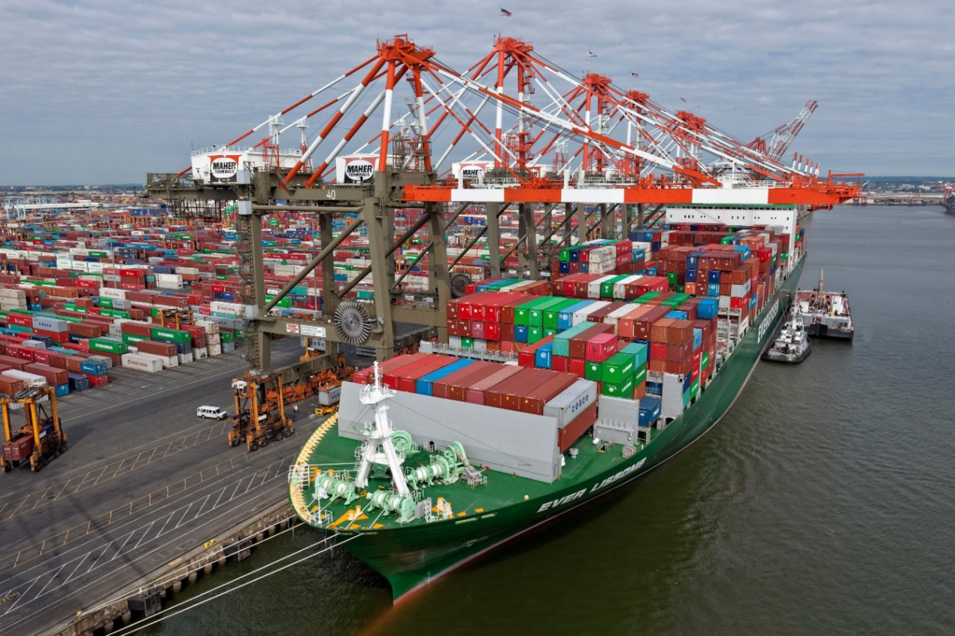
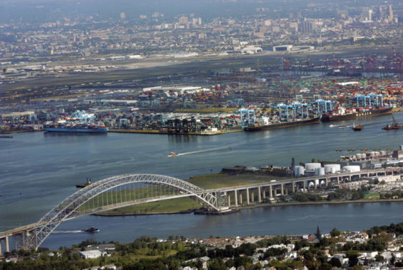
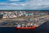
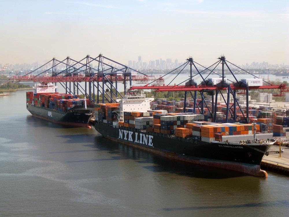
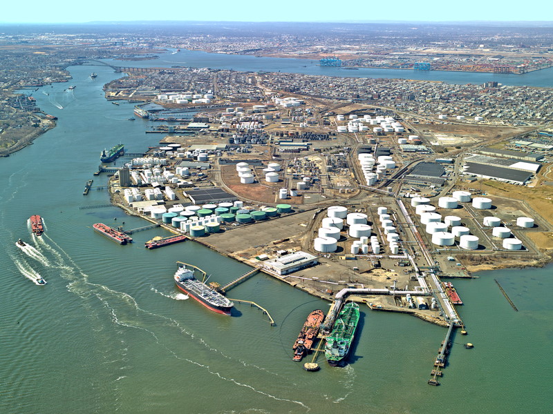
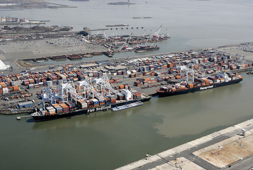
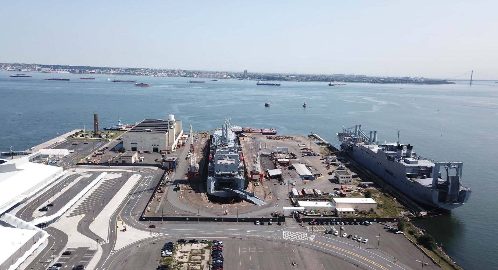
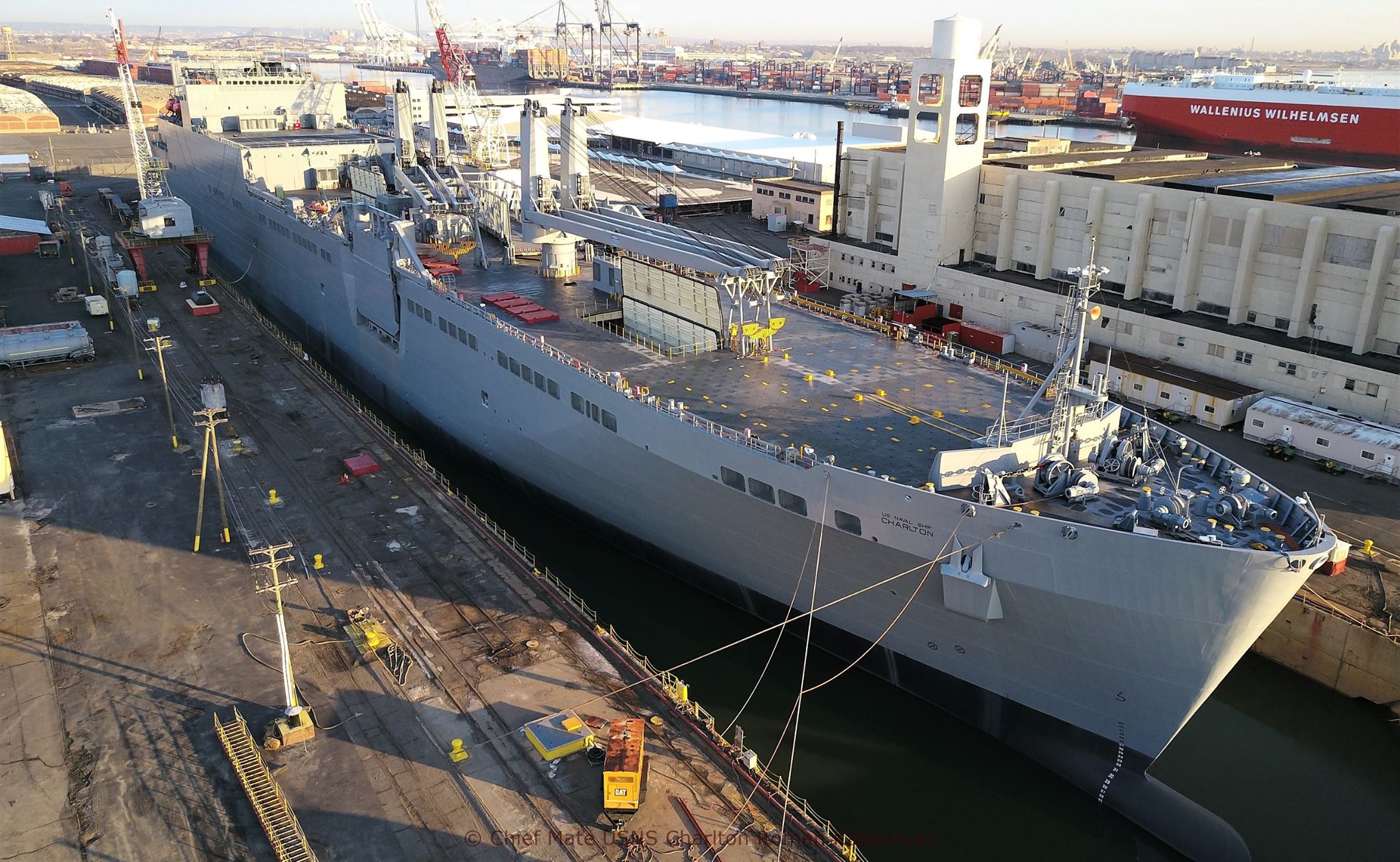
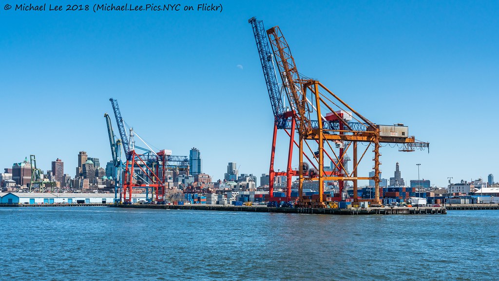
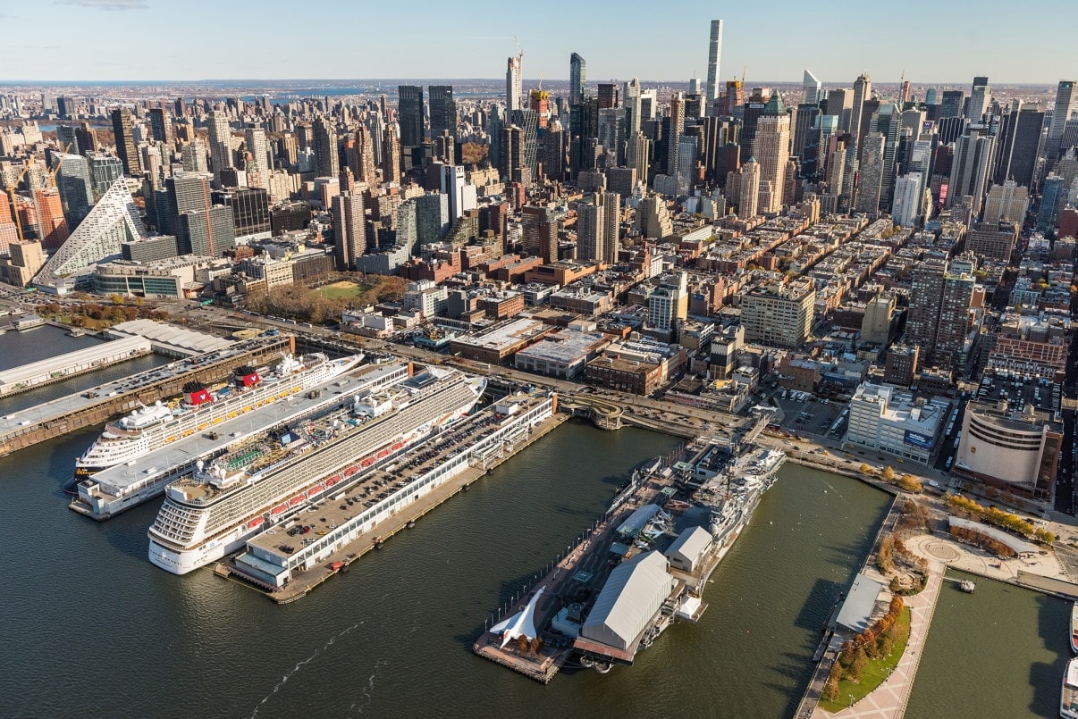
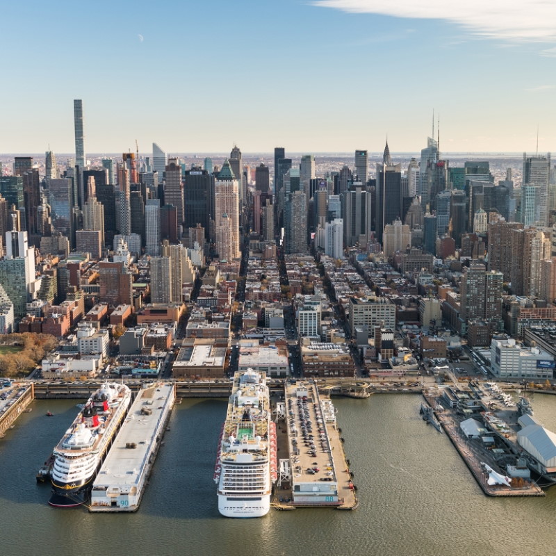
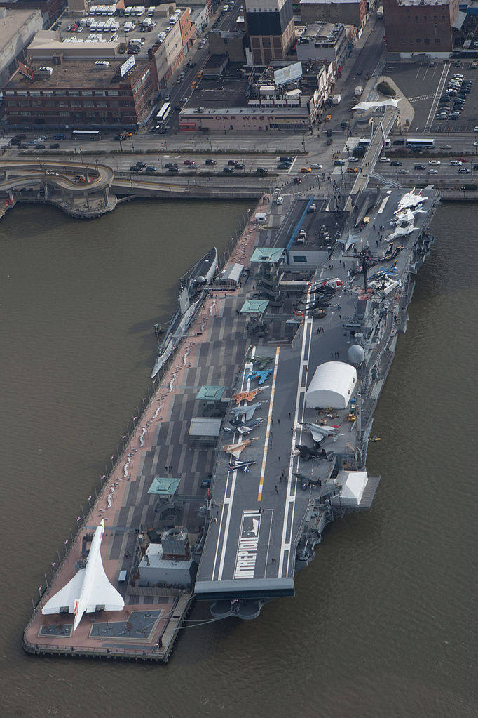
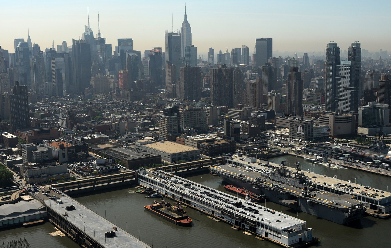
Actualmente las instalaciones portuarias de Nueva York y de Nueva Jersey importan más crudo y contenedores de la nación. Las responsabilidades del Puerto están a cargo de los Gobiernos Municipales y Federales y el resto controlado por las Autoridades del Puerto. Designado el Puerto más importante entre América y Europa por volumen en cuanto a Puertos se refiere. A través de el llegan muchos pasajeros y un mayor tonelaje. Entre 1892 a 1954 llegó a tener 12 millones de llegadas. Sin embargo el Puerto tuvo se apogeo en Marzo de 1943, con 543 naves anclados 1,100 almacenes, 575 remolcadores y 39 Astilleros.
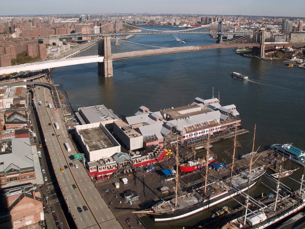
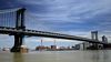
Su éxito se debe a que mantiene una gran actividad Comercial y es el puerto más grande en el litoral este, abarcando cinco ciudades de la costa incluyendo a Nueva Jersey y Brooklyn. Si bien ha disminuido en cuanto al número de pasajeros, Nueva York City aún mantiene varias líneas de travesía entre ellos: Staten Island Ferry, Barcos Turísticos y recientemente se ha abierto Red Hook Container Terminal. Staten Island Ferry funciona por el Departamento de Transporte de Nueva York City.
http://www.trotamillas.es/13778/puerto-de-nueva-york-uno-de-los-mas-importantes/
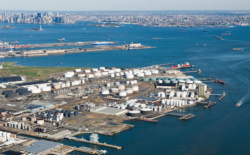
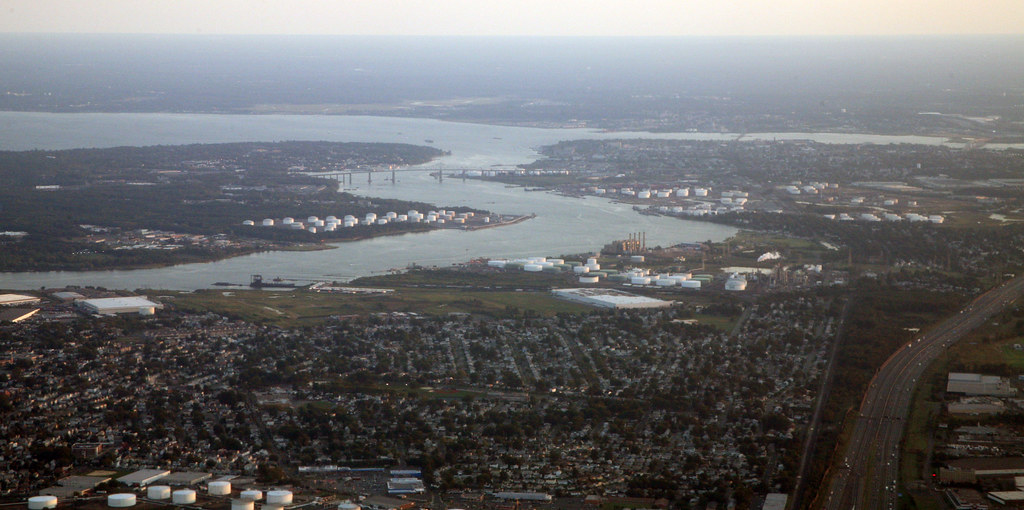
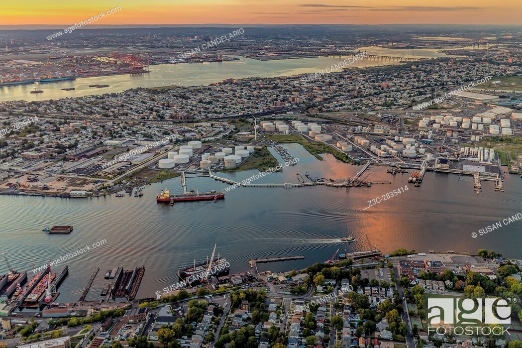
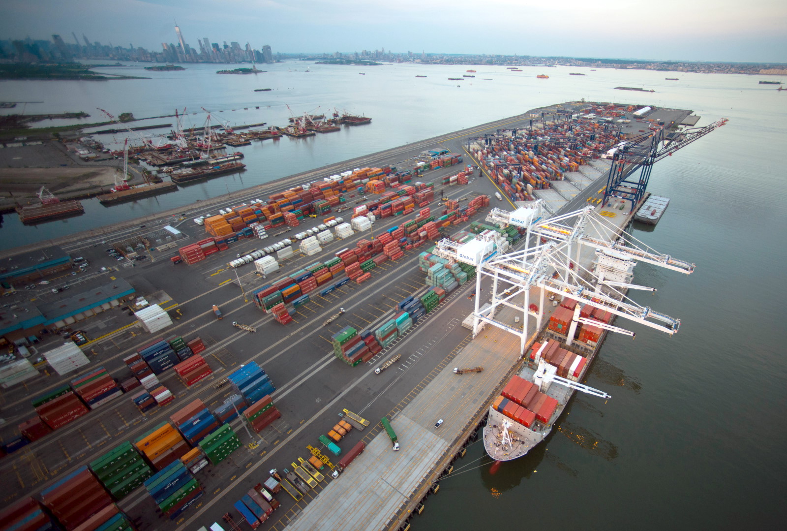
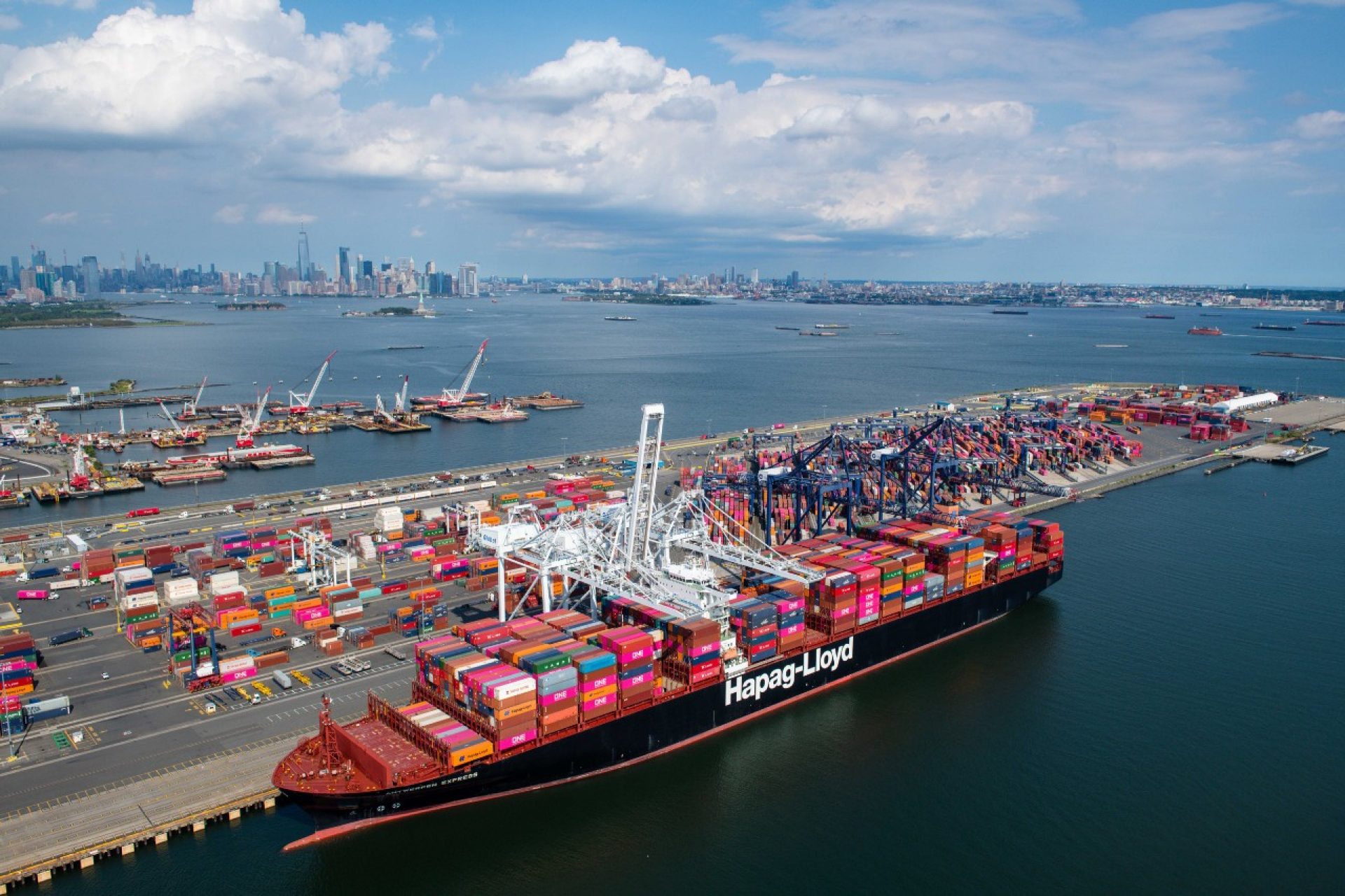
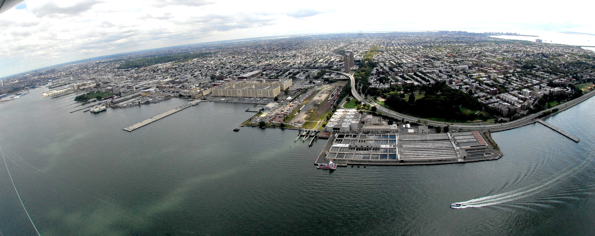
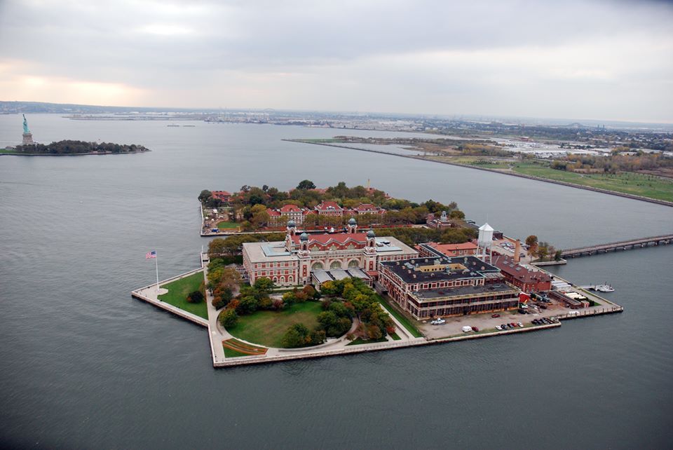
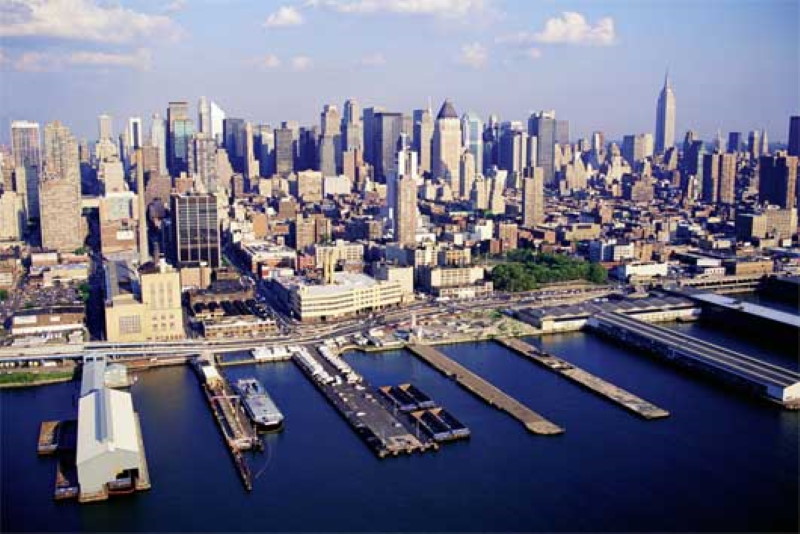
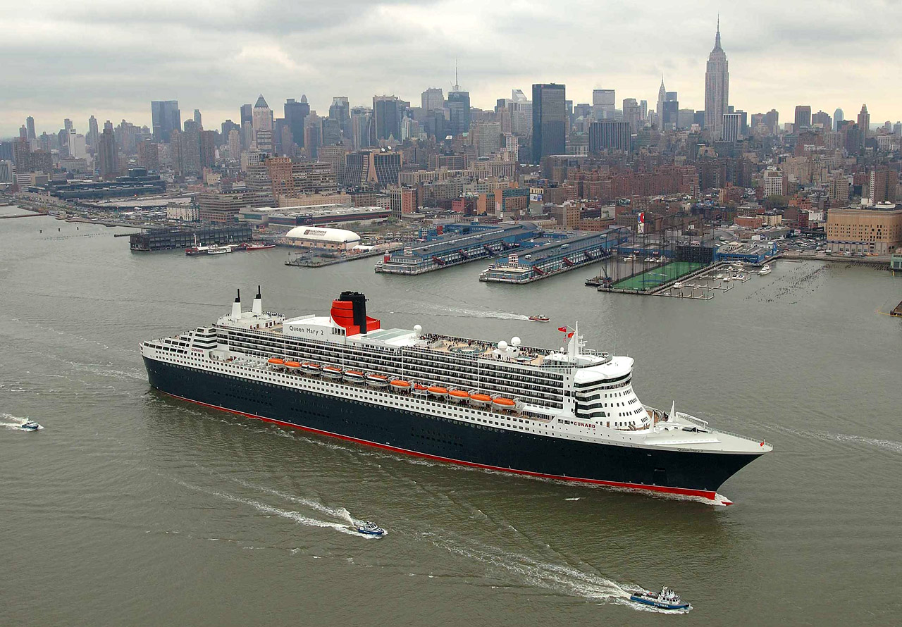
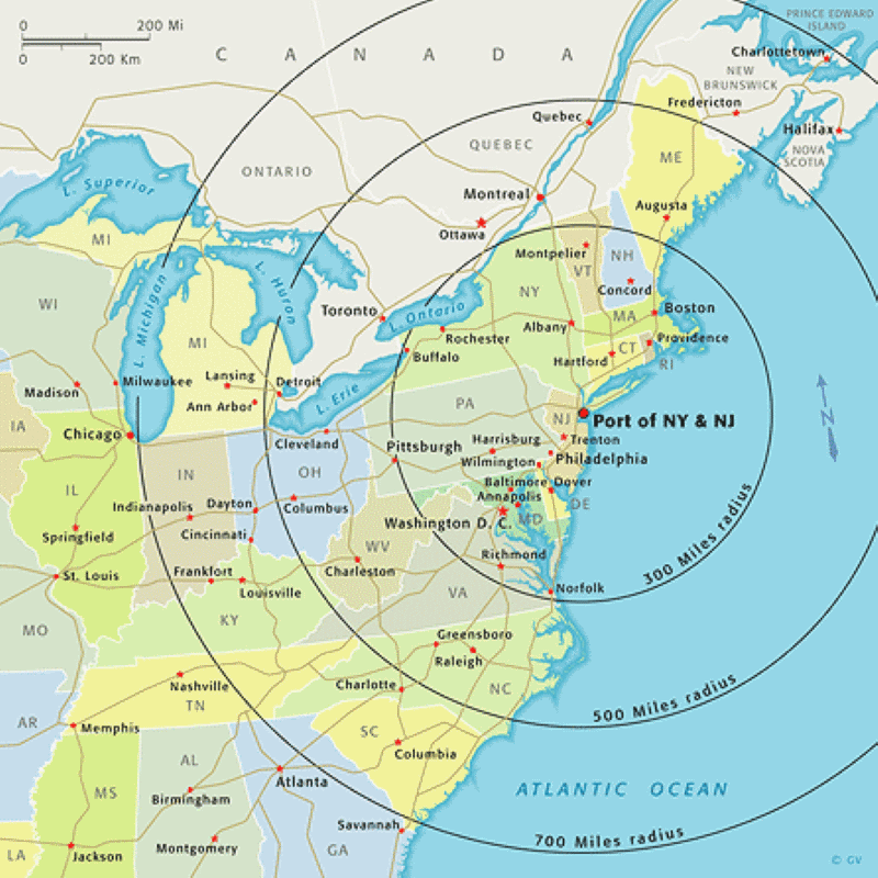
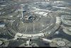
El Puerto de Nueva York y Nueva Jersey es el distrito portuario del área metropolitana Nueva York-Newark que abarca a la región dentro de un radio aproximado de 40 kilómetros desde el monumento nacional de la Estatua de la Libertad. Incluye al sistema de vías fluviales navegables en el estuario a lo largo de 1.050 kilómetros de costa en las proximidades de la ciudad de Nueva York y el noroeste de Nueva Jersey, al igual que a los aeropuertos de la región, ayudando al sistema de vías ferroviarias y carreteras.
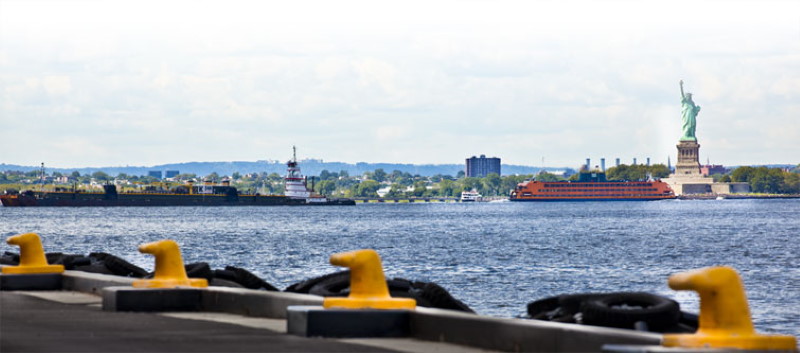
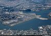
Considerado uno de los mejores puertos naturales en el mundo,1 el mismo es, por tonelaje, el tercer puerto más grande de los Estados Unidos y el más activo en la Costa Este.234 En 2010, 4.811 barcos ingresaron en el puerto, llevando más de 32,2 millones de toneladas métricas de carga, valuadas en más de US$ 175.000 millones.5 En 2011, el puerto manejó US$ 208.000 millones en transporte marítimo de carga. Aproximadamente 3.200.000 unidades TEU en contenedores y 700.000 autos son manejados cada año. El puerto es la principal puerta de entrada de vuelos internacionales en el país y el centro más activo en cuanto a total de pasajeros y vuelos de carga. Hay dos zonas francas (FTZ, por sus siglas en inglés) dentro del puerto: la FTZ 1, primera en el país (establecida en 1937), en el lado de Nueva York, y la FTZ 49, en el lado de Nueva Jersey.
https://es.wikipedia.org/wiki/Puerto_de_Nueva_York_y_Nueva_Jersey
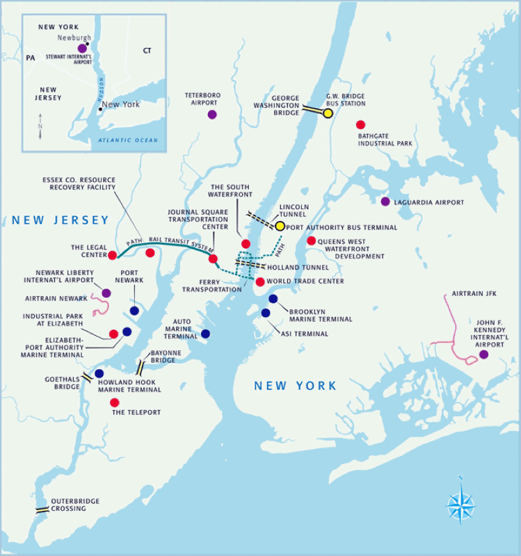
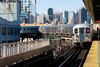
La Autoridad Portuaria de Nueva York y Nueva Jersey gestiona y mantiene infraestructura crítica para la red de comercio y transporte de la región de Nueva York y Nueva Jersey—los cuatro aeropuertos de la región, el puerto de Nueva York y Nueva Jersey, el sistema de tránsito ferroviario PATH, seis túneles y puentes entre Nueva York y Nueva Jersey, la Terminal de Autobuses de la Autoridad Portuaria en Manhattan y el sitio del World Trade Center.
Puertos
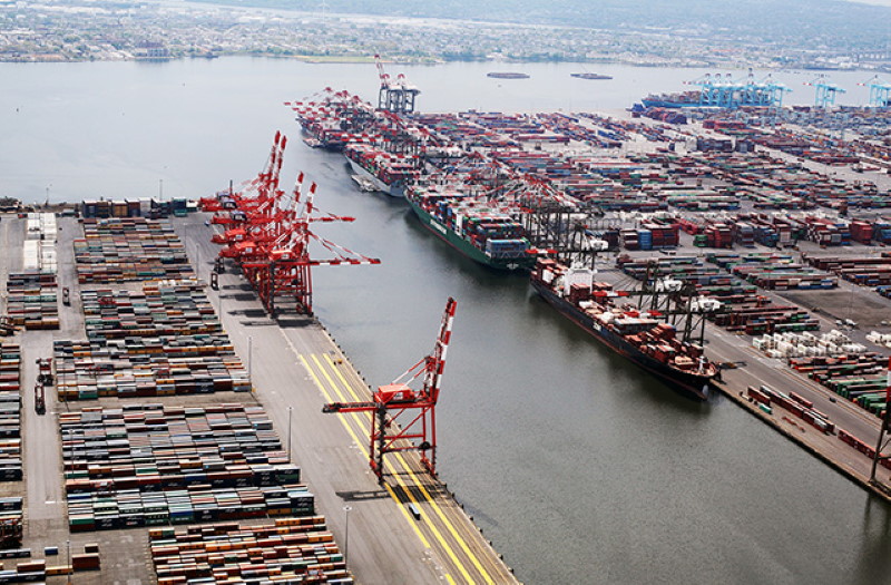
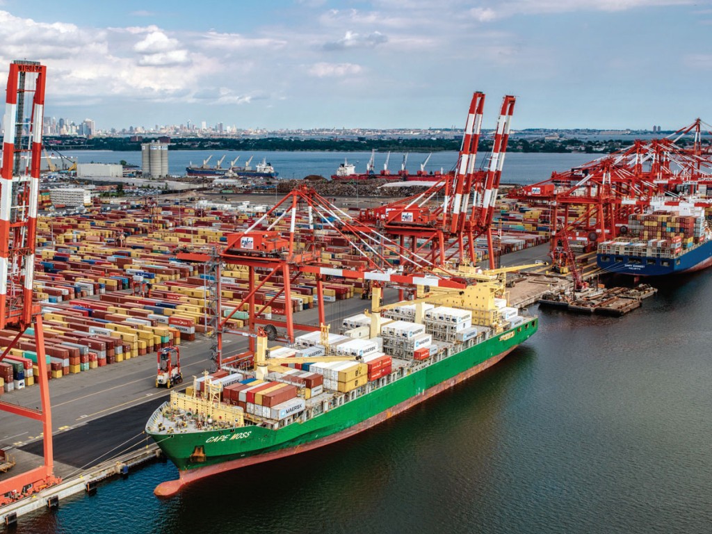
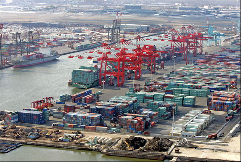
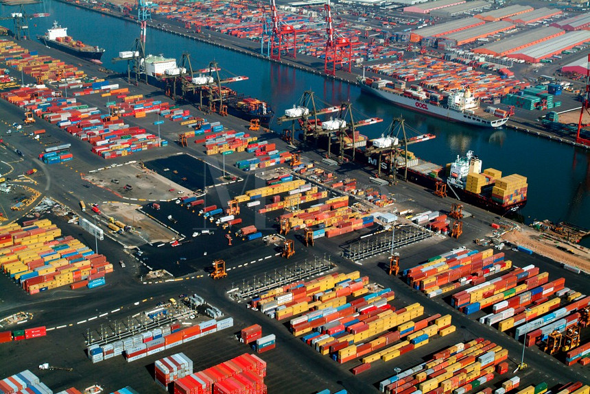
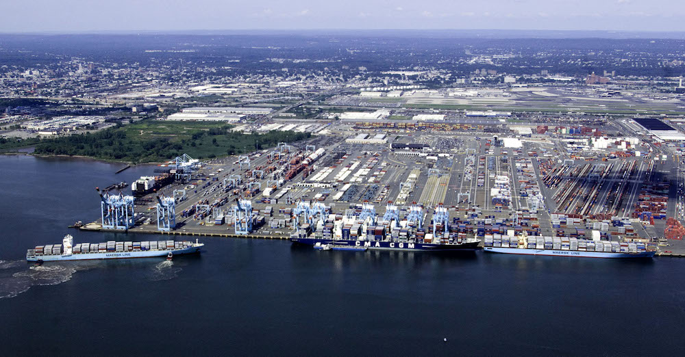
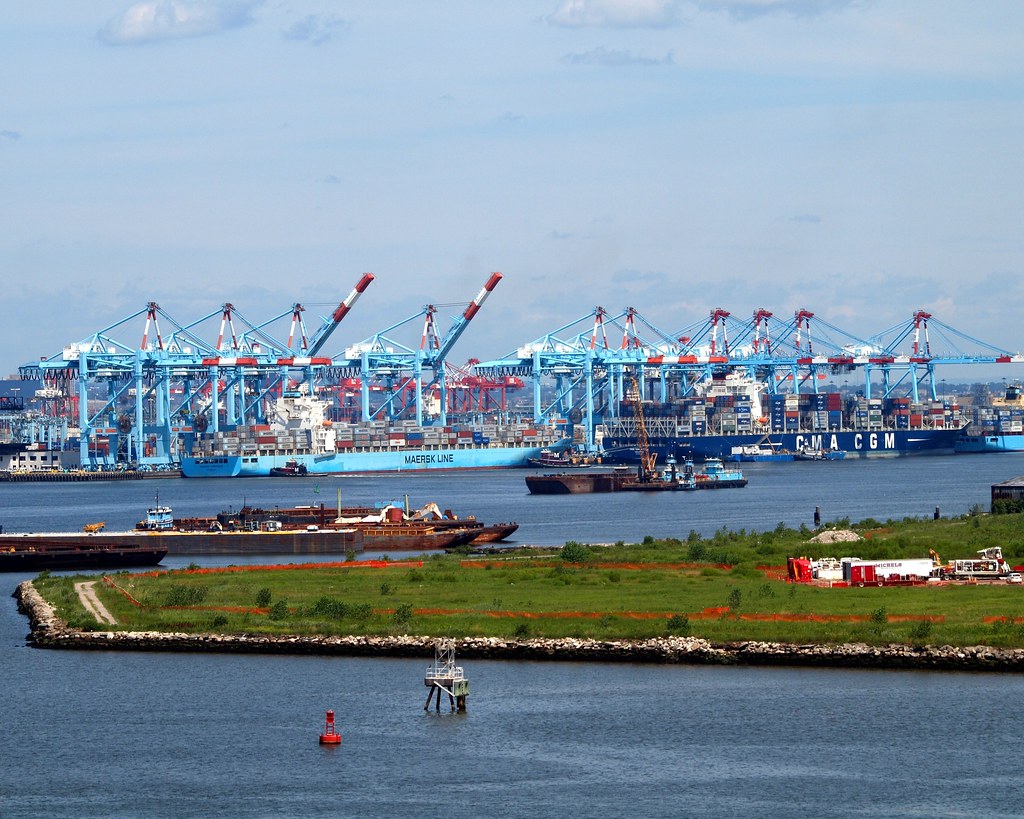
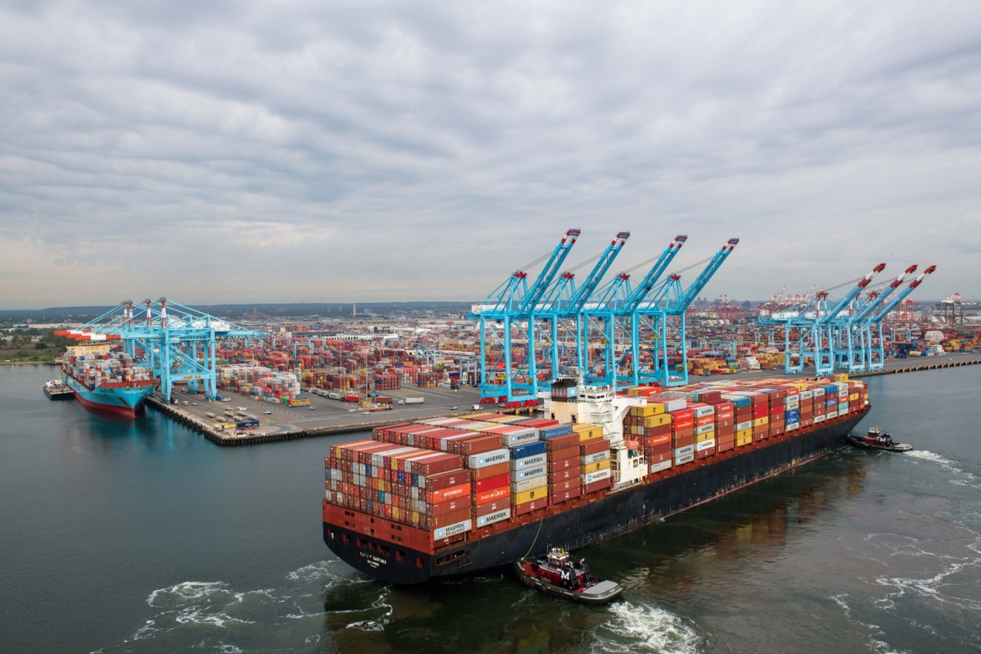
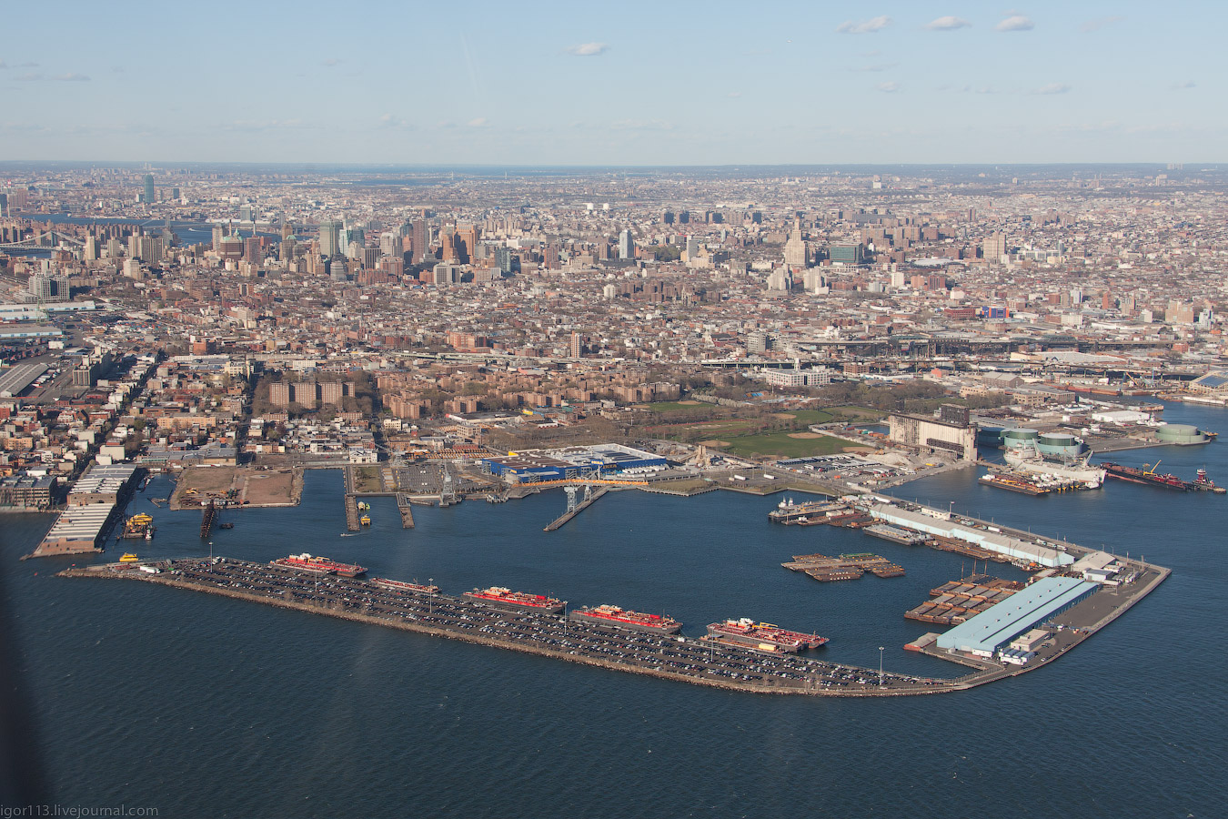
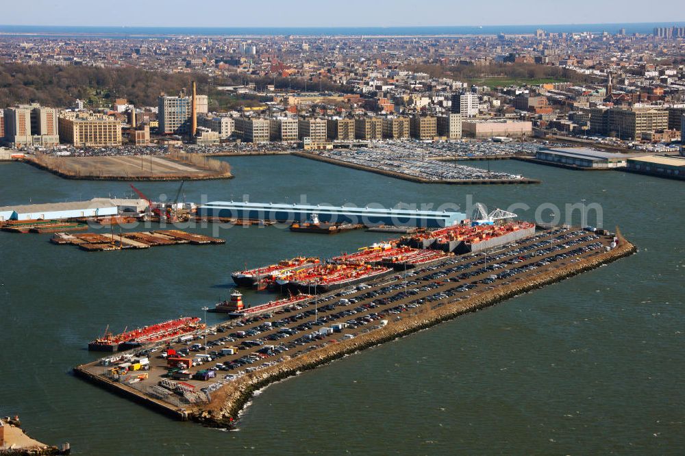
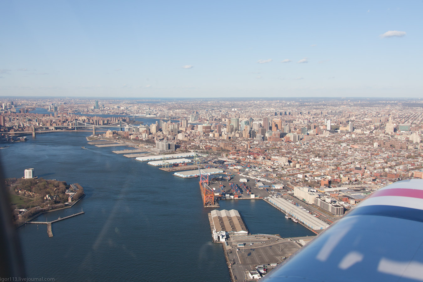
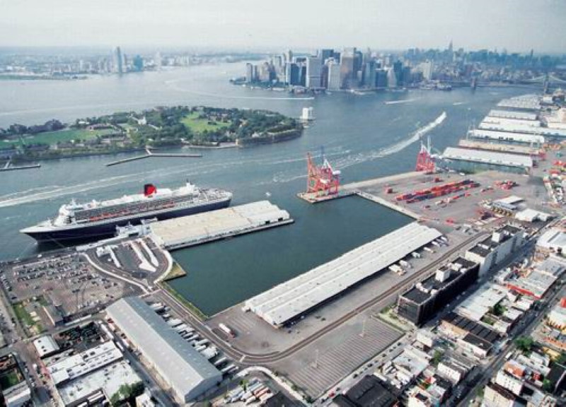
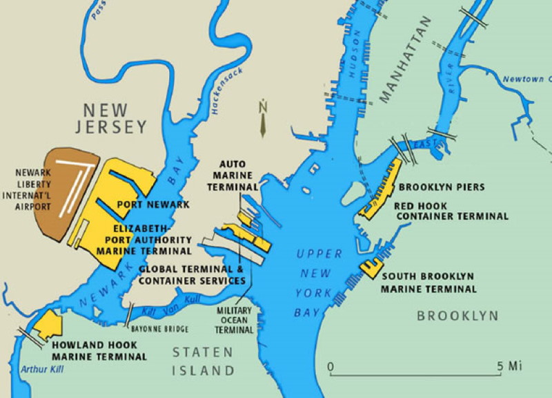
El Puerto de Nueva York/Nueva Jersey es el mayor complejo portuario en la Costa Este de Norteamérica y se encuentra al centro del mercado consumidor más concentrado y próspero del mundo, con acceso inmediato a las redes interestatales de carretera y ferrocarril más extensas de la región. Además, la Autoridad Portuaria supervisa directamente la operación de siete terminales de carga en la región de Nueva York y Nueva Jersey. Cada terminal ofrece servicios completos de navegación, servicios ferroviarios y de transporte por camión.
La Autoridad Portuaria opera los siguientes puertos:
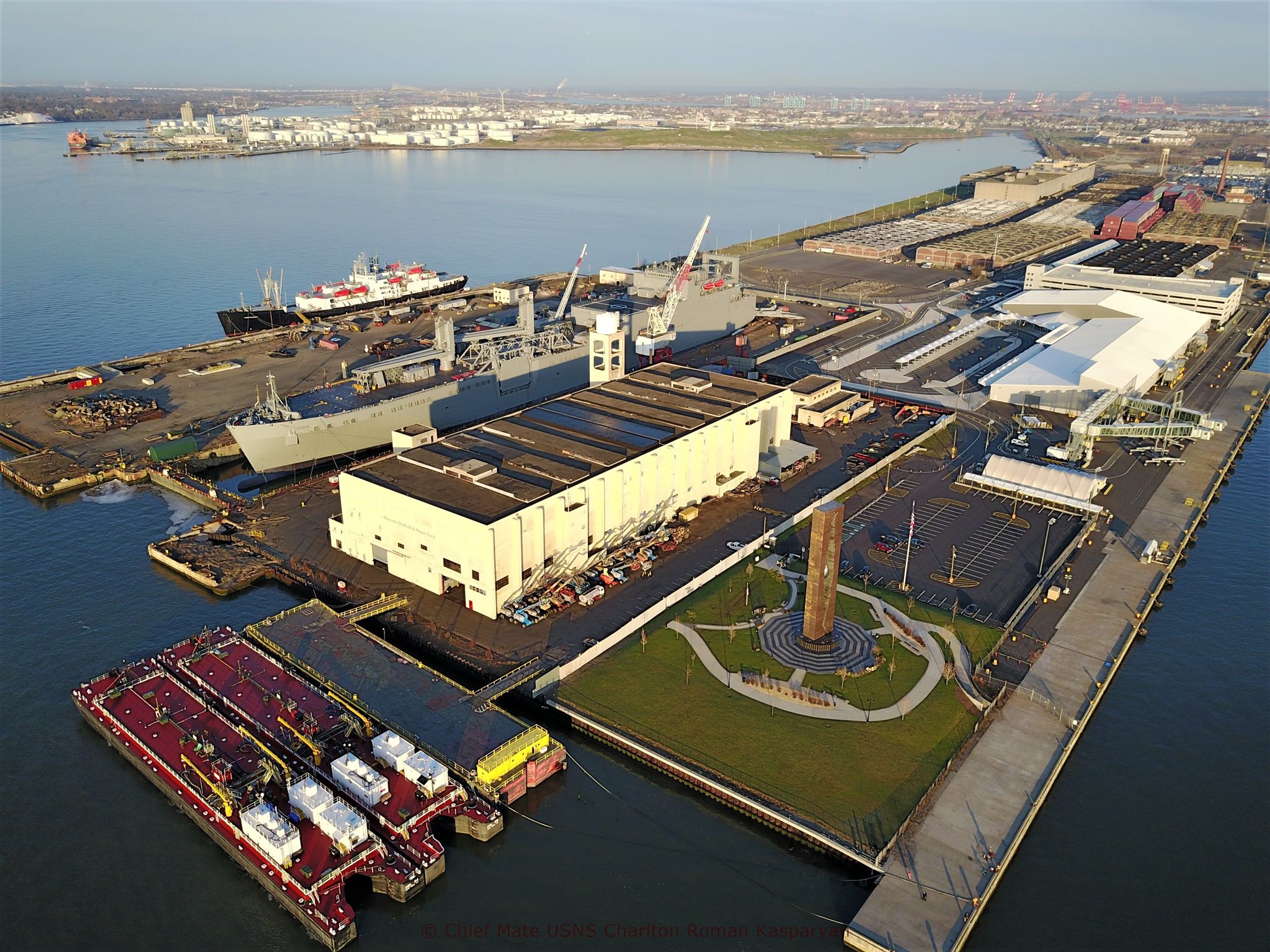
Auto Marine Terminal en Bayonne y Jersey City, Nueva Jersey
Terminal Marítima de la Autoridad Portuaria de Brooklyn (Brooklyn Port Authority Marine Terminal) (una terminal combinada de los Muelles de Brooklyn (Brooklyn Piers) y la Terminal de Contenedores de Red Hook) en Red Hook, Brooklyn, Nueva York
Terminal Marítima Howland Hook en Staten Island
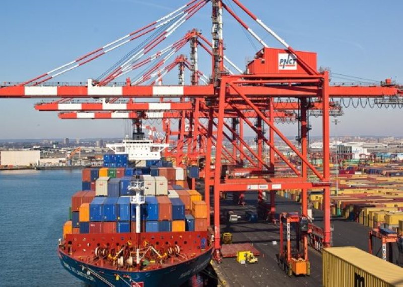
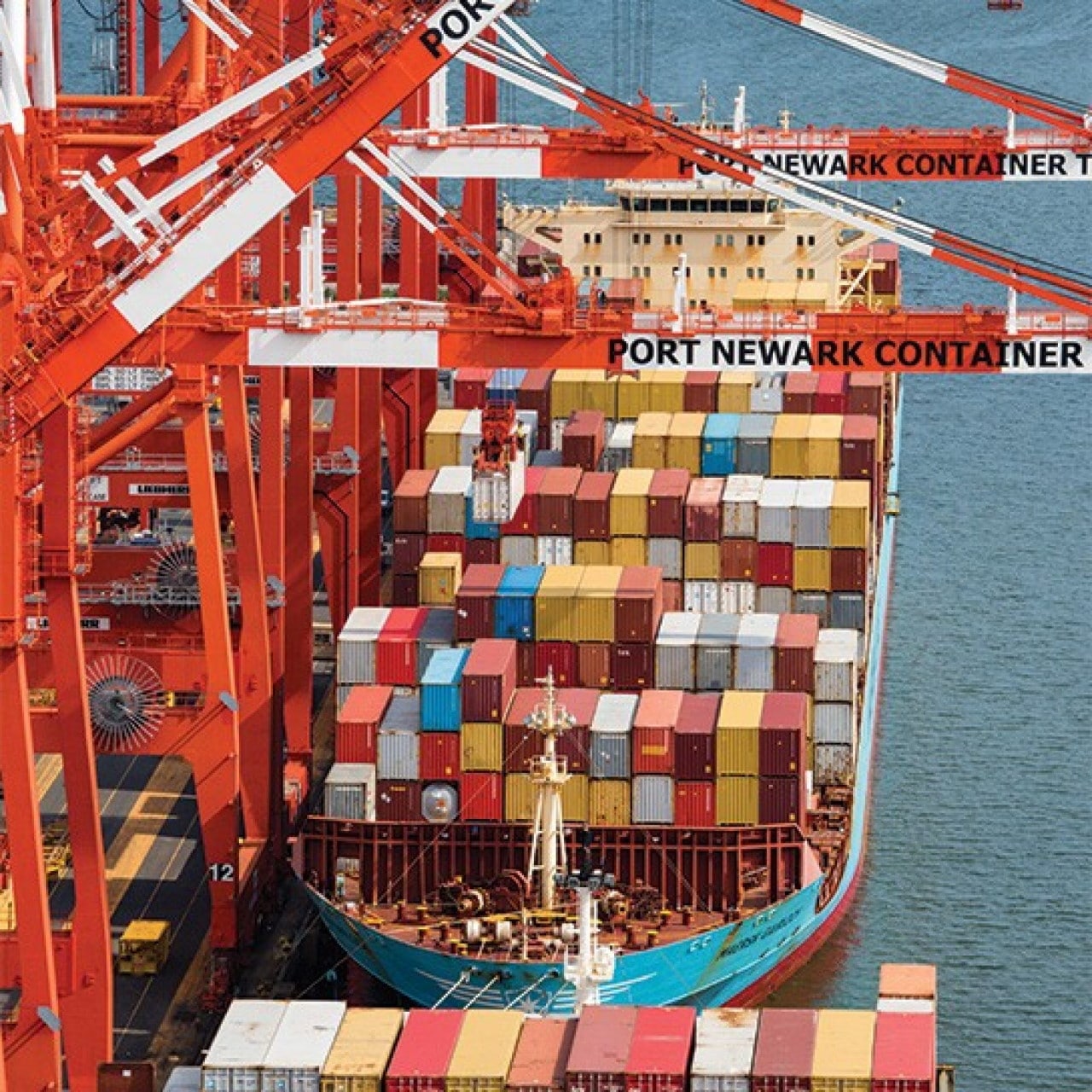
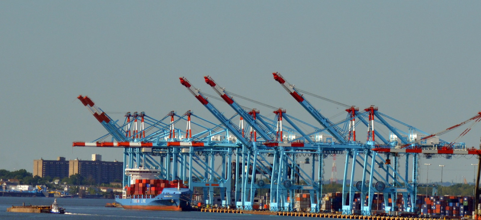
Terminal Marítima Port Newark-Elizabeth en Elizabeth, Nueva Jersey
La Terminal Marítima Port Newark-Elizabeth fue el primer puerto del país en adoptar contenedores, A partir de 2004, los puertos de la Autoridad Portuaria procesan la tercera mayor cantidad de tráfico marítimo de todos los puertos estadounidenses, medido en toneladas.
http://es.wikipedia.org/wiki/Autoridad_Portuaria_de_Nueva_York_y_Nueva_Jersey
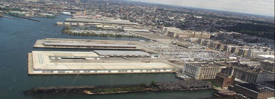
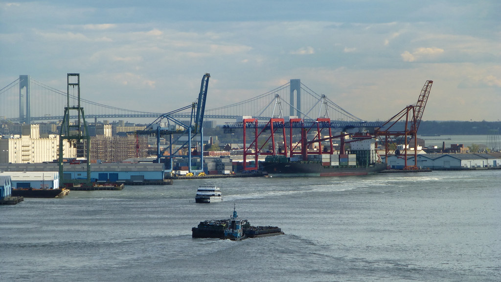
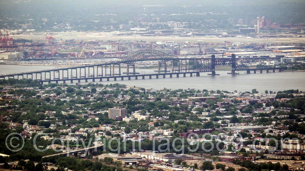
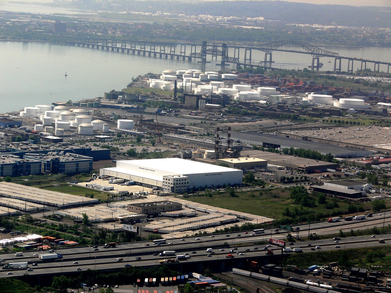
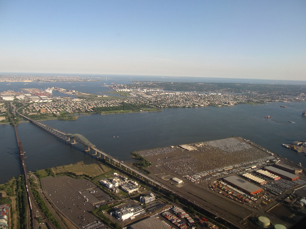
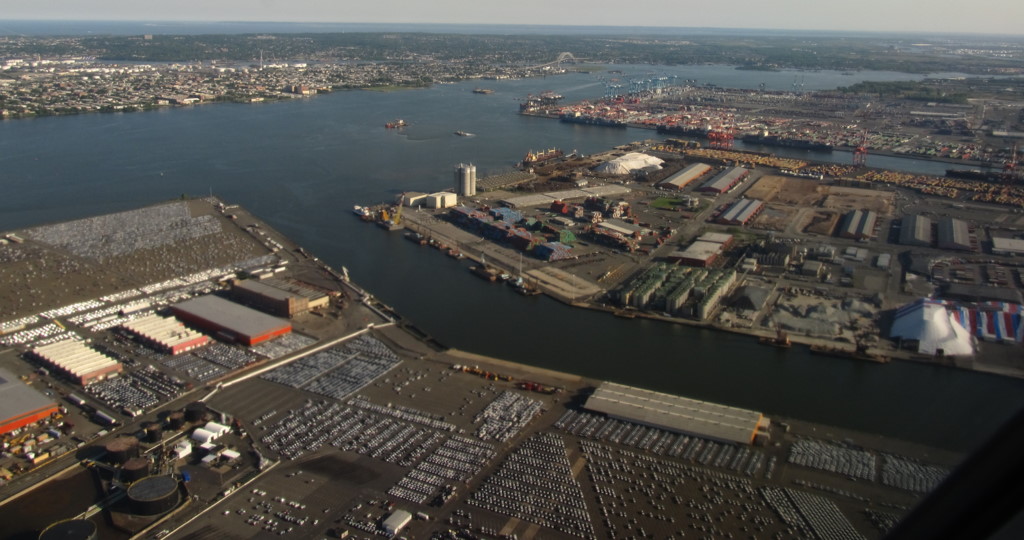
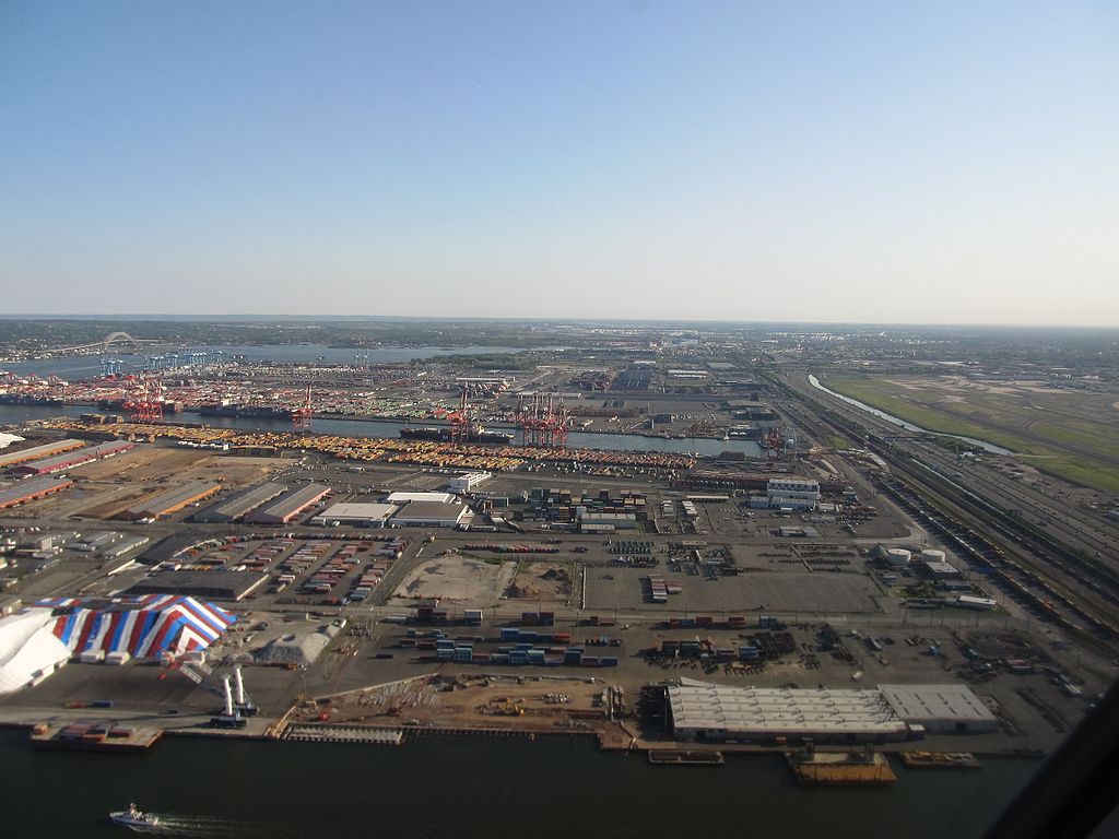
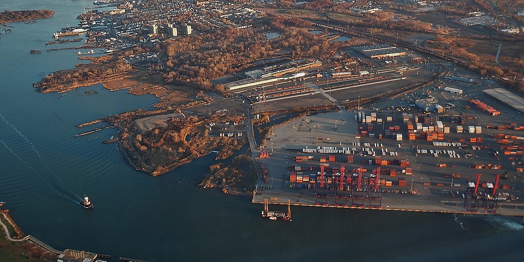
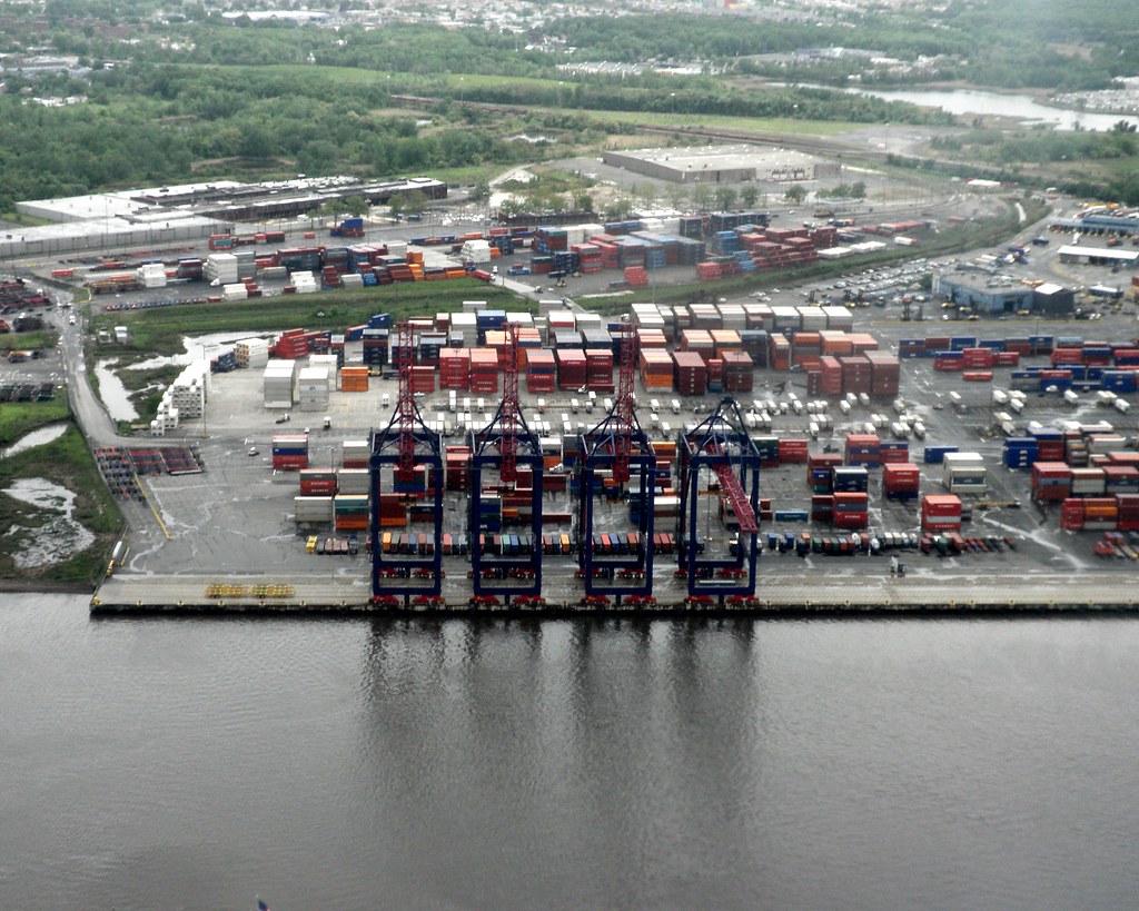
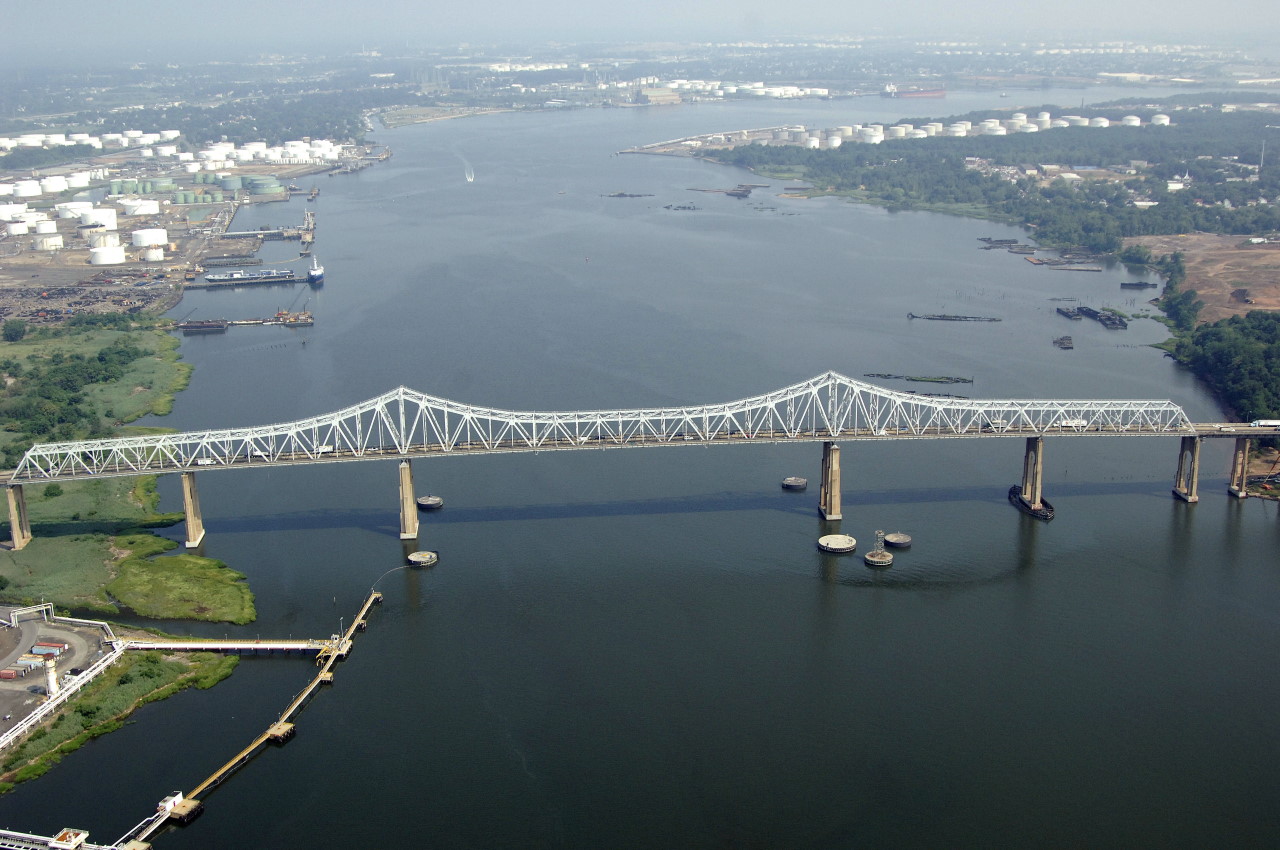
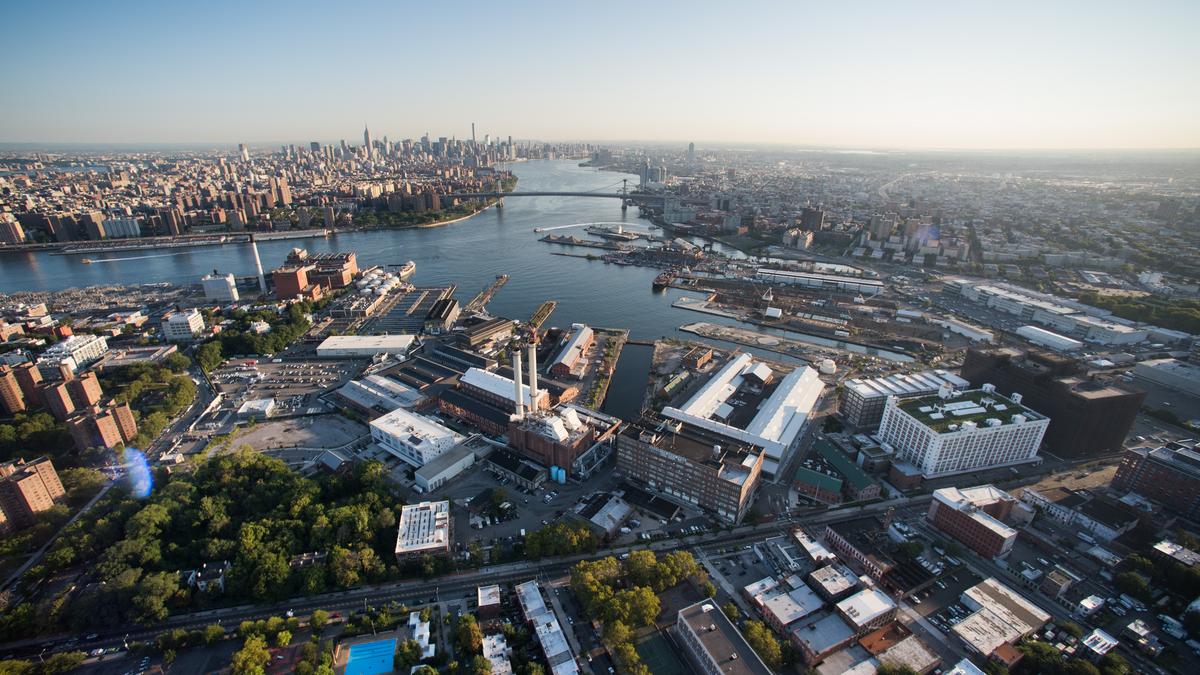
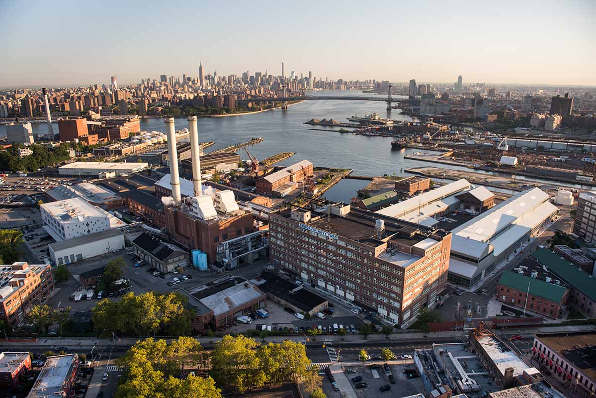
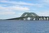
Port Newark-Elizabeth Marine Terminal is a major component of the Port of New York and New Jersey. Located on the Newark Bay it serves as the principal container ship facility for goods entering and leaving New York-Newark metropolitan area, and the northeastern quadrant of North America. It consists of two components – Port Newark and the Elizabeth Marine Terminal (sometimes called "Port Newark" and "Port Elizabeth" respectively) – which exist side-by-side and are run conjointly by the Port Authority of New York and New Jersey. The facility is located within the boundaries of the two cities of Newark and Elizabeth, New Jersey, just east of the New Jersey Turnpike and Newark Liberty International Airport.
It is considered one of the most at-risk terrorist targets in the United States.
Operations
The Port is the twenty-second busiest in the world today, but was number one as recently as 1985. Amongst the records it retains is being the port with the largest volume of imports from Germany of all US ports, with over 2.6 million tonnes in 2006, over 20% of the total volume of imports from Germany.
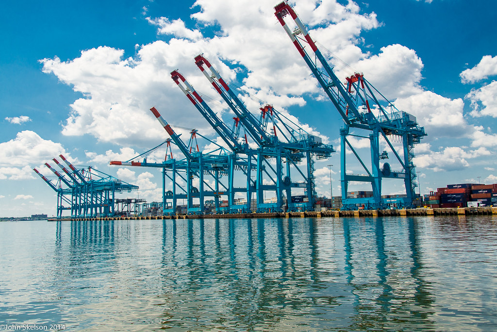
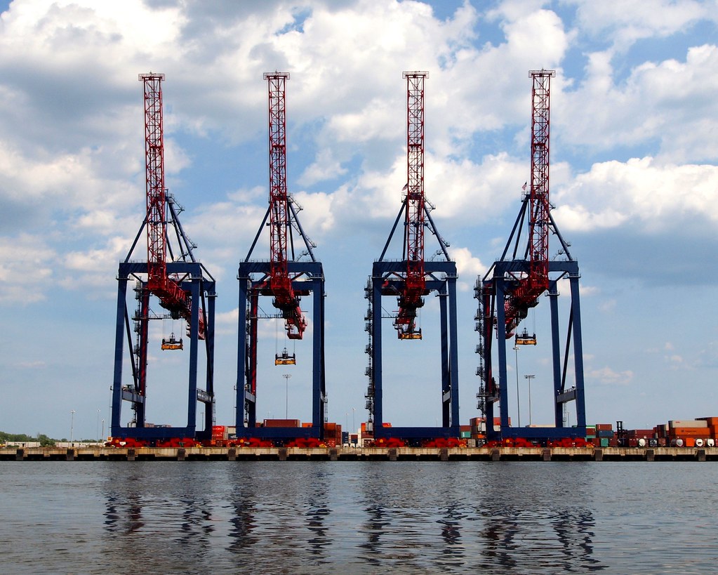
Since 1998, the Port has seen a 65 percent increase in traffic volume. In 2003, the Port moved over $100 billion in goods.[citation needed] Plans are underway for billions of dollars in improvements - larger cranes, bigger railyard facilities, deeper channels, and expanded wharves. New longshoremen are being hired as well.
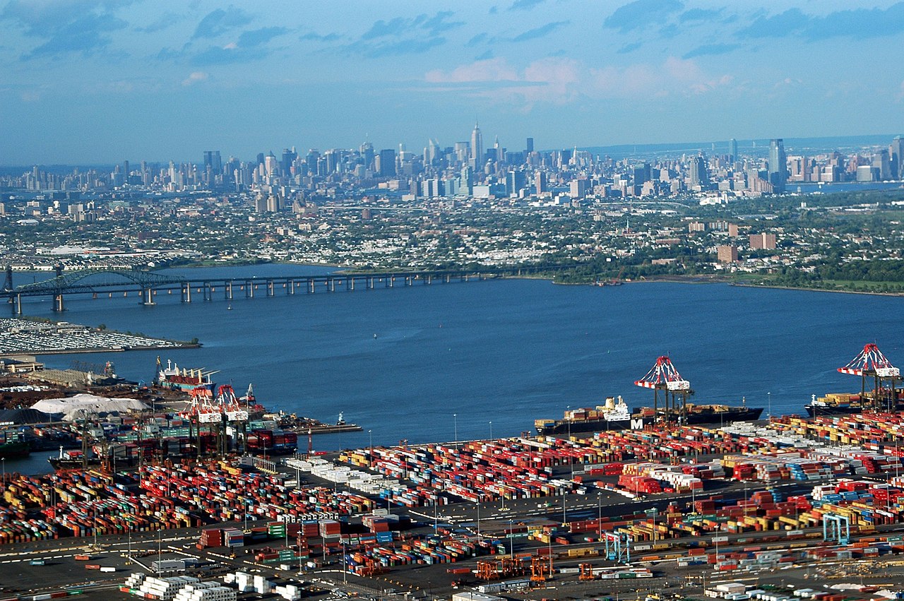
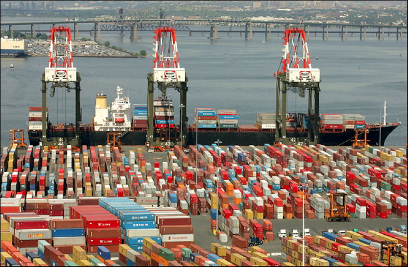
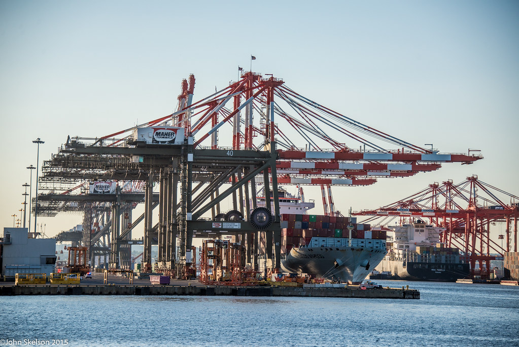
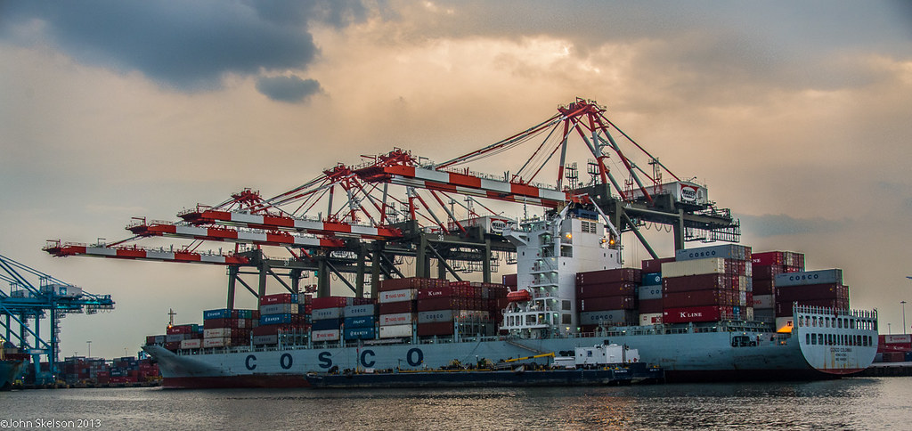
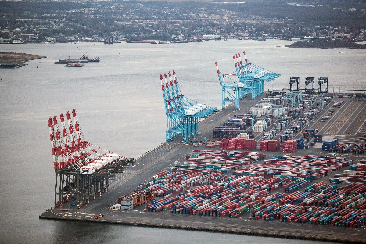
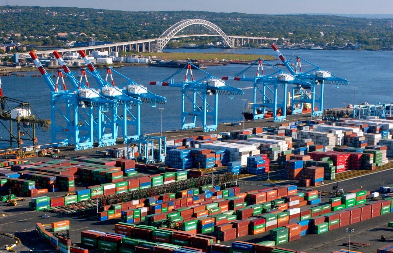
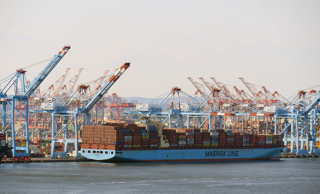
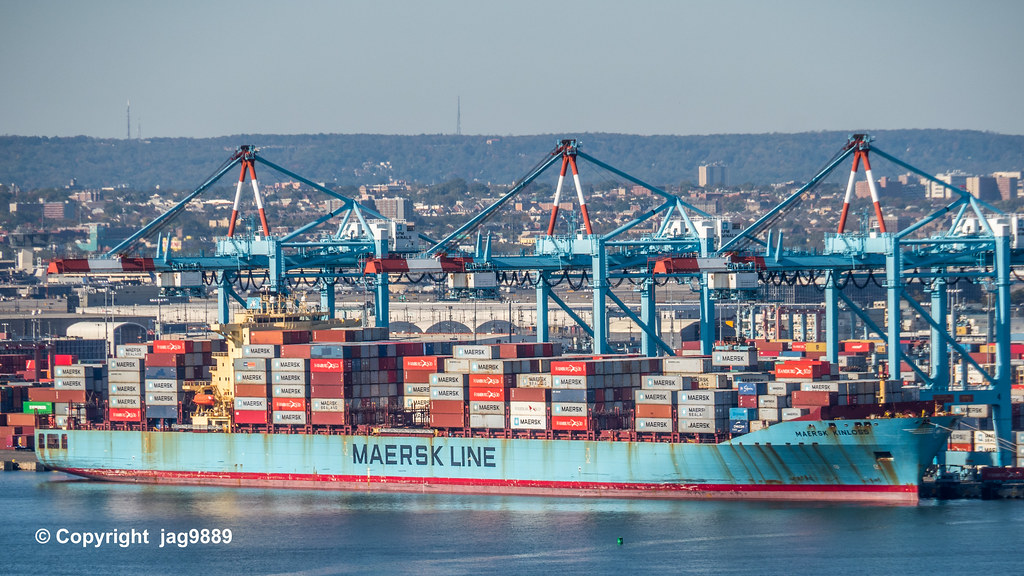
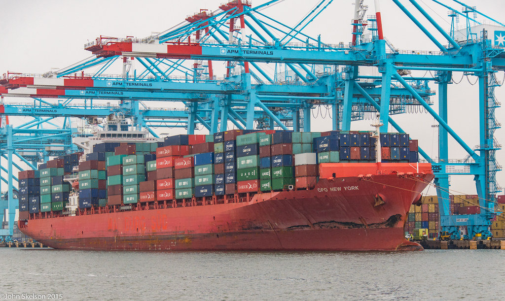
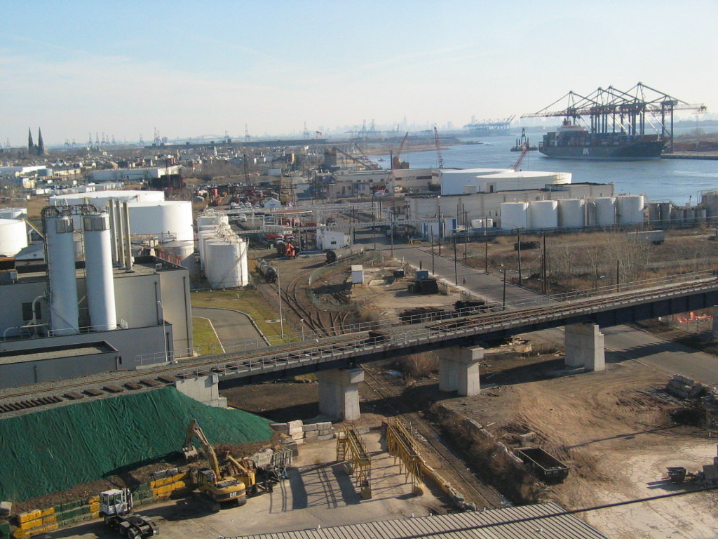
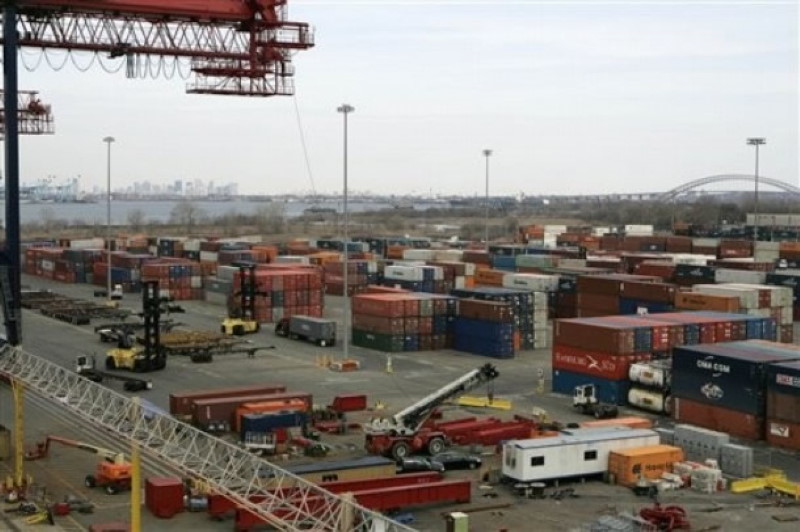
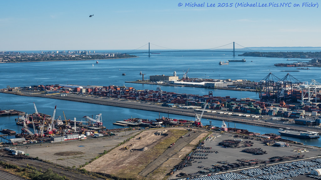
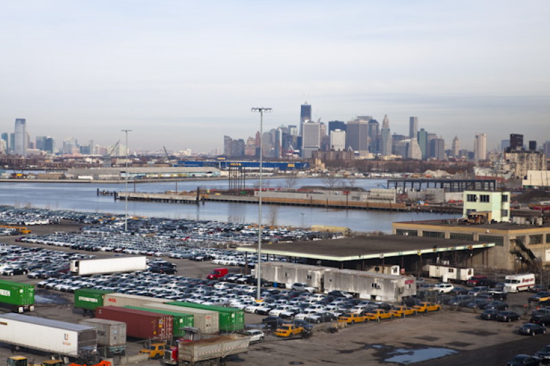
It is the largest container port in the eastern United States and the third largest in the country. Container goods typically arrive on container ships through the Narrows and the Kill Van Kull before entering Newark Bay, a shallow body of water that is dredged to accommodate the larger ships (some ships enter Newark Bay via the Arthur Kill). The port facility consists of two main dredged slips and multiple loading cranes. Metal containers are stacked in large arrays visible from the New Jersey Turnpike before being loaded onto rail cars and trucks.
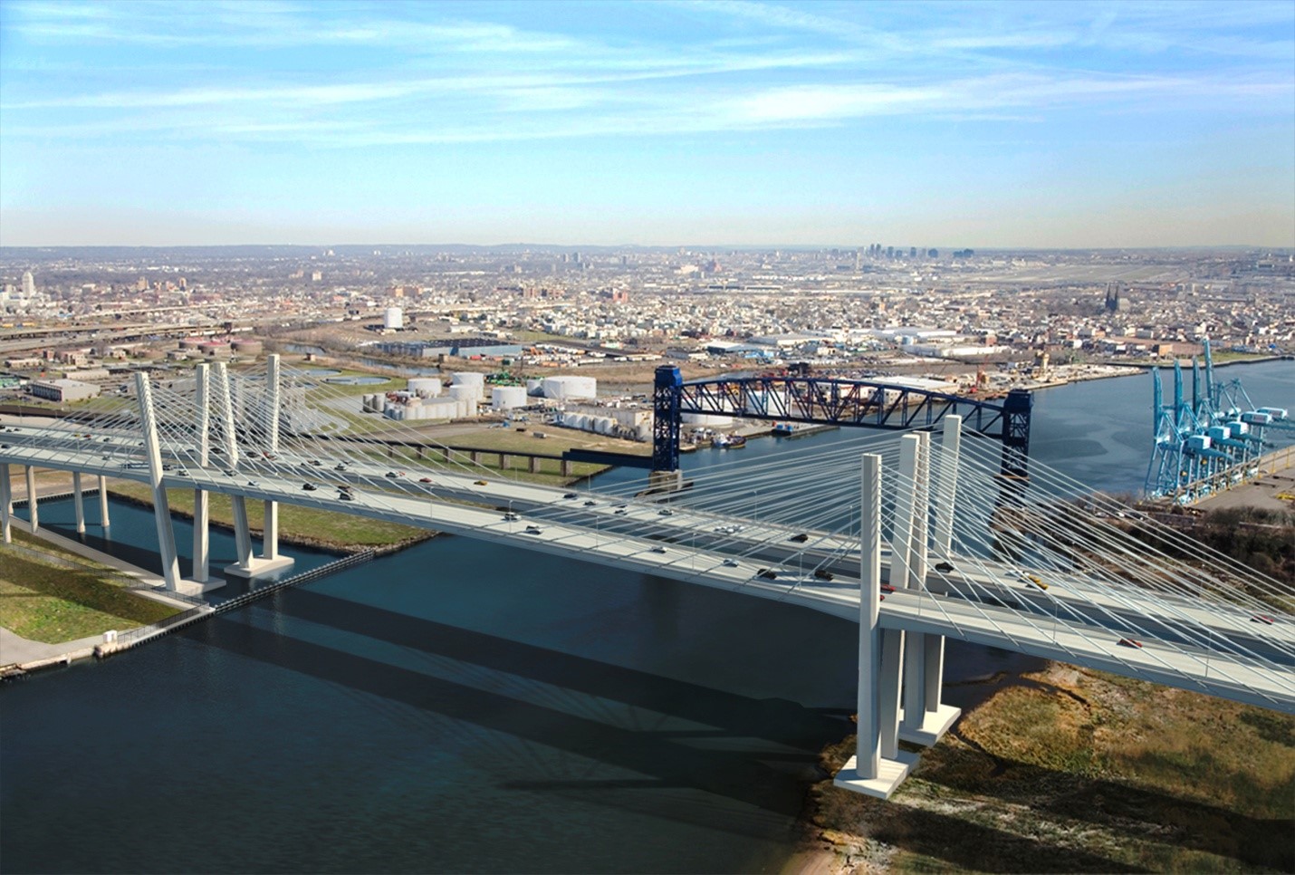
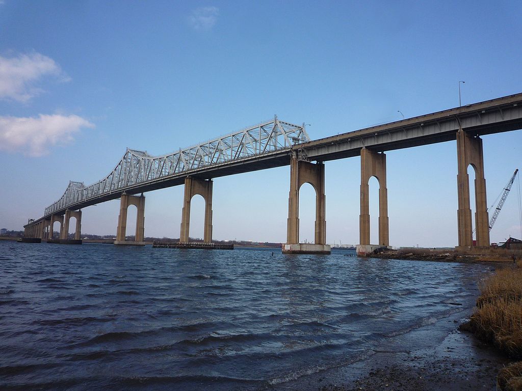
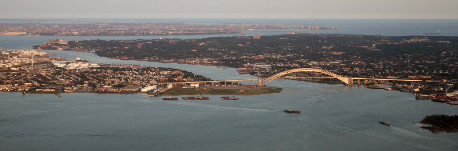
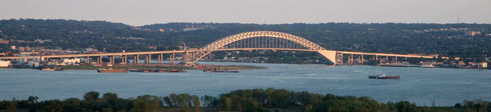
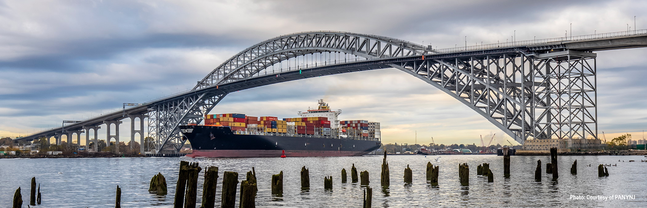
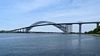
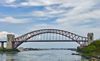
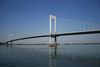
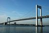
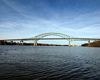
The height of ships serving the port is limited by the Bayonne Bridge over Kill Van Kull, a limitation that will become more serious when the Panama Canal expansion project opens in 2014, allowing bigger ships to reach the port from Asia. Options to remedy the situation under consideration include jacking up the bridge, building a new bridge or a tunnel. Likely, a facility at MOTBY on the Upper New York Bay will be built to handle the larger ships.
In 2009, the major port operators at Port Newark-Elizabeth included Maher terminals, APM terminal (A. P. Moller-Maersk), and PNCT (Port Newark Container terminal).
History
The western edge of Newark Bay was originally shallow tidal wetlands covering approximately 12 square miles (31 km2). In 1910s the City of Newark began excavating an angled shipping channel in the northeastern quadrant of the wetland which formed the basis of Port Newark.Work on the channel and terminal facilities on its north side accelerated during World War I, when the federal government took control of Port Newark. During the war there were close to 25,000 troops stationed at the Newark Bay Shipyard.
http://en.wikipedia.org/wiki/Port_Newark-Elizabeth_Marine_Terminal
The Port Authority of New York and New Jersey was formed in 1921 and the Newark Bay Channels were authorized by the Rivers and Harbors Acts in 1922. Shipping operations languished after the war, and in 1927, the City of Newark started construction of Newark Airport (now known as Newark Liberty International Airport) on the northwest quadrant of the wetlands which lay between Port Newark and the edge of the developed city. Port Authority took over the operations of Port Newark and Newark Airport in 1948 and began modernizing and expanding both facilities southward.
The SS Ideal X, considered the first container ship, made her maiden voyage on April 26, 1956 carrying 58 containers from Port Newark to the Port of Houston.
In 1958, the Port Authority dredged another shipping channel which straightened the course of Bound Brook, the tidal inlet forming the boundary between Newark and Elizabeth. Dredged materials was used to create new upland south of the new Elizabeth Channel, where the Port Authority constructed the Elizabeth Marine Terminal. The first shipping facility to open upon the Elizabeth Channel was the new 90-acre (36 ha) Sea-Land Container Terminal, which was the prototype for virtually every other container terminal constructed thereafter.
The building of the port facility antiquated most of the traditional waterfront port facilities in New York Harbor, leading to a steep decline in such areas as Manhattan, Hoboken, and Brooklyn. The automated nature of the facility requires far fewer workers and does not require the opening of containers before onward shipping.
In 2011 PANYNJ restructured the lease of major tenant, Port Newark Container Terminal (PNCT). The agreement calls for a 20-year extension of PNCT's existing lease through 2050, subject to PNCT's investment of the $500 million and an expansion from 180 to about 287 acres to accommodate the additional volume. It is expected to generate an annual increase in container volume from Mediterranean Shipping Company, the world's second-largest shipping company from 414,000 to 1.1 million containers by 2030. The deepening of the Kill van Kull, the raising of the Bayonne Bridge, and expansion of rail freight facilities are also elements of plans to accommodate anticipated larger volumes.
The facility is considered to be one of the most high-risk terrorist target sites in the United States. Other such sites in New Jersey include the Holland Tunnel and the PATH station at Exchange Place, both of which are in Jersey City, and the Lincoln Tunnel, which connects nearby Weehawken to Manhattan.
http://en.wikipedia.org/wiki/Port_Newark-Elizabeth_Marine_Terminal
http://www.worldshipny.com/hpaulman.shtml
http://www.panynj.gov/about/facilities-services.html
http://aviewfromthehook.blogspot.com.es/2010_04_01_archive.html
http://e-arcades.com/blog/?cat=16
https://www.flickr.com/photos/docsearls/albums/72157623432228871
https://www.flickr.com/photos/docsearls/albums/72157631557226993
https://www.flickr.com/photos/docsearls/albums/72157623521803750
Vídeo:
Web recomendada: https://www.panynj.gov/port/en/index.html
Contador: 20037
Inserción: 2012-05-21 15:00:11
Lugares a visitar en un radio de 100 km (en línea recta)


Mapa de los lugares a 100 km (en línea recta)
Mostrando Registros desde el 1 hasta el 0 de un total de 0
Visitas RSS |
Más visitados Basílica de San Marcos  149079 Catedral de Notre Dame (París)  137705 Torre de Pisa  128214 Monte Saint-Michel  97343 Presa de las Tres Gargantas  73674 |
Incorporaciones |
Comentarios Arq. Jaime Fuentes Flores  Torres Obispado EXTRAORDINARIO . FELICIDADES . Un Cordial saludo Directivos y Personal de ... hazola  Cúpula de la Roca gracias me... gera  Buenos Aires las mejores fotos de la mejor ciudad del... Daniel M. - BRASIL  San Francisco ... PEQUE  Presa Chicoasén SERA QUE ALGUIEN ME PUEDE DAR MAS INFORMACIÓN DE ESTE PROYECTO ESTUDIO EN LA UNACH Y ES PARA UN... |